After a soggy Sunday, the weekly outlook turns much drier as a strong ridge of high pressure will dominate Colorado through at least Thursday. The hottest days ahead, likely landing in the mid to even upper 90s, are favored towards the end of the week. Monsoonal moisture looks to return by the weekend with a better chance of much-needed storms in tow.
This week’s highlights include:
- Torrential rainfall caused flash flooding in parts of the Denver Metro area on Sunday
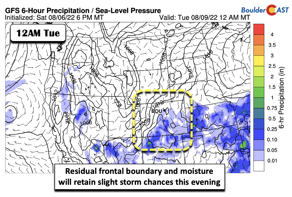
- A lingering front and mid-level energy will warrant a tiny chance of storms Monday, but expect a mostly dry day
- Dry and hot weather is favored Tuesday through Thursday, with the end of the week possibly nearing record highs
- Monsoonal moisture builds back into the area by Friday, increasing our chances of storms throughout the extended
DISCLAIMER: This weekly outlook forecast is created Monday morning and covers the entire upcoming week. Accuracy will decrease as the week progresses as this post is NOT updated. To receive daily updated forecasts from our team, among many other perks, subscribe to BoulderCAST Premium.
Flooding rains on Sunday
We warned of the potential for a big uptick in rainfall in our weekly outlook last Monday with the arrival of the remnant moisture from Hurricane Frank. Six days later, that transpired into the worst urban flooding of the year in parts of the Denver Metro area yesterday.
⛈️FLOOD WATCH IN EFFECT SUNDAY⚠️
The risk of slow-moving thunderstorms with heavy rainfall is elevated today across much of eastern Colorado. Prime time for our area is 3PM-11PM with a 70+% chance of rain. Be weather & flood aware! #COwx #Denverweather #Boulder #Denver #Colorado pic.twitter.com/9YytYUBwt2
— BoulderCAST Weather (@BoulderCAST) August 7, 2022
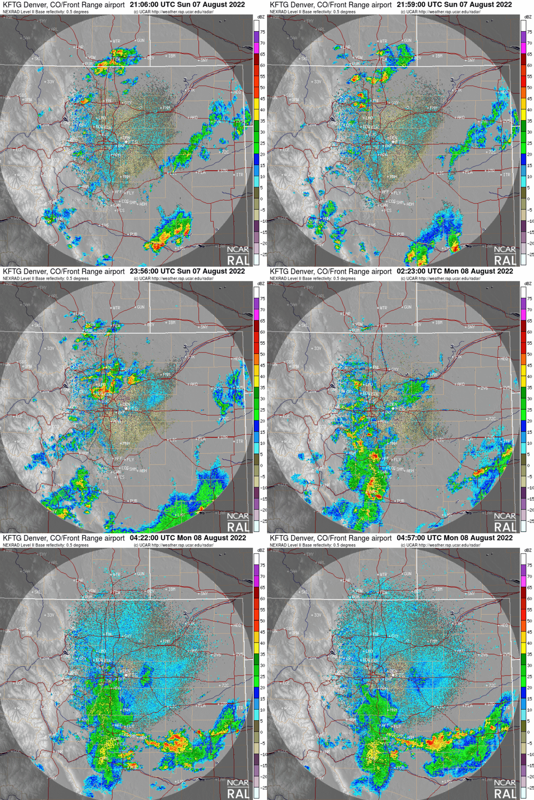
Storms developed first across the higher terrain by late afternoon before spreading east across the lower elevations in the evening and overnight. The radar animation below is from Sunday evening. The most intense storm last evening cut a line from Broomfield to Aurora with torrential rainfall and small hail in between.
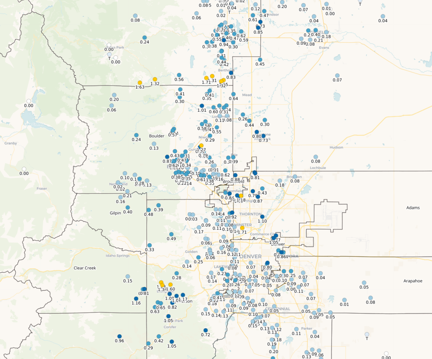
Rainfall totals from that cell pushed above 2″ in spots creating localized flash urban flooding. At one point, Interstate 70 flooded out and was completely closed in both directions, with several cars stranded and water rescues needed.
Incredible video of rescuers helping stranded travelers on I-70 near Brighton via @sofiadaley3 pic.twitter.com/MgOOc2si9z
— Jaclyn Allen (@jaclynreporting) August 8, 2022
Major traffic headache on I70 between York and Steele. This video is facing West.
People are stuck on the interstate and walking around because water is blocking the lanes.
Multiple cars appear to be stuck. Denver Fire says crews 11 people near I70 and York. pic.twitter.com/Wk7pjk0QRg
— Kelly Reinke (@KellyReinkeTV) August 8, 2022
Just about everyone got some rainfall on Sunday, though some spots definitely did better than others…
Turning drier and seasonal Monday
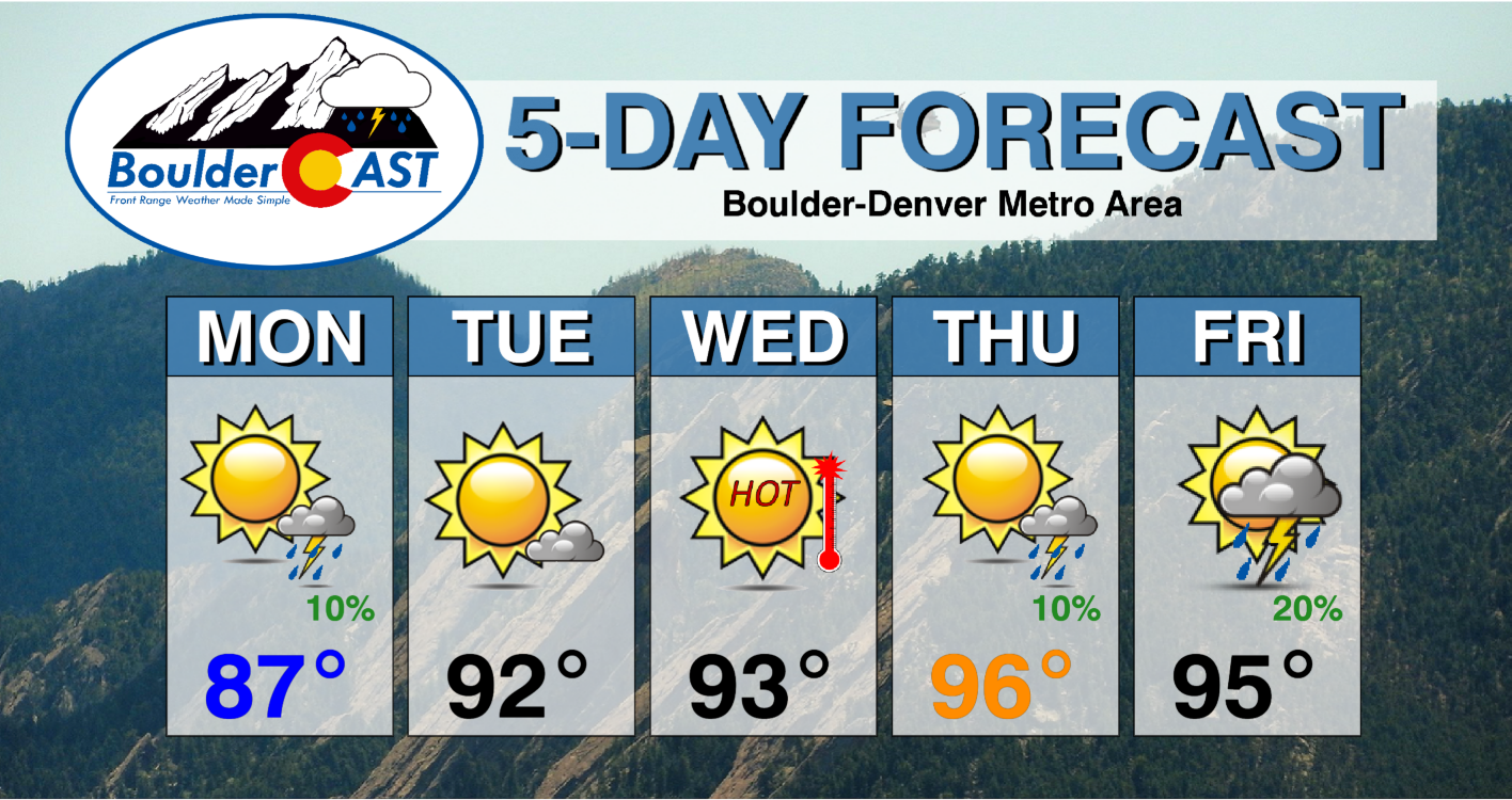
Fortunately, we’re going to see a big break from the unsettled weather Monday and actually much of this week. The frontal boundary has become more diffuse across the area today, but its presence will continue to warrant a slight chance (5-10%) of a few isolated afternoon/evening storms. Expect a much drier day overall with a nearly non-existent risk of further flooding. Highs will be seasonal in the middle to upper 80s as the airmass is still somewhat “cool”.
Dry & hot the rest of the week
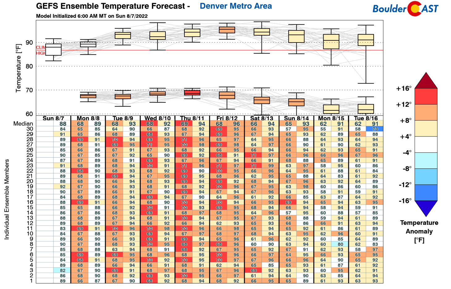
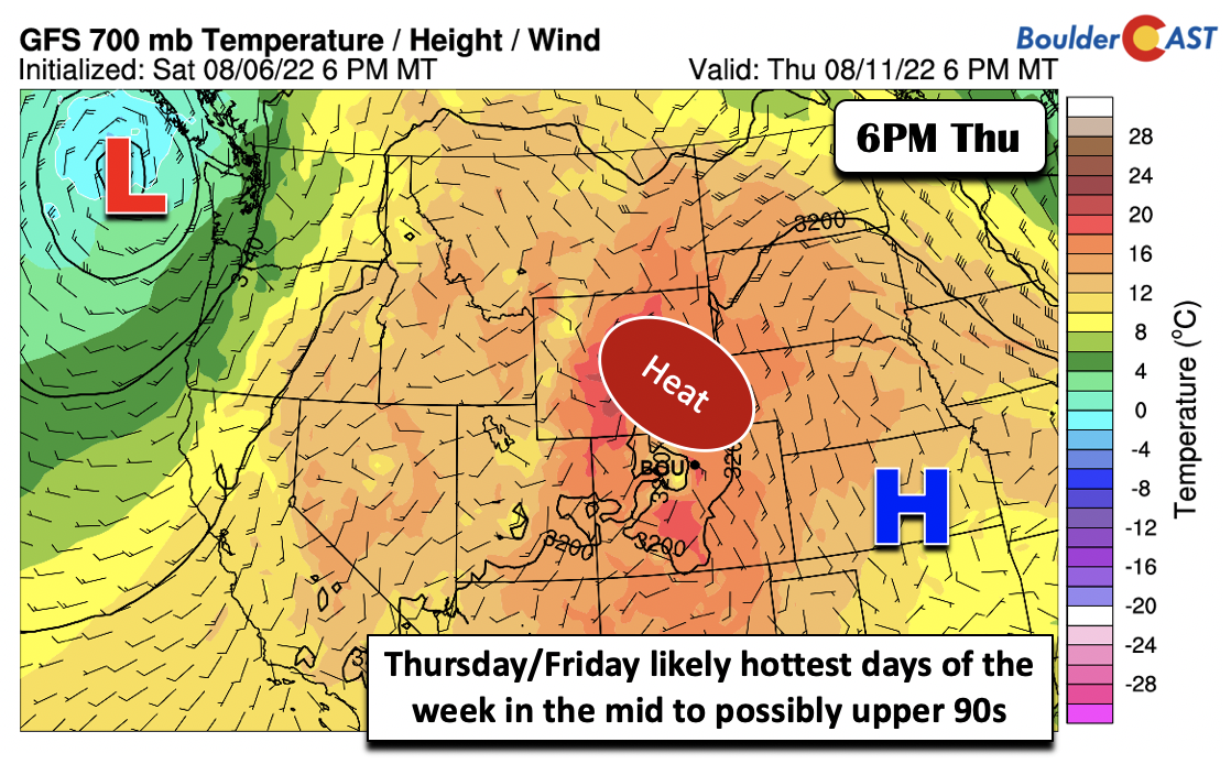
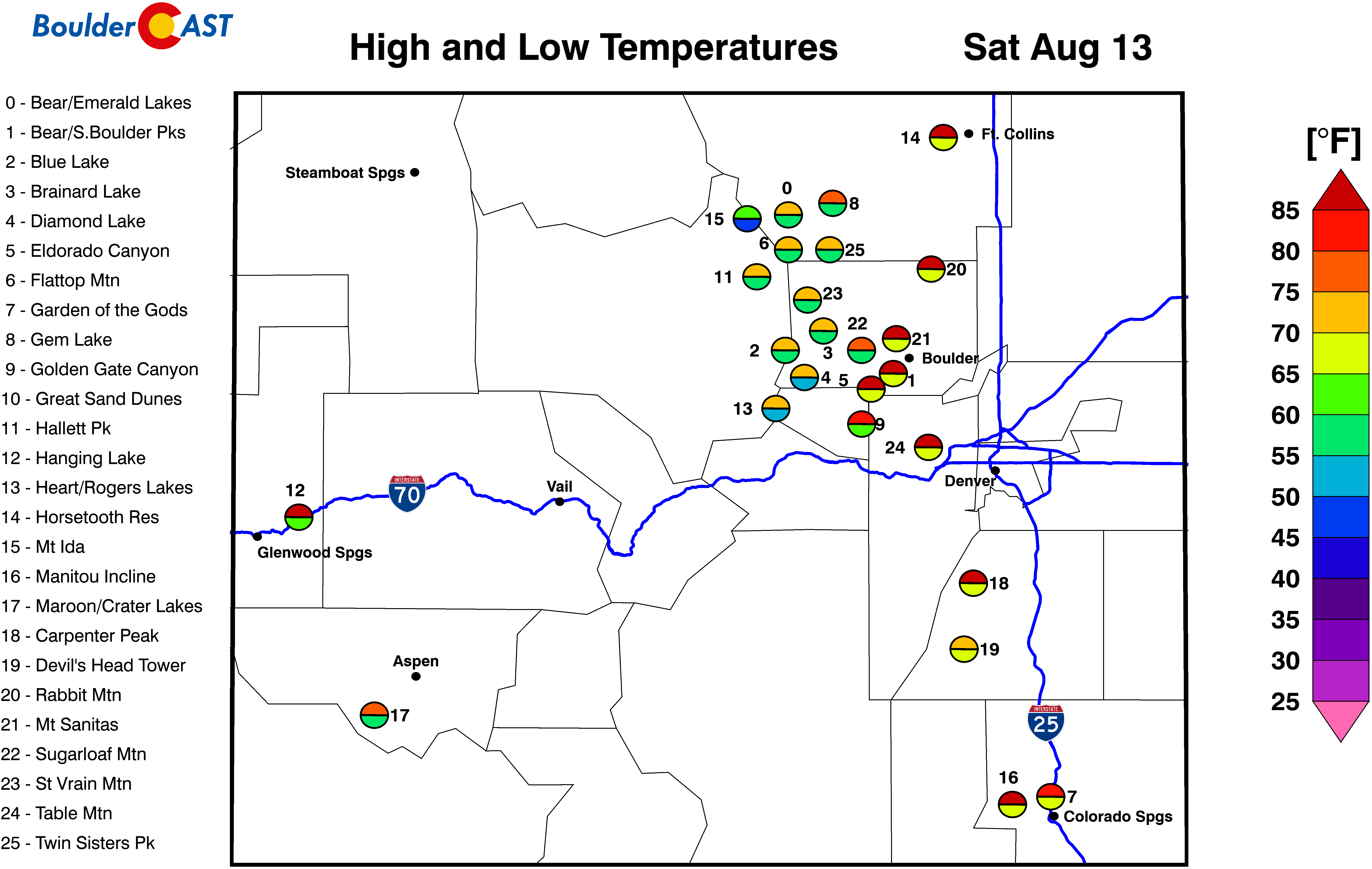
The forecast from Tuesday onward will trend toward a dry and hot weather pattern for the early to middle part of August. As depicted in the GEFS temperature forecast below, we’ll get back into the 90s on Tuesday. By the end of the week, we’ll be getting close to record high territory with temperatures in the mid to even upper 90s.
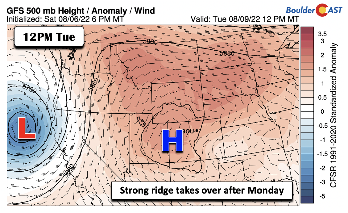
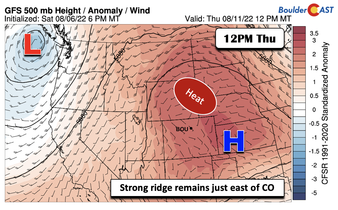
A trend toward record heat usually means a decrease in unsettled weather, as clear skies allow for peak solar heating. The mid-level ridge will begin to dominate the state, setting up over western Colorado on Tuesday.
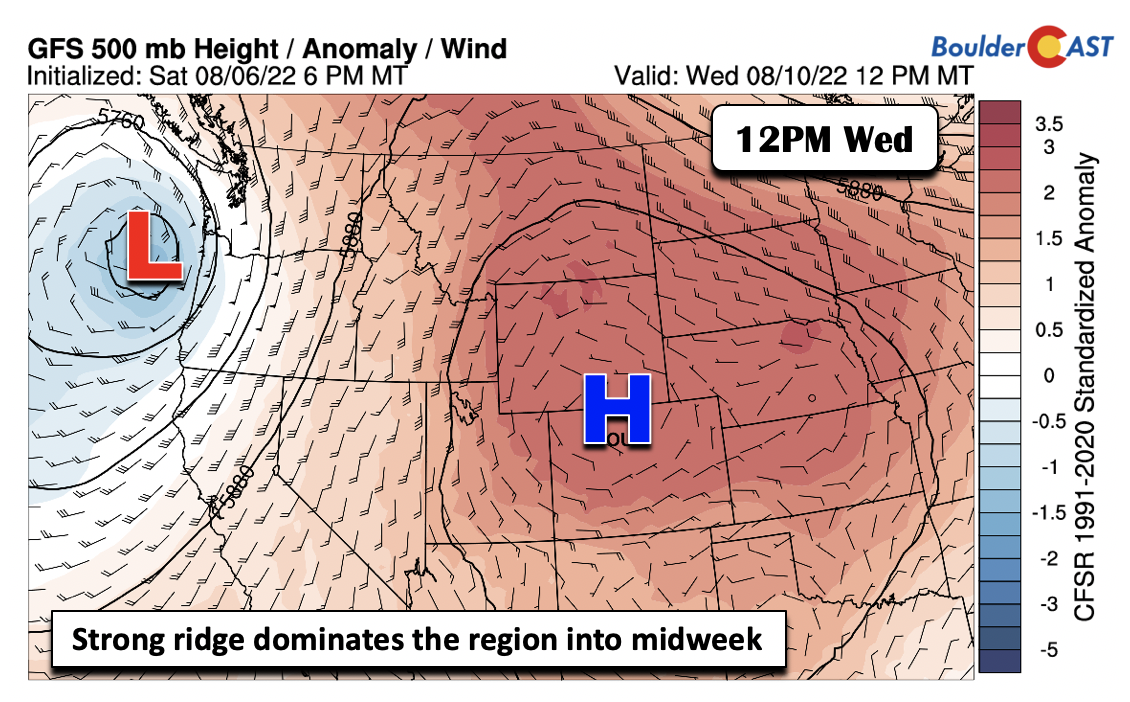
By Wednesday, the ridge will more or less be overhead, extending into Wyoming. The surface high pressure will be over Nebraska, allowing a persistent easterly flow to remain from Tuesday into Wednesday, keeping temperatures “somewhat cooler” the lower 90s.
The heat will really take hold by week’s end though as the ridge shifts a tad to the east. This will allow the hotter airmass from the Desert Southwest to inch into our region.
Thursday and Friday are likely to be our hottest days in the middle 90s as 700 mb temperatures approach 18 to 20°C. Some places could reach the upper 90s in the Metro area.
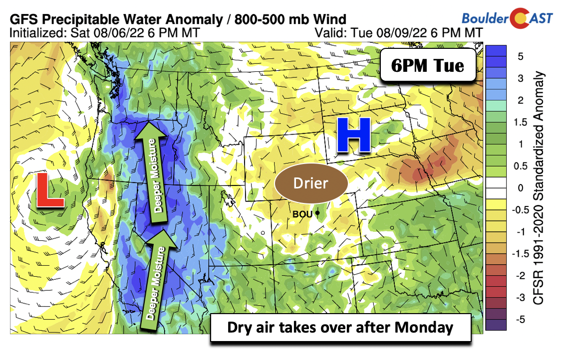
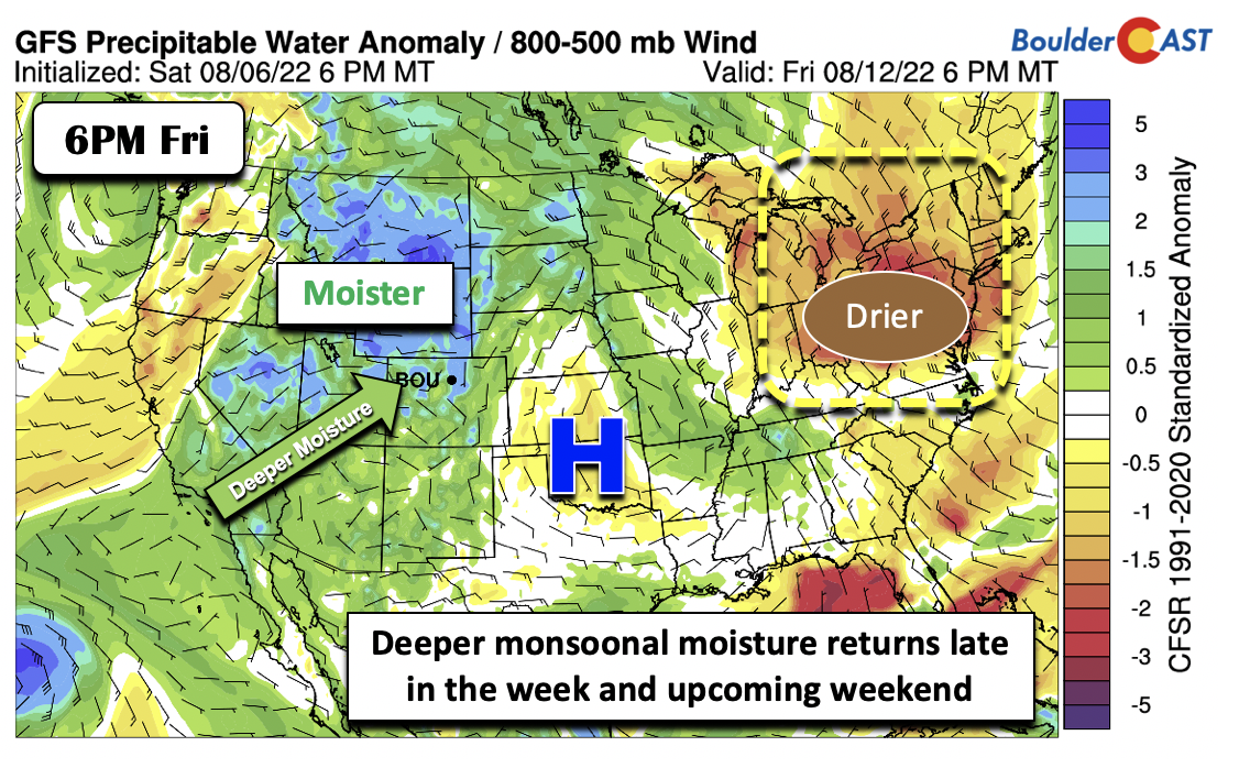
As a result of the ridge overhead much of the work week, the deep and anomalous monsoonal moisture will get shunted to the west over California, Nevada, and Oregon. Tuesday and Wednesday will be largely void of any clouds/storms, with the exception of far southwest Colorado.
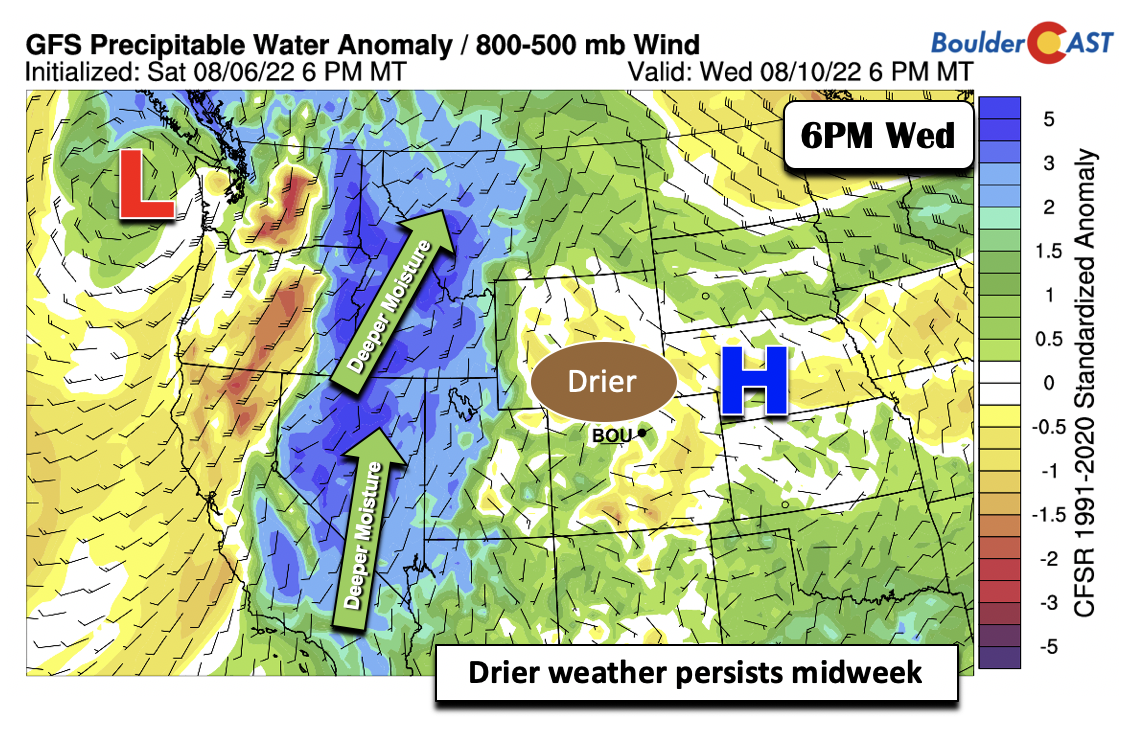
Much of the same moisture pattern will persist Wednesday, as the deep moisture tracks into Idaho and western Montana.
However, as the ridge slowly sides to the east by Friday, the moisture will eventually make its way back into our area. This will lead to an uptick in storm chances, especially for the weekend and early next week.
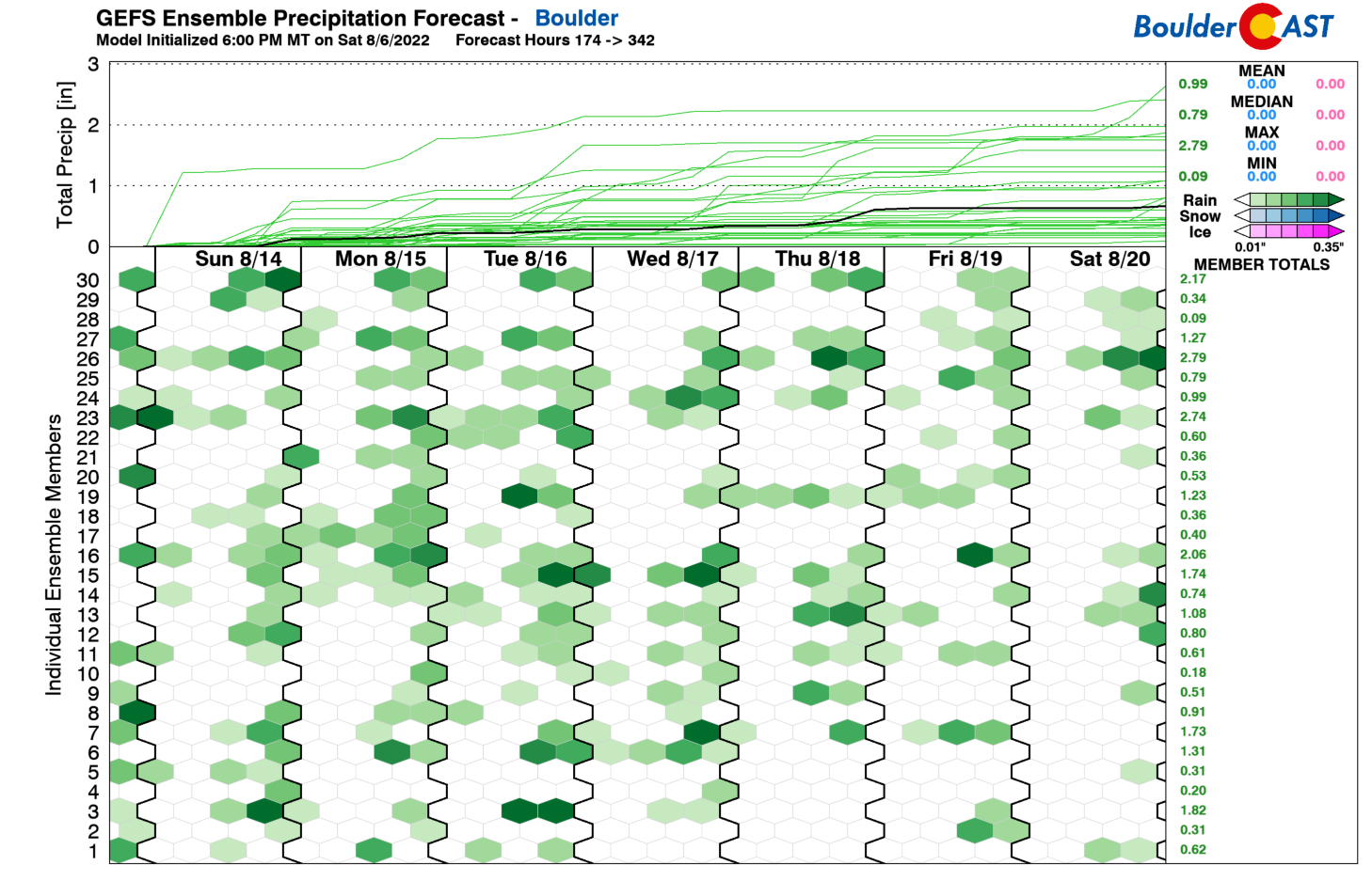
Not surprisingly, based on what we discussed above, the extended pattern next week looks far more active for the Front Range, with nearly every day seeing a chance of showers and storms. Enjoy!
Stay up to date with Colorado weather and get notified of our latest forecasts and storm updates:
Forecast Specifics:
Monday: Mostly sunny skies and seasonal in the middle 80s with a 10% chance of isolated storms, mainly south of Denver. Highs in the Foothills near the middle 70s.
Tuesday and Wednesday: Sunny and warmer with highs in the lower 90s for the Plains and lower 80s in the Foothills. No chance of rain sadly.
Thursday and Friday: Partly to mostly sunny and hot with near-record highs in the mid to upper 90s for the Plains and low to middle 80s in the Foothills. There will be a slight chance of afternoon/evening storms, particularly Friday.
High Country: Expect the best chance of diurnal showers/storms over south-central and southwest portions of the state into midweek. There will be an uptick in storm chances over the higher terrain statewide come Thursday, Friday, and the weekend over the central and eastern part of the state.
Help support our team of Front Range weather bloggers by joining BoulderCAST Premium. We talk Boulder and Denver weather every single day. Sign up now to get access to our daily forecast discussions each morning, complete six-day skiing and hiking forecasts powered by machine learning, first-class access to all our Colorado-centric high-resolution weather graphics, bonus storm updates and much more! Or not, we just appreciate your readership!
Spread the word, share the BoulderCAST forecast!




You must be logged in to post a comment.