A strong low pressure system passing to our north will wrap in a potent jet stream to northern Colorado in the coming days. This will result in a period of Mountain snow, but to the east several days of strong downslope winds and high fire danger for the lower elevations. Read on for all the details of the weather week ahead.
This week’s highlights include:
- A distant but tightly-packed low pressure system moving along the Canadian border will produce a slew of weather impacts to Colorado through the week
- Snow and blowing snow for the Mountains Monday night into Tuesday with difficult travel expected, some light spill-over snow near Nederland as well
- Very strong winds will impact the Denver Metro area, mainly Tuesday afternoon and evening with gusts above 50 MPH creating high fire danger
- Temperatures cool off with gusty winds sticking around in some form through Thursday — watch for a continued risk of rapid fire growth
- Warmer and quiet to end the week — we’ll be heading into the 70s over the weekend
- Little to no chances for precipitation this week in the Metro area
DISCLAIMER: This weekly outlook forecast is created Monday morning and covers the entire upcoming week. Accuracy will decrease as the week progresses as this post is NOT updated. To receive daily updated forecasts from our team, among many other perks, subscribe to BoulderCAST Premium.
Windy with elevated fire danger much of the week
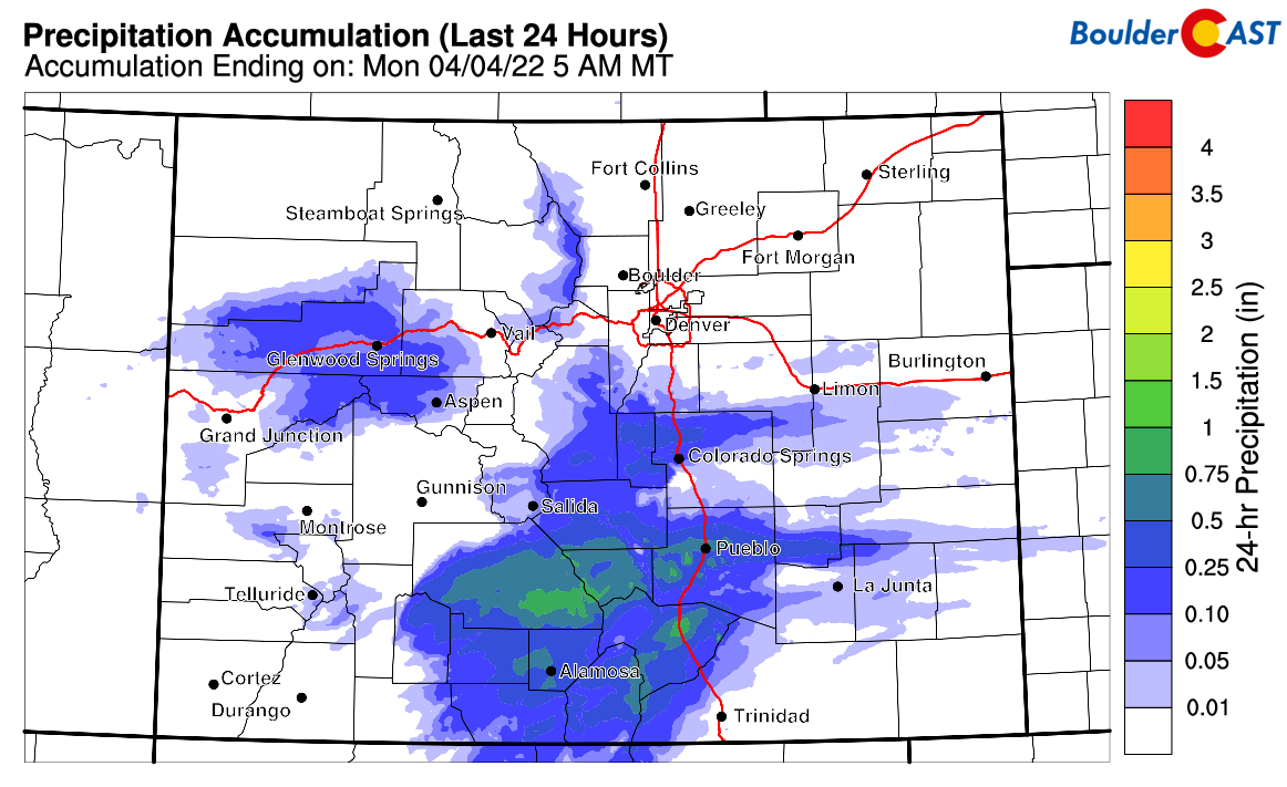
This past weekend was dry in the Denver Metro area, with all the precipitation being confined along the Continental Divide (orographic snowfall) and well south from Colorado Springs to Pueblo (jet-forced rain bands). The graphic below shows the precipitation that fell on Sunday across the state. While it was cloudy and cooler in the Boulder area, it was indeed dry.
The week ahead will be largely devoid of moisture as well, but we are monitoring a stunningly strong storm projected to move across the northern Rockies Monday night through Tuesday. The track of this system will be right along the Canadian border and into the Dakotas, with the system eventually stalling out near the Great Lakes.
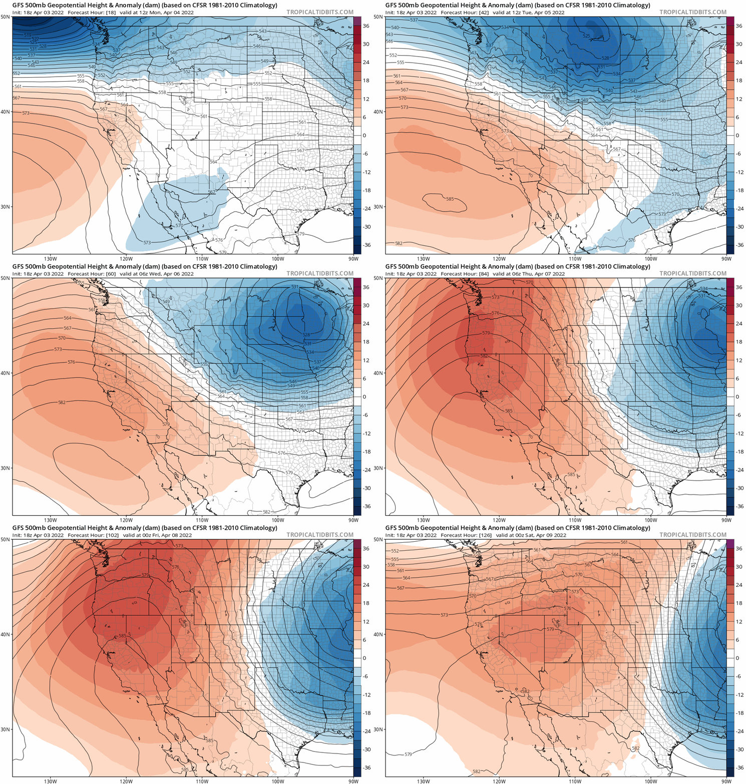
GFS 500mb height anomaly forecast animation through the week. Notice the big low tracking to the north which stalls out over the Great Lakes, as well as the induced tight gradient over Colorado.
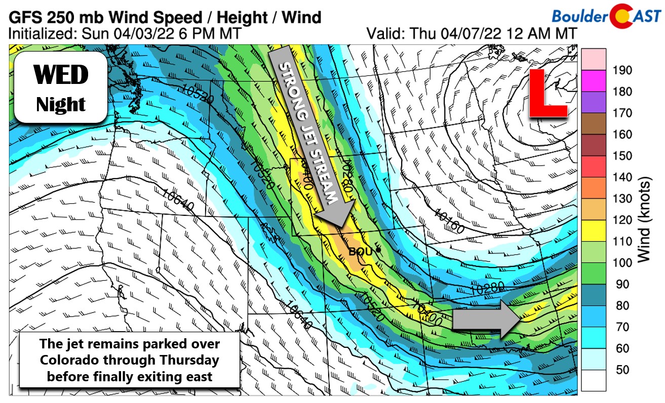
Typically something this far north wouldn’t be worth mentioning for the Denver area, but this trough will have an absolute bull of a Pacific jet wrapped around its base, pushing directly into Colorado from the west Monday night, then turning northerly and lingering all the way into Thursday before it finally kicks east. This jet is not just impressive by April standards, but for any time of year.
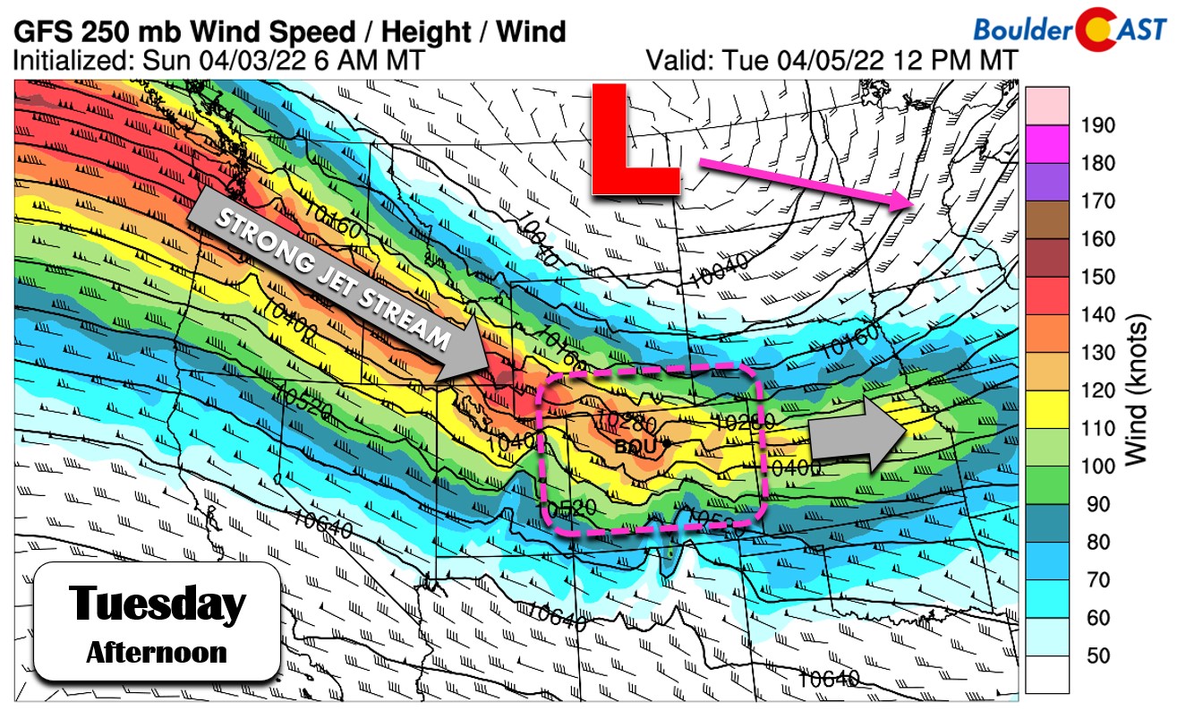
Strong Pacific jet wraps around the base of a large and potent low pressure along the Canadian border
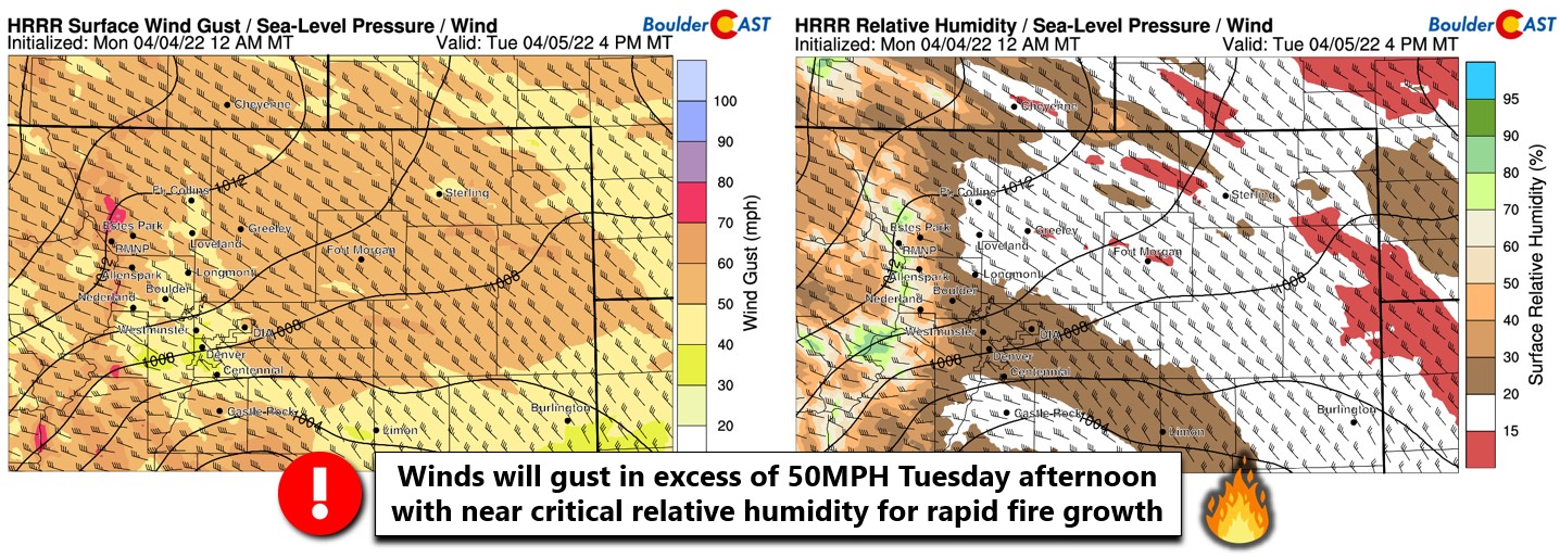
Right now it appears probable that this potent jet and associated tight pressure gradient will create a bora-type high wind event for the Front Range on Tuesday following a cold frontal passage. Winds will be strongest north of Fort Collins (60+ MPH gusts Tuesday morning and afternoon), but Denver and Boulder should get into the action as well Tuesday afternoon and evening. Models are showing gusts exceeding 50 MPH across much of northeast Colorado. Furthermore, before the bora wind event, a mountain wave will develop cascading strong downslope winds into the Foothills Monday evening and night. Gusts in the Foothills could exceed 80 MPH during this time. This mountain wave is not fully expected to make it down into Boulder, but certainly could in some weaker form considering the strong winds aloft associated with the nose of the jet moving in.
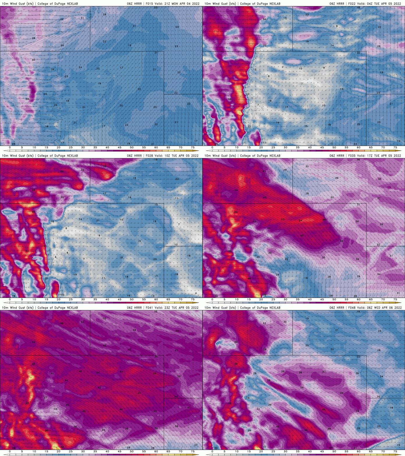
HRRR wind gust forecast from Monday afternoon into Tuesday night. Note the Mountain wave in the Foothills Monday night and then the widespread bora winds on Tuesday for the entire area.
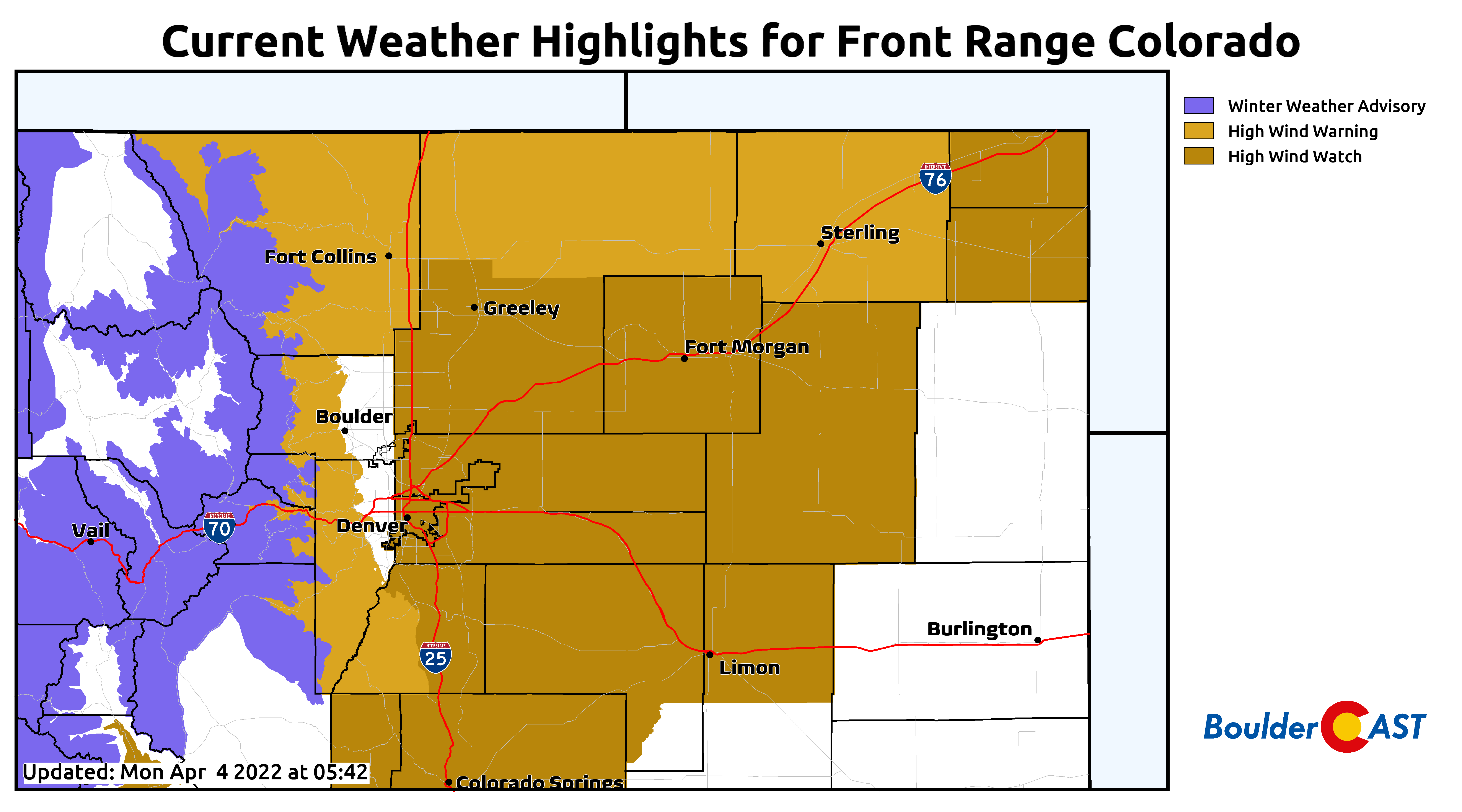
All in all, it’s going to be a very windy Monday evening and night (Foothills), Tuesday morning (Wyoming Border area) and Tuesday afternoon and evening (most of northeast Colorado). While there is no wind-related advisories posted for the city of Boulder yet — check out the comical omission below — there are plenty blanketing areas upstream and all around us in eastern Colorado, including in Denver which is currently under a High Wind Watch.
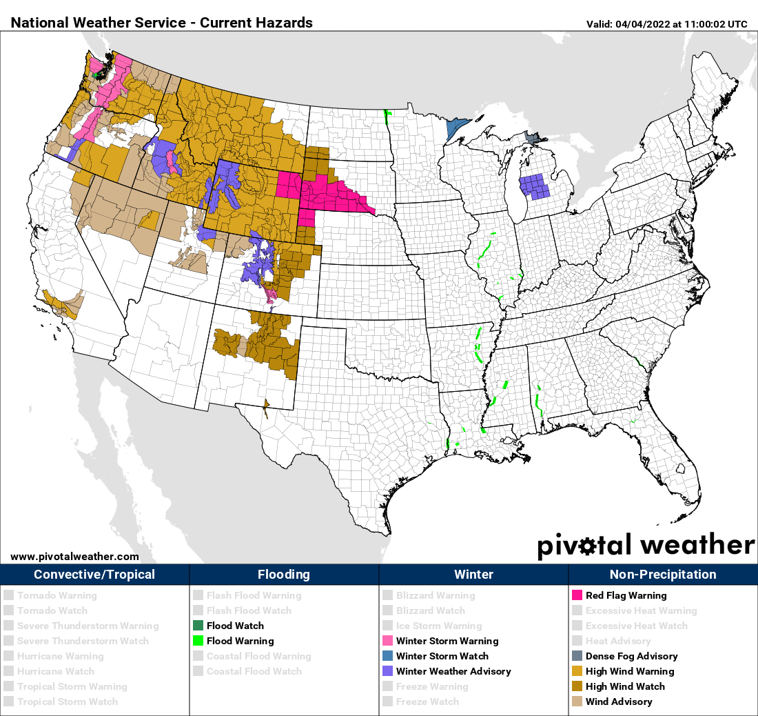
This is a huge storm and it will have widespread windy impacts across the nation in the coming days.
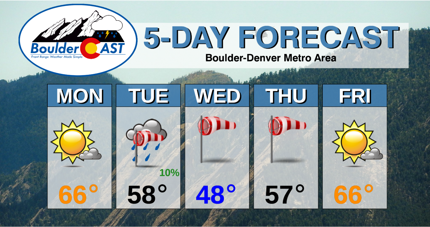
For Monday we’ll see mostly sunny skies, a slight afternoon breeze and highs in the 60s. Fire danger will be elevated with very low relative humidities, but it won’t be critical due to the modest winds.
Tuesday is the day we are most concerned about for strong winds and rapid fire growth. Winds look to begin ramping up towards midday and last into the evening or overnight. Humidity won’t be as low on Tuesday, but given the winds, fire danger will be very high. Any small ignitions could rapidly grow into something dangerous with northwest winds raging across the Front Range. High temperature on Tuesday will be early in the day and in the 50s.
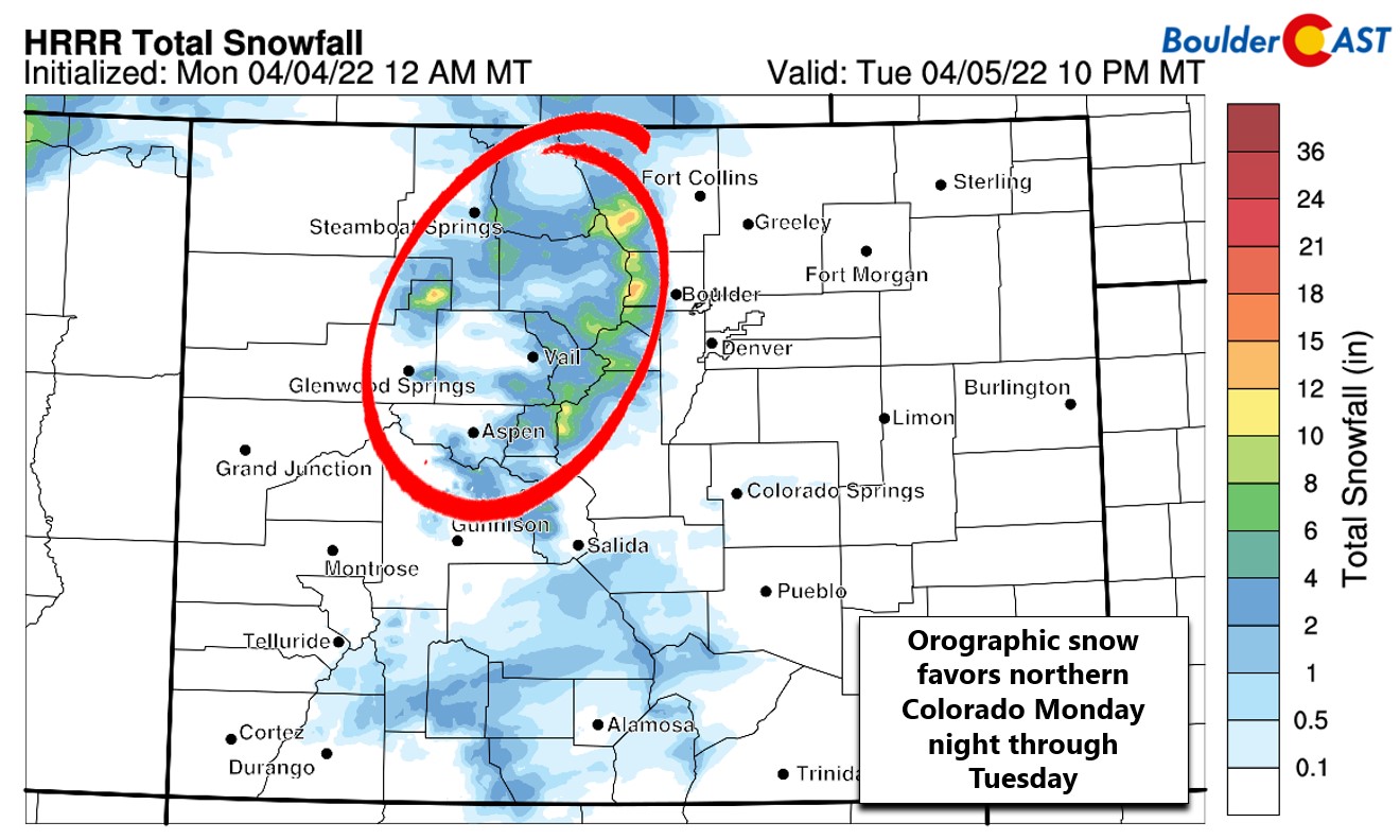
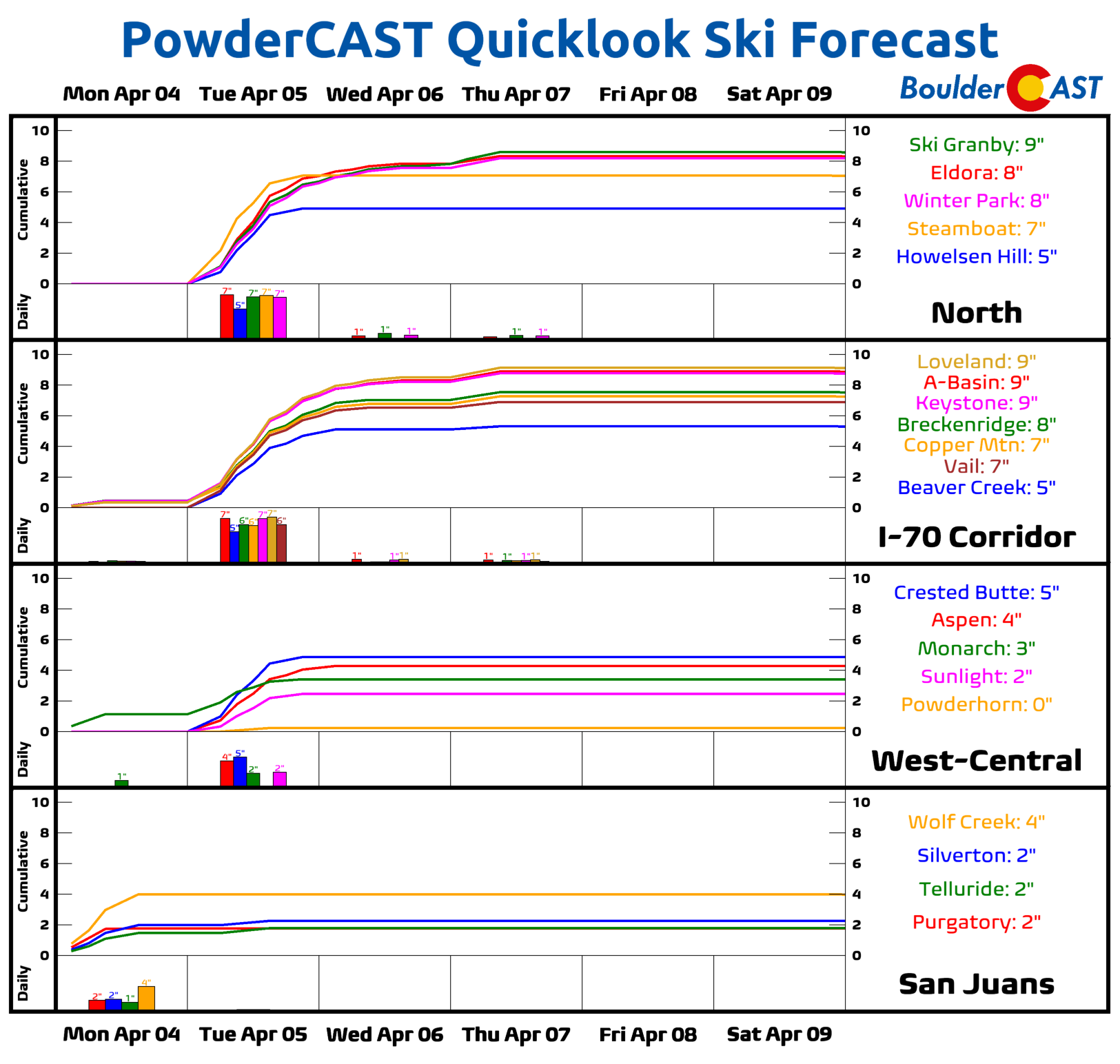
At the same time, that same Pacific jet will bring orographic snow to the Mountains of central and northern Colorado. Areas like Steamboat and Winter Park will be favored by this event for upwards of 8″ of snow. Combined with the strong winds, travel will become difficult in the High Country. Use caution if driving over any of the Mountain passes. Expect snow-covered roads, blowing snow and reduced visibility Monday night into midday Tuesday. The higher Foothills from Nederland to Ward could see an inch or two of snow early Tuesday. There could be a few raindrops spreading eastward off the higher terrain on Tuesday as well, but with the downslope flow, this won’t amount to much anywhere in the Denver area.
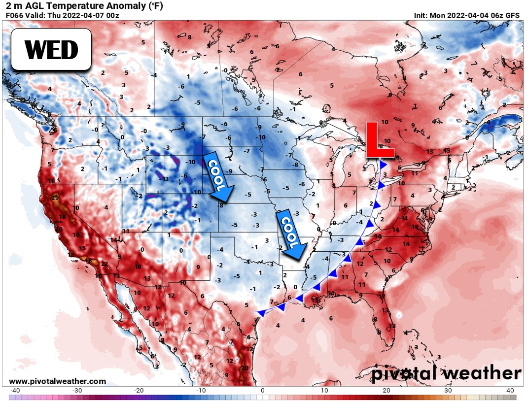
Things stay blustery across the region Wednesday and Thursday as the big low pressure stalls out near the Great Lakes. Colder air will spread across the nation from the northwest keeping things chilly for a few days in the Front Range. Highs on Wednesday will be in the upper 40s with a return to the 50s anticipated for Thursday.
The jet stream will remain draped across our area from the northwest and north during this time. We will see continued windy conditions across the area — definitely on Wednesday and probably to some degree on Thursday as well. Thus, both days will have elevated fire danger, but humidities will creep up a tad. Skies will be partly sunny with winds fluctuating but generally remaining a concern.
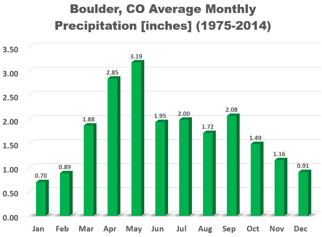
By Friday, a ridge will begin to build in from the west and the jet moves out. This will spell out a quiet and seasonal end to the week with plenty of sunshine and highs returning well into the 60s. The weekend will be even warmer in the 70s. So yes, we will be starting our second wettest month of the year with a lengthy dry spell.
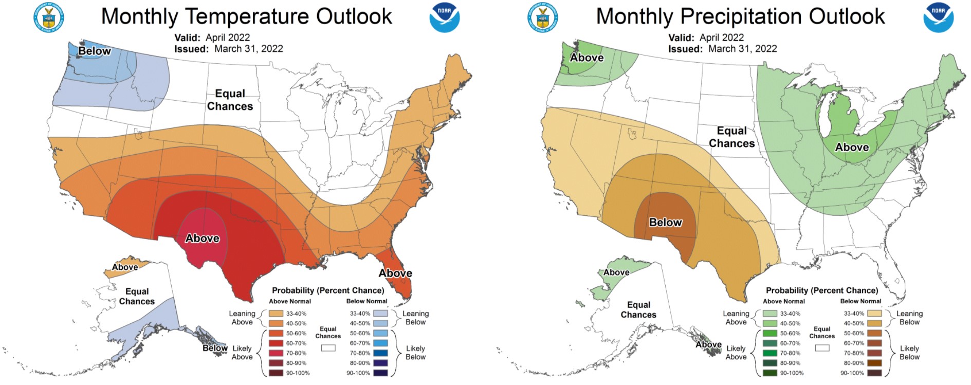
Unfortunately, this falls right in line with the overall outlook for the month of April…
A few more photos from in an around the #NCARFire burn scar pic.twitter.com/U2a9sJFxy7
— BoulderCAST Weather (@BoulderCAST) April 4, 2022
Stay up to date with Colorado weather and get notified of our latest forecasts and storm updates:
Forecast Specifics:
Monday: Morning and evening clouds, but sunny for much of the middle of the day. Highs in the middle 60s across the Plains with lower 50s in the Foothills. A mountain wave develops Monday evening into the overnight with wind gusts up to 80 MPH in the Foothills.
Tuesday: Partly to mostly cloudy, cooler and windy with high fire danger. Winds increase in intensity around midday with widespread 50+ MPH gusts expected across the area. Winds decrease during the evening and overnight. A few isolated rain showers may impact the area during the day as well. Spill-over snow showers possible in the highest Foothills along and west of Peak-to-Peak Highway with 1-2″ of accumulation. Highs in the 50s across the Plains with upper 30s in the Foothills.
Wednesday: Partly cloudy, cool and dry with temperatures in the upper 40s on the Plains and in the middle 30s in the Foothills. Winds will gust 30-40 MPH across much of the area out of the northwest creating another day of elevated fire danger.
Thursday: Partly cloudy, breezy and staying chilly with highs in the 50s on the Plains and 40s in the Foothills. Afternoon breezes of 20 to 30 MPH expected from the north-northwest with continued risk of rapid fire growth.
Friday: A beautiful day with lighter winds and sunny skies. High temperatures reach the middle 60s on the Plains with lower 50s in the Foothills.
Mountains: Monday will begin fairly tame in the Mountains, but things deteriorate rapidly during the afternoon and evening as the blasting jet arrives from the west. Snow will break out with strong winds creating dangerous travel alongside wind gusts of 50+ MPH. 4 to 9″ of snow is expected in the Mountains of northern and central Colorado by Tuesday afternoon. Wednesday and Thursday will be drier with just isolated snow showers and strong northwest winds lingering. Friday will be warmer and sunny statewide with lighter winds — a trend that will continue into the weekend ahead.
Help support our team of Front Range weather bloggers by joining BoulderCAST Premium. We talk Boulder and Denver weather every single day. Sign up now to get access to our daily forecast discussions each morning, complete six-day skiing and hiking forecasts powered by machine learning, first-class access to all our Colorado-centric high-resolution weather graphics, bonus storm updates and much more! Or not, we just appreciate your readership!
Spread the word, share the BoulderCAST forecast!




You must be logged in to post a comment.