This week for the Front Range will feature thunderstorm chances early in the week followed by dry and hot weather for the latter portion. Flash flooding remains a concern through Tuesday, especially for the burn scars, as slow storm motions and monsoonal moisture team up. Very smoky conditions will persist through Wednesday, but some improvement in air quality should develop later in the week. Let’s take a look.
This week’s highlights include:
- Monsoon moisture increases Monday across the High Country and Tuesday over the Plains
- Potential for isolated heavy rainfall through Tuesday with flash flooding concerns for the burn scars
- Drier and hot conditions take hold Thursday into Friday
- Thick smoke to start the week, but improved air quality is favored later on
DISCLAIMER: This weekly outlook forecast is created Monday morning and covers the entire upcoming week. Accuracy will decrease as the week progresses as this post is NOT updated. To receive daily updated forecasts from our team, subscribe to BoulderCAST Premium.
Moisture returns for the beginning part of the week
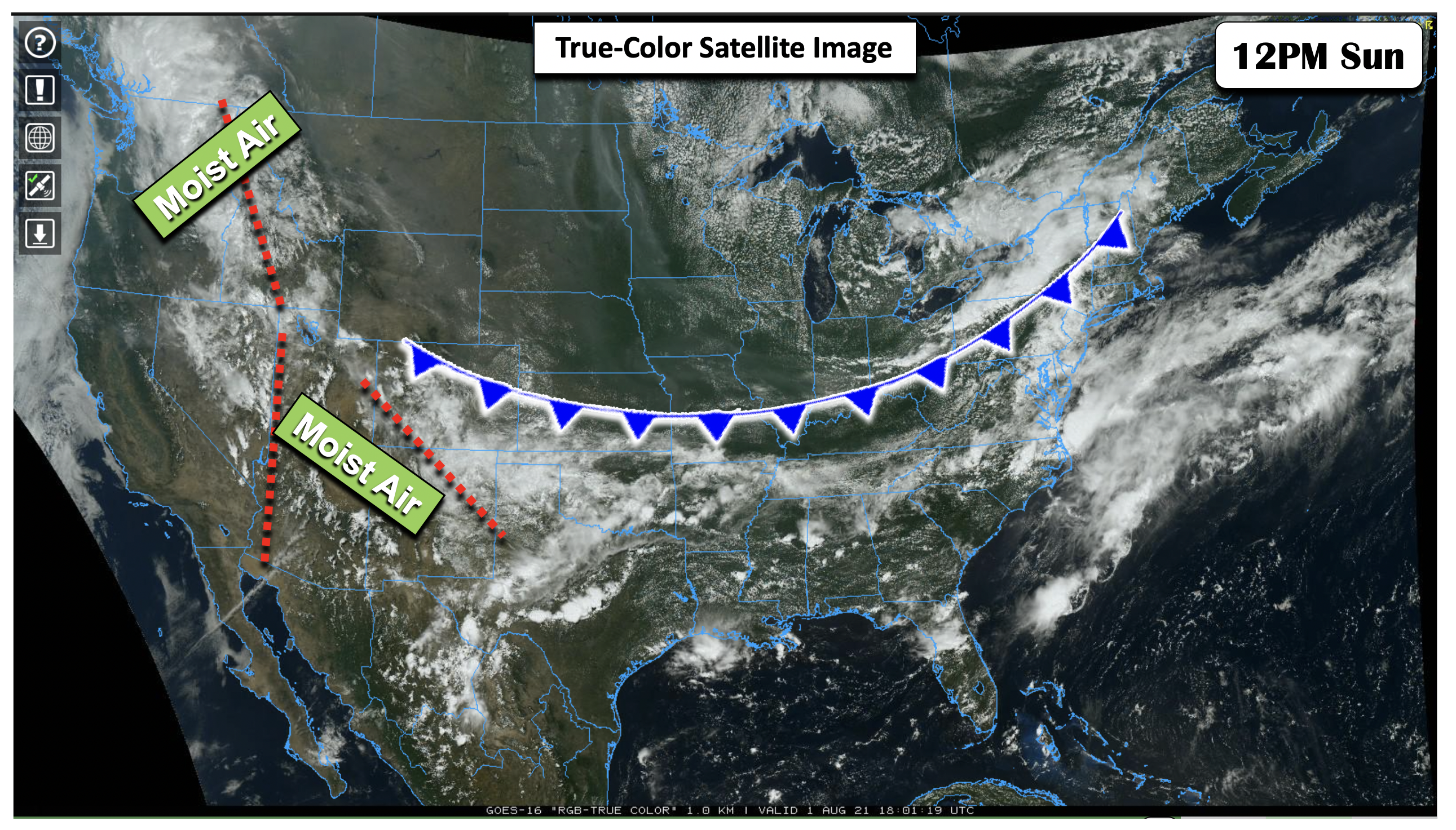
The figure below highlights a true-color satellite image as of 12 PM Sunday (yesterday afternoon) across the Nation. A cold front was located over the Midwest into the northeastern U.S. Drier weather was present over the Front Range yesterday, but monsoon moisture was not far away. The moisture axis yesterday was over two regions: (1) over southwest Colorado into northern New Mexico, and (2) a region oriented north-south from Idaho into western Arizona. This moisture plume will slowly make its way east today and tomorrow, increasing our rain chances through Tuesday.
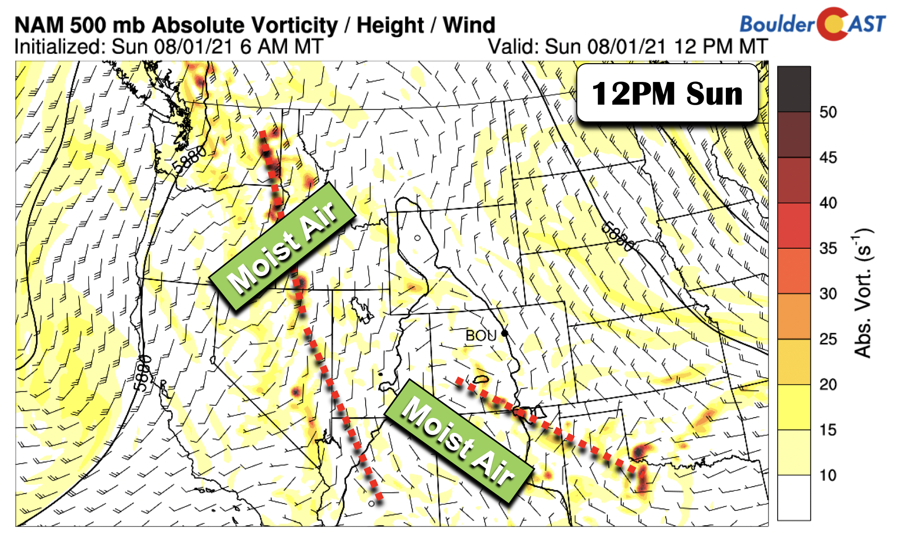
The moisture axis from Sunday is also depicted in model output from the NAM at the mid-levels (below). Our focus on the next few days will be the movement of this subtle feature and its influence on our sensible weather.
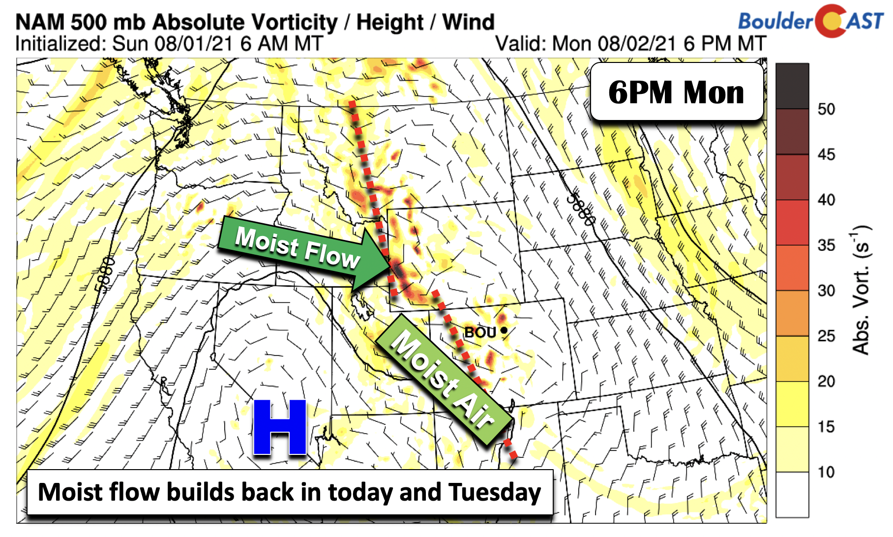
Come Monday afternoon and evening, the trough axis and moist flow will inch eastward into the western portions of Wyoming and Colorado (below) . Storm activity will increase by quite a bit over the Mountains as a result later today.
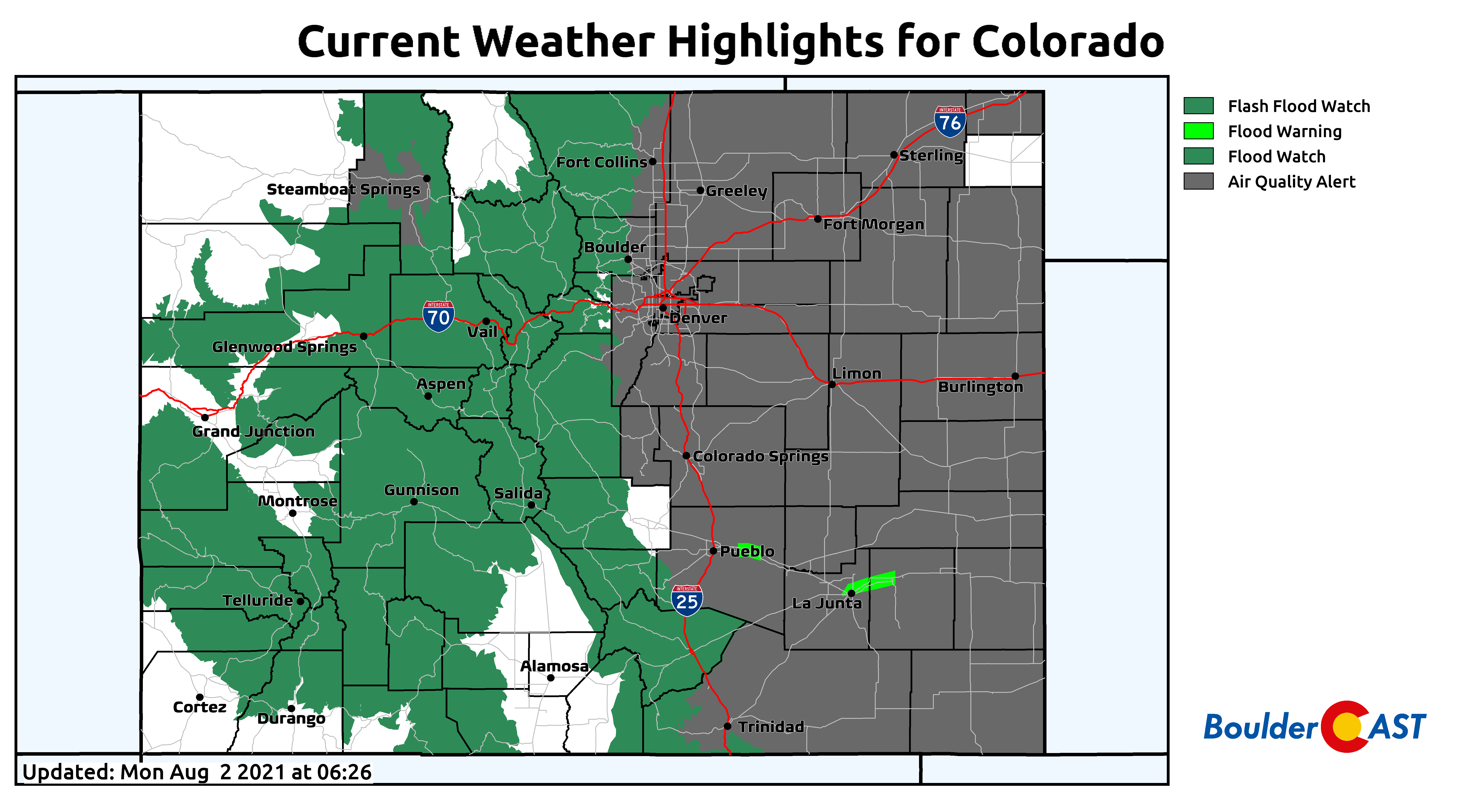
A Flash Flood Watch remains in effect for the Mountains and Foothills today. On the Plains, however, only a 10-20% chance of rain is forecast, given less than favorable conditions for the storms to survive their trek into the Denver Metro area. Highs Monday afternoon will hover near the middle 80’s, about average for early August.
Thick smoke remains entrenched across the Denver Metro area as of early Monday. This is the view looking east from Pikes Peak this morning. A thick layer of smoke is blanketing the Plains, with minimal smoke aloft.
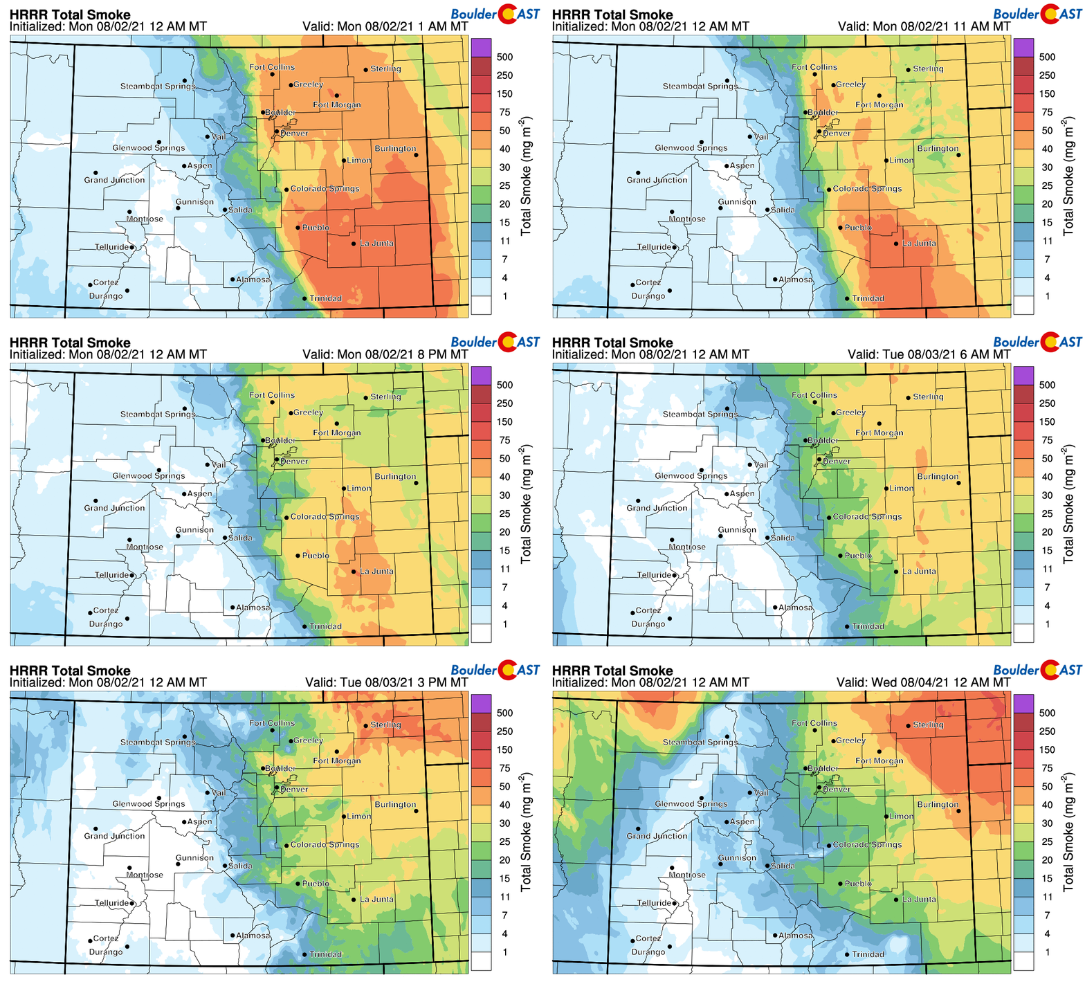
Overall, the smoke forecast shows minor improvements in total smoke as the day progresses Monday into Tuesday. However, it’s still going to be quite hazy with poor air quality.
Surface smoke, which directly impacts PM2.5 air quality, is expected to decrease slight as the day wears on Monday, with more significant improvement expected on Tuesday. Hang in there!

HRRR surface smoke forecast for Monday and Tuesday. Notable improvement is expected in our surface air quality on Tuesday!
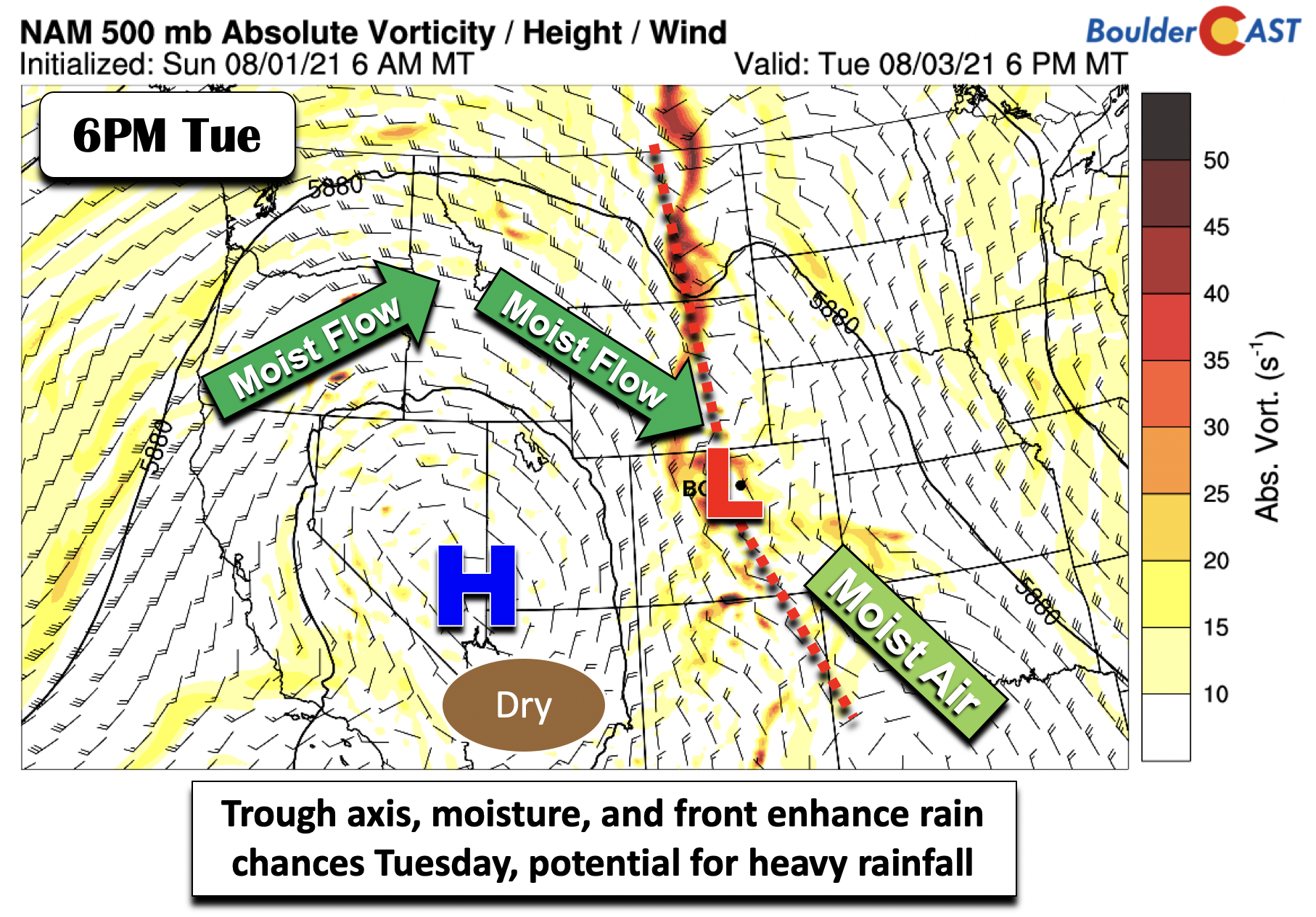
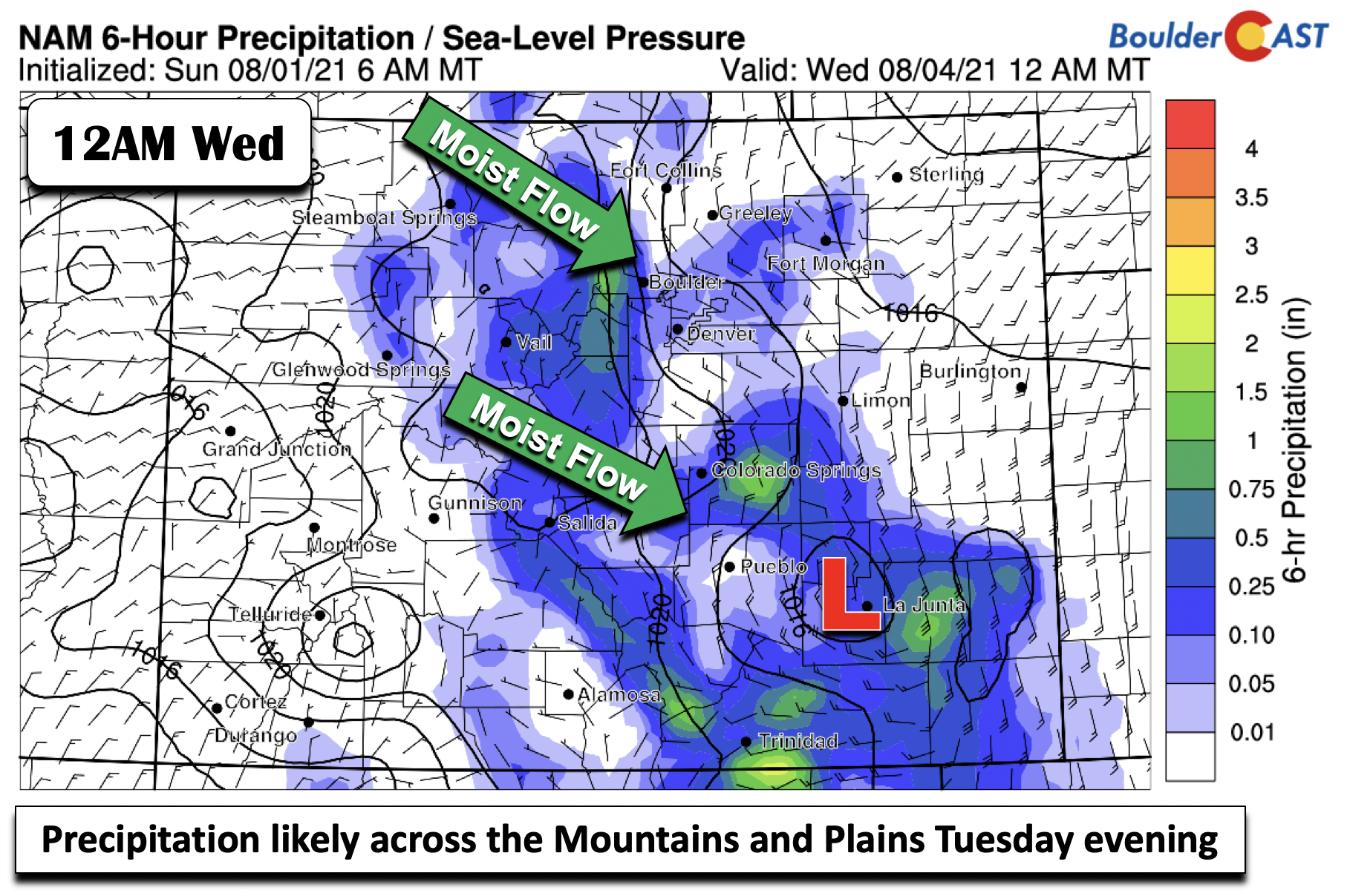
By Tuesday evening, the aforementioned trough axis and moist flow will largely intersect the central part of the state, and be located near the boundary of the Foothills and Plains (below). The moist flow will focus along and west of the Foothills. A weak area of low pressure is also forecasted by the guidance to aid lift for the Plains, though we have some doubts. As a result of increased moisture tomorrow, clouds will limit our daytime highs to the lower 80’s.
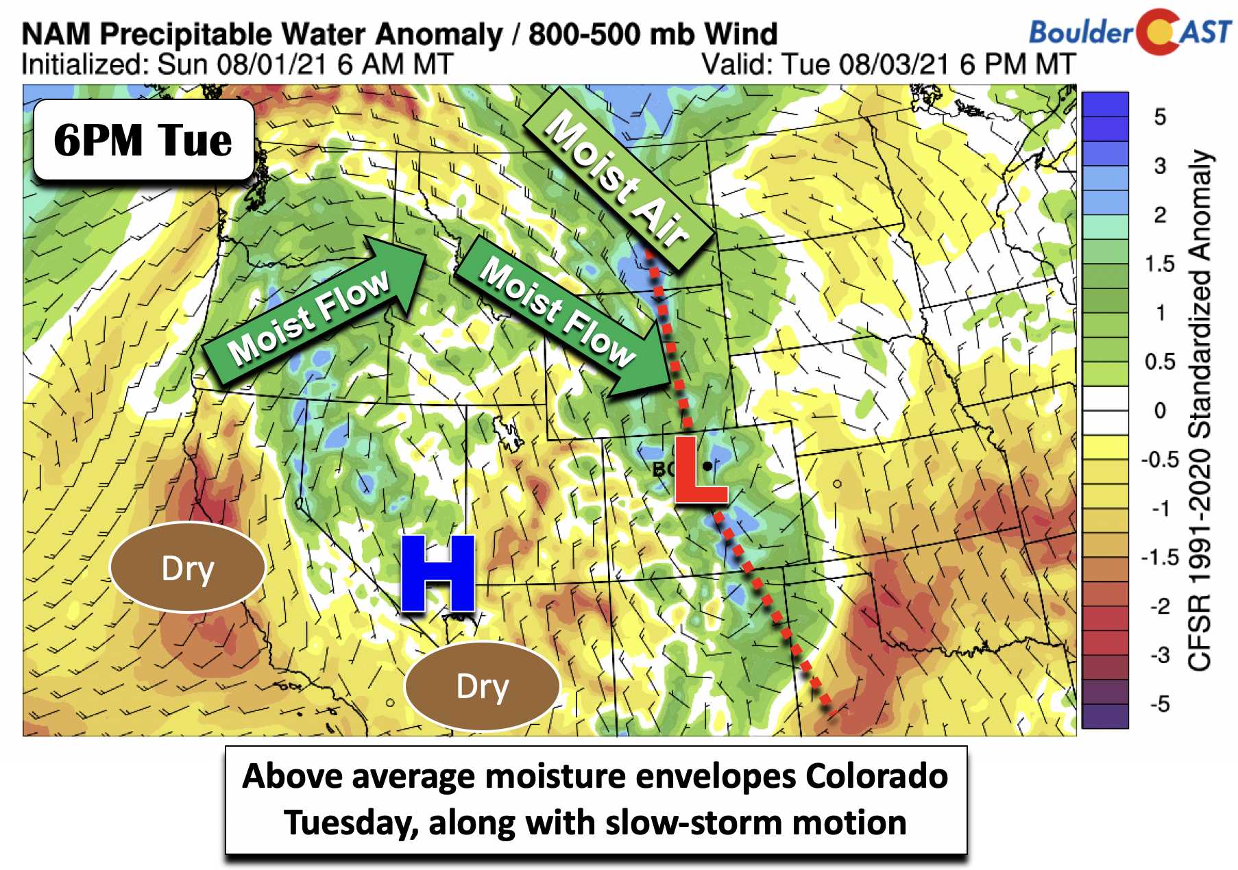
The anomalous precipitable water (total atmospheric moisture anomaly) will largely reside where the trough axis will be located. In the figure below, it is also worth noting how the mean flow from the surface to the mid-levels is quite weak, almost 5 mph or less over the Front Range. Thus, any training of storms could lead to a flash flood threat. As always, the risk will be highest in our state’s many recent burn scars.
The ensembles, as well as the global and regional models, are not particularly gung-ho on precipitation amounts Tuesday and Tuesday night, with the NAM still painting the highest amounts just near and west of Boulder. The GEFS mean has less than a quarter of an inch for Denver. Part of this could be related to a general downslope flow on the Plains. However, given the atmospheric pattern, we are concerned for potential heavy rainfall and have thus forecasted a 30-40% chance of rain/storms in the evening on Tuesday.
Hot and drier toward the latter part of the week
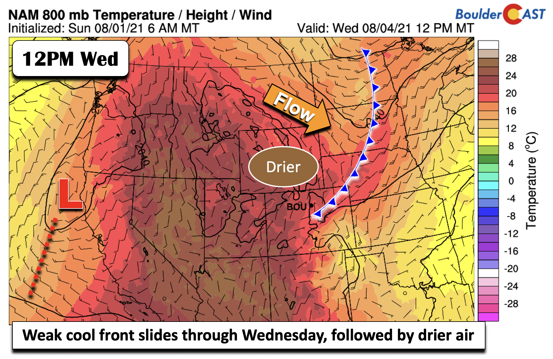
On Wednesday, a weak cool front will slide through, as the trough axis and moisture boundary pushes south into southeastern Colorado. Drier air and northeast flow will ensue over the Front Range. Although the airmass behind the front is not particularly that much cooler, highs should remain near the lower 80’s, similar to Tuesday. There is a slight chance of an afternoon storm, given the weak upslope and some lingering moisture, but most areas should be dry.
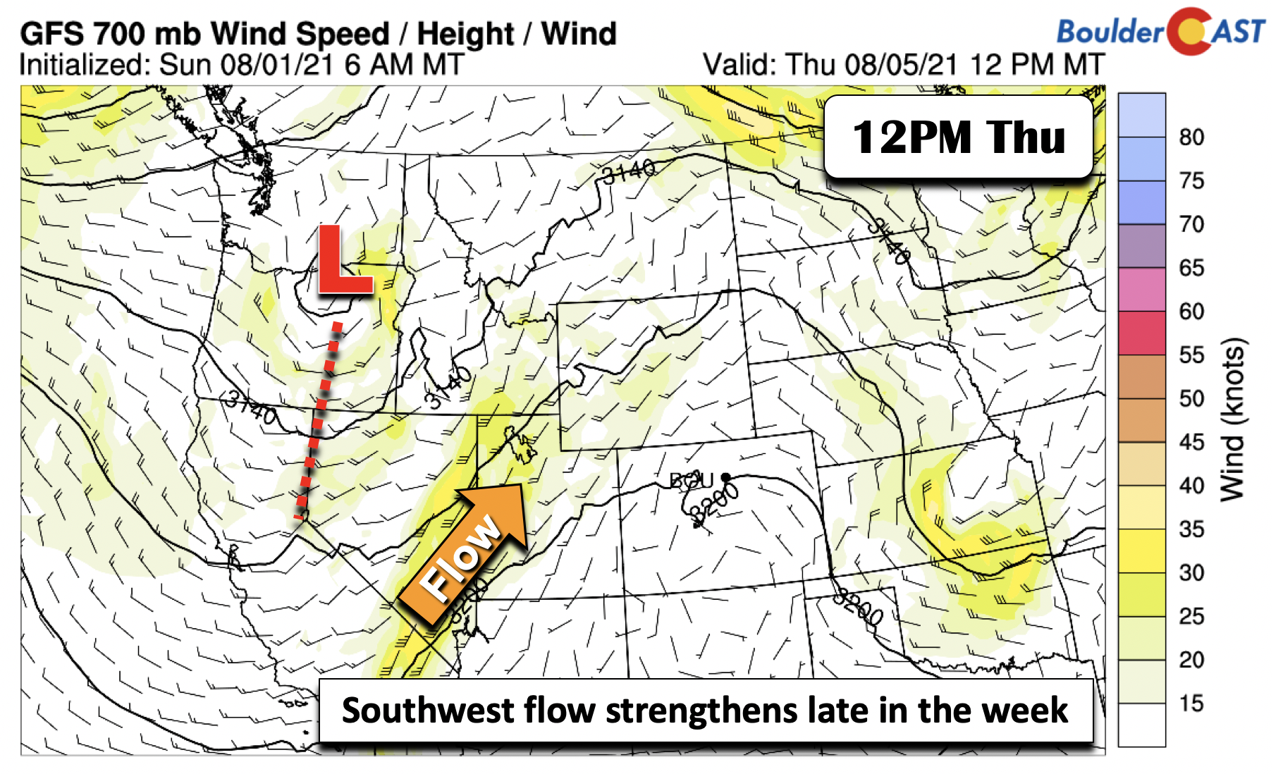
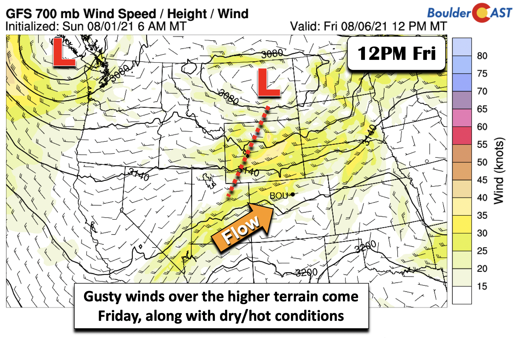
On Thursday, a trough of low pressure offshore from California Wednesday will be tracking east-northeast into Oregon and eventually Montana by week’s end. As the eastern part of this system encroaches closer to Colorado, southwest flow should start to dominate, particularly late Thursday and much of the day on Friday.
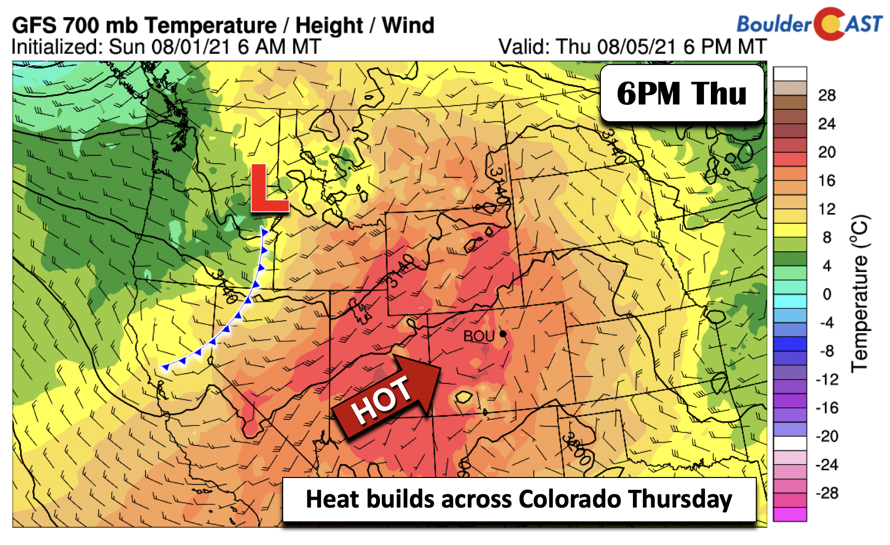
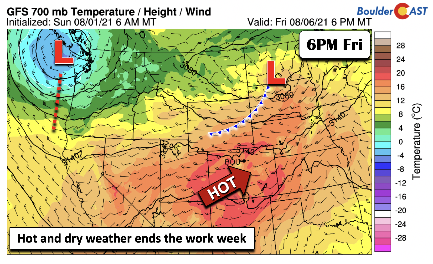
What will this mean for the Denver-Boulder area? Two words: hot and dry! Low-level temperatures on Thursday increase to around 18°C, enough to push highs for us back into the lower 90’s.
And, by Friday, the southwest flow should strengthen as the low pressure system makes its way into eastern Montana. In the absence of any new wildfires, this southwest flow should truly help to alleviate the air quality and smoke late Thursday and especially Friday. The westerly downslope flow should aid in pushing the pollutants into the Midwest.
Low-level temperatures will be at or above 18°C(below). A weak cold front will be sagging south behind the trough over the Dakotas. There should be a slight increase in moisture ahead of this front, enough to warrant a 20% chance of late-day storms. Confidence in this solution is low at the moment, however. The main story will be the heat and potentially gusty winds on Friday. We’ll need to keep an eye on the fire danger as a result.
The cold front will more than likely slide through late in the day on Friday or early on Saturday, leading to highs closer to average for the weekend and a slight increase in precipitation chances. However, this is somewhat uncertain right now. The Climate Prediction Center includes Front Range Colorado in a dry and warm forecast trend through the weekend into early next week.

Temperature (left) and precipitation (right) outlook for August 7 (Saturday) through August 11 (next Wednesday) from the CPC. A warmer, drier stretch is more likely for the Front Range.
Stay up to date with Colorado weather and get notified of our latest forecasts and storm updates:
We respect your privacy. You can unsubscribe at any time.
.
Forecast Specifics:
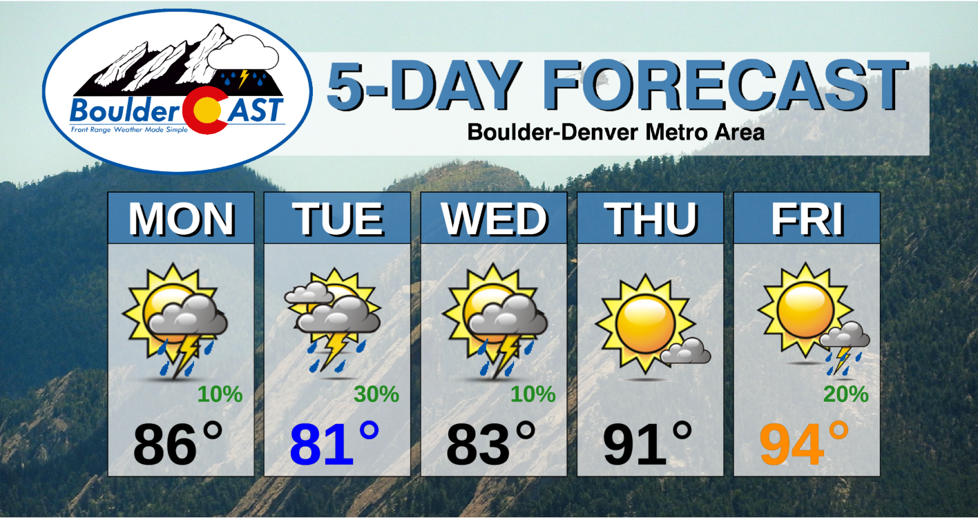
Monday: Mostly sunny skies giving way to increasing clouds and a chance of isolated storms, mainly over the Foothills. Highs in the middle 80’s on the Plains and lower 70’s in the Foothills.
Tuesday: Mostly cloudy skies with scattered late-day rain and storms. Heavy rainfall is possible with isolated flash flooding over the Foothills and possibly Plains. Watch out burn scars! Highs in the lower 80’s on the Plains and near 70 in the Foothills.
Wednesday: Partly cloudy skies with isolated storm or two. Highs in the lower 80’s on the Plains and middle 70’s in the Foothills.
Thursday: Mostly sunny and warmer. Highs reaching the lower 90’s for the Plains and upper 70’s in the Foothills.
Friday: Sunny and hot with a slight chance of late-day storms. Highs near the low to middle 90’s on the Plains and near 80 in the Foothills.
Mountains: Widespread showers and thunderstorms are expected over the High Country Monday and Tuesday with the risk of heavy rain, flash flooding, and mudslides, especially over the burn scar areas. On Wednesday, with the passage of a trough axis, showers and storms will continue to be around, but the threat should lower, especially by Wednesday afternoon. Drier, sunnier, and warmer weather is expected Thursday. An approaching system late in the week will favor scattered storms over the higher terrain on Friday afternoon and evening.
Help support our team of Front Range weather bloggers by joining BoulderCAST Premium. We talk Boulder and Denver weather every single day. Sign up now to get access to our daily forecast discussions each morning, complete six-day skiing and hiking forecasts powered by machine learning, first-class access to all our Colorado-centric high-resolution weather graphics, bonus storm updates and much more! Or not, we just appreciate your readership!
.
Spread the word, share the BoulderCAST forecast!
.






You must be logged in to post a comment.