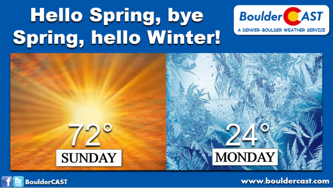
We hope you didn’t change out your winter tires already! Despite the very warm temperatures expected this weekend, bitter cold and snow are on the way! We discuss how and when record-warmth will transition back to the winter we haven’t seen in nearly two months. We also take a peek at potential snowfall amounts.
C
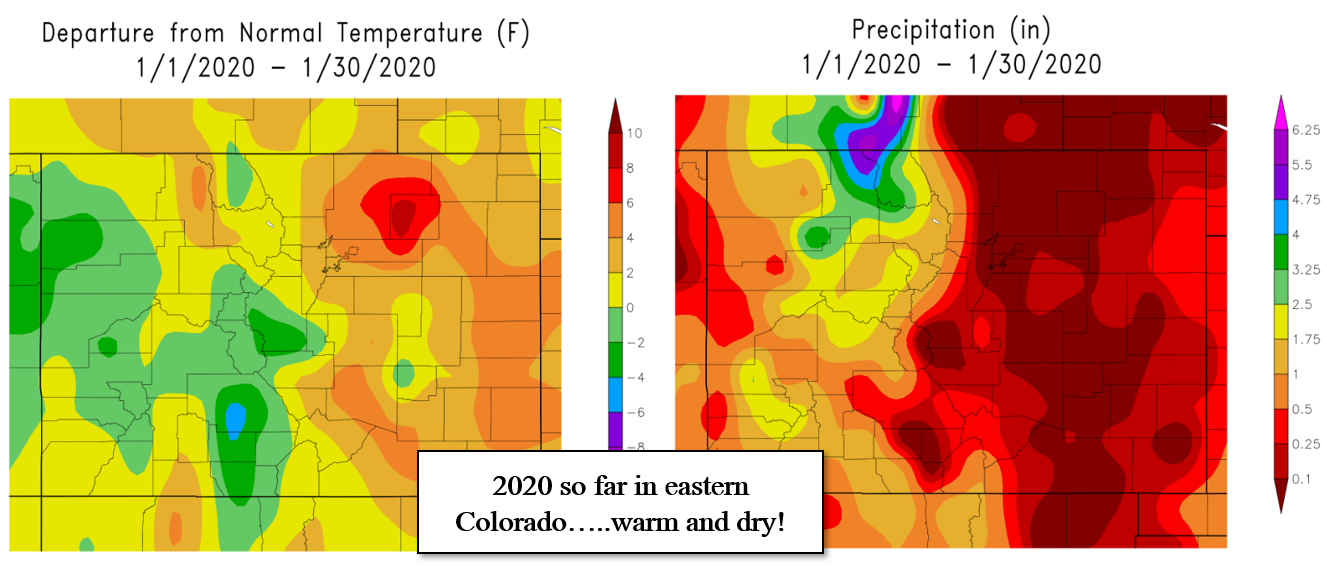
an you believe that we haven’t had to issue a single snowfall forecast for the Boulder/Denver area in exactly five weeks? That’s not the kind of vacation meteorologists want to take in the middle of winter! Our last snowfall of any consequence was during the holidays at the end of 2019. For a storm of only a few inches, that one was a surprisingly difficult forecast! Since then, temperatures have largely remained above normal with next to no precipitation falling across most of eastern Colorado. Some of you may have managed to pick-up a few snowflakes Wednesday or Thursday this week, but nothing to write home about that’s for sure!
This forecast update comes bearing good news on two different fronts (no pun intended!):
- Super Bowl Weekend will be lovely with unseasonably warm conditions and heaps of sunshine. Seriously, get out and enjoy it!
- A return of winter is on the horizon for Monday with accumulating snow and frigid temperatures for the Denver Metro area
There’s a little something in the works for everyone. Let’s take a look at both of these facets….
The WARM before the STORM
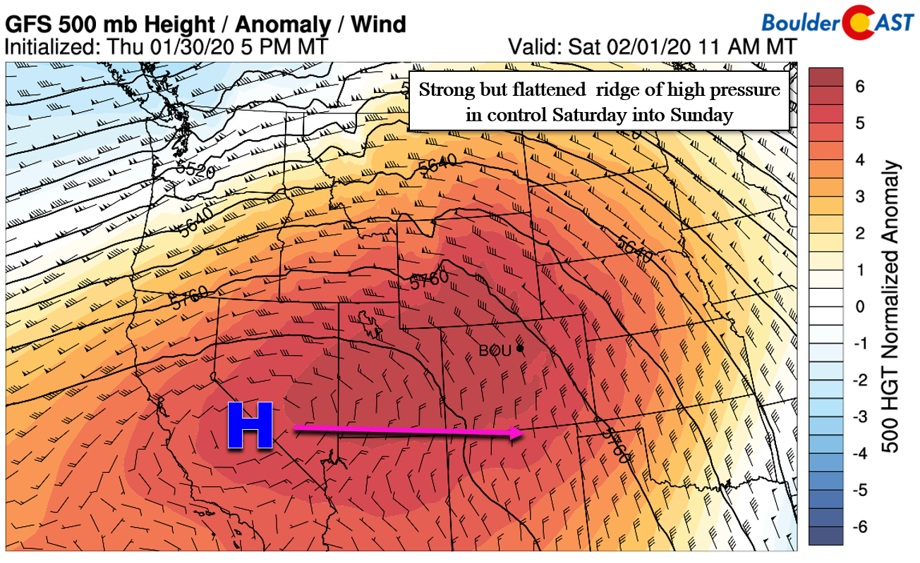
It’s been quite a while since we’ve seen the magnitude of warmth currently headed our way for the weekend. Boulder hasn’t cracked 65 degrees, a value we could surpass both days this weekend, since mid-November. The unseasonable warmth bearing down on Colorado can be attributed to a large ridge of high pressure building across the area from the west. A ridge this warm doesn’t frequently develop during the middle of winter. Large-scale weather models have consistently been advertising this ridge for more than a week now, and as of Friday evening, it is finally beginning to enter the area.
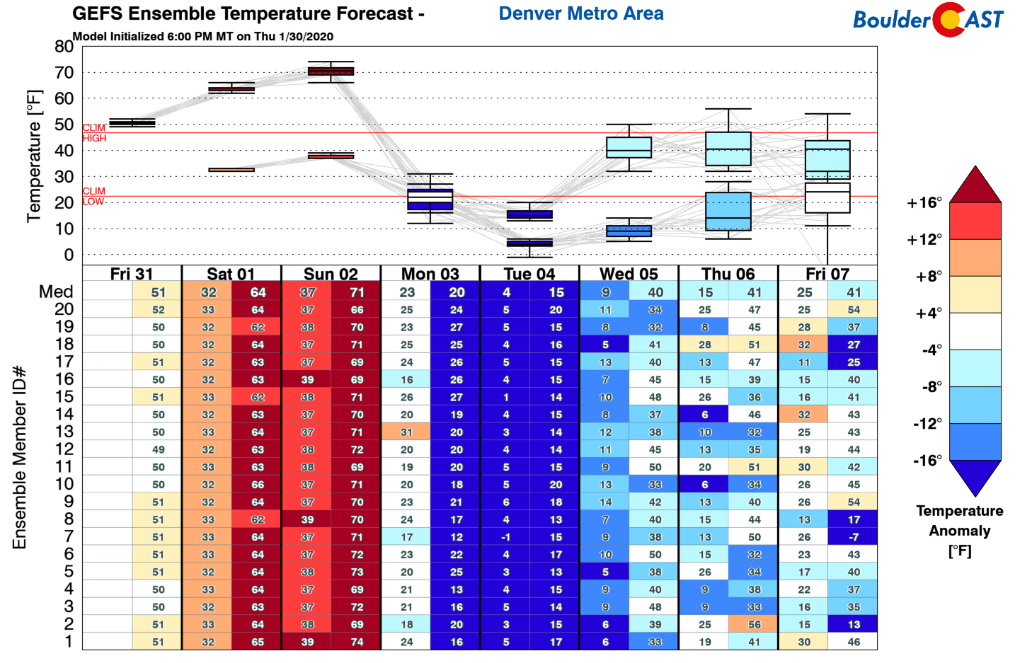
The warmest portion of the airmass will be directly over Colorado for most of the weekend. Though as you can see above, the ridge is fairly flattened and thus we won’t capitalize on much southerly flow aloft until Saturday night or early Sunday. In fact, much of Friday night and Saturday will still see northwest flow aloft over the Front Range. This will limit our potential warming to some extent, but highs are still expected to easily climb into the middle 60’s on Saturday and perhaps crest above 70 degrees Sunday afternoon. 70’s in early February will have many Front Range cities flirting with record highs. This weekend will offer exceptional weather for anything outdoorsy, whether it be catching up on yard work, walking the dog, or exploring a mountain trail.
The STORM
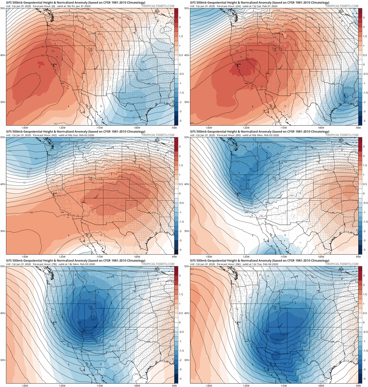
All good things must come to an end, however! Major changes will begin following the arrival of a strong cold front later in the day Sunday. The 500 mb height anomaly animation below shows just how quickly our toasty ridge of high pressure will get evicted by a potent Pacific storm system late in the weekend.
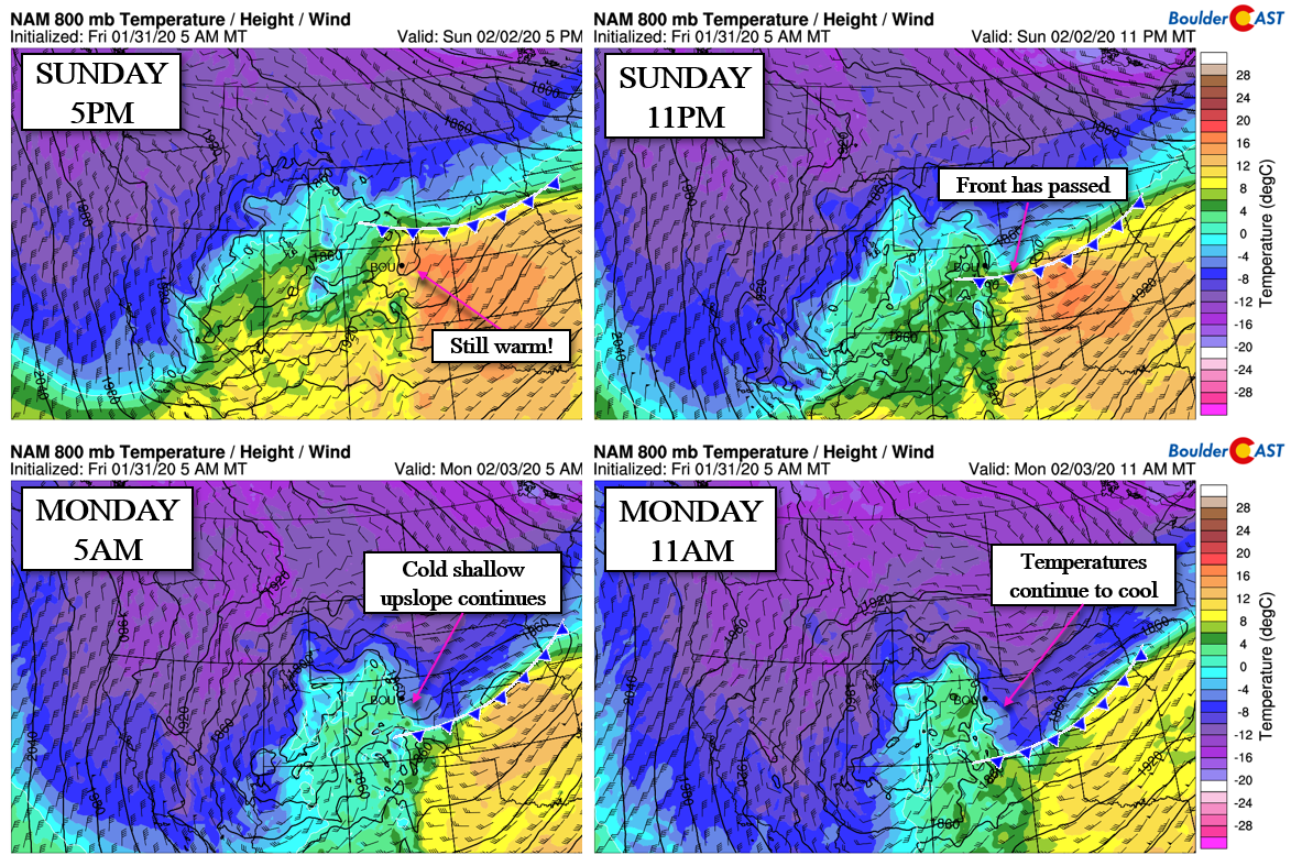
We’ve been tracking the associated cold front for many days already and have watched the timing shift from Sunday afternoon to Monday afternoon and just about anywhere in between. Models are starting to zero-in on when exactly this front will plow through the Boulder-Denver area. We’re still two days out, but we’re seeing good agreement for the front to show its ugly face between 4PM and 8PM Sunday…yes sometime during the Super Bowl?! This window could still change slightly of course, but that’s the latest from our team and the models.
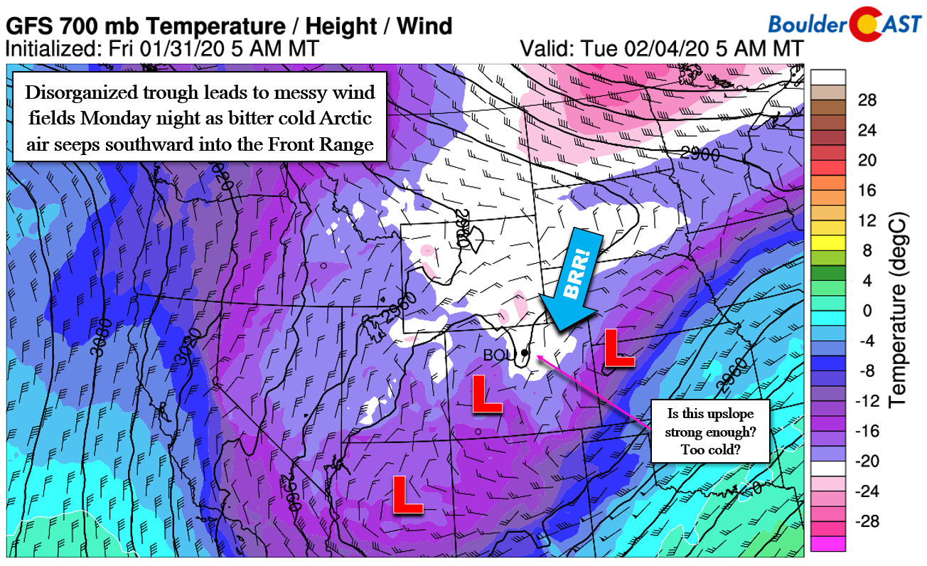
The biggest drop in temperatures will occur Sunday evening with the passage of the initial front. We could conceivably see daytime highs in the 20’s Monday after having been in the 70’s on Sunday. Temperatures will figuratively fall off a cliff! A secondary, truly Arctic airmass will slowly ooze southward into the Front Range Monday night into Tuesday as the main storm system approaches. Tuesday could be even colder with highs in the teens, possibly even falling through the day into the single digits. Tuesday night could get down close to zero degrees.
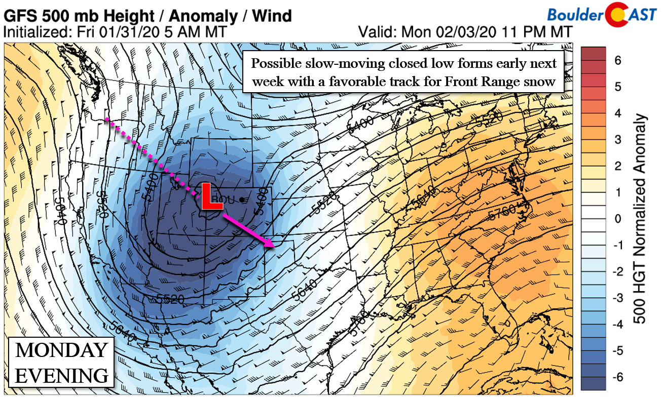
Of course, we won’t forget to discuss the aspect of the forecast you’re likely most interested in: the snow! The storm system set to slam the area on Monday is currently being advertised as a relatively slow-moving closed-low pressure by the GFS and Euro models with a track that would be somewhat favorable for Front Range snow. The “closed” nature of the low is still debatable and may or may not hold as it passes across Colorado early next week.
As such, we’re unfortunately not overly impressed with the way everything is coming together at the moment. The main energy with the Pacific storm is so sluggish that it might prevent the best lift from getting to the Front Range until Monday afternoon into Monday night. By this time, the overhead jet would be long gone and the extremely cold (and don’t forget dry!) Arctic airmass would be flowing into northeast Colorado. This colder, drier airmass wouldn’t bode well for snow ratios or snow totals.
Despite the potential shortcomings of the storm, we are nonetheless excited for a period of sub-freezing temperatures and shallow upslope that will persist from Sunday night into Tuesday night. Without the large-scale forcing early-on (Sunday night into Monday morning), freezing fog and freezing drizzle could be a concern for the Metro area as the predominant precipitation type. Snow should begin to spread across the region sometime during the day Monday into Monday night when lift from the approaching storm and deeper (though still fairly weak) upslope winds take hold. Snow will likely continue lightly into early Tuesday.
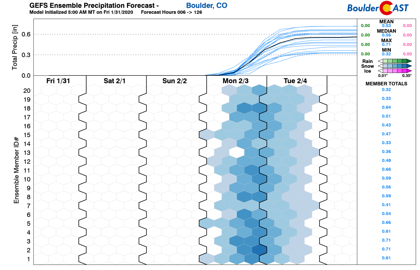
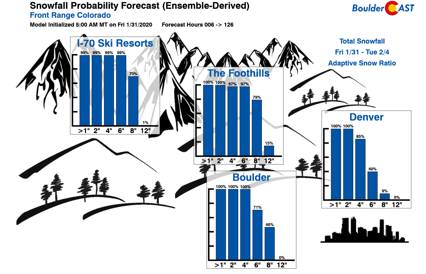
Potential snow amounts are highly dependent on the track and intensity of the low and how quickly it gets here and how long it sticks around once it does. All of these aspects are still somewhat uncertain as of Friday evening. We know it’s going to snow AT LEAST an inch or two for everyone and it’s going to be darn cold. It’s still too early for specifics however. Latest guidance from the GFS and European models and ensembles suggests this could be a 3 to 6″ snowfall event for the Denver Metro area (GFS 4-8″, Euro 2-5″). Given that the primary forcing would be near-surface and low-level upslope over a long duration with very cold temperatures, snow amounts could be higher in the western suburbs like Boulder and in the lower Foothills, maybe 5-10″.
We remind you that things could change drastically come Monday. This particular storm still has a lot of potential on paper, but it doesn’t look like it will live up to it. Whether it comes together for a dumping of early February snow in Boulder remains to be seen. The key takeaway for now is that despite the very warm weekend ahead, winter will return in full-force early next week with bitter cold and snow certainly impacting travel conditions. Get ready and stay tuned for updates…
—
We discuss Boulder and Denver weather every single day on BoulderCAST Premium. Sign up today to get access to our daily forecast discussions every morning, complete six-day skiing and hiking forecasts powered by machine learning, access to all our Front Range specific weather models, additional storm updates and much more!
Subscribe to receive email notifications for BoulderCAST updates:
We respect your privacy. You can unsubscribe at any time.
.
Spread the word, share the BoulderCAST snow forecast!



You must be logged in to post a comment.