Considering how warm and beautiful the weather has been of late, it’s a little shocking that we are now talking snow to end the month of April. But alas, this is the norm for Front Range Colorado. We provide our preliminary thoughts on big changes in the weather headed our way Monday, including significant snow in the Foothills and lesser amounts for Boulder and Denver as well.
We’ll keep today’s forecast update relatively short as there is still some uncertainty in regards to temperatures across the Metro area which will play into potential snow accumulations. Our final update and snowfall forecast map will be issued Monday morning.
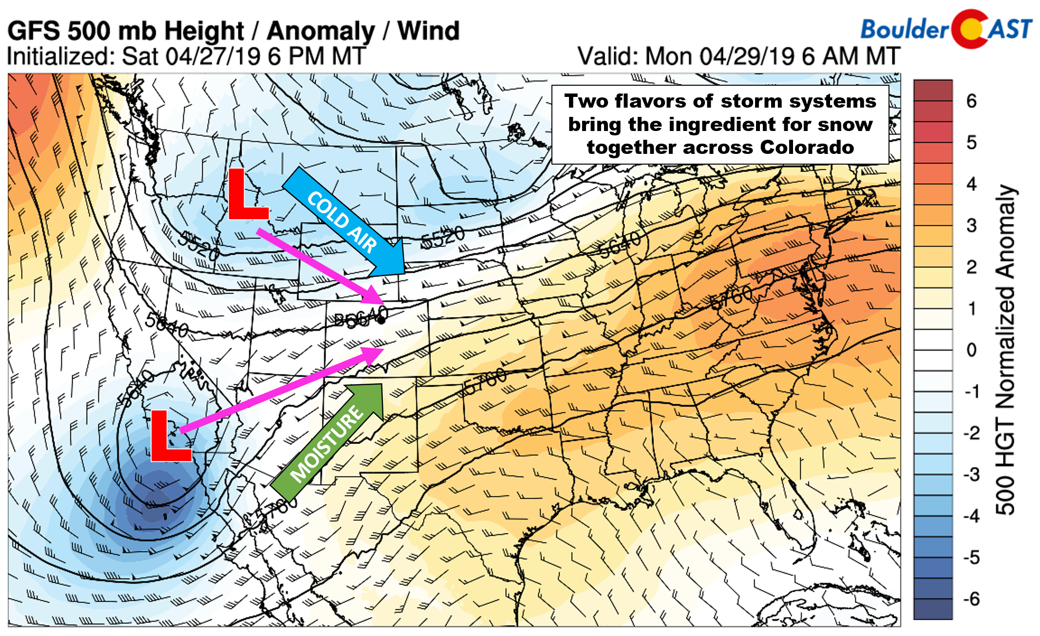
Similar to what transpired during the March 13th Denver Blizzard, two unique storm systems are poised to merge across Colorado on Monday. Each system has vastly different origins and thus will bring a different essential ingredient to the table for late-season snow. Of course, the outcome of the merger won’t be the strongest storm in Colorado’s history like it was back in mid-March. However, we are expecting accumulating wet snow across the Front Range.
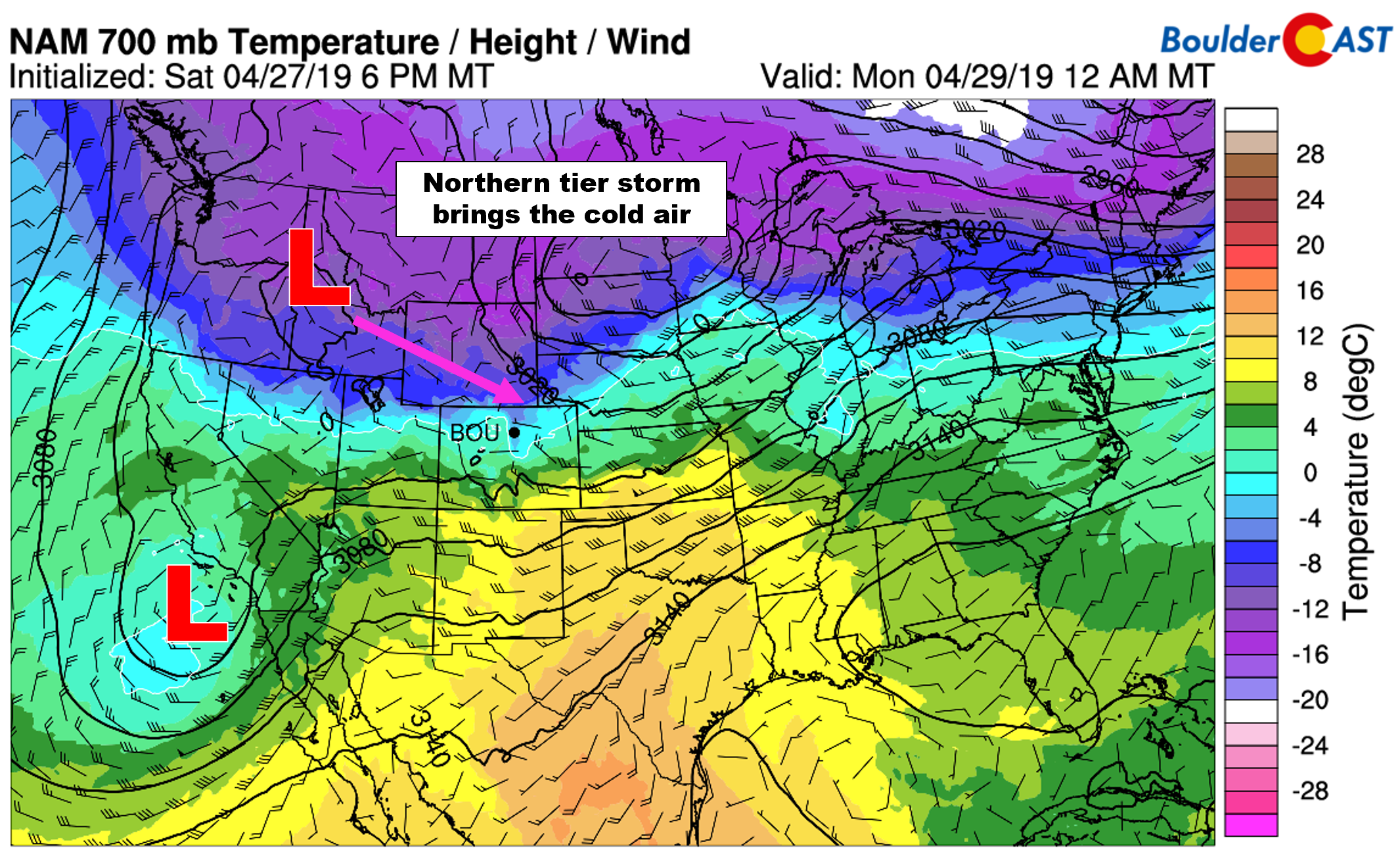
The northern tier system is dropping southward out of Canada and has very cold air associated with it. 700 mb temperatures are some 15°C below zero in Montana, more akin to a mid-March airmass than that of late April.
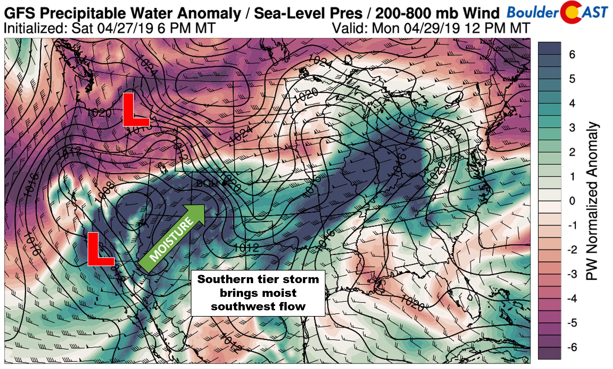
The southern tier storm system is helping to redirect the subtropical jet northward, which in turn will pump warm and moist southwesterly flow into Colorado Sunday night through Tuesday.
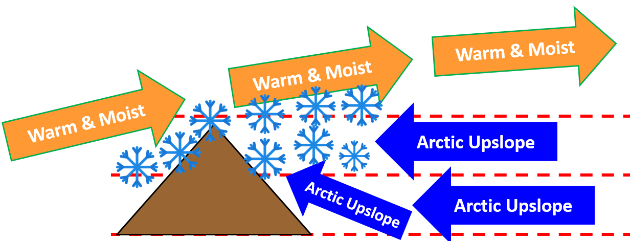
This will set the stage for the primary forcing mechanism for this event….over-running. The warm and moist southwest flow will seed into the shallow cold airmass east of the Mountains.
Throw in the possibility of favorable jet dynamics across northern Colorado (banded snow…woo!) and we have ourselves a real chance at a late-season spring snow event! The net result will be very heavy snow in the Foothills, with some snow likely across the Plains as well.
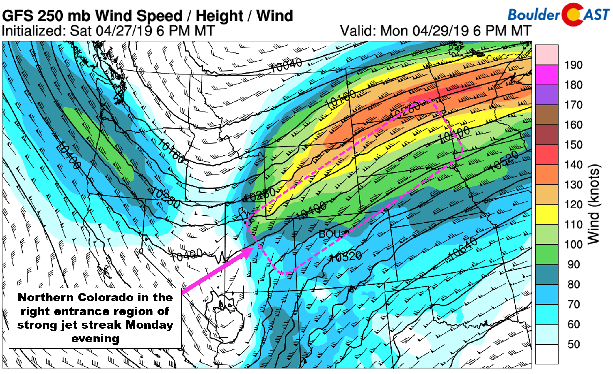
GFS 250 mb wind forecast for Monday evening. Northern Colorado will be in the right entrance region of the jet.
The primary lingering concern for us right now is exactly how cold it will get Monday evening as everything aligns across the region. Despite the unseasonable cold airmass in-place across our area on Monday, it may not be quite cold enough for much accumulating snow as the Metro area will be on the very southern fringe of the coldest air. The fact that most models are showing low-level southeasterly winds is definitely a red flag as this direction is often too warm for snow this time of year and can cause downslope into the Denver area from the Palmer Divide. We’ve been discussing this concern in our Premium forecasts for the last several days.

NAM model temperature and wind forecast for Monday night near the surface (left) and 10,000 feet elevation (right)
The GFS has been bullishly showing very cold temperatures without fault for many days, while other models have been a little more cautious (i.e. warmer). Despite this uncertainty, the local media has already been hyping up the snow potential. No surprise there….
It appears that the GFS has gone north and turned a little warmer in its last few runs and is now in better agreement with the NAM and Euro models. Temperatures are still going to be right on the cusp of rain and snow across the lower elevations. Due to the aforementioned downslope from southeasterly winds, we believe the northern Metro area will be a tad cooler overall compared to the southern Metro area, and thus see more snow.
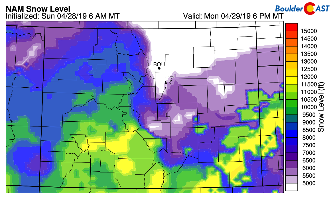
NAM model-derived snow level forecast for Monday early evening. The primary precipitation type should be snow for everyone.
Here’e a quick timeline for the storm:
- Sunday: Partly sunny with high temperatures in the low to middle 70’s. Watch for widely scattered thunderstorms during the afternoon and evening hours. Only light rainfall is expected with brief gusty outflows.
- Sunday night: The primary cold front arrives before midnight with gusty winds and temperatures falling into the 30’s by sunrise Monday morning.
- Monday morning and early afternoon: Heavy over-running snow develops through the day in the Foothills and Mountains, with some of this spilling across the Plains as a light rain/snow mix. Skies will be overcast with low clouds and temperatures in the 30’s across the Plains.
- Monday afternoon into the night: This will be the period of most intense dynamics across the Front Range. Expect very heavy snow in the Foothills and wet snow across the Plains as well. Banded snowfall is likely during this period with snowfall rates of 1″ per hour or higher. We believe that despite the marginal temperatures, the higher precipitation rates will allow for added dynamic cooling with just about everyone seeing accumulating snow. Amounts however will drastically depend on elevation.
Liquid precipitation amounts for the event are expected to be around 1″ across our area with most of this falling late Monday afternoon into Monday night as wet snow.
This is great moisture, but ground-temperatures are very warm and air temperatures will be marginal as well. Thus, accumulation will be difficult during the daytime hours on Monday across the Plains, but we should start to see more snow stick as Monday evening progresses and the pesky April sun goes down.
Our preliminary snowfall forecast is as follows:
- Boulder/Denver area: 1 to 6″ (lowest south and east, highest north and west)
- Foothills below 7000 feet: 5 to 10″
- Foothills above 7000 feet: 8 to 16″
At this point in time, there is enough uncertainty to keep us a little uneasy about the forecast. The snowfall amounts we have outlined are very much “middle of the road”. If models trend a couple of degrees warmer or colder, we could see much lower or higher snow totals across the Plains. The indicated snowfall amounts for the higher elevations are a near-certainty, however.
We also caution that the exact location of the jet-forced heavy snow bands Monday evening are not locked-in yet. While most models are targeting the area further north from Fort Collins to Cheyenne, Boulder and Denver could see some of this action as well. Ultimately our forecast of 1 to 6″ in the Metro area assumes most but not all of the heavy banding will be north of our area.
If slightly colder air and more jet forcing hits the Front Range, snowfall totals across the lower elevations could exceed 8 to 10″, but we do consider this a low-end chance. Models are tending to keep these type of totals north in Wyoming right now.
We’ll continue to comb through the models and finalize all the important details soon. Check back early Monday for our final snowfall forecast and map.
Summer today. Winter tomorrow. Happy Sunday!
Share our forecast:
.




You must be logged in to post a comment.