We discuss the strong snow storm that eluded the Front Range, the very cold temperatures expected the next few days, and when our next chance of snow will be.
Our daily forecast discussions are Premium content. Periodically, we open this forecast up to all of our readers. Today is one of those days!
Sign up today to get the best BoulderCAST experience, including these daily forecasts every morning, complete 6-day skiing and hiking forecasts, additional storm updates and much more!
White “Day After” Christmas
Last evening’s light snow arrived to the Metro area one day too late for a White Christmas. Early reports and overnight webcams show that portions of the area saw only a few flakes (around Boulder), or a dusting (around Broomfield and Westminster), up to a few inches in the Foothills west of Boulder. This is more or less in-line with our forecast. It wasn’t much, but it is a nice reminder what the weather should be like this time of year! Yesterday snapped Boulder’s 18-day streak of warmer than normal temperatures, nabbing a high of only 35 degrees.
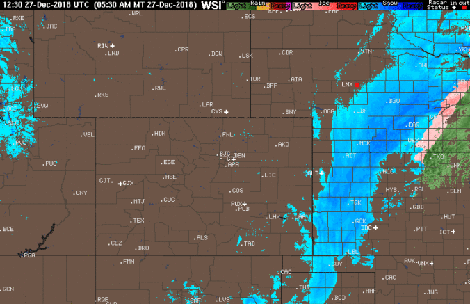
Judging by where the northern edge of the heavy snow in eastern Colorado ended up last night, the storm appears to have tracked even further south and east than models were indicating by 50 miles or so. This slight shift didn’t ultimately impact the forecast in Denver much, but many areas of far eastern Colorado got short-changed and likely saw well below their expected snowfall amounts. Most of the heavy snow was across the border in Kansas.
Sunshine today and turning colder
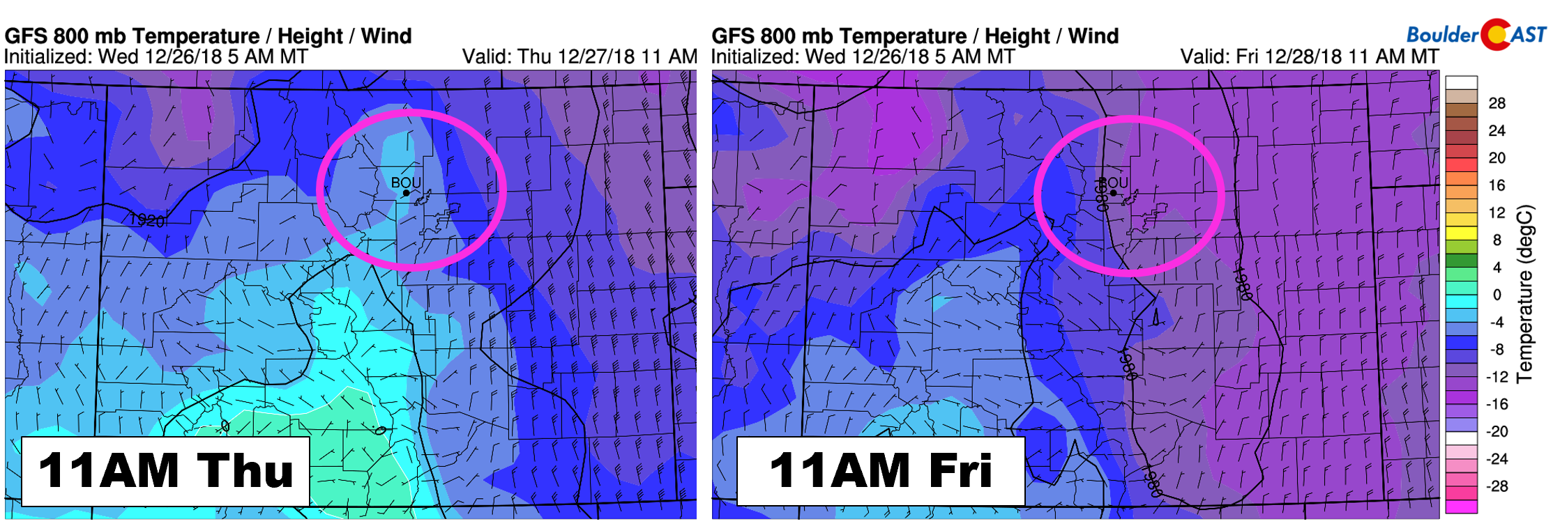
As the big snowstorm pulls northeast into the Great Lakes by tonight, we’ll see quiet weather across our region today with mostly sunny skies as a dome of high pressure builds in from the north. Northerly winds will really help to bring down the colder air later this afternoon and evening. It may seem cold now, but tomorrow will be even colder. The graphic below compares mid-day temperatures at 800mb today (left) with tomorrow (right). Today’s temperatures will top out in the mid to upper 20’s. Tomorrow will be some 10 to 15 degrees colder…more than likely remaining in the teens.

GFS 800 mb temperature forecast for today (left) and tomorrow (right). It will be even colder tomorrow!
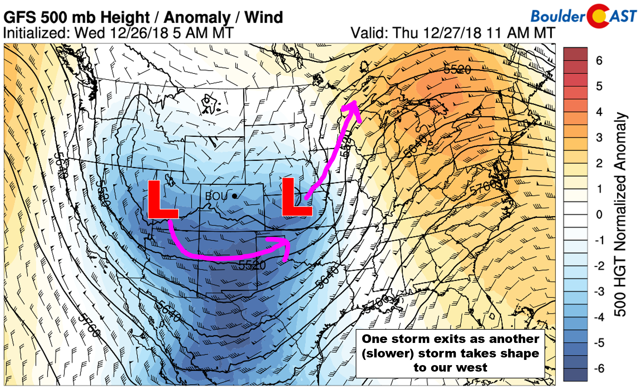
As one storm exits, another storm is already taking shape to our west. In the 500 mb height anomaly forecast below, you can see both storms. The incoming system will swoop south and then east across Arizona and New Mexico over the next few days. This system will ultimately be too far south again to have much influence to our region (outside of keeping the cold air socked in through Saturday).
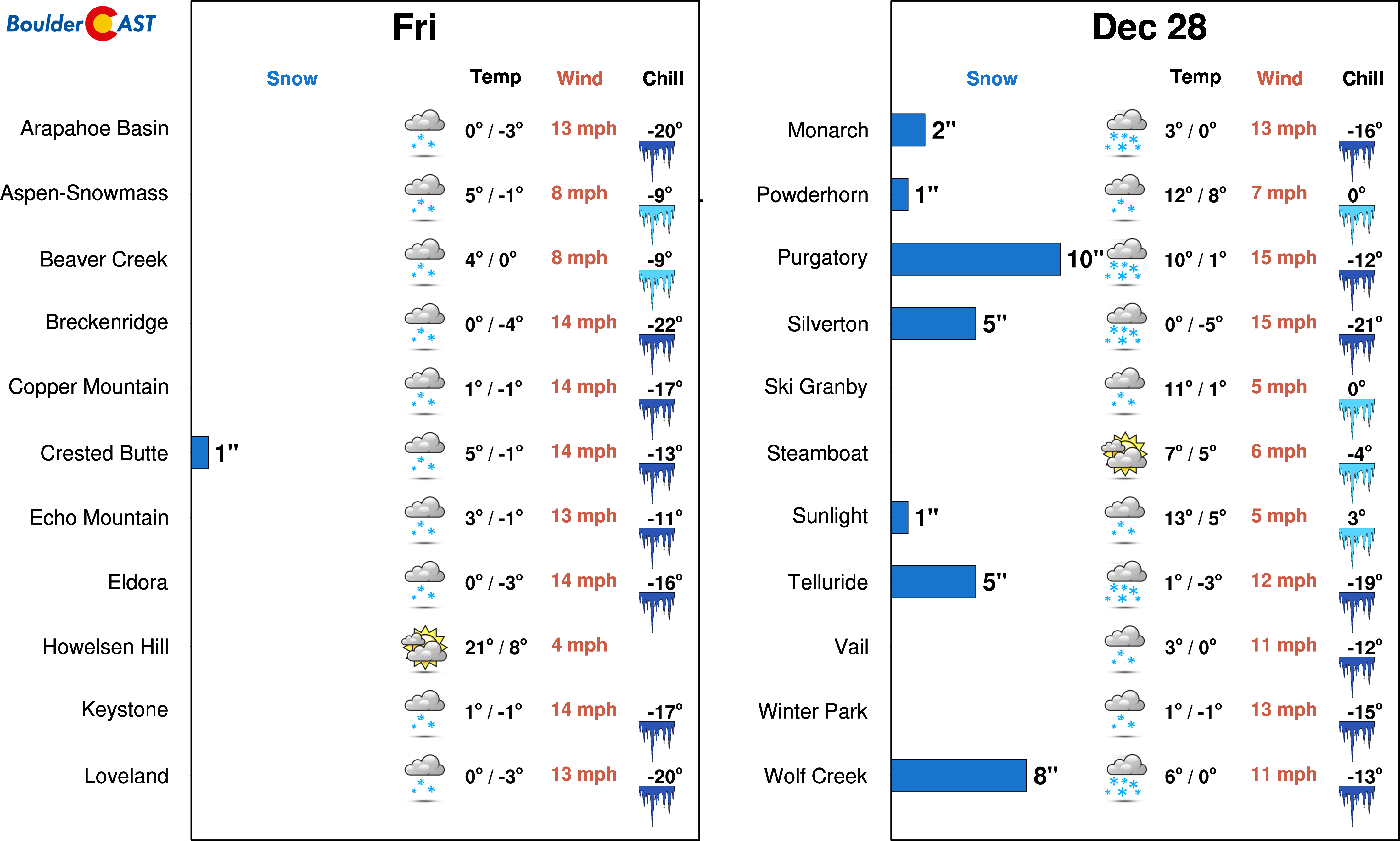
This secondary storm will take a similar track to the first one, but will be moving much slower. Expect snow showers to spread across the Mountains of southern Colorado by early this evening and continue into Friday night with 4 to 8″ possible. A few isolated flurries could fall in and around Denver during the day Friday with no accumulation. This is a very small chance, only 5 to 10%, but I figure I should mention it. It mainly will be just cold here with overcast skies to end the week.
The next potential system we are tracking may bring snowfall to our entire region. It is currently slated for sometime Monday (New Years Eve) and has the makings of a “light” snow event. More on this in the coming days…
Stay warm!


You must be logged in to post a comment.