Winter is about to make a move again along the Front Range for the first time in 2026. After one last mild day Wednesday, a pair of storm systems will team up to bring moisture, colder air, and a decent shot at accumulating snow to finish the week. The setup is a little tricky, the timing isn’t perfect, and the details are still fuzzy due to some uncertainty—but there’s plenty to be hopeful for as this event plays out Thursday into Friday. We discuss the broader setup, how things may unfold and where the biggest impacts could land alongside heavy wet snow.
Update (Thu 1/8/26 5AM): Lower end scenarios now appear more likely with this tricky pair of storm systems not phasing together well. Based on latest guidance, we have reduced snow amounts by 1 or 2 inches across the board. Snow map and discussion of amounts are updated. Timing looks fine with rain/snow developing Thursday morning, snow on-and-off during the day into the evening, and snow coming to an end Thursday night or early Friday.
What You Need to Know
- 🌤️ Quiet Weather Ends Wednesday: After one more mild, sunny day, the pattern turns active with two incoming storm systems.
- 🌀 Storm Setup: Warm Baja moisture meets colder northwest energy Thursday, creating our best window for accumulating snow.
- 🌧️🌨️ Thursday Daytime Mix: Light rain/snow develops Thursday morning, fighting very dry air and near‑freezing temps that limit early accumulation.
- 🌬️❄️ Evening Cold Surge: Better cold air arrives Thursday evening, briefly boosting upslope and raising travel concerns as moisture begins to wane.
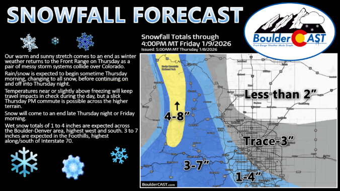
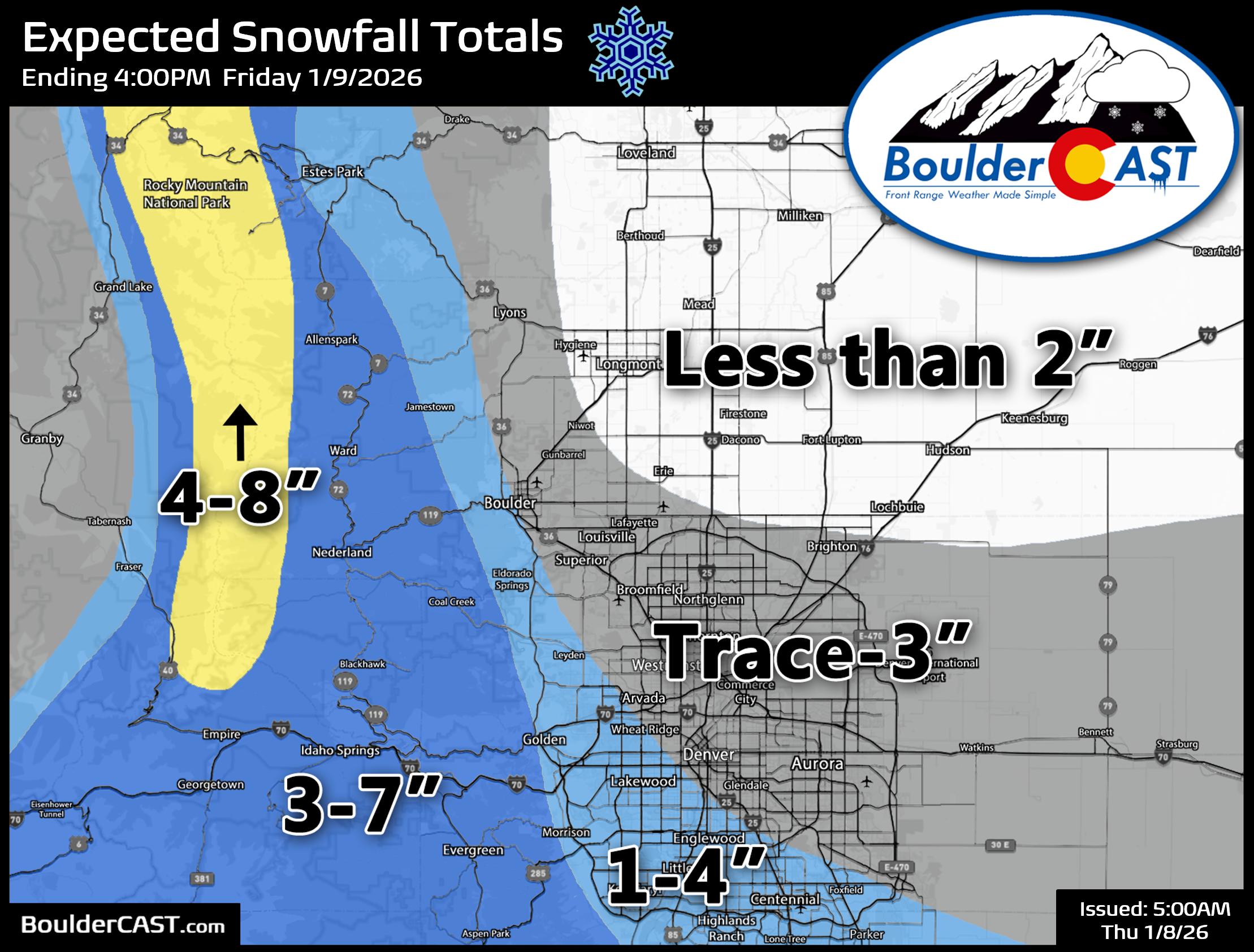
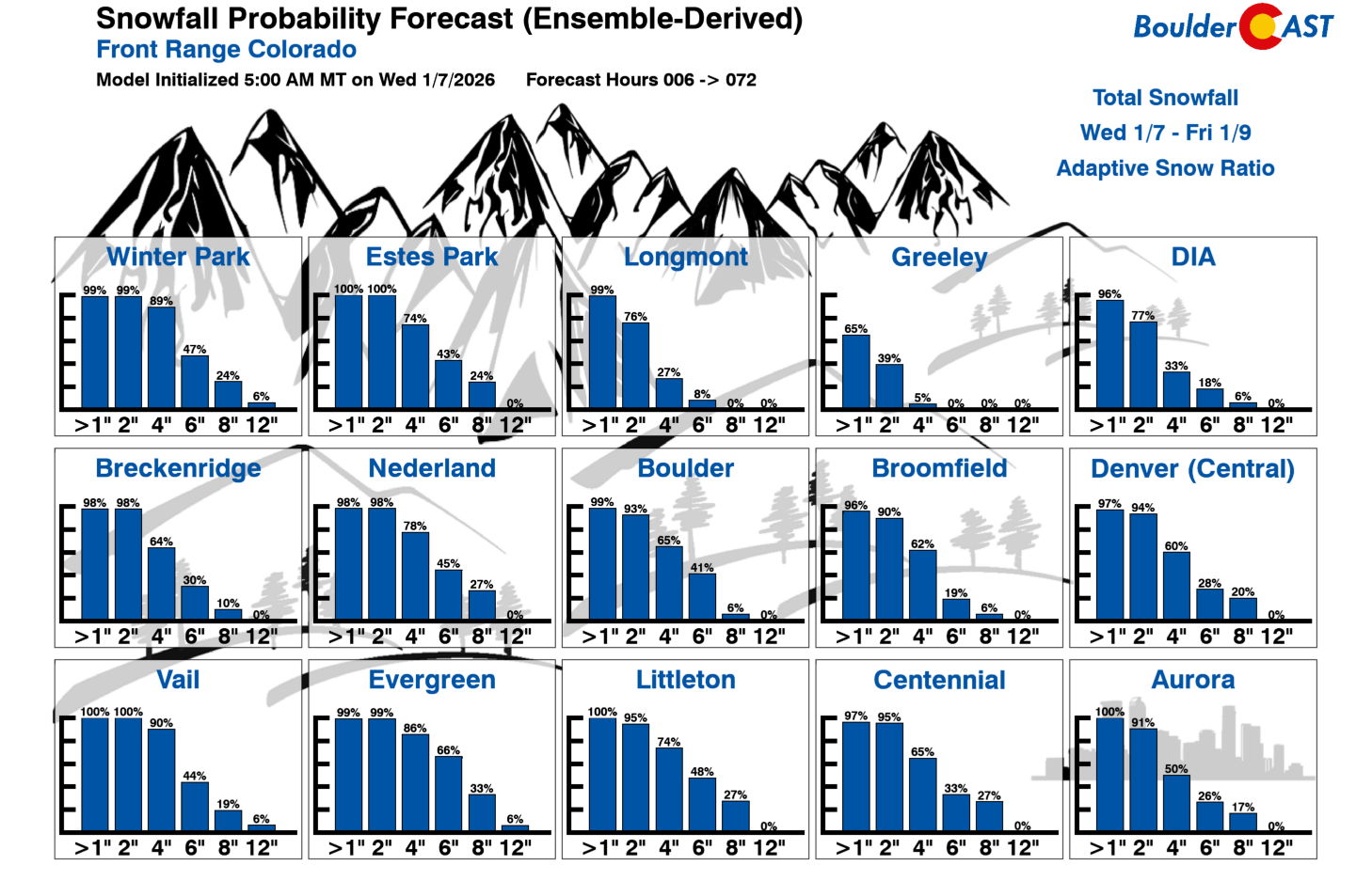
- 📏 Expected Snow Totals: Lower elevations 1–4″ (lowest northeast, highest south/west suburbs); Foothills 3–7″; Continental Divide/RMNP 4–8″.
- 🚗⚠️ Impact Window: Thursday evening commute is the main trouble spot—especially Foothills & Palmer Divide—where heavier convective bursts could deteriorate things quickly.

Go Premium, get all the perks.
Daily Forecast Updates
Get our daily forecast discussion every morning delivered to your inbox.
All Our Model Data
Access to all our Colorado-centric high-resolution weather model graphics. Seriously — every one!
Ski & Hiking Forecasts
6-day forecasts for all the Colorado ski resorts, plus more than 120 hiking trails, including every 14er.
Smoke Forecasts
Wildfire smoke concentration predictions up to 72 hours into the future.
Exclusive Content
Weekend outlooks every Thursday, bonus storm updates, historical data and much more!
No Advertisements
Enjoy ad-free viewing on the entire site.
The first snow of 2026 will be…wet!
After one more mild, mostly sunny day across the Front Range on Wednesday, our quiet stretch comes to an end. The weather pattern turns noticeably more active to finish the week as two separate low‑pressure systems slide through the southern Rockies—each taking a different path, each contributing a different ingredient to our eventual snow chances.
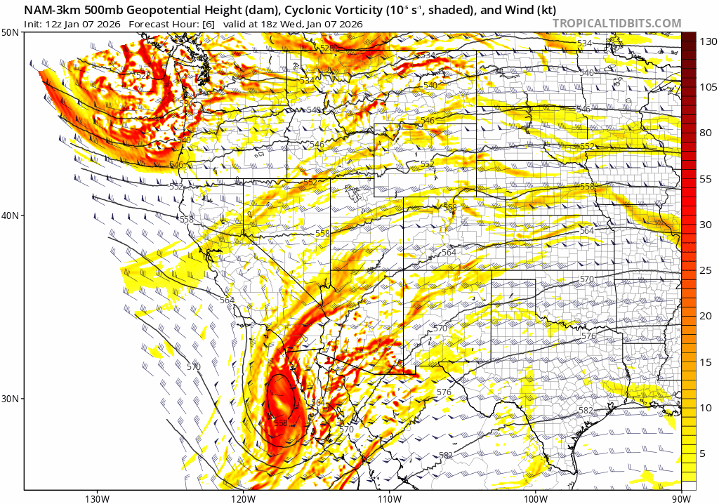
The first system lifts out of Baja California Wednesday night. It’s a warm, moisture‑rich disturbance, but its track is simply too far south to deliver a direct hit to the Boulder–Denver Metro. Most of its deeper lift and heavier precipitation will stay pinned across southern Colorado and New Mexico. Hot on its heels, however, comes a second, colder system dropping in from the northwest late Thursday. This one also sends most of its energy south of us, but the key to our forecast is the interaction between the two—Baja moisture meeting incoming cold air. That overlap is what gives the Front Range its best shot at accumulating snow.
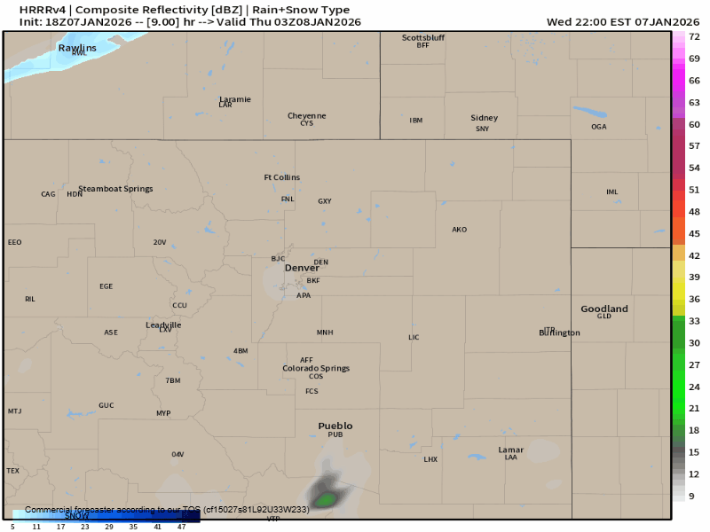
As the Baja low passes to our south Wednesday night, a strong mid‑level circulation develops over southeast Colorado and western Kansas. This helps flip our winds weakly upslope sometime after midnight and draw in cooler air from the north. The problem early on is the extremely dry surface layer across the Metro area. It will take hours for that layer to moisten, so the first echoes on radar may not reach the ground for quite a while. Still, we expect light rain, snow, or a mix to begin filtering into the area Thursday morning and continue on and off through the day.
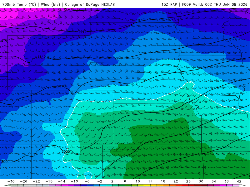
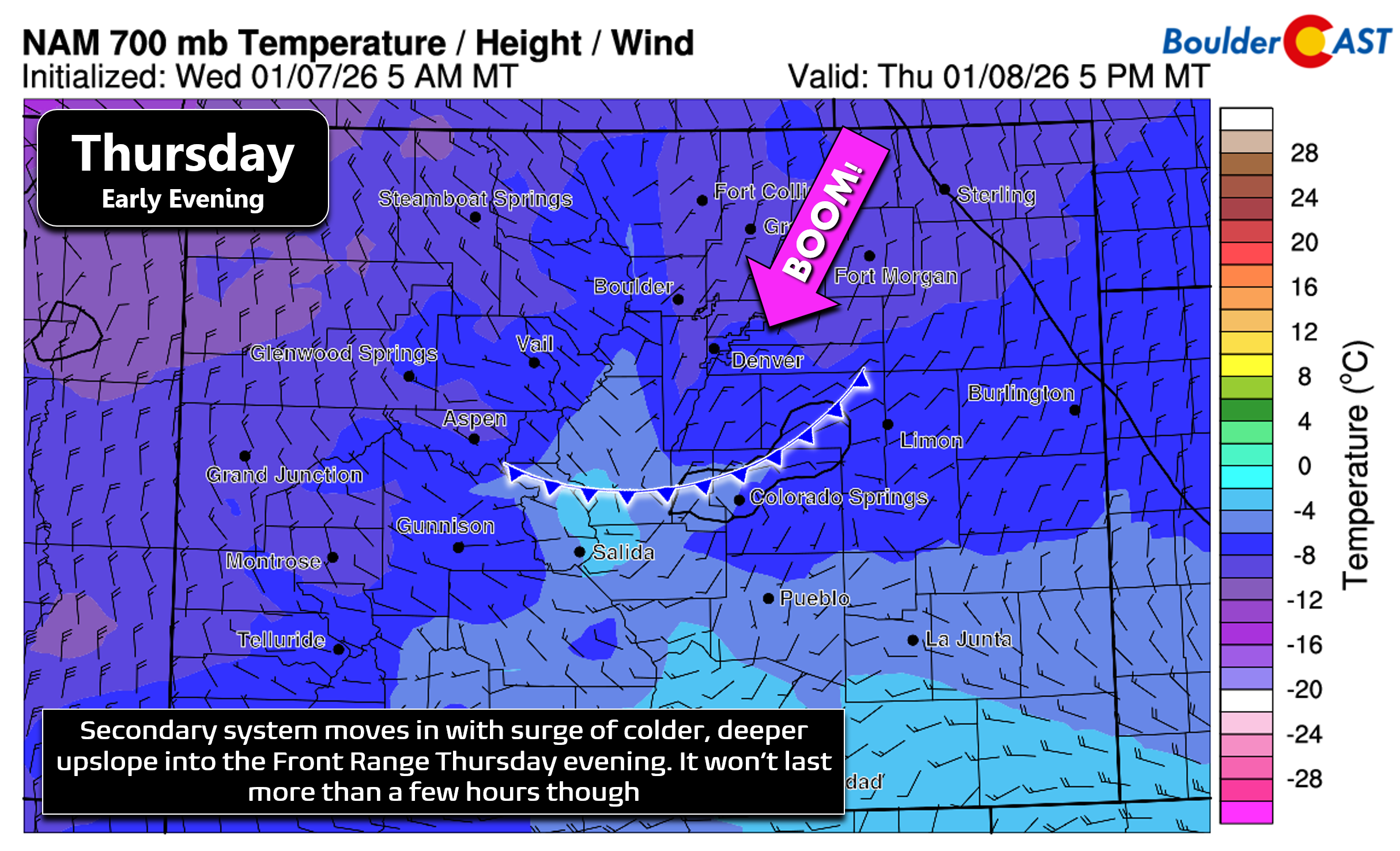
Temperatures and precipitation type remain a forecast issue. Readings will hover near or slightly above freezing for much of Thursday, which complicates how efficiently snow can accumulate at lower elevations. Better cold air doesn’t arrive until the secondary pulse pushes in Thursday evening. That surge briefly strengthens upslope flow and could create some headaches for the evening commute. Unfortunately, this colder push also arrives as moisture and large‑scale lift begin to wane, so the timing mismatch leaves us with lingering uncertainty about how much snow can actually pile up across the area.
Even so, both short‑range and global models continue to paint a broad shield of precipitation across the Front Range from late Thursday morning into Thursday evening. We’re not overly concerned about a complete miss, even though the storm tracks aren’t ideal and a few ensemble members still keep us drier. The Foothills will be cold enough for all snow, and it should stick easily. Down in Boulder and Denver, we’ll may see a mix early on, but most of the event should fall as snow—and a wet snow at that.
Model guidance is fairly consistent on liquid totals, generally showing 0.20″ to 0.70″ across the Front Range, highest south and west of Denver and lowest northeast.
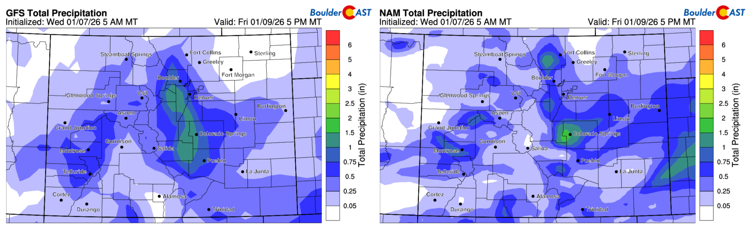
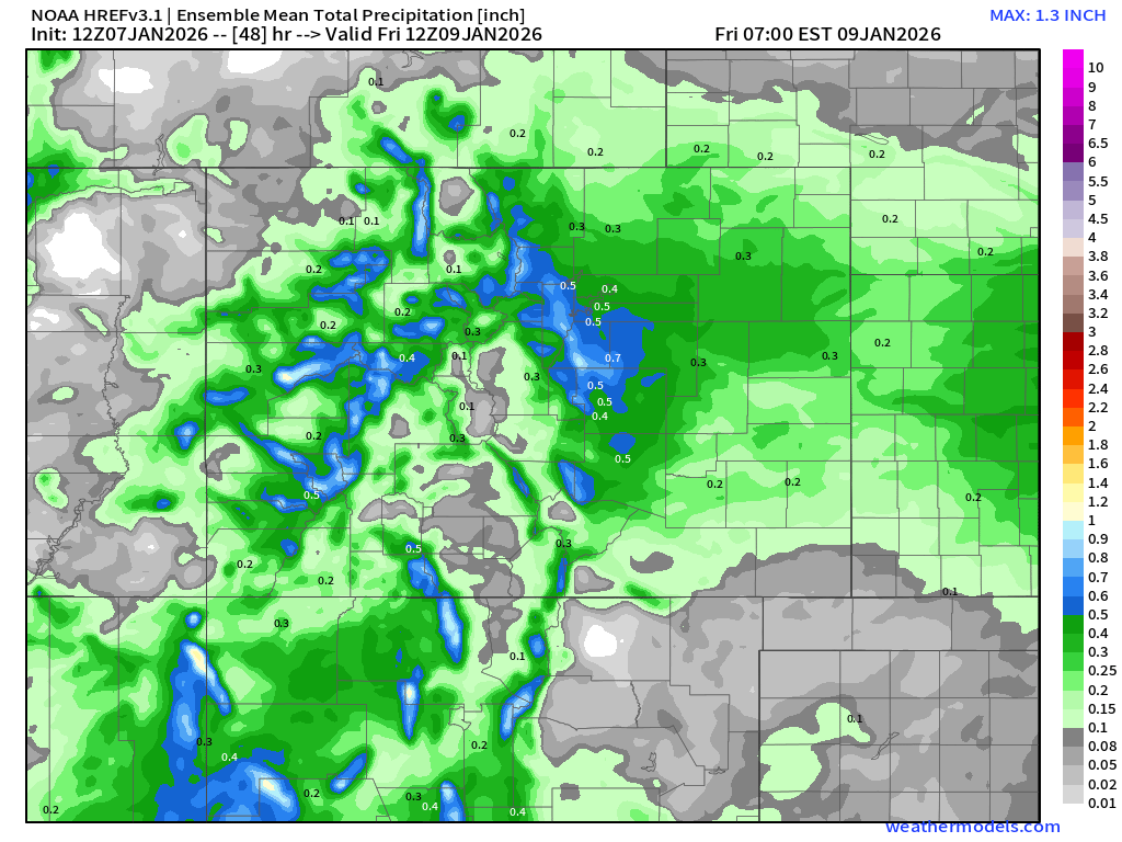
The HREF high‑resolution ensemble supports this idea, though we remain cautious. The wind fields are only borderline upslope, and even a subtle shift could flip parts of the area into a downslope regime, cutting off the storm’s potential quickly with dry air spoiling the party.
As of Wednesday afternoon, forecast uncertainty remains elevated, and our snowfall map reflects that with wider‑than‑usual ranges. For the lower elevations, we’re calling for 1 to 4 inches, with the higher end more likely across the southern and southwestern suburbs. Eastern Boulder may only manage an inch or so, while western Boulder could see double or triple that. The Foothills, with colder temperatures and stronger forcing, can expect 3 to 8 inches, highest along and south of I‑70. Along the Continental Divide and through Rocky Mountain National Park above 10,000 feet, 4 to 8 inches looks reasonable. Roughly half of whatever you get will fall during the day Thursday—anywhere from a dusting to about 2 inches—with another dusting to 2 inches possible Thursday evening and overnight as colder air finally settles in. Snow should wind down sometime Thursday night or early Friday, but with temperatures dropping into the teens and lower 20s, a little ice on the roads is certainly on the table for the Friday morning commute. Take it slow!
Our latest Snowfall Probabilities reinforce the idea of a modest event: odds of reaching 2 inches in Boulder and Denver are around 90%, but the chance of exceeding 6 inches drops sharply—roughly 20% for Denver and 40% for Boulder. We’re not leaning into those higher‑end outcomes. Too many pieces would need to align perfectly with a pair of systems that, frankly, aren’t lining up perfectly at this juncture.
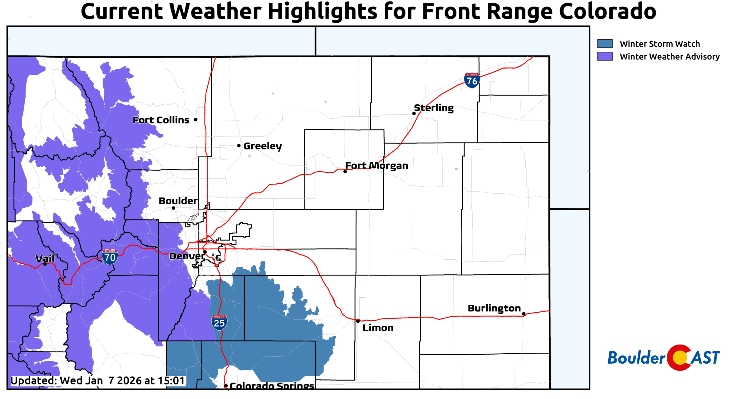
The National Weather Service has issued Winter Weather Advisories for the Mountains and southern Foothills (excluding Boulder County), along with a Winter Storm Watch for the Palmer Divide south of Denver.
The Thursday evening commute remains the most vulnerable to travel impacts, especially near the Foothills and across the Palmer Divide. And if Mother Nature decides to throw in a few pockets of heavier, convective snow—as a handful of models continue to hint at—localized trouble spots could develop quickly there. I-25 south of Denver and I-70 to the west could get very slick at times Thursday evening and night.
Bottom Line
All told, this is a classic “ingredients‑are-there-but-the-timing-is-tricky” setup for the Front Range. We have moisture from the south, cold air from the north, and just enough upslope to make things interesting—but not enough alignment to guarantee a decent event for the area. Expect a messy mix early Thursday morning, a quick transition to wet snow during the day, and the potential for a few travel headaches as colder air arrives just in time for the evening commute (mainly higher terrain). By Friday morning, most of the storm will be in the rearview mirror, though a few slick spots may linger with temperatures dipping into the teens and 20s.
We’ll continue to refine the details as the systems approach and pass along any updates. For now, plan on a modest, slushy snowfall for the Metro area, heavier totals in the Foothills, and a quick return to quieter weather heading into the weekend as ridging rebuilds (yay…).

Let it snow!
Spread the word, share our crazy Colorado weather:
Go Premium, get all the perks.
Daily Forecast Updates
Get our daily forecast discussion every morning delivered to your inbox.
All Our Model Data
Access to all our Colorado-centric high-resolution weather model graphics. Seriously — every one!
Ski & Hiking Forecasts
6-day forecasts for all the Colorado ski resorts, plus more than 120 hiking trails, including every 14er.
Smoke Forecasts
Wildfire smoke concentration predictions up to 72 hours into the future.
Exclusive Content
Weekend outlooks every Thursday, bonus storm updates, historical data and much more!
No Advertisements
Enjoy ad-free viewing on the entire site.


You must be logged in to post a comment.