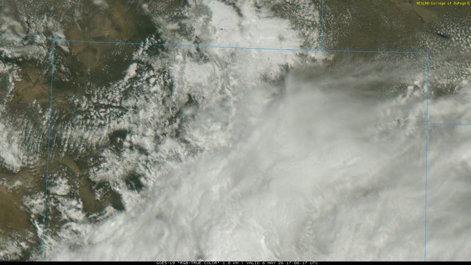
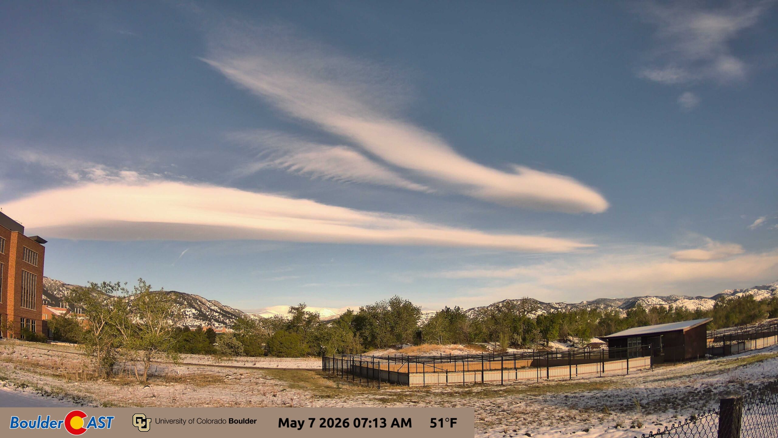
❄️ Storm aftermath — Yesterday’s system exited by afternoon but left widespread tree damage and a striking fresh May snowpack visible on satellite.
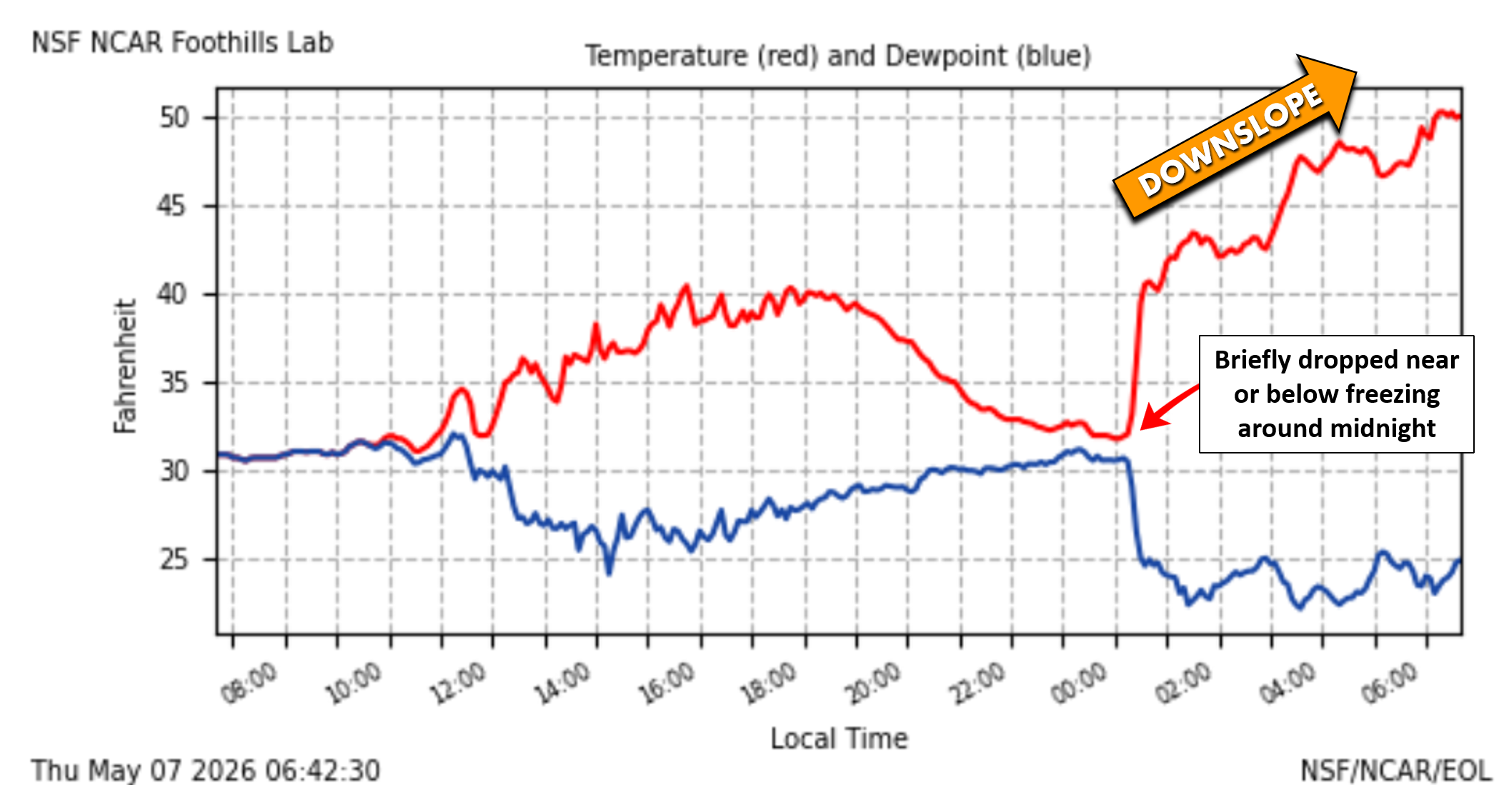
🌡️ Overnight downslope — Warm, late‑night downslope spared most of the Denver Metro from a hard freeze; only a few pockets came close.
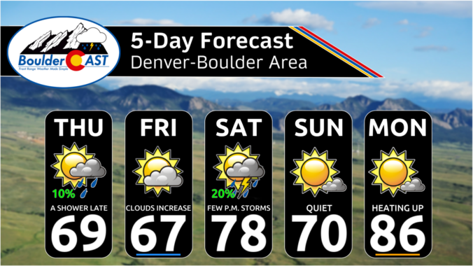
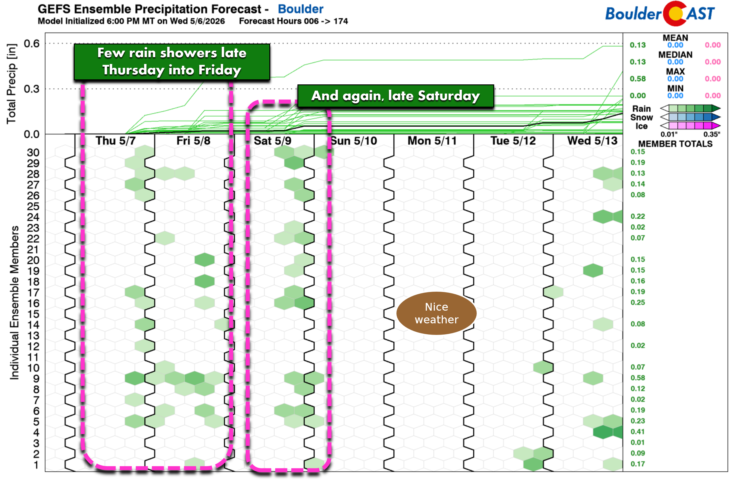
🌤️ Shortwaves ahead — Two weak disturbances (Thu & Sat) bring small rain chances and minor fronts, but overall conditions stay mild and mostly dry through the weekend.
☀️ Warm pattern returns — Weekend stays pleasant with isolated storms; next week heats up significantly as a ridge builds, pushing highs into the 80s.
Y
esterday’s storm may have exited the Front Range by mid‑afternoon, but it certainly left its mark. A sharply defined post‑storm snow signature showed up beautifully on the GOES‑East imagery as clouds peeled away to reveal a clean white blanket across northern Colorado.
Overnight, the atmosphere pulled off a bit of a magic trick. Despite clear skies and fresh snow—normally a recipe for a hard freeze—downslope winds surged into the Denver Metro area after midnight, warming the lowest few thousand feet of the atmosphere just enough to spare most locations.
Only the usual cold spots near Greeley, Fort Morgan, and perhaps isolated pockets around Longmont, Loveland, or Fort Collins flirted with a true freeze. For the rest of us, the growing season lives on—and likely won’t face another freeze threat for another five months or so in the Fall. Fingers crossed!
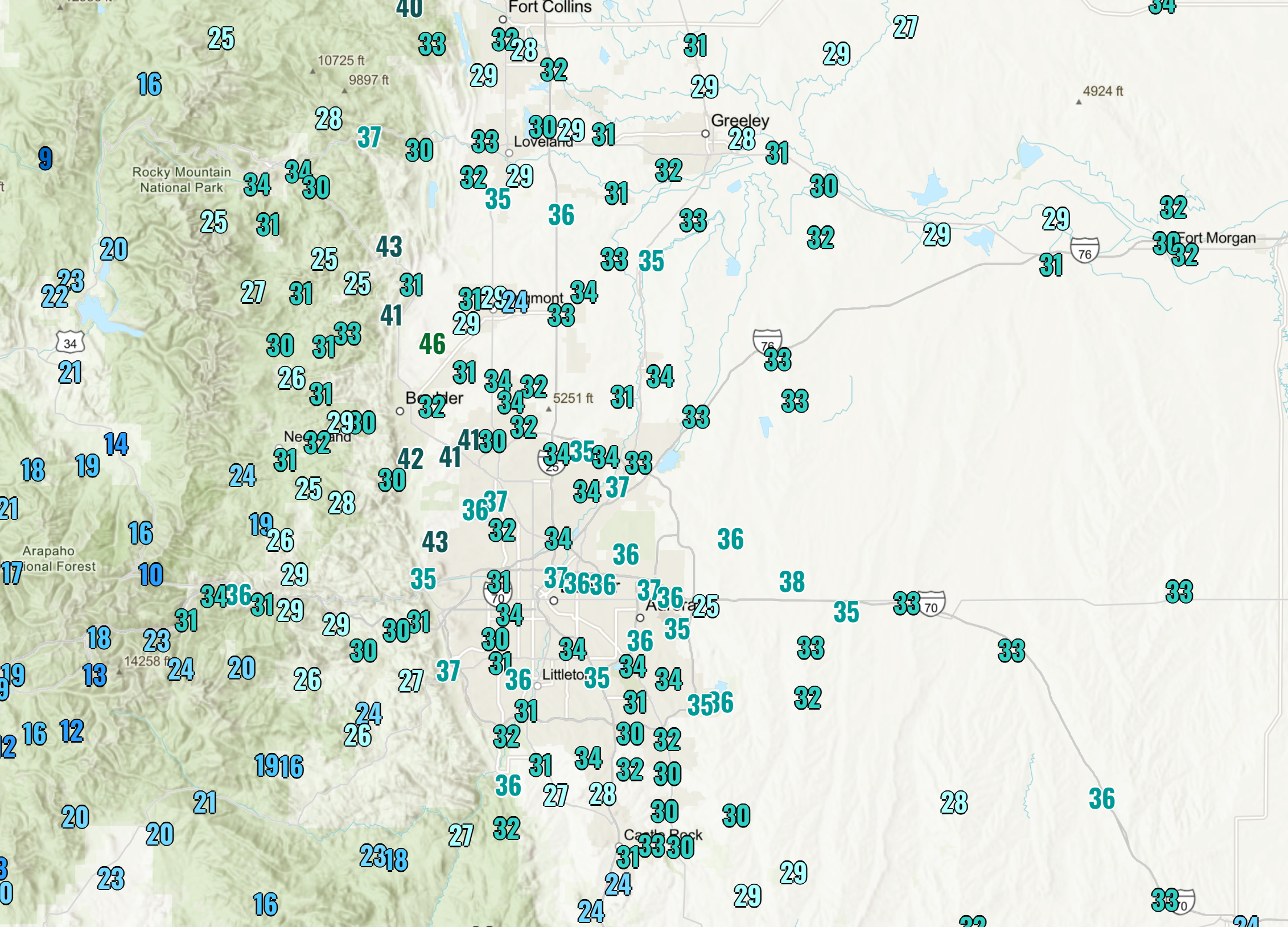
Observed overnight lows across the Denver area
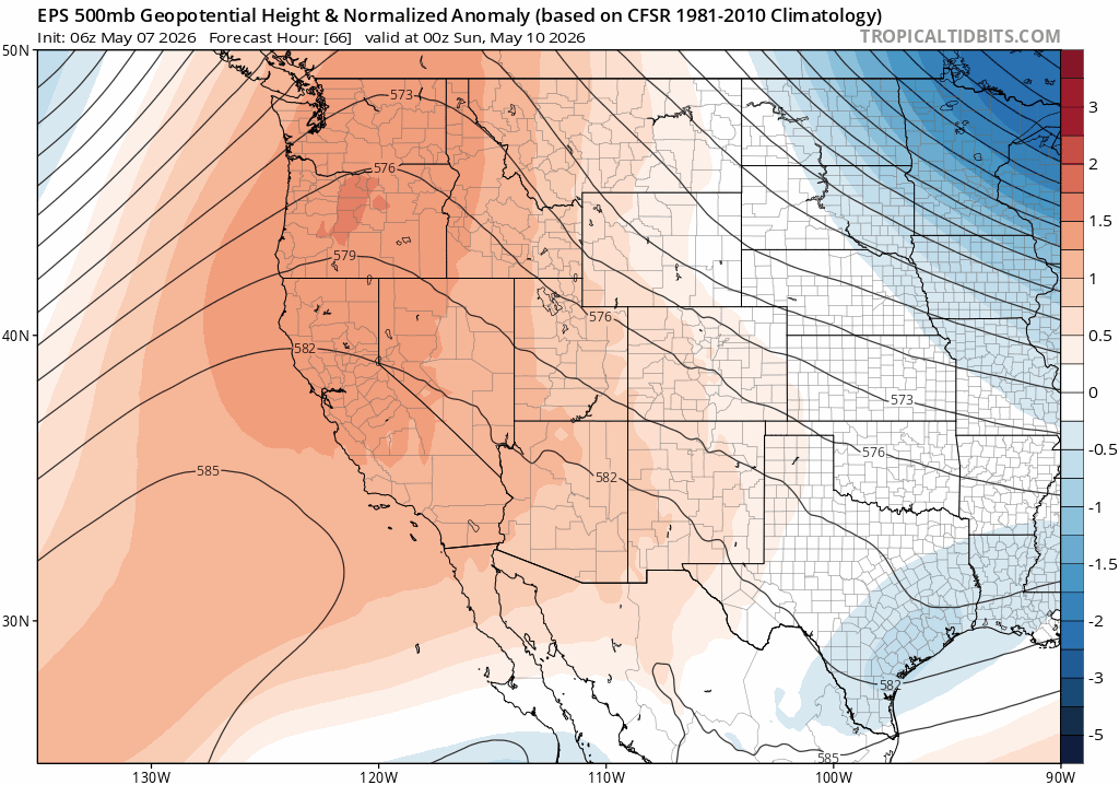
Pattern Reset: A Quieter Northwest Flow
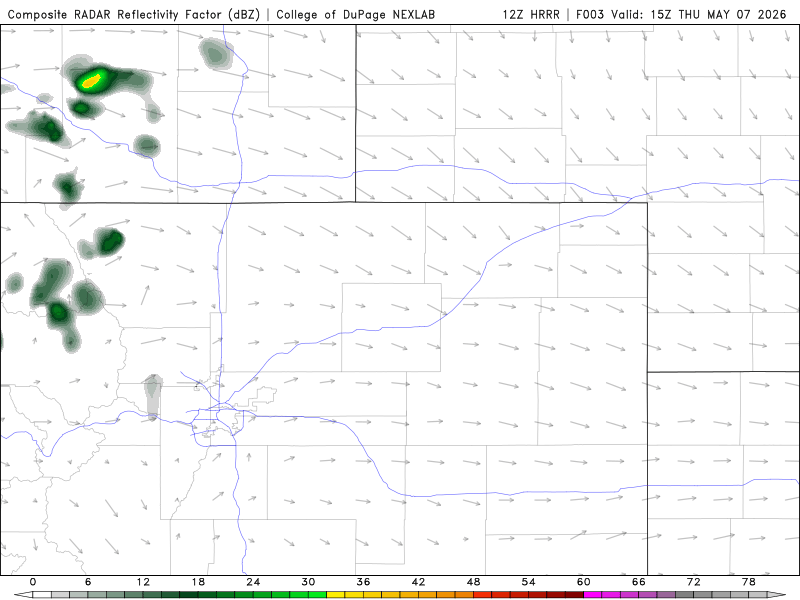
Colorado now settles into a calmer, drier northwest flow regime through the weekend. It’s not perfectly quiet—embedded shortwaves will ripple through the flow—but the overall tone is far more benign than yesterday’s big snowstorm.
Two disturbances are worth noting:
- Thursday shortwave — late‑day arrival
- Saturday shortwave — another late‑day feature
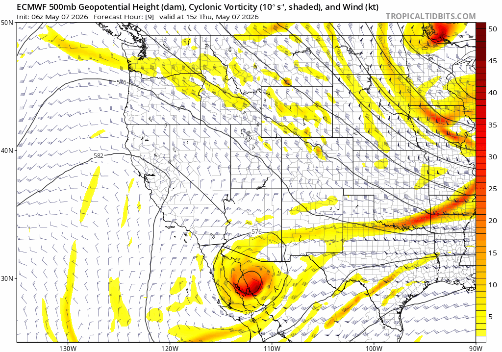
Both will drag weak cold fronts across the Metro and bring small chances for light rain (and Mountain snow showers), but neither carries meaningful moisture or dynamical support.
Clouds increase later as the first shortwave approaches.
- Highs near 70°
- About a 10% chance of a shower or isolated thunderstorm from 3 PM to 3 AM
- Best chances northeast of Denver
Most areas stay dry, but the atmosphere will have just enough instability for a stray cell or two to clip our neck of the woods.
Friday: Mild, Mostly Dry, Upper 60s
A weak cold front Thursday evening may trim temperatures a few degrees, but the change will be subtle and nearly imperceivable.
- Morning sun → partly cloudy afternoon
- Highs in the upper 60s
- A few higher‑terrain weak showers may try to drift east but should fizzle before reaching Boulder or Denver.
Saturday: Warm, Mid–Upper 70s, Slight Storm Chance
The second shortwave arrives late in the day.
- Highs mid to upper 70s
- About a 20% chance of a late‑day shower
- Enough warmth for a rumble of thunder to accompany any showers.
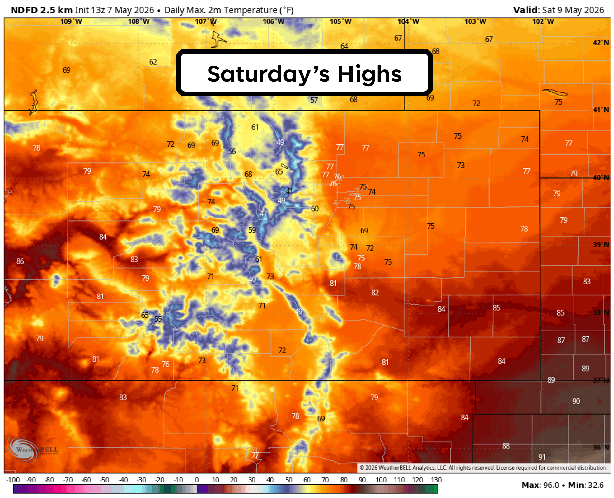
Overall, Saturday will be the perfect day to dedicate to storm clean-up of any downed trees or branches from the recent storm. That is exactly what we will be doing — a chainsaw party with other impacted neighbors!

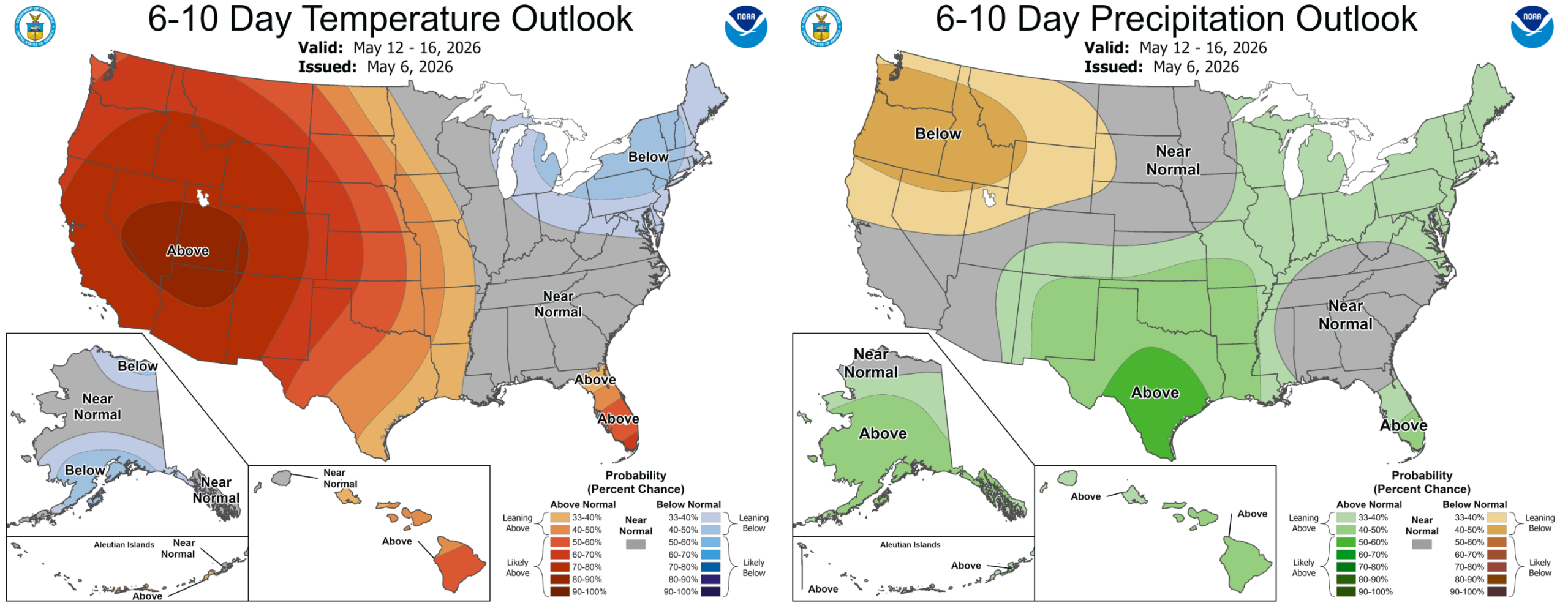
Sunday Into Next Week: Ridge Builds, Heat Returns
A broad ridge of high pressure will expand over the West on Sunday, shifting us back toward the warm, dry pattern that has dominated much of our spring (and winter).
- Sunday: Sunny but cooler behind a weak front.
- Beginning Monday: The real warmup—mid to upper 80s likely, with several days of heat under the ridge lasting perhaps most of next week.
Wrap-up
The destructive May snow is behind us, the freeze threat is gone, and the Front Range now transitions into a stretch of calmer, warmer weather ahead. A couple of weak disturbances may bring isolated showers here and there, but the weekend is shaping up to be overwhelmingly pleasant. Keep an eye on the developing heat next week, though.


You must be logged in to post a comment.