It truly felt like summer came to a close as Fall officially began last Friday. What a great reprieve these last few days have been! The large trough which began to influence our region last Friday will continue to be our main focus for much of the week ahead with below normal temperatures and unsettled weather prevailing across Colorado.
A dreary Monday
The 500 mb map below shows a large trough digging across the Rockies southward into Mexico. This expansive system was responsible for the cool-down over the weekend and those tragic last two days where the sun failed to make an appearance.
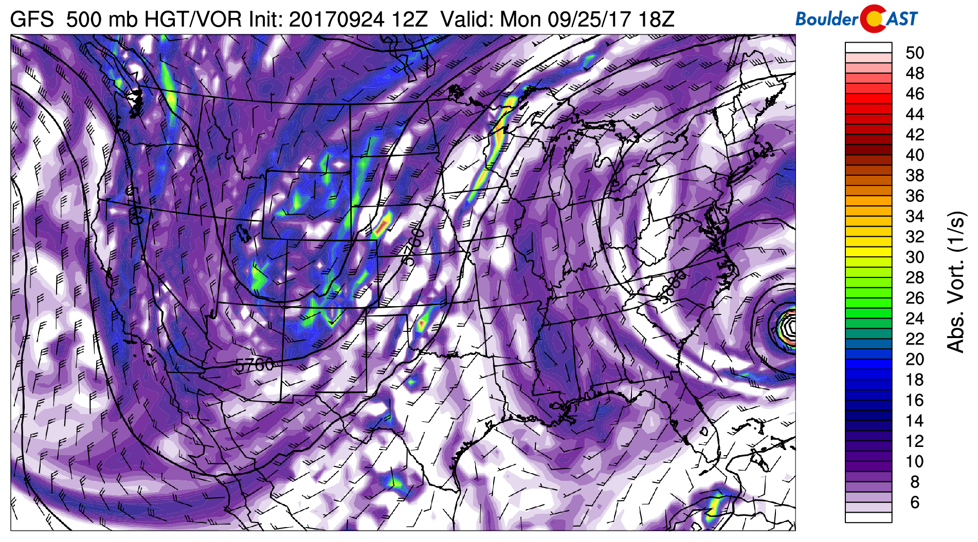
GFS 500 mb vorticity forecast map for Monday afternoon
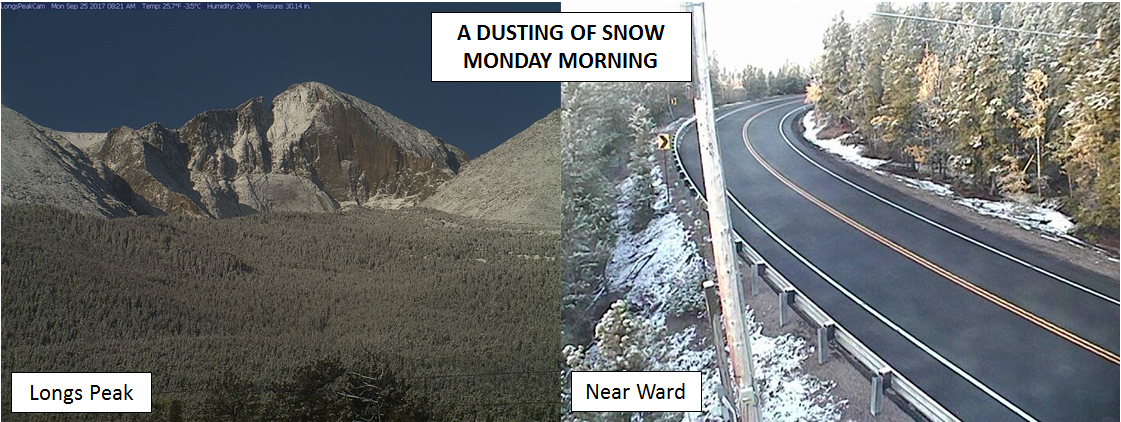
Moisture is fairly high today in the lowest levels of the atmosphere, and with the trough axis yet to pass, showers will linger through the day across the Front Range, especially in and near the Foothills where the shallow upslope remaining in place will be most effective. Cold air aloft will also act to enhance these showers this afternoon. We’re not expecting anything too heavy or widespread, but light rain and clouds will keep us cool and dreary today with highs in the low to middle 50’s. Across the highest Foothills above 9,000 feet elevation, light snow accumulations will be possible this morning west of Boulder (less than 1″).
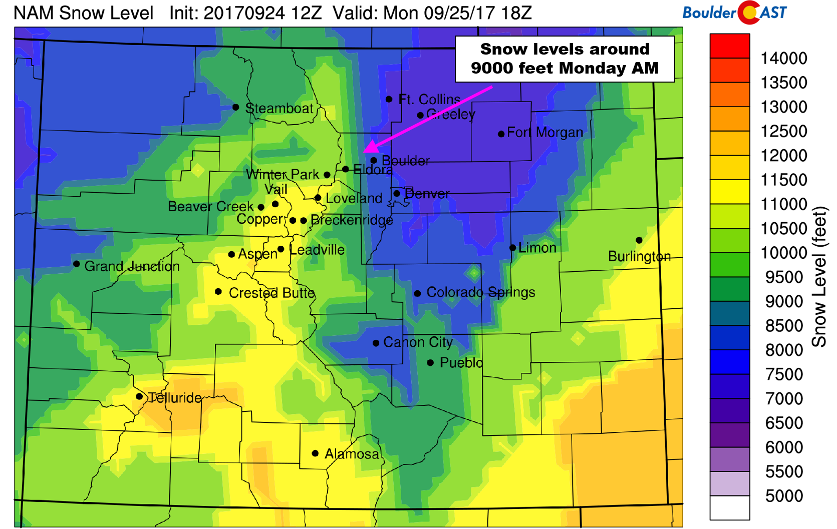
NAM derided snow level forecast for Monday morning. Some flakes could fly as low as 8,500 feet west of Boulder
Drying and warming by mid-week
By Tuesday and Wednesday, the colder air mass moves away into the northern Great Plains following the core of the main trough. However, models are in good agreement that a piece of energy will split from the flow across Arizona, forming a cut-off low pressure system Tuesday night (see below).
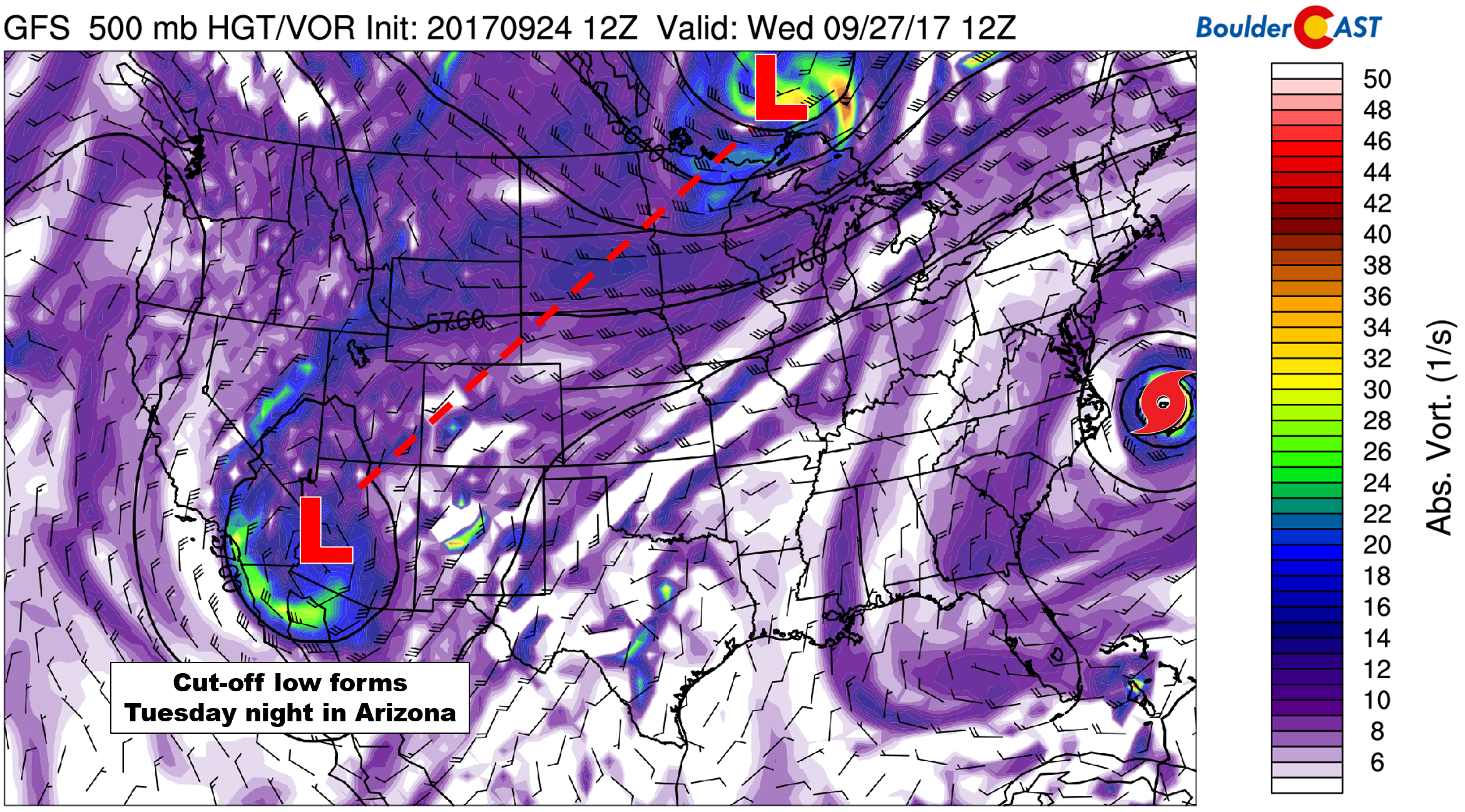
GFS 500 mb vorticity map for Wednesday morning showing the cut-off low developing in Arizona
This system will gain strength across Arizona and eventually move into western Colorado late on Thursday. In the meantime, Tuesday and Wednesday will be the nicest days of the week for us! Expect a mix of clouds and sun with temperatures warming back up into the 60’s both days. This is still below normal, but at least it should be drier.
Cut-off low dampens the end of the week
By Thursday, ensembles are showing relatively good agreement that the cut-off low will move northeastward towards the Four Corners region. This will provide moisture and low-level southeasterly upslope to eastern Colorado.
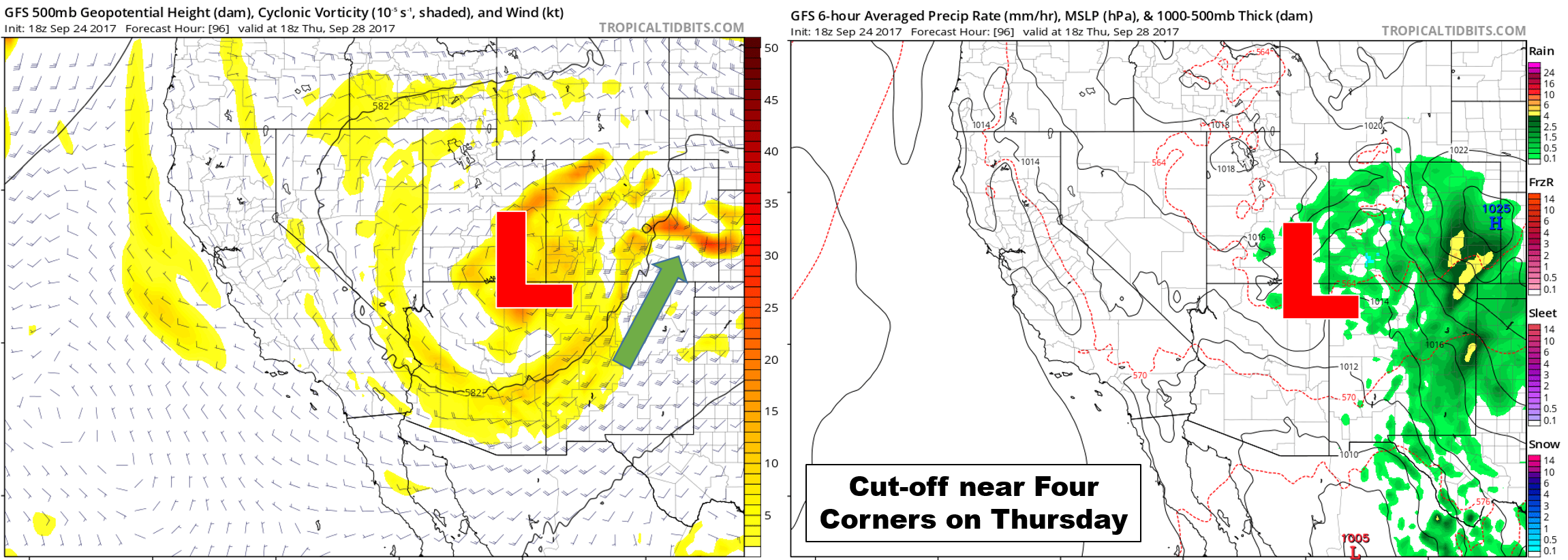
GFS model forecast for 500 mb vorticity and wind (left) and precipitation (right). The position of the upper-level cut-off low is denoted by a red “L”.
At this time, it looks like the best overlap between moisture and lift will be across southeastern portions of the state. However, the Front Range will still be within the sphere of influence, too! Thursday looks like a good chance of showers and cloud cover, with Friday not far behind. The southern origins of this storm system means that it will have limited cold air to work with. Snow levels will be high, likely above 10,000 or 11,000 feet to close out the week.
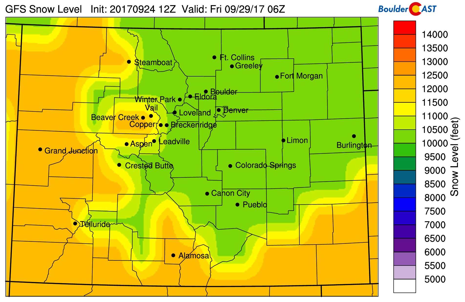
GFS derived snow level forecast for Thursday night
More eliminations will come this week for our First Snow Contest as there are no signs of snow yet for Plains. Stay tuned and enjoy the first week of Fall!
Forecast Specifics:
Monday: Overcast with on-and-off showers through the day, especially in and near the Foothills. Light snow accumulations of 1″ may be possible above 9,000 feet in the Foothills. Highs across the Plains will be chilly in the lower 50’s with mid 40’s in the Foothills.
Tuesday: A mix of clouds and sun with dry conditions prevailing. Highs in the lower 60’s across the Plains, with low 50’s in the Foothills.
Wednesday: Partly sunny with widely scattered afternoon and evening showers. Precipitation will become more widespread overnight into Thursday morning. Highs in the mid 60’s on the Plains and in the low 50’s in the Foothills.
Thursday: Mostly cloudy, cool, and dreary. Expect intermittent showers through the day. Highs across the Plains will be in the upper 50’s, with upper 40’s in the Foothills.
Friday: Partly to mostly cloudy skies with a slight chance of showers. Expect temperatures to warm into the mid 60’s for the Plains, with low 50’s in the Foothills.
Weekend: A split-flow pattern sets up for the weekend, so we expect at least the chance of showers for the region both Saturday and Sunday, though temperatures should rebound slightly into the 60’s or low 70’s.
High Country: Monday and Friday will see scattered afternoon storms across the Mountains. Tuesday will be the nicest day with generally dry conditions statewide. On Wednesday and Thursday, look for widespread showers (with snow above 11,000 feet, with generally less than 3″ expected). Find the best days to hit the mountains over at our SummitCAST page.
DISCLAIMER: This weekly outlook forecast is created late Sunday or Monday morning and covers the entire upcoming work-week. Accuracy will decrease as the week progresses as this post is NOT updated. To receive daily updated forecasts, subscribe to BoulderCAST Premium.
Share our forecast:
Mon
Tue
Wed
Thu
Fri


Temperature
52
62
64
58
66


Precip Chc (Plains)
70%
0%
10%(pm)
40%
20%




You must be logged in to post a comment.