Our weather this week will be typical for mid-June. The initial focus will be the threat of severe thunderstorms Monday afternoon and evening, with tornadoes a viable concern. This will be followed by sunny and warm weather the rest of the week. High Country conditions will be exceptional this week, too.
Severe on Monday
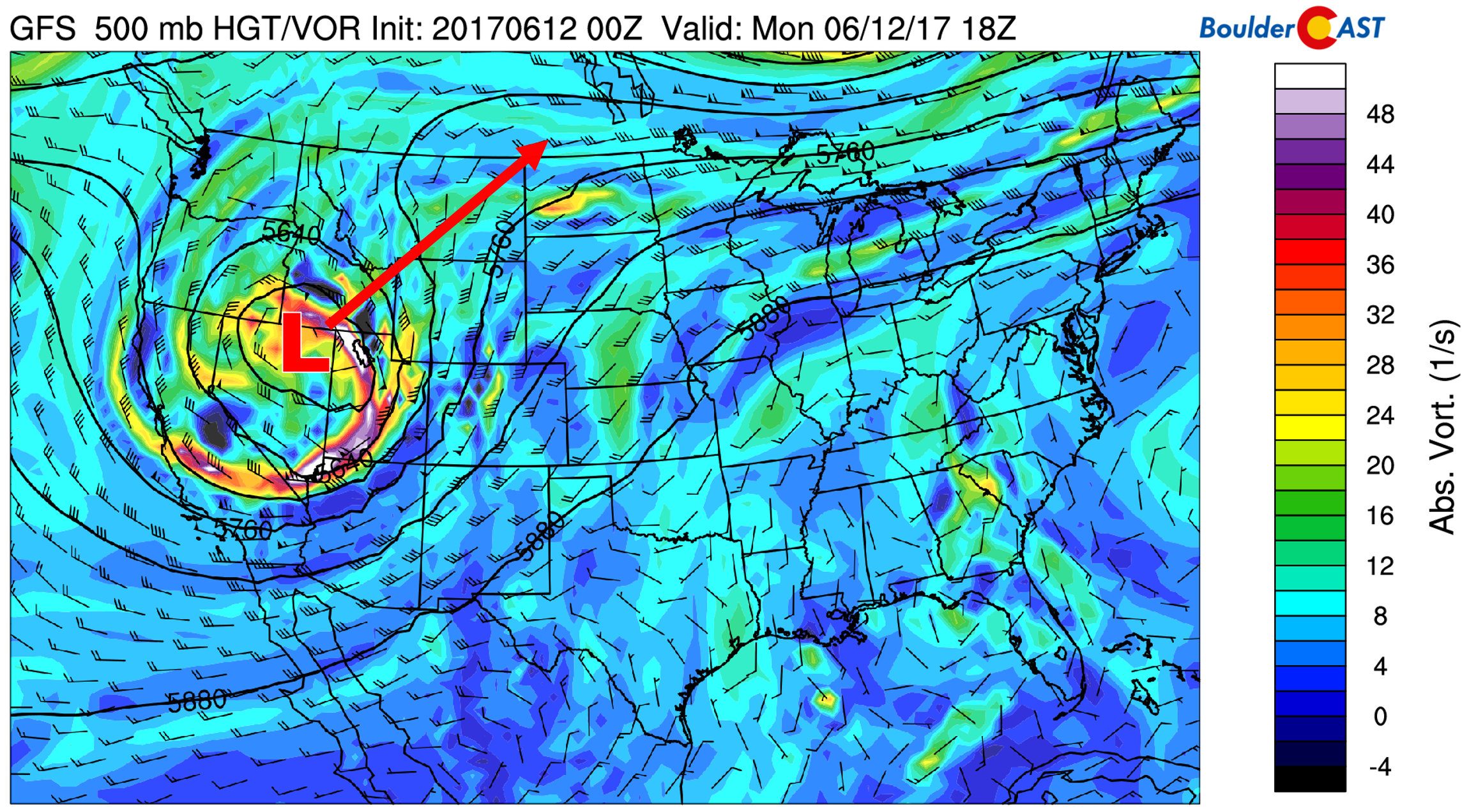
Today’s 500 mb vorticity map is shown below. A ridge exists over the eastern two-thirds of the United States, while a large trough of low pressure sits just to our west in Nevada. This trough is quite impressive for this time of year. It packs enough cold air to bring significant snow to the Tetons and Yellowstone National Parks. However, it is expected to track northeastward into Montana and only brush our region.

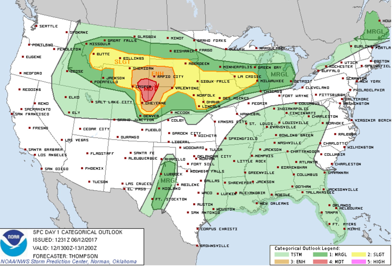
On the southeastern flank of this trough, conditions will be favorable for the development of supercell thunderstorms north and east of Denver (good shear, CAPE over 2000, added lift from the trough). The Storm Prediction Center outlines a bullseye of Moderate Risk for severe storms this afternoon and evening to our north. The tornado threat is about as high as it gets today for southeastern Wyoming. The situation is much less favorable in Denver and Boulder, but we at least have to mention it.

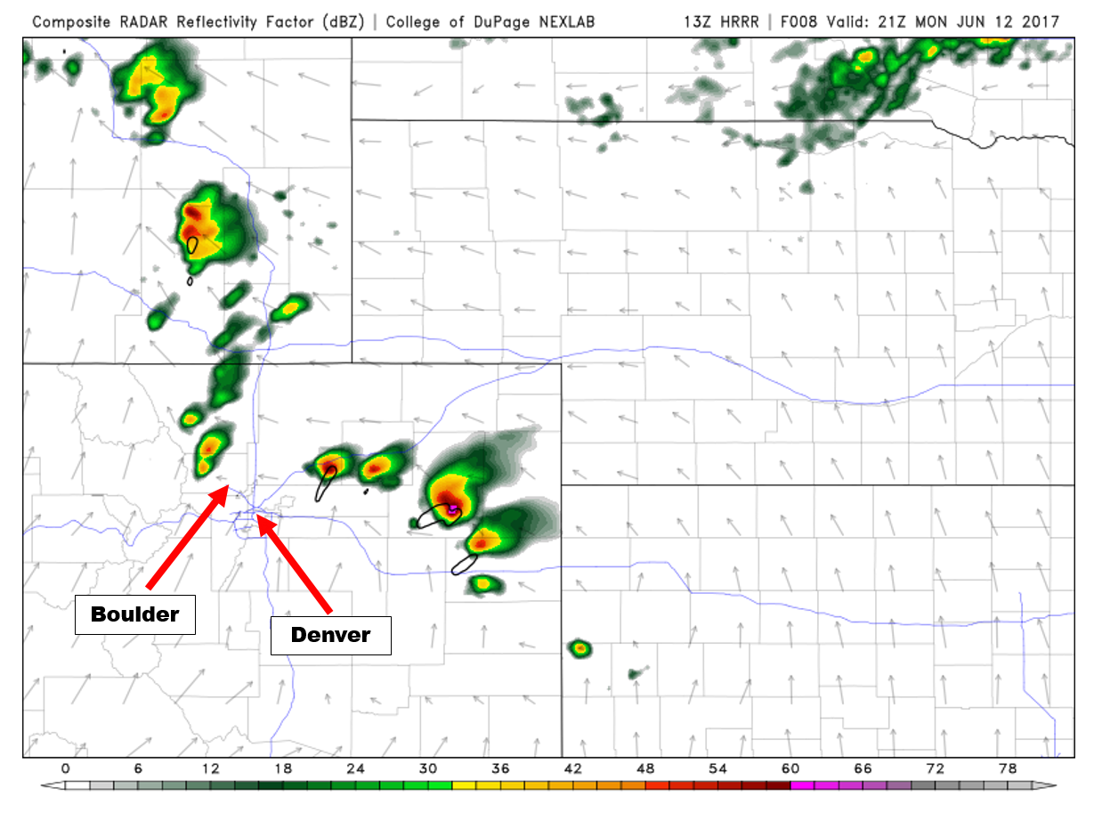
The initial ignition point of the severe storms will be just north and east of Denver between 2 and 5PM (and could actually clip a few suburbs). Large hail and strong tornadoes are the main threats today.

While chances of anything materializing in the Denver Metro area are small, do keep an eye to the sky. After 6PM tonight, we should be in the clear for severe storms, AND in the clear for precipitation the rest of the week.
Calm weather prevails
By Tuesday morning, the trough is already pulling away to our north. In its wake, gusty downslope winds and cooler air will linger across northern Colorado. Temperatures will top out in the mid 70’s with mostly sunny skies overhead.

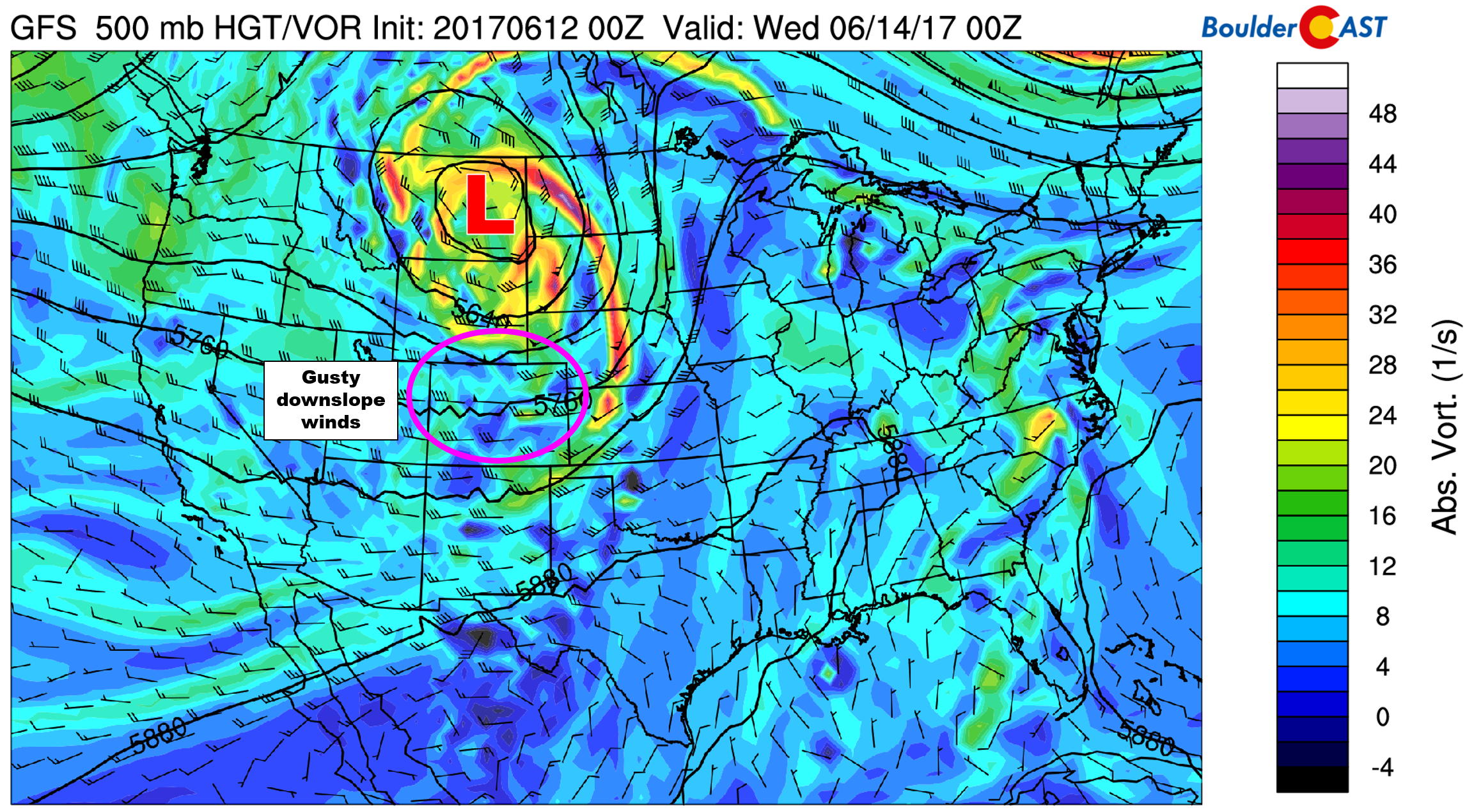
Wednesday through Friday will see weak downslope flow across Colorado as a flattened ridge builds in. This will facilitate dry weather, a gradual warming trend, and plenty of sunshine. On Wednesday, we should mention that there is a weak disturbance ticketed to move across Wyoming (lower left map). It looks too far north to bring much impact to Colorado. However, it could swing a weak cold front through Wednesday evening or night. Either way, this shouldn’t knock our high temperatures below 80 degrees.

Expect temperatures Wednesday through Friday to top out in the mid to upper 80’s with no chance of rain and mostly sunny skies.
Longer range, models are indicating moisture working back in for the weekend, with at minimum storms returning to the High Country by Saturday afternoon and Sunday as well.
Enjoy the quiet week ahead!
Forecast Specifics:
Monday: Sunny early with increasing clouds in the afternoon and breezy southeasterly winds gusting to 25 mph. Isolated strong to severe thunderstorms will form during the afternoon hours, almost exclusively north and east of Denver. Large hail and strong tornadoes are a major concern heading towards the Wyoming and Nebraska borders. Storms will lift northward of our region after 6PM. Expect highs in the upper 80’s across the Plains, with mid 70’s in the Foothills.
Tuesday: Mostly sunny and cooler with gusty west winds to 30 mph. Expect highs only in the mid to upper 70’s on the Plains, with mid 60’s in the Foothills.
Wednesday: Mostly sunny and dry. Highs in the low to middle 80’s across the Plains and low 70’s in the Foothills.
Thursday: Lots of sun with highs in the mid 80’s over the Plains and mid 70’s in the Foothills.
Friday: Partly sunny and quiet. Temperatures climbing into the mid to upper 80’s on the Plains and mid 70’s in the Foothills.
High Country: This week will be stellar in the Mountains! There is no chance of rain any day this week. The only cause for concern will be unseasonably strong winds Monday and Tuesday across the northern Mountains. Gusts above treeline could approach 50-60 mph, especially during the day Tuesday.
Mon
Tue
Wed
Thu
Fri


Temperature
88
76
84
84
88


Precip Chc (Plains)
10%(pm)
0%
0%
0%
0%


.


You must be logged in to post a comment.