While the upcoming week will feature dry conditions and warm temperatures by January’s standards, the primary concern will be the very strong bora wind event making for dangerous travel at times on Monday west of Interstate 25. Read on for our full outlook of the upcoming week.
Very windy Monday
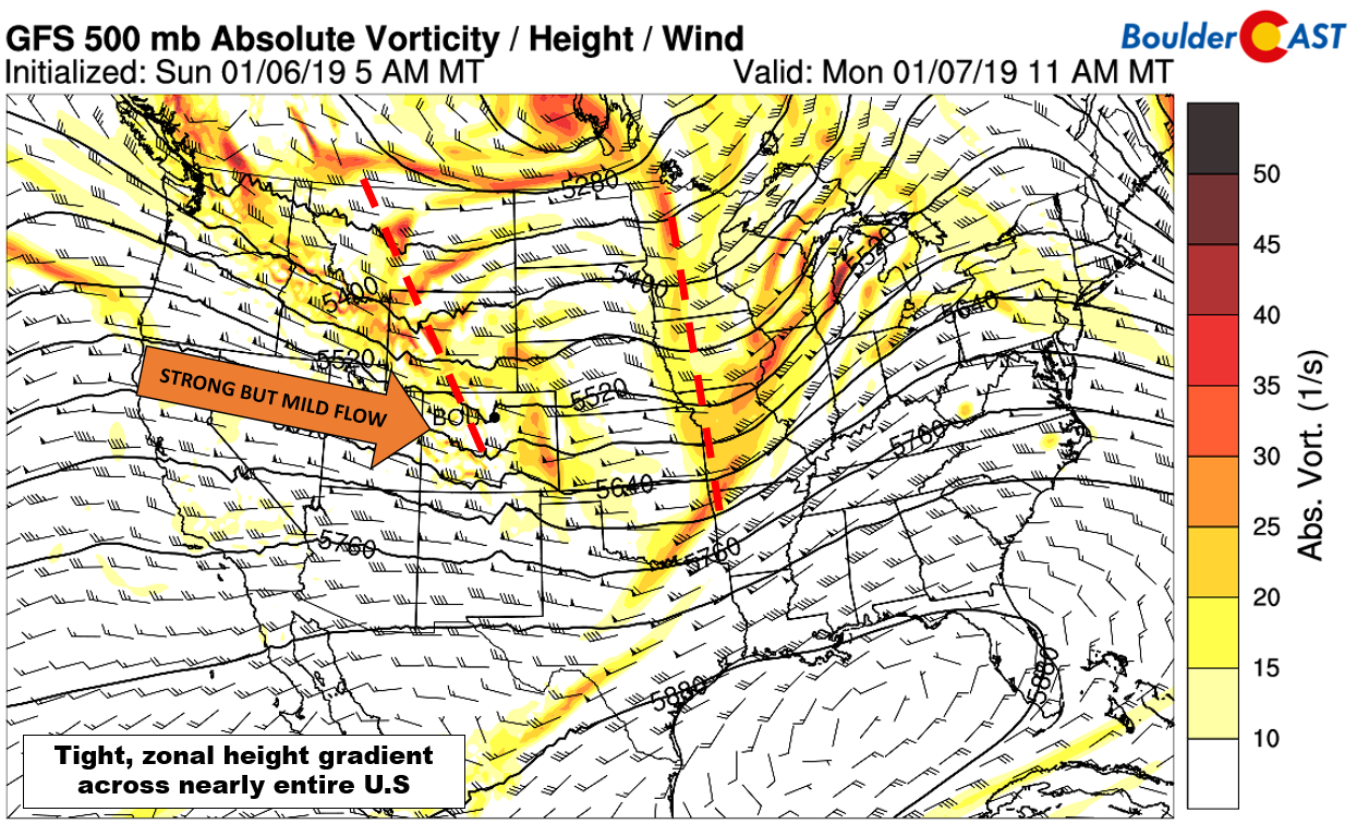
We begin the week with de-amplified flow in the atmosphere across the western United States. By this, we mean that that the troughs and ridges are relatively minor and flow in general is zonal or flat.
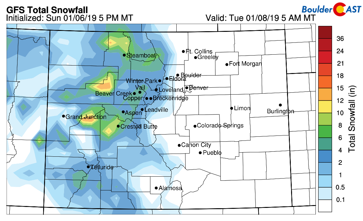
There is a weak Pacific trough moving across Colorado today, though, producing just enough lift for some light snow to continue in the Mountains. Up to 1″ of accumulation is possible from spill-over in the Foothills above 8500 feet on Monday as well.
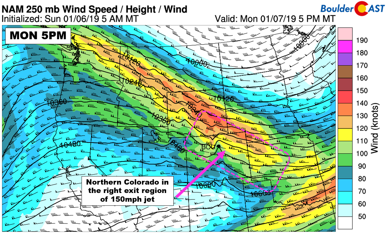
Of greater importance, embedded in the long fetch of west-northwest flow is a 160 mph jet streak (shown below). As we move towards mid-day on Monday, northern Colorado will shift into the right-entrance region of this jet streak (pink box below)…an area of strong subsidence.
This subsidence combined with cold air advection aloft and mixing from daytime heating will help bring the stronger winds from the jet down to the surface on the leeward slopes of the Rockies. The GFS and NAM below are showing winds at around 10,000 feet elevation exceeding 70 mph over the Metro area. In fact, the NAM has winds closer to 95 mph. Both models show a very favorable due westerly direction to the winds at this level, allowing the full-force the wind to be captured by the terrain.
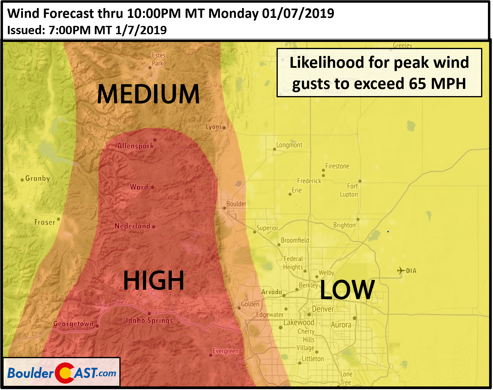
We expect winds to ramp-up by mid-morning through early afternoon as the jet shifts into place. Wind gusts will be strongest in and near the Foothills. It’s a near-certainty they gusts at times will exceed 70 mph in the Foothills. We cannot rule out a few gusts approaching 90 mph as well in Boulder or Jefferson Counties.
The wind potential today is no joke! Travel will be dangerous along exposed north-to-south highways such as Highway 93 between Boulder and Golden and also Peak-to-Peak Highway. Isolated power outages could also occur. The strength of the winds will decrease heading eastward from the base of the Foothills. It will still be windy, but peak gusts should only be in the 35 to 50 mph range around Denver. As the jet pushes further north and east this evening, we should see strong winds taper off across the Metro area shortly after sunset.
As for the general weather on Monday, outside of the extremely strong winds, expect high temperatures in the mid to upper 50’s with mostly sunny skies.
Tame rest of the week
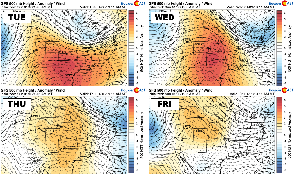
The remainder of the week will feel quiet compared to Monday as a broad ridge gets established across the western United States. You can track the ridge’s development below on Tuesday and Wednesday. By Thursday and Friday, though, the overall ridge weakens with signs pointing to a split-flow pattern developing across the southwestern United States.
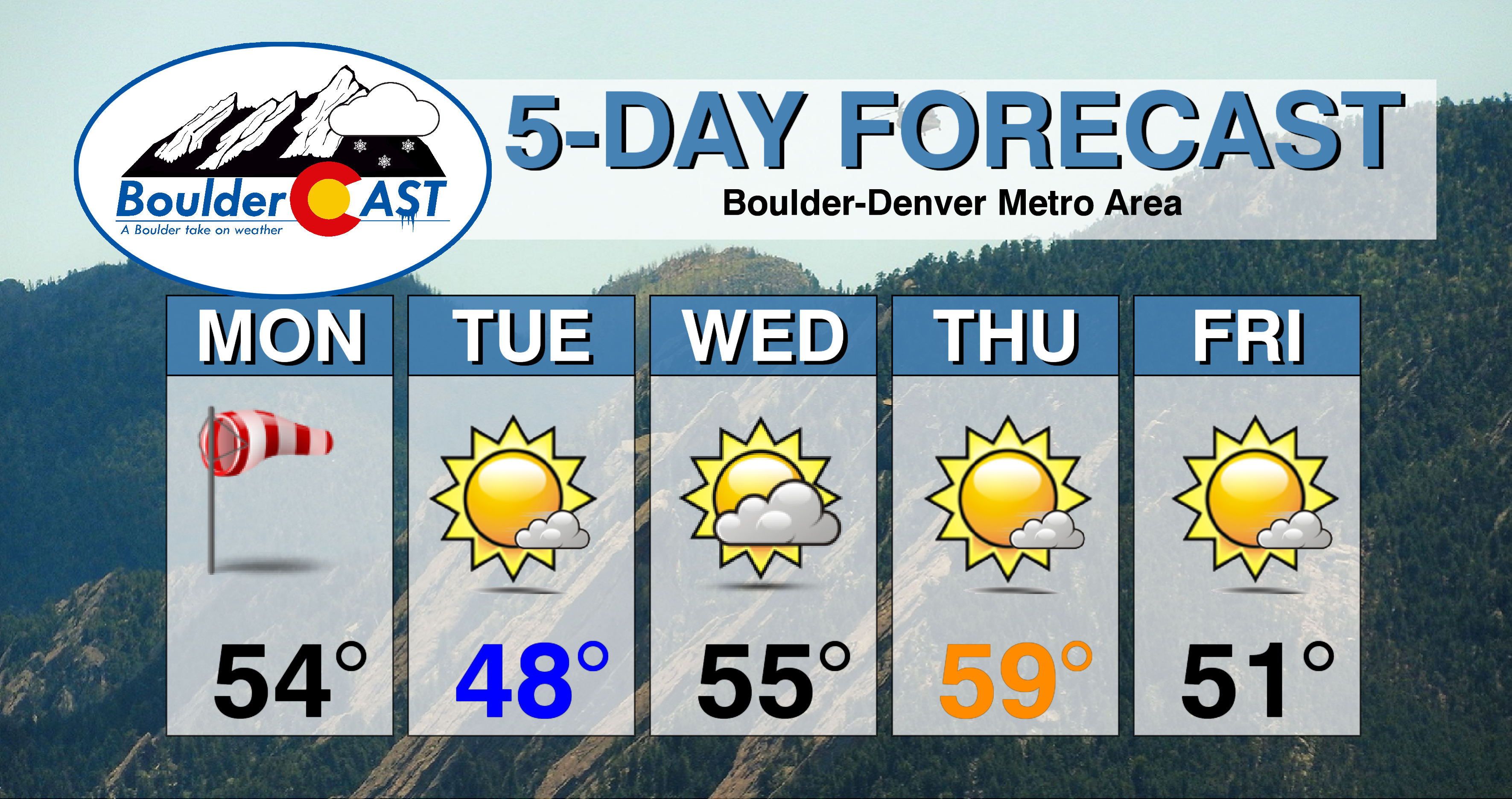
In any case, this set-up will produce unseasonably warm temperatures and dry conditions for the state of Colorado in the near term. Look for highs near 50 on Tuesday, then even warmer in the middle to upper 50’s Wednesday and Thursday. There are some models showing a weak cold front impacting the Front Range on Friday, but the timing is unclear at this time and even if it does materialize, temperatures would likely still remain above normal and the weather dry.
ASIDE: The longer the government shutdown continues, the more websites we discover that are offline due to the shutdown. While most of the forecast model data is still accessible in its raw form, many government website that display the data cannot be accessed. There are key observations inaccessible as well, including the Platteville Wind Profiling Radar which would be great for verifying today’s high wind forecast in real-time and tweaking the forecast as necessary.
Forecast Specifics:
Monday: Mostly sunny with very strong downslope winds building by mid-morning and continuing into the evening. West winds could gust in excess of 80 mph in the Foothills and near Boulder, with gusts up to 50 mph in and around Denver. Some mountain snow will spill-over from the Continental Divide into Foothills’ areas above 8500 feet. Up to 1″ of accumulation is possible. Highs will be in the mid 50’s on the Plains with middle 40’s in the Foothills.
Tuesday: Mostly sunny, cooler, and quiet with highs near 50 across the Plains and in the upper 30’s in the Foothills.
Wednesday: A mix of clouds and sun, but warmer. Highs in the middle 50’s on the Plains and low 40’s in the Foothills.
Thursday: Mostly sunny and mild. Highs in the mid to upper 50’s on the Plains and in the mid 40’s in the Foothills.
Friday: Sunny and warm with highs near 50 on the Plains and in the upper 30’s in the Foothills.
High Country: Very strong winds and light to moderate snowfall are expected in the Mountains on Monday. Storm snow totals will be in the 4 to 10″ range across western Colorado, with dangerous travel in spots due to blowing snow. Tuesday through Friday will be dry and mainly sunny with winds relaxing to almost summer levels late week as split-flow develops across the southwestern United States. Check PowderCAST for forecasts for all the Colorado ski resorts.
DISCLAIMER: This weekly outlook forecast was created Monday morning and covers the entire upcoming week. Accuracy will decrease as the week progresses as this post is NOT updated. To receive daily updated forecasts, subscribe to BoulderCAST Premium.
.
Share our forecast!






You must be logged in to post a comment.