Though we’re not expecting any rain or snow in the Metro area this week, temperatures will vary considerably day to day. We also discuss a developing atmospheric river event later this week and how it could impact our region over the weekend.
T
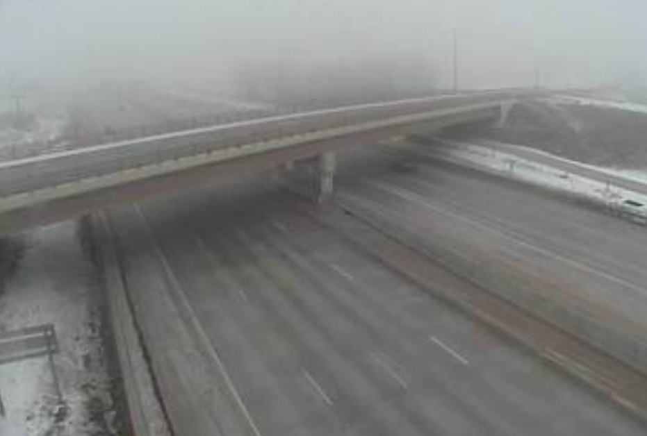
he cold airmass that has been with us since last Wednesday will slowly shift eastward today. However, it could linger across the northern Metro area through the morning, with Arctic temperatures, freezing fog, and light flurries.
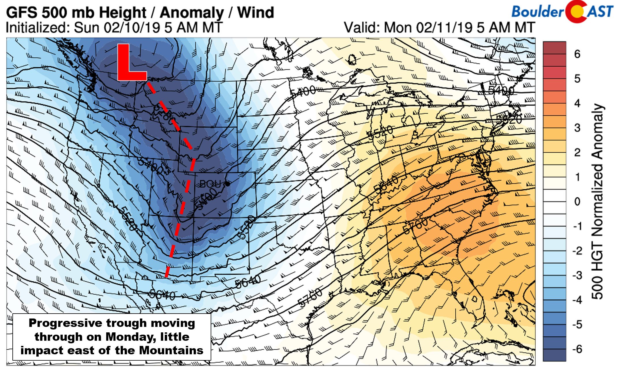
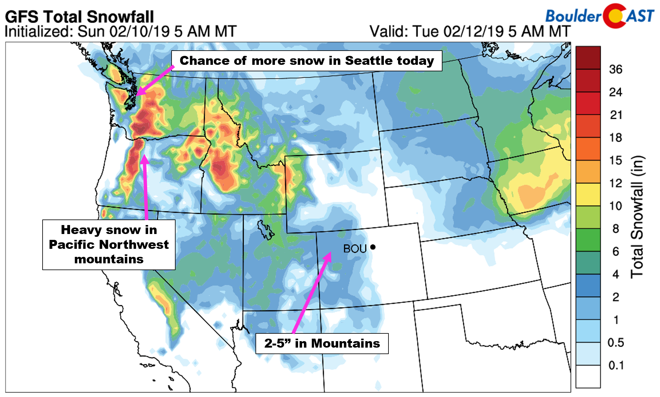
The eventual eastward shift is thanks to southwesterly downslope flow ahead of a passing trough. The main energy with this system remains well to our north and west across the Pacific Northwest, with only weak lift and moisture trailing southward along the trough into Colorado. This system has pummeled parts of coastal Washington with several inches of snow this past weekend. Seattle had its biggest snowstorm in more than 70 YEARS. Don’t worry, it wasn’t a Snowmaggedon… That’s only about 8 inches!
Today’s trough is quick-moving, which will help to keep snow on the light side overall in the Mountains, with only a couple of inches expected. The downslope into the Metro area will keep us dry and relatively warm. Expect highs in the 30’s with mostly sunny skies.
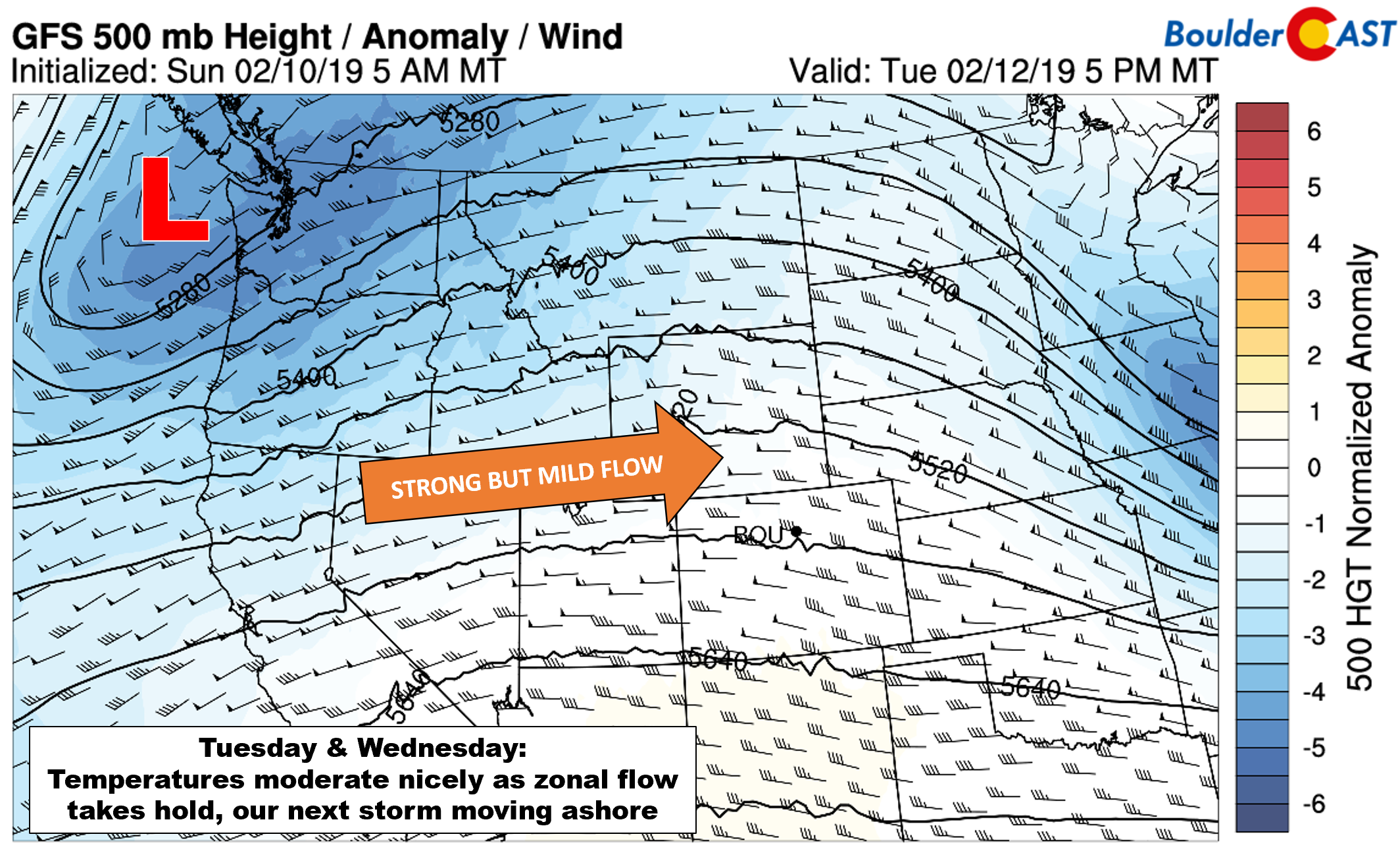
Tuesday and Wednesday will be the nicest days of the week as strong but mild zonal flow sets up across the central and southern Rockies (see below). We should see temperatures respond quite nicely to this directional shift in the winds. Expect highs to climb to near 50 degrees on Tuesday and then several degrees warmer Wednesday.
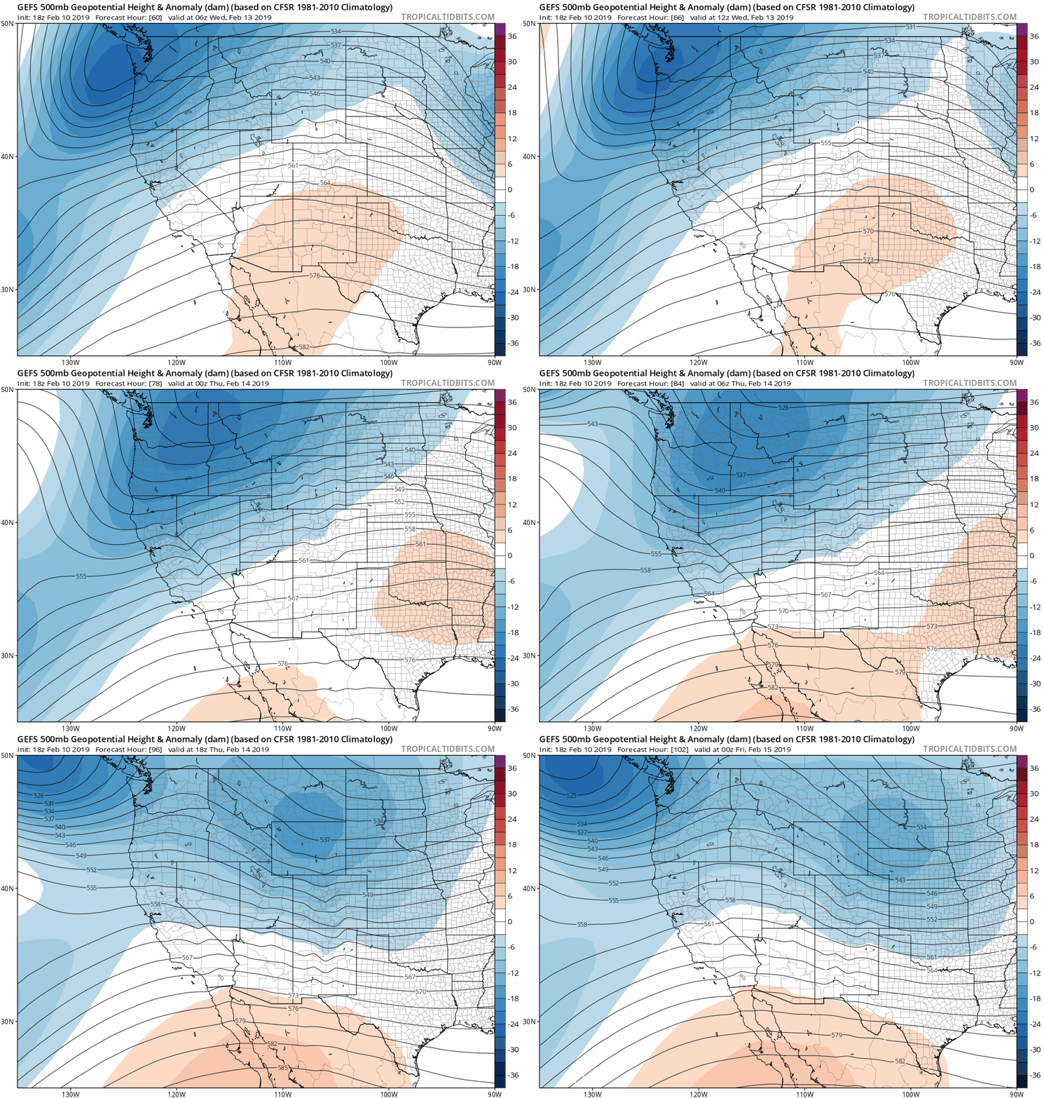
The second storm system of consequence this week is visible coming ashore in the 500 mb height anomaly map above. You can watch its progression across the northern Rockies by Thursday evening in the animation below. This animation is from the GFS ensembles, and as you can see, most of the energy passes across Wyoming and Montana. This track would largely favor downslope into the Denver Metro area.
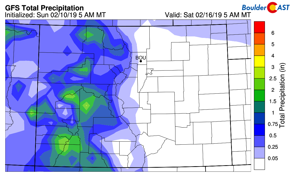
You can see clear indication of this in the GFS total precipitation forecast through Saturday morning (see below). All of the moisture from both systems this week will remain across the High Country and northward of the Wyoming border area.
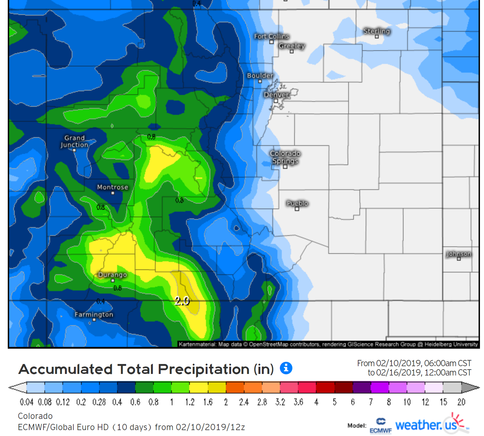
The Euro model is relatively aligned with the GFS, albeit a little slower with the late-week storm. Thus, its precipitation forecast looks very similar:
At this time, we see no reason to believe the secondary storm system will bring any rain or snow showers to Denver. The downslope will be a lot to overcome. We are tracking a cold front, though. The timing remains slightly uncertain, as it could be as early as Thursday morning, or as late as Thursday evening. This means Thursday’s highs are anyone’s guess at this point. We’re thinking there will be a very mild morning with falling temperatures through the rest of the day. It will be breezy both before and after the front passes. Then, Friday will be cooler in the 30’s to lower 40’s.
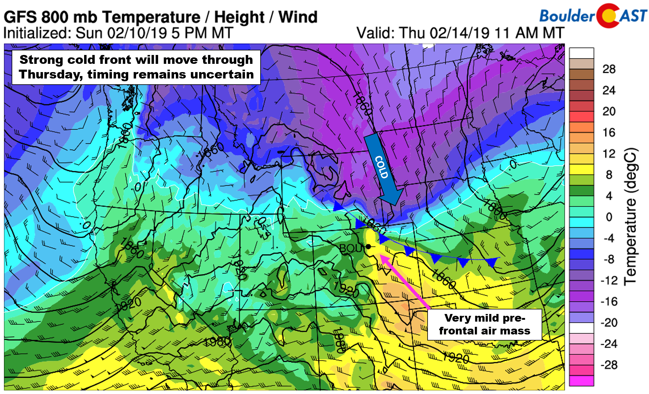
GFS 800 mb temperature and wind forecast amp for Thursday at mid-day. A cold front will be approaching (timing uncertain).
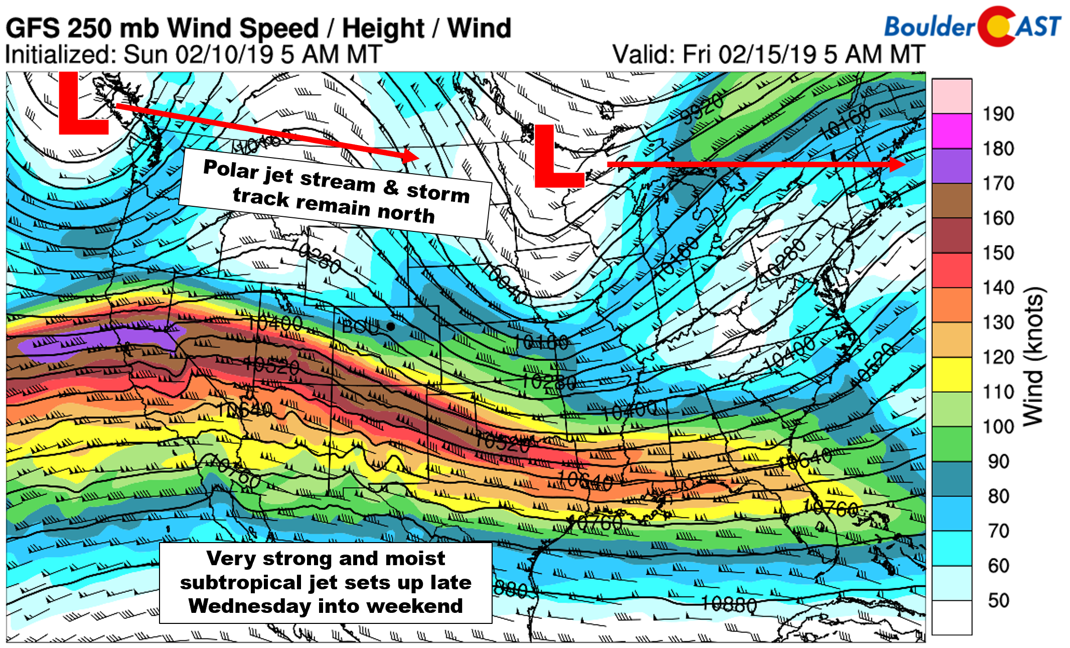
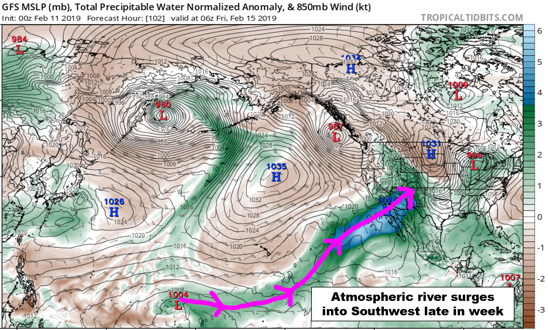
Finally, one aspect of this week’s weather pattern we haven’t discussed yet is a developing atmospheric river event across California and the southwestern United States Wednesday night through Friday. An atypically strong, moist, and continuous subtropical jet has developed along the southern tier of the United States, while the weak polar jet stream and main storm track continues to do its thing along the northern third of the country.
The subtropical jet will persist and eventually entrain deep tropical moisture later this week in classic atmospheric river form.
California’s Sierra Nevada Mountains will catch the brunt of this atmospheric river event, with feet of snow expected. However, the higher terrain of particularly western Colorado could see more than a foot of snow as well.
The models show a bit of a dry slot cutting off the river’s flow on Friday, but there is some agreement that it will reform and surge back northward over the upcoming weekend. It remains to be seen if this will again bring heavy snow to southwestern Colorado, but there is the decent chance. A few model runs here and there are even showing the potential for significant wintry impacts for the Front Range from this river later in the weekend. We’ll be watching this closely, but as of now, our concern is quite low.
For once, enjoy the relatively quiet week in weather!
Forecast Specifics:
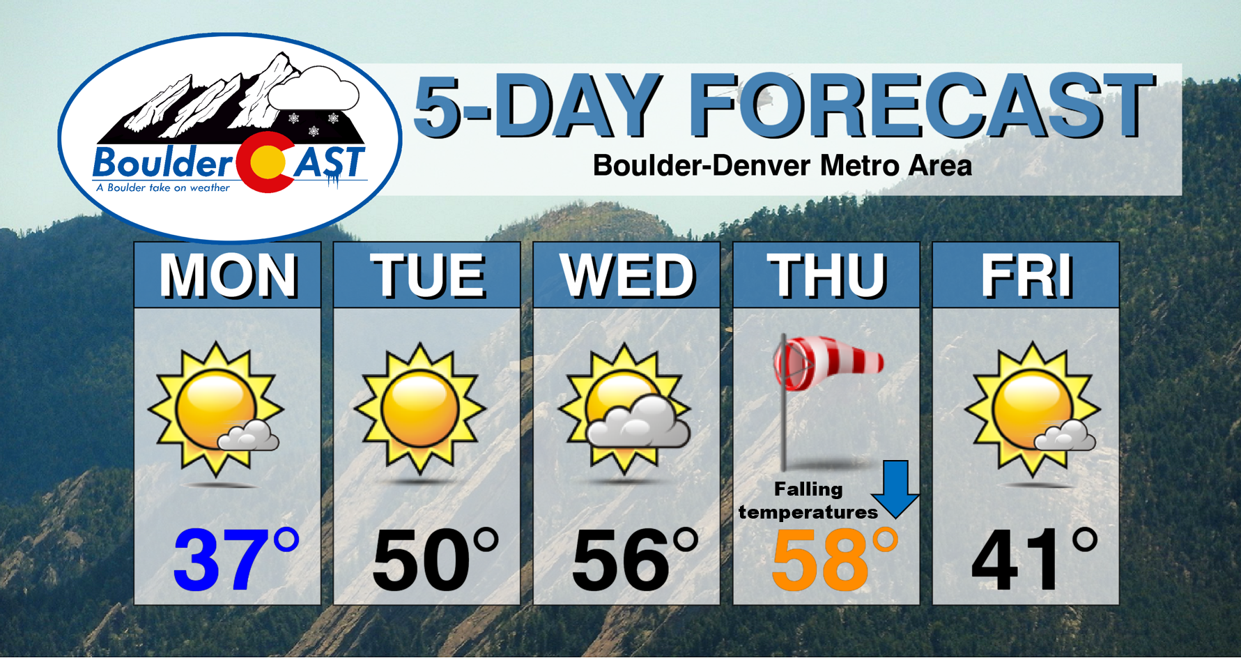
Monday: Patchy morning freezing fog and snow flurries, then partly to mostly sunny with highs in the middle 30’s on the Plains and in the middle 20’s in the Foothills.
Tuesday: Sunny and mild with highs near 50 degrees on the Plains and in the upper 30’s in the Foothills.
Wednesday: A mixture of clouds and sun. Warmer with highs in the middle 50’s on the Plains and in the lower 40’s in the Foothills.
Thursday: Partly to mostly cloudy skies and breezy. A very mild morning will transition cooler through the day as a cold front dives southward across the Metro area. Highs could be in the 50’s to lower 60’s in the morning, falling into the 20’s by evening. No precipitation is expected at this time.
Friday: Generally sunny with increasing clouds late in the day. Highs in the upper 30’s to lower 40’s on the Plains and upper 20’s in the Foothills.
High Country: Light snow showers are expected in the Mountains on Monday with a couple inches of accumulation expected. Tuesday and Wednesday will be dry but windy. A developing atmospheric river event will pump deep moisture into Colorado, with heavy snow expected in southwestern Colorado Wednesday night into Thursday night. Some ranges could see more than 12″ of snow from this event. Check PowderCAST for updated forecasts for all the Colorado ski resorts.
DISCLAIMER: This weekly outlook forecast was created Tuesday morning and covers the entire upcoming week. Accuracy will decrease as the week progresses as this post is NOT updated. To receive daily updated forecasts from our team, subscribe to BoulderCAST Premium.
.
Share our forecast!





You must be logged in to post a comment.