The ongoing brutal heatwave will continue for Labor Day and through the first full week of September. A strong and anomalous ridge parks itself over the Utah region through Thursday resulting in hot and dry weather in the 90s across the Denver area. Record highs are likely under this setup and we may even see some triple digits at times as well. The light at the end of the tunnel is a welcomed cold front currently scheduled to arrive on Friday.
This week’s highlights include:
- A strong and anomalous ridge of high pressure results in hot and dry weather for much of the week
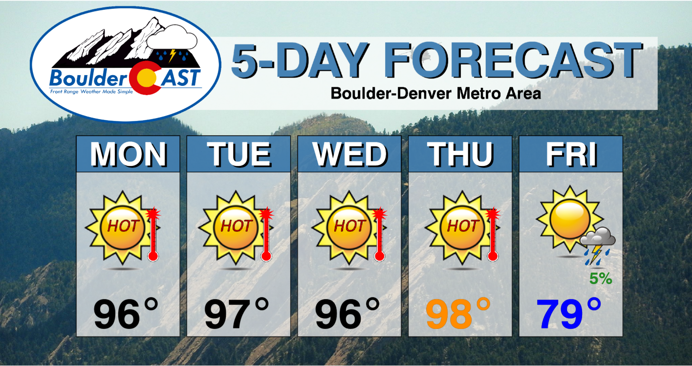
- High temperatures soar into the mid to upper 90s through Thursday, with record highs possible on several occasions
- A nice cooldown is forecast come Friday and Saturday behind a cold front
DISCLAIMER: This weekly outlook forecast is created Monday morning and covers the entire upcoming week. Accuracy will decrease as the week progresses as this post is NOT updated. To receive daily updated forecasts from our team, among many other perks, subscribe to BoulderCAST Premium.
Heatwave to start our week
It is worthwhile to discuss this week’s temperature normals and records seeing as how a heatwave will be the main story in the days ahead. The table below shows Boulder’s normal highs (grey) and record highs (red) through Friday. Normal highs start out around 84°F and drop to 80 come Friday. Record highs begin in the upper 90s (thanks to the wild weather we had in 2020 leading up to the earliest snow on record) but then hover in the low to middle 90s the rest of the week. There will indeed be potential to break one or more of these records.
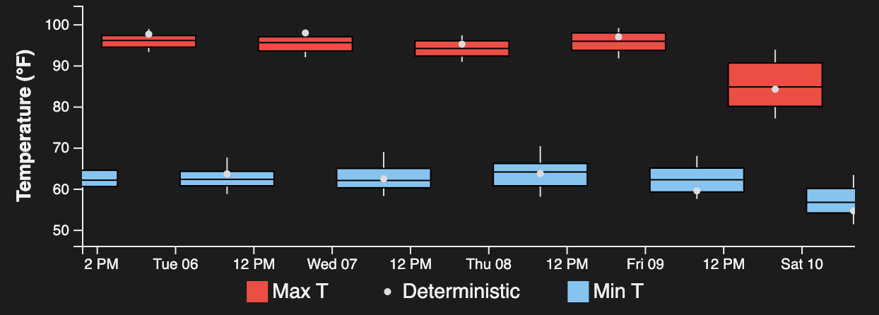
The graph below shows forecast highs (red) and lows (blue) from a blend of several numerical model guidance. The spread in predicted highs and lows is indicated by the size of the box (larger box – more spread; smaller box – less spread). Note little spread through most of the week — with highs projected to be in the mid to upper 90s. Much more spread exists for Friday, where a cold front is slated to move through the area, producing a range in highs from the upper 70s to to lower 90s.
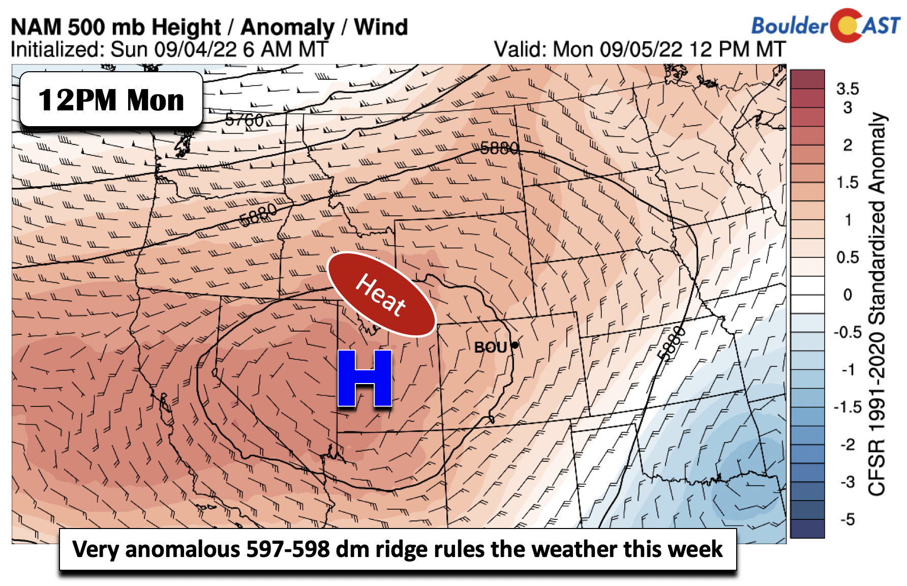
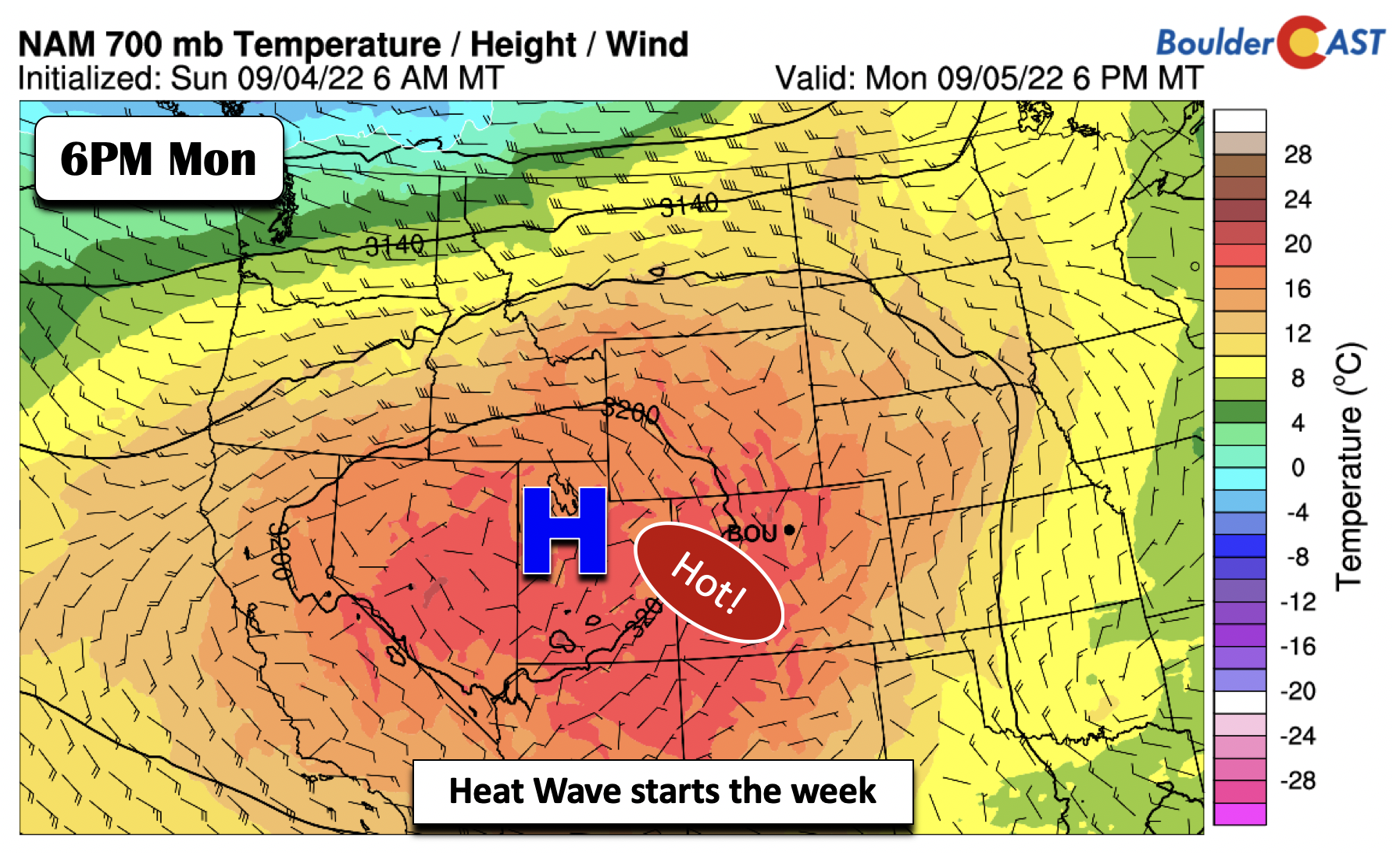
We can thank the heat for our Labor Day and first full week of September on a 598 decameter ridge centered near Utah. The ridge will not move much at all through about Thursday. However, it will meander just enough each day to lead to subtle changes in our forecast highs.
Temperatures some 5000 feet off the ground approach 18°C Monday afternoon, hot enough to support middle to upper 90s on the Plains, even with summer giving its last hurrah. This will get us close to the record of 99°F in Boulder but we’ll likely come up just short.
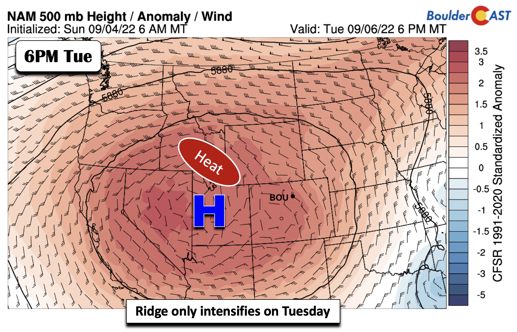
Come Tuesday, the ridge only intensifies, remaining anchored over Utah. Lots of sunshine and hot/dry weather is the story!
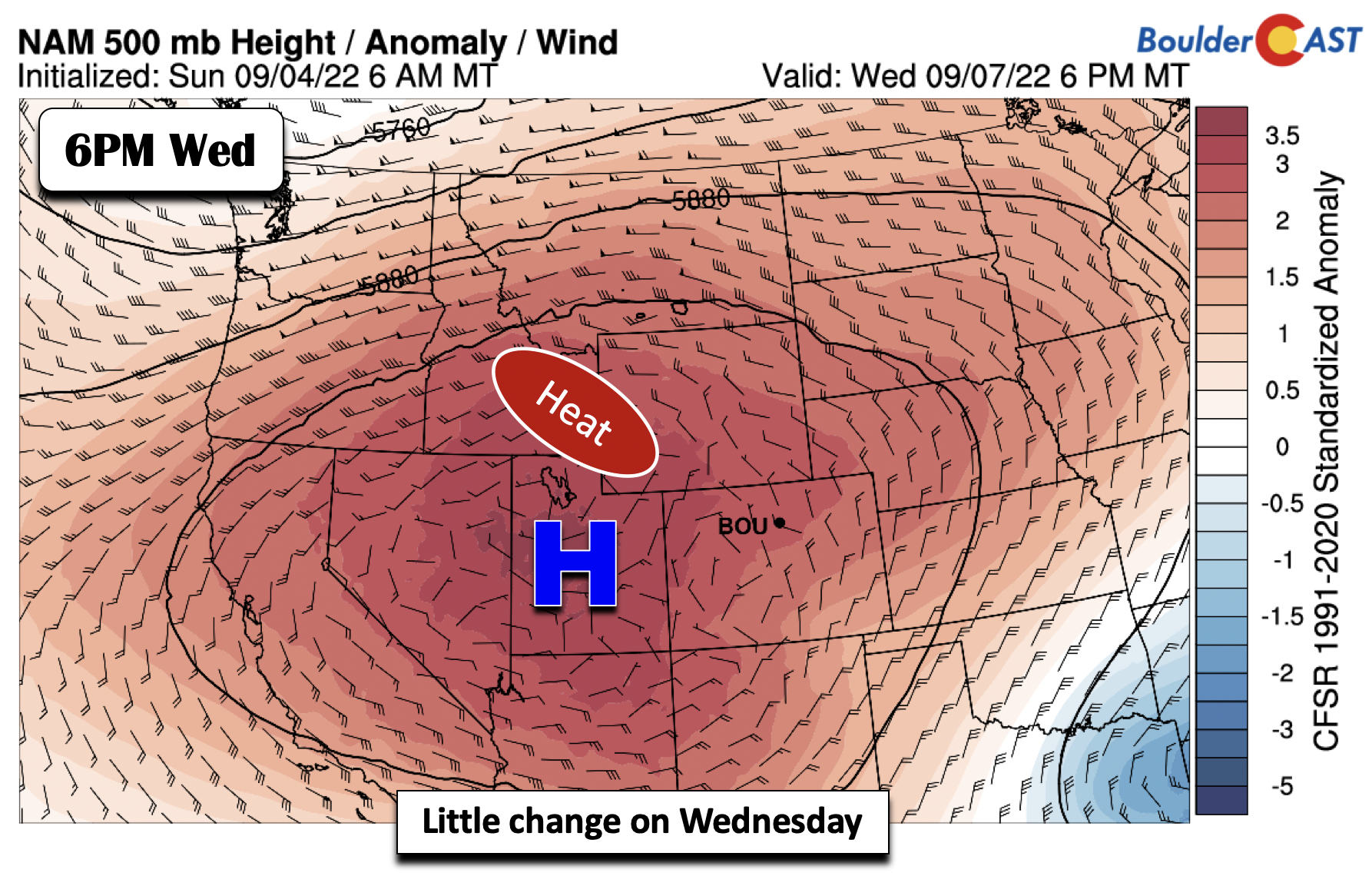
On Wednesday, the ridge stays over Utah, but strengthens ever so slightly, extending its reach from California into Kansas.
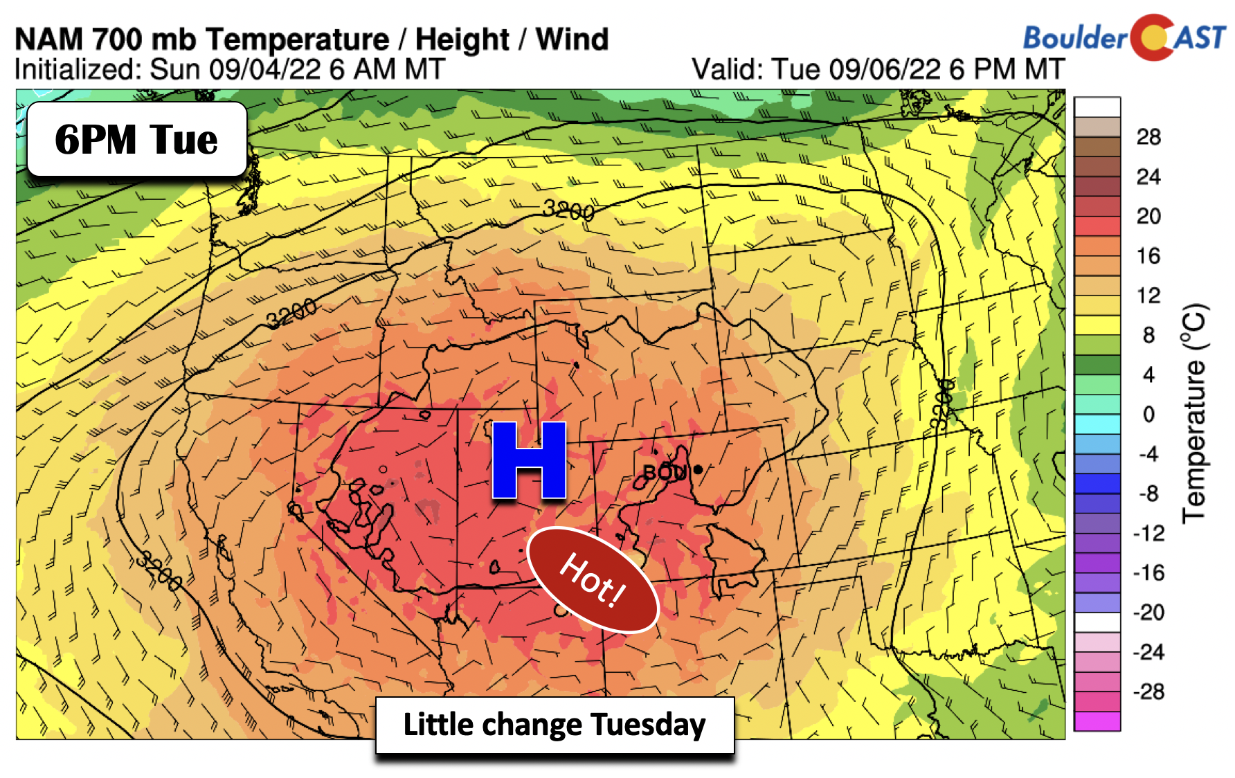
There is little change in the airmass Tuesday, though perhaps a marginal movement of the hottest air slightly to our west. Highs will still be in the mid to upper 90s, getting close to record highs once again.
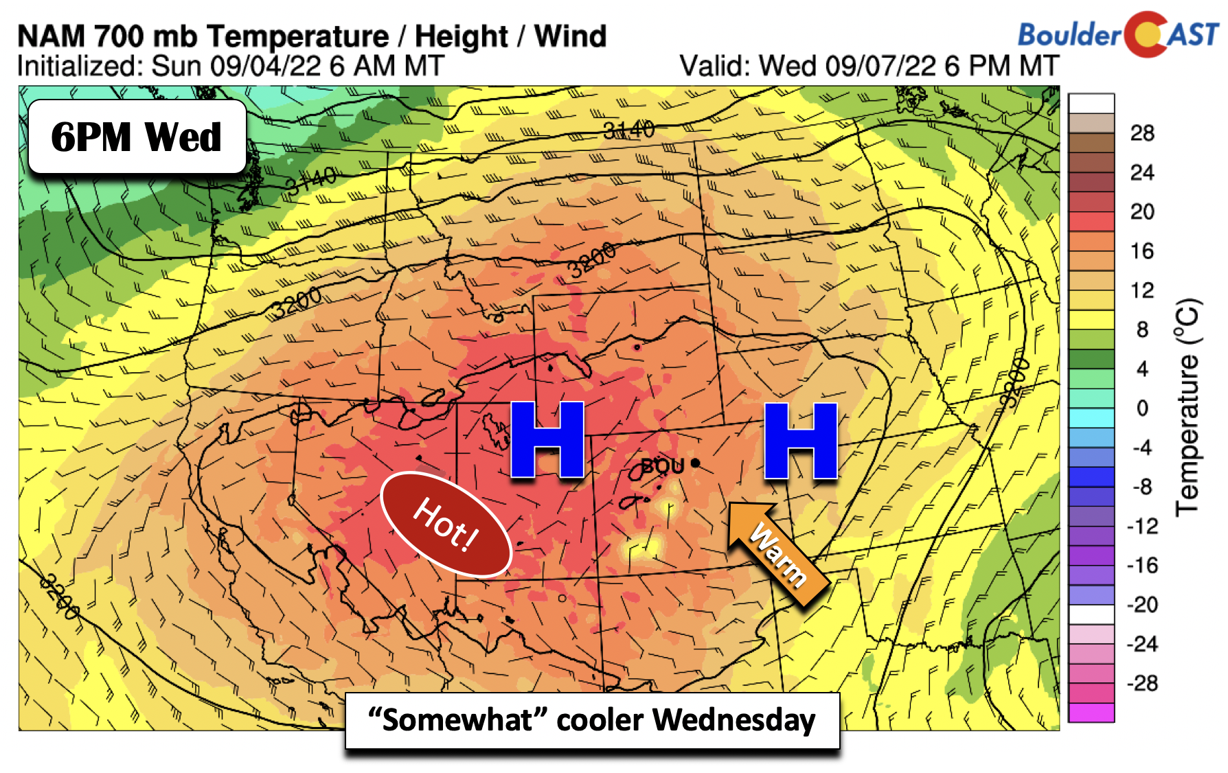
There is a more noticeable change on Wednesday as a secondary high pressure sets up over western Kansas. The models all show a weak east-northeast flow on Wednesday across the Front Range. It is hard to say if this is a weak front or some type of trough. Either way, this setup could drop highs a few degrees into the middle 90s as the hot airmass shifts a bit towards western Colorado. Some record highs are still possible — but dependent on the strength of the easterly flow as there won’t be any clouds to speak of.
Welcomed relief from the heat come Friday
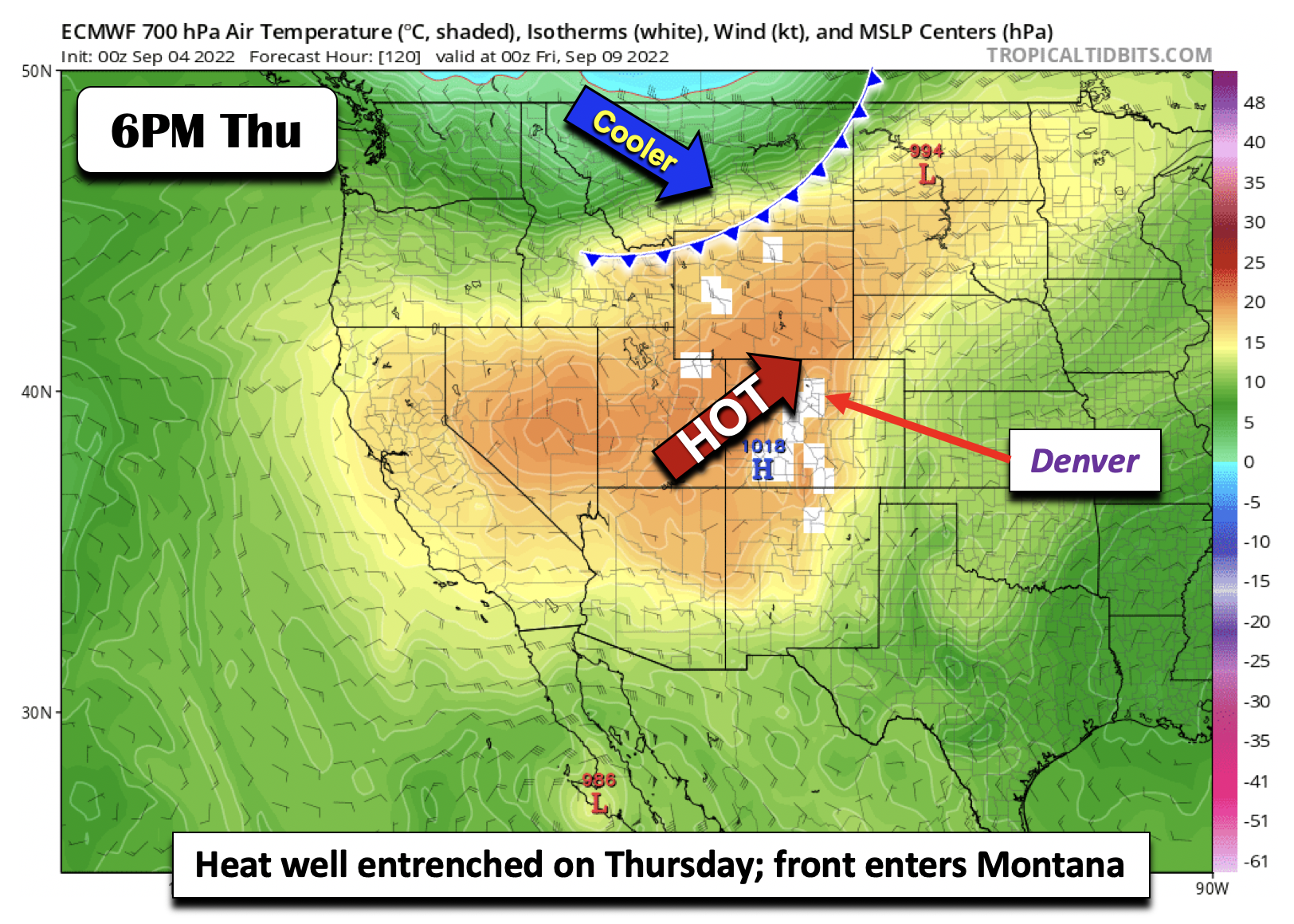
The slight reduction of highs Wednesday becomes but a distant memory on Thursday as the hot air builds back eastward. Highs in the middle to upper 90s are again favored. Thursday will likely see some records broken as it stands now. Boulder’s record high for September 8th is only 93°F, and that seems like a safe bet to get destroyed at the moment… Though, there is good news on the horizon as a cold front likely will be pushing through Montana late Thursday. This front will be the focus for our neck of the woods on Friday!
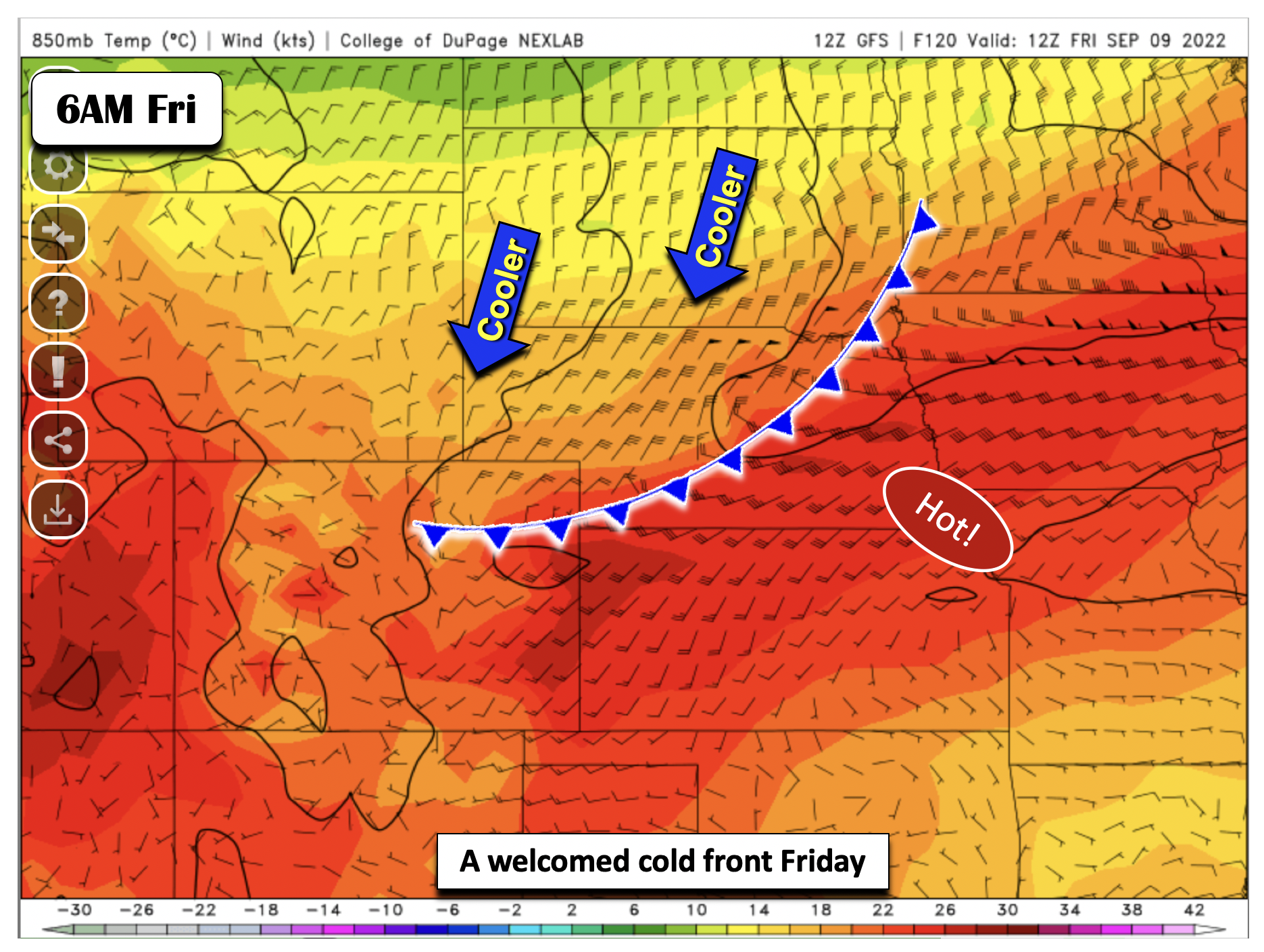
While there continues to be some uncertainty, most deterministic and ensemble guidance does hint that a potent cold front will plow through the Front Range sometime late Thursday night or Friday morning. The GFS/Euro models both show the frontal passage, with the cooler air continuing to spread into the area by early next weekend. How cool will our highs be on Friday? It’s difficult to say with still a nearly 15 degree spread in forecast highs. The GFS brings a weaker front through Friday, then a stronger one through on Saturday. The Euro is similar but cooler with the initial surge on Friday. Our best guess right now would be around 80 degrees — a very nice change from earlier in the week and closer to normal! We can’t rule out a storm or two with the front but early indications point to a mostly dry end to the work-week.
We’ll likely start the weekend near to below normal, though there are signs the heat builds back quickly by early next week. Stay cool out there and Happy Labor Day!
Forecast Specifics:
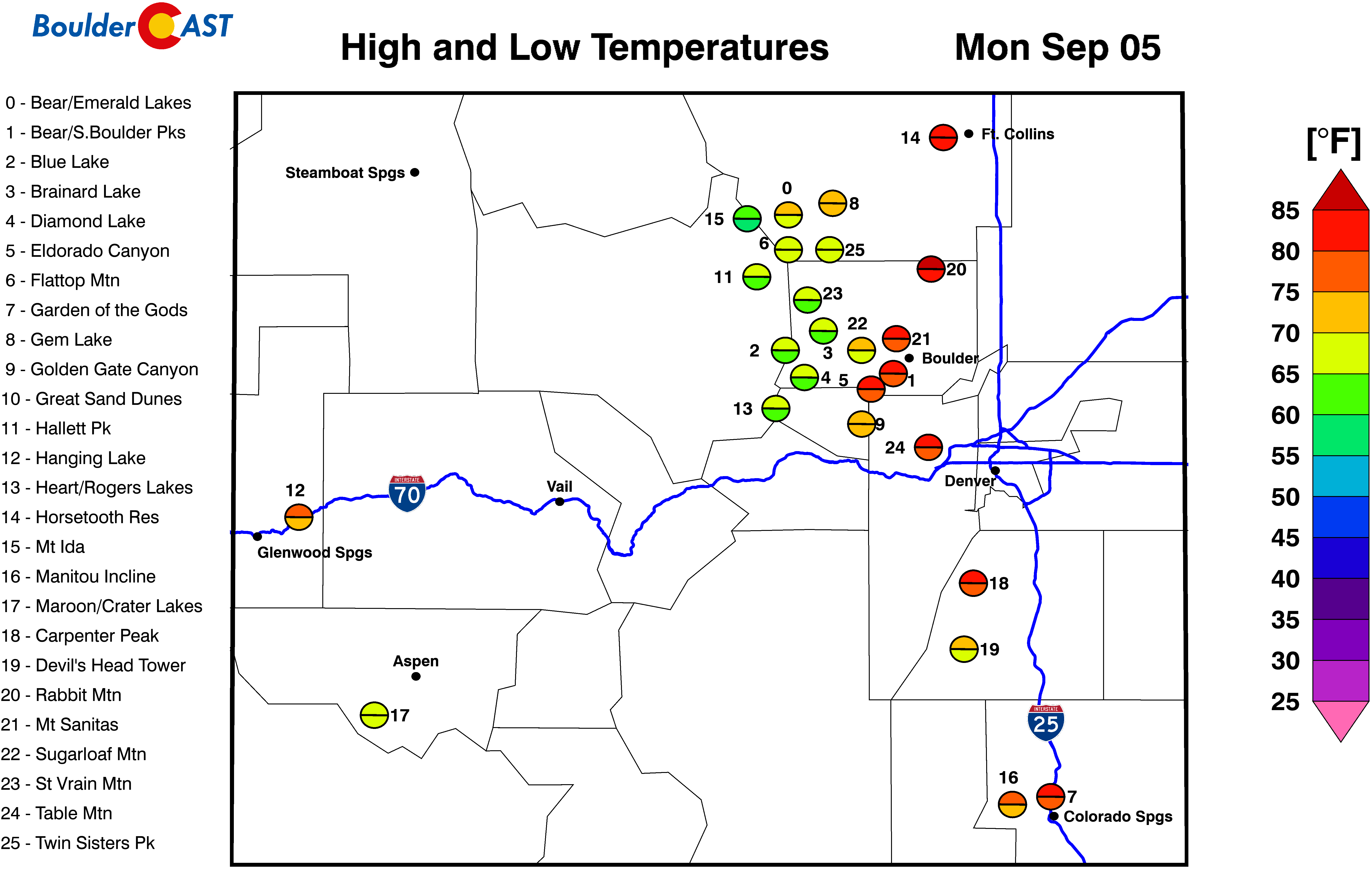
Monday: Hot and dry with middle to upper 90s on the Plains and middle 80s in the Foothills.
Tuesday: Hot and near record highs with middle to upper 90s for the Plains and middle 80s in the Foothills.
Wednesday: A tad cooler perhaps but still very hot with highs in the middle 90s on the Plains and lower 80s in the Foothills.
Thursday: Hot and sunny with middle to upper 90s for the Plains and middle 80s in the Foothills. This should be the hottest day of the week with a chance of reaching 100°F in spots!
Friday: Mostly sunny and much cooler and closer to normal with upper 70s to near 80 degree temperatures on the Plains and upper 60s in the Foothills. There is just a slight risk of a late-day shower or thunderstorms. It’s not much, but it is the only rain chance this work week.
High Country: The week is largely dry and void of thunderstorms for the High Country. High pressure overhead will suppress most storms from forming. There will be a chance of late-week storms Friday and Saturday with a frontal passage, along with a slight increase in wind speeds at higher mountain peaks.
Help support our team of Front Range weather bloggers by joining BoulderCAST Premium. We talk Boulder and Denver weather every single day. Sign up now to get access to our daily forecast discussions each morning, complete six-day skiing and hiking forecasts powered by machine learning, first-class access to all our Colorado-centric high-resolution weather graphics, bonus storm updates and much more! Or not, we just appreciate your readership!
Spread the word, share the BoulderCAST forecast!





You must be logged in to post a comment.