On this first full week of September, an overall dry pattern will exist across the Front Range with plenty of sunshine to go around. The best chance of storms will be during this Labor Day with a strong cold front moving east, though we suspect almost all of the action will be well north of the Denver Metro area. Tuesday will see temperatures drop pleasantly into the 70s behind a cold front, but it will be a short reprieve as above normal temperatures regain control in the days to follow.
This week’s highlights include:
- A strong cold front will bring a threat of storms Monday to the northern Front Range,increasing severe storms closer to the Wyoming border and the Dakotas
- Temperatures turn cooler and more seasonal Tuesday dropping back into the upper 70s
- Highs warm back up through the week but largely stay below 90 degrees
- A slight chance of storms by Friday as moisture levels increase
- Fire weather concerns possible Monday near the Palmer Divide
DISCLAIMER: This weekly outlook forecast is created Monday morning and covers the entire upcoming week. Accuracy will decrease as the week progresses as this post is NOT updated. To receive daily updated forecasts from our team, among many other perks, subscribe to BoulderCAST Premium.
Daily Forecast Updates
Get our daily forecast discussion every morning delivered to your inbox.
All Our Model Data
Access to all our Colorado-centric high-resolution weather model graphics. Seriously — every one!
Ski & Hiking Forecasts
6-day forecasts for all the Colorado ski resorts, plus more than 120 hiking trails, including every 14er.
Smoke Forecasts
Wildfire smoke concentration predictions up to 72 hours into the future.
Exclusive Content
Weekend outlooks every Thursday, bonus storm updates, historical data and much more!
No Advertisements
Enjoy ad-free viewing on the entire site.
A cold front favors storms on Labor Day
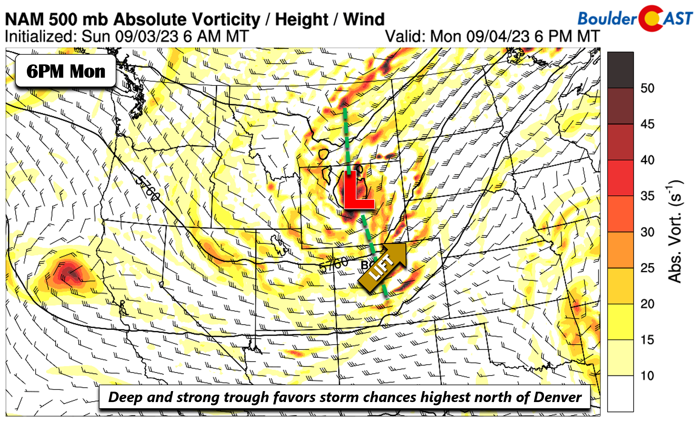
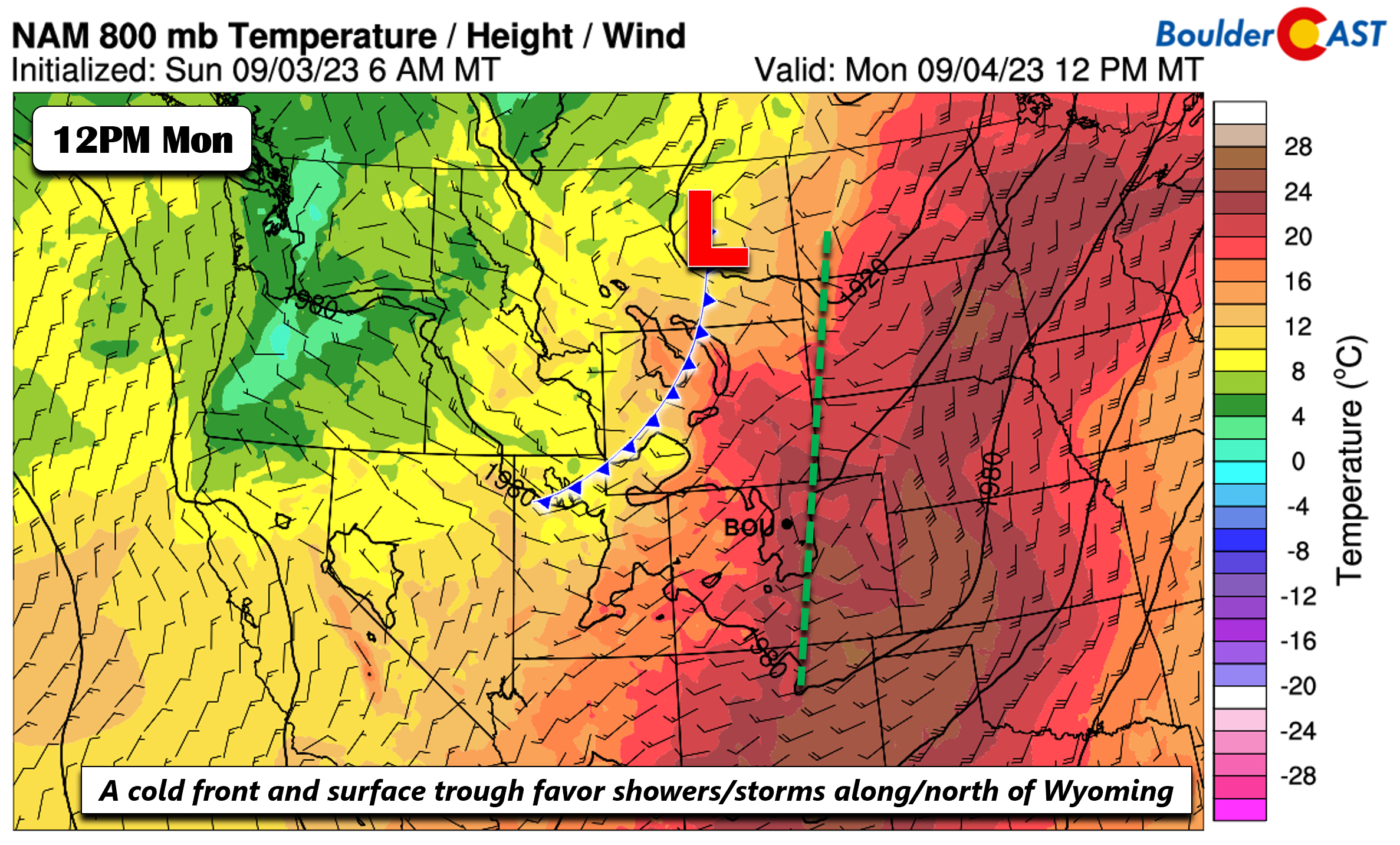
Happy Labor Day! We hope you are enjoying the long weekend! A strong mid-level shortwave will be lifting northeast out of Utah and into northeastern Wyoming this evening. Strong lift will be present east of the system across northeast Colorado, eastern Wyoming, and the Dakotas.
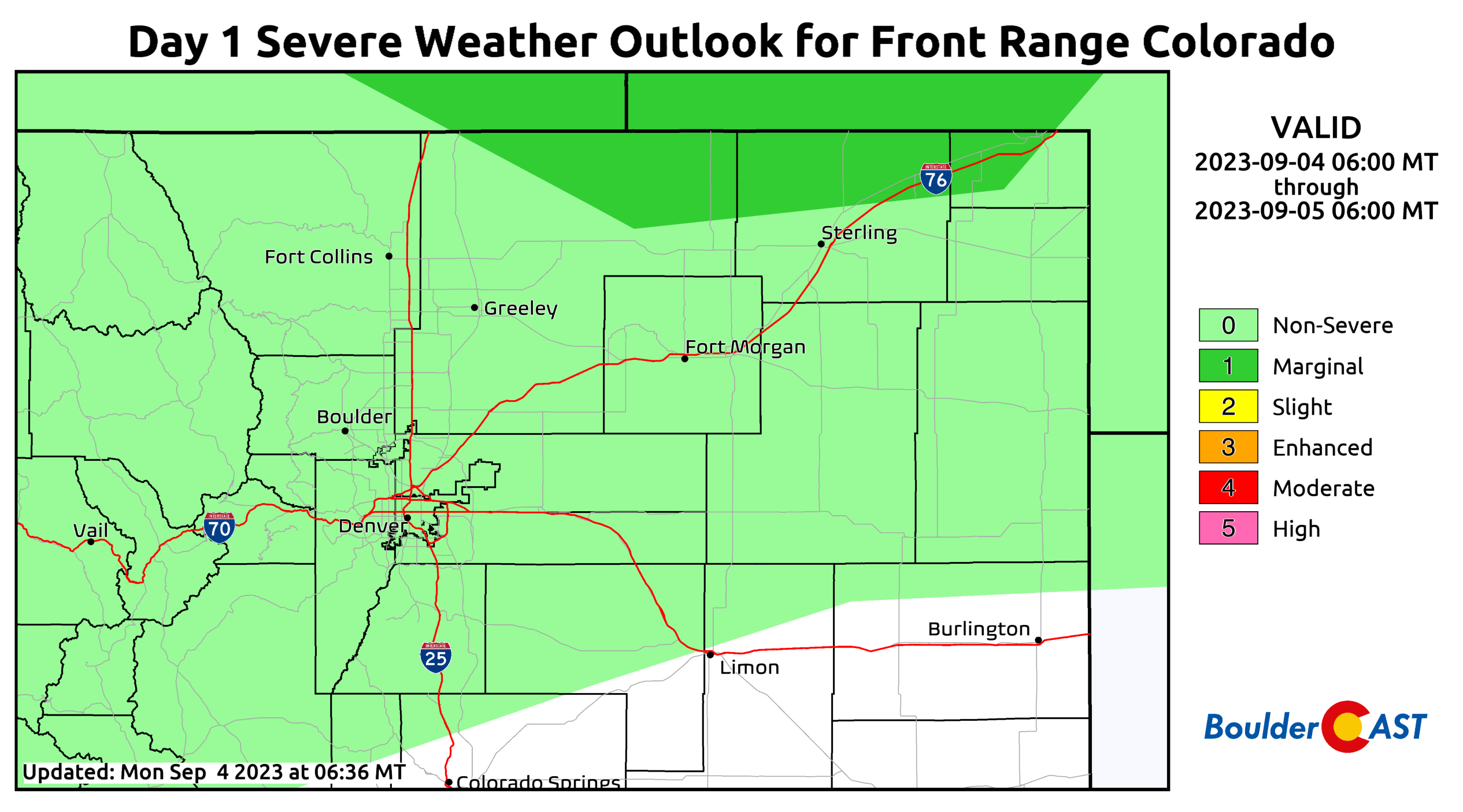
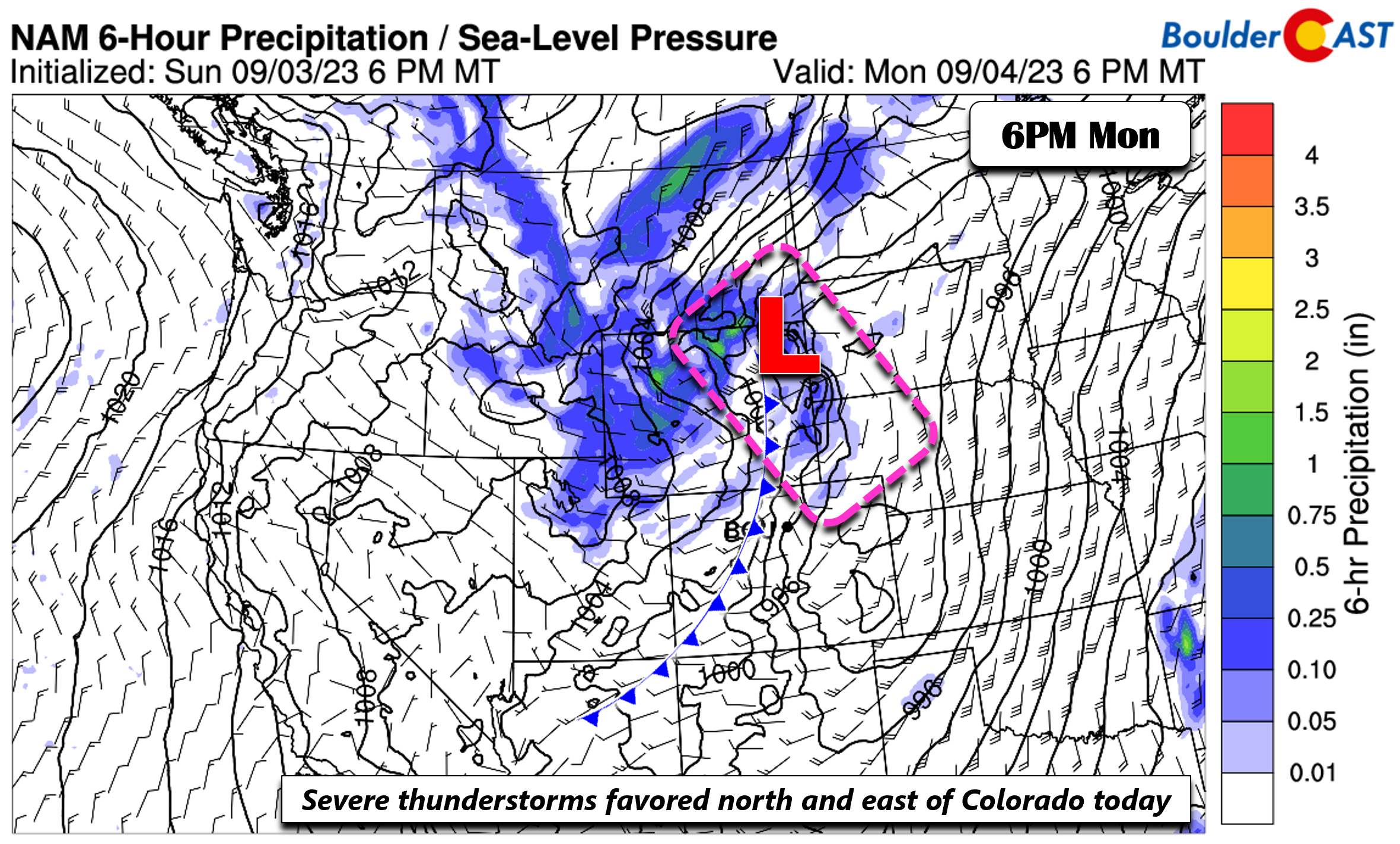
There will exist strong shear and decent instability over far northeast Colorado and into the Dakotas where a few isolated severe storms may develop.
At the surface Monday, a trough will exist along/east of the Denver Metro and extend northward into western portions of the Dakotas. At the same time, a cold front will start to develop and push into western Colorado later in the day from Utah and Wyoming. The trough and front will combine with the trough to aid shower and thunderstorm development. The airmass is similar to Sunday, supporting highs near the lower 90s.
The greatest coverage of showers and storms this afternoon and evening will be found north and east of the Denver region, largely along/north of Interstate 76 and east of I-25. We put the chance of storms today in Boulder and Denver only in the 10% range, with most of the action unfortunately lining up to be well north of the area. We don’t expect storms to become severe in our neck of the woods. In addition to the storm threat, gusty winds and dry air with the trough will promote somewhat elevated fire danger near the Palmer Divide where southwest winds may gust in excess of 25 MPH Monday afternoon and early evening.
Turning cooler to slightly above average the remainder of the week
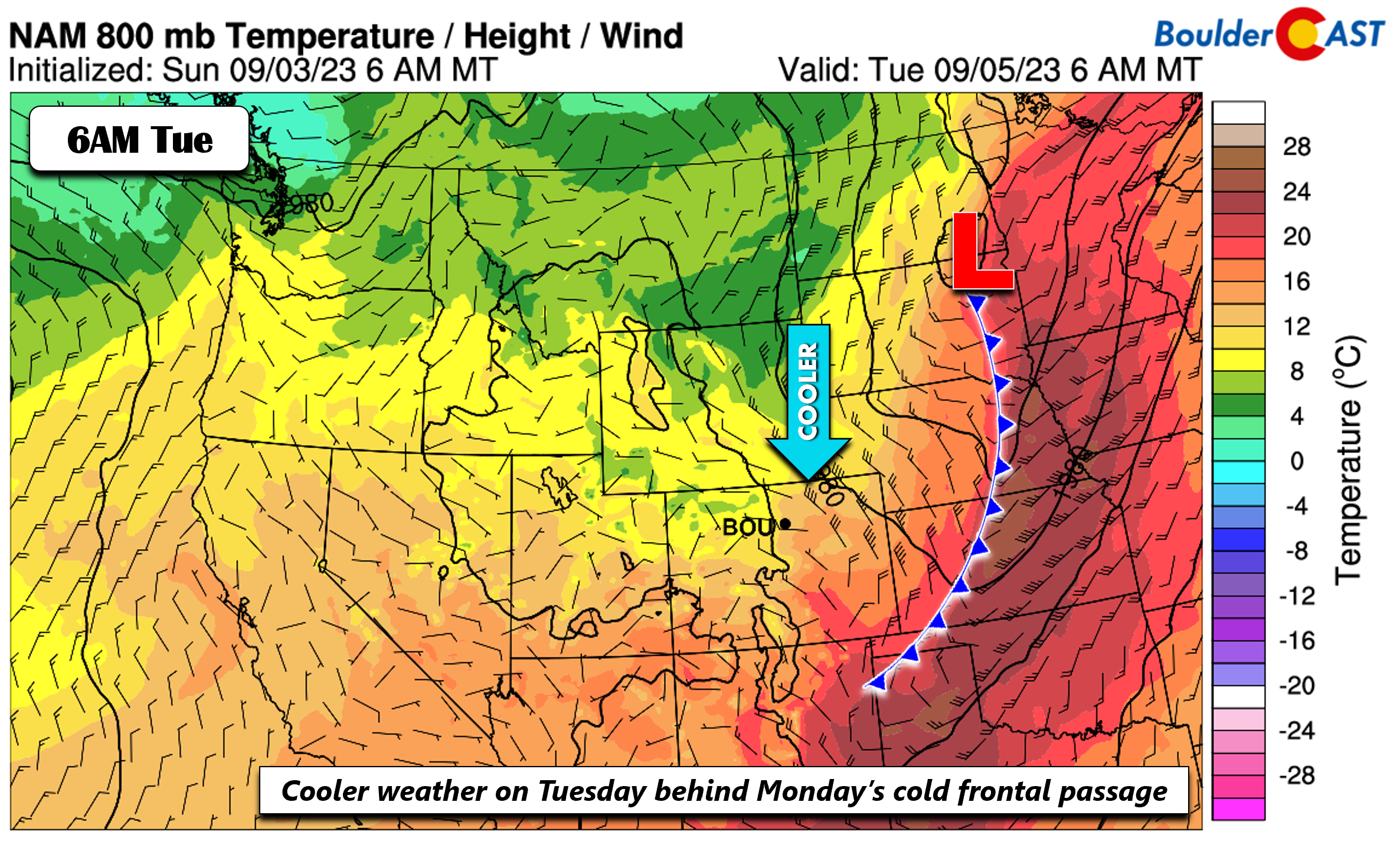
The cold front from Monday will push well east of our area into the central Plains. Behind it, dry and cooler weather will be the norm for Tuesday, with highs largely in the upper 70s to around 80 along the Front Range. Tuesday will be the most comfortable day of the week for sure!
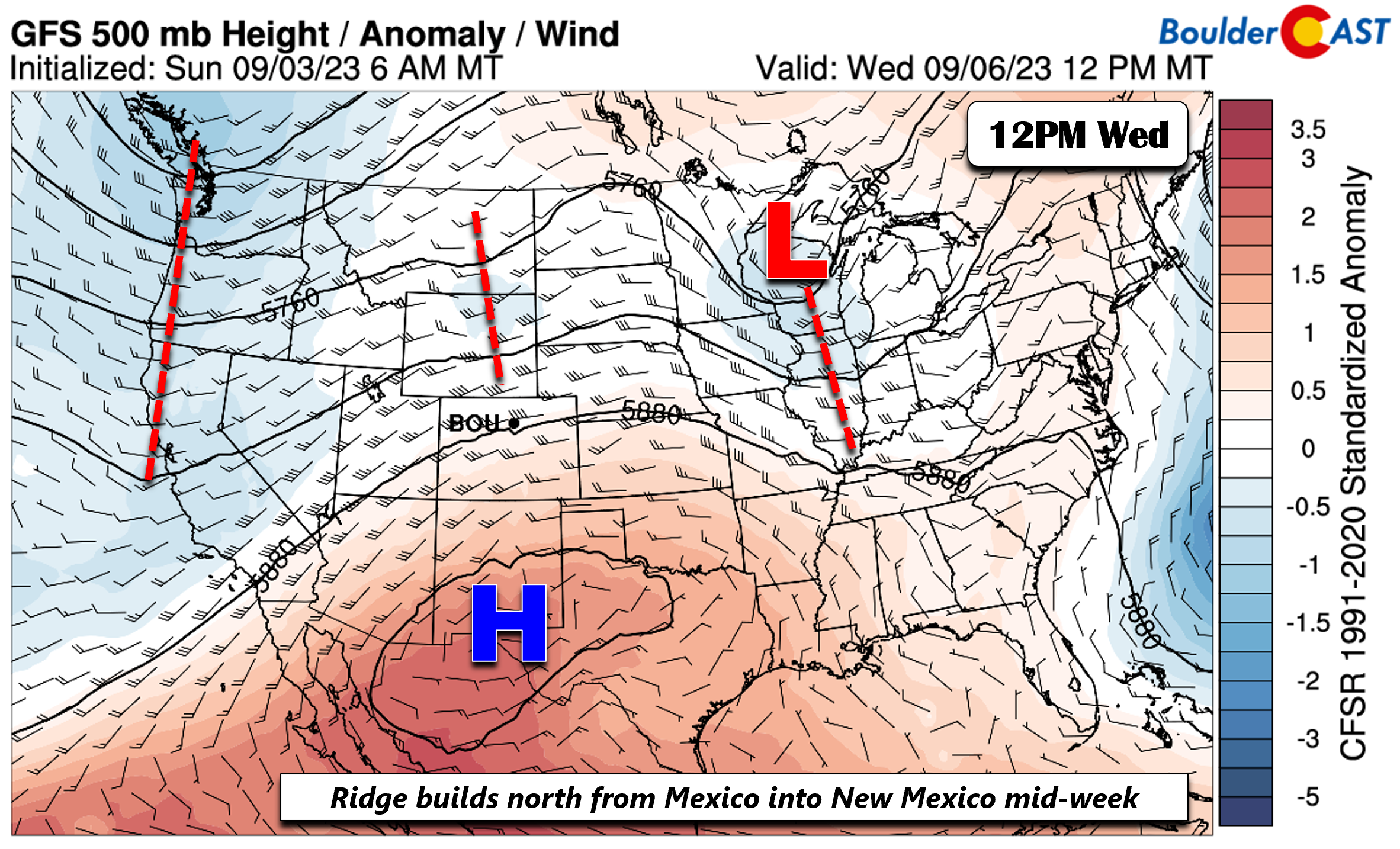
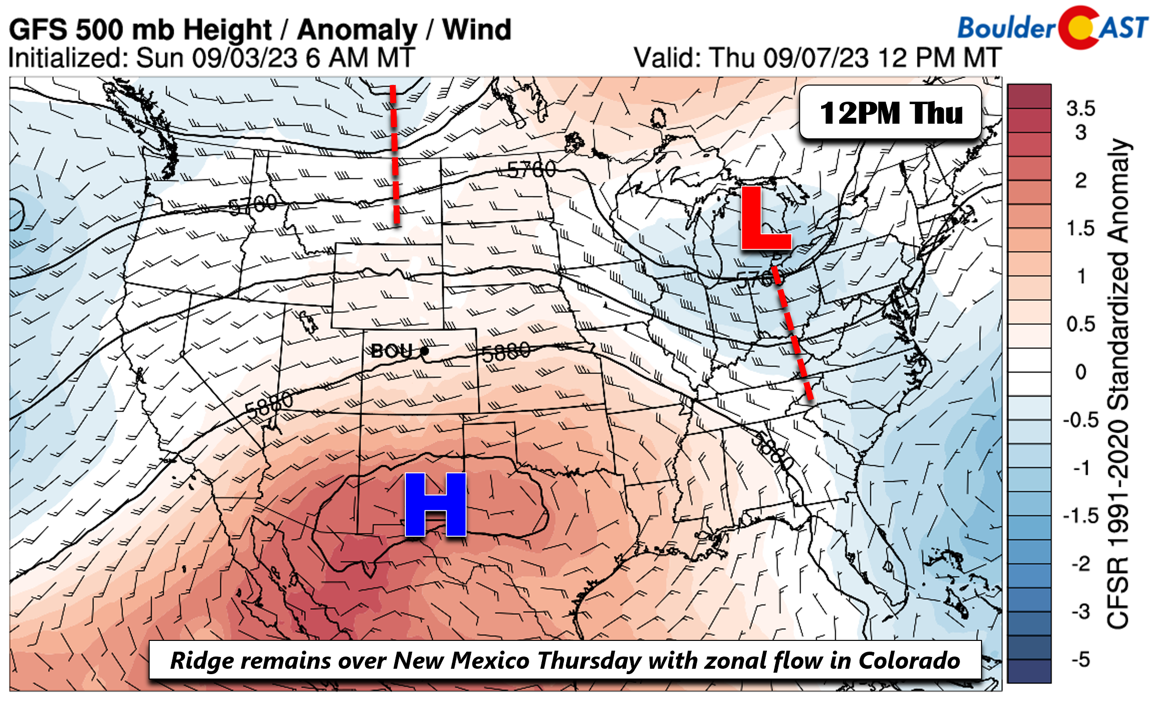
As we head into the midweek period, the trough from Monday continues to track east into the Great Lakes. Meanwhile, a ridge over Mexico moves north and west into Arizona/New Mexico come Wednesday. A southwest to westward flow will take shape across our beautiful state. This should favor more mild weather with temperatures near the middle to upper 80s.
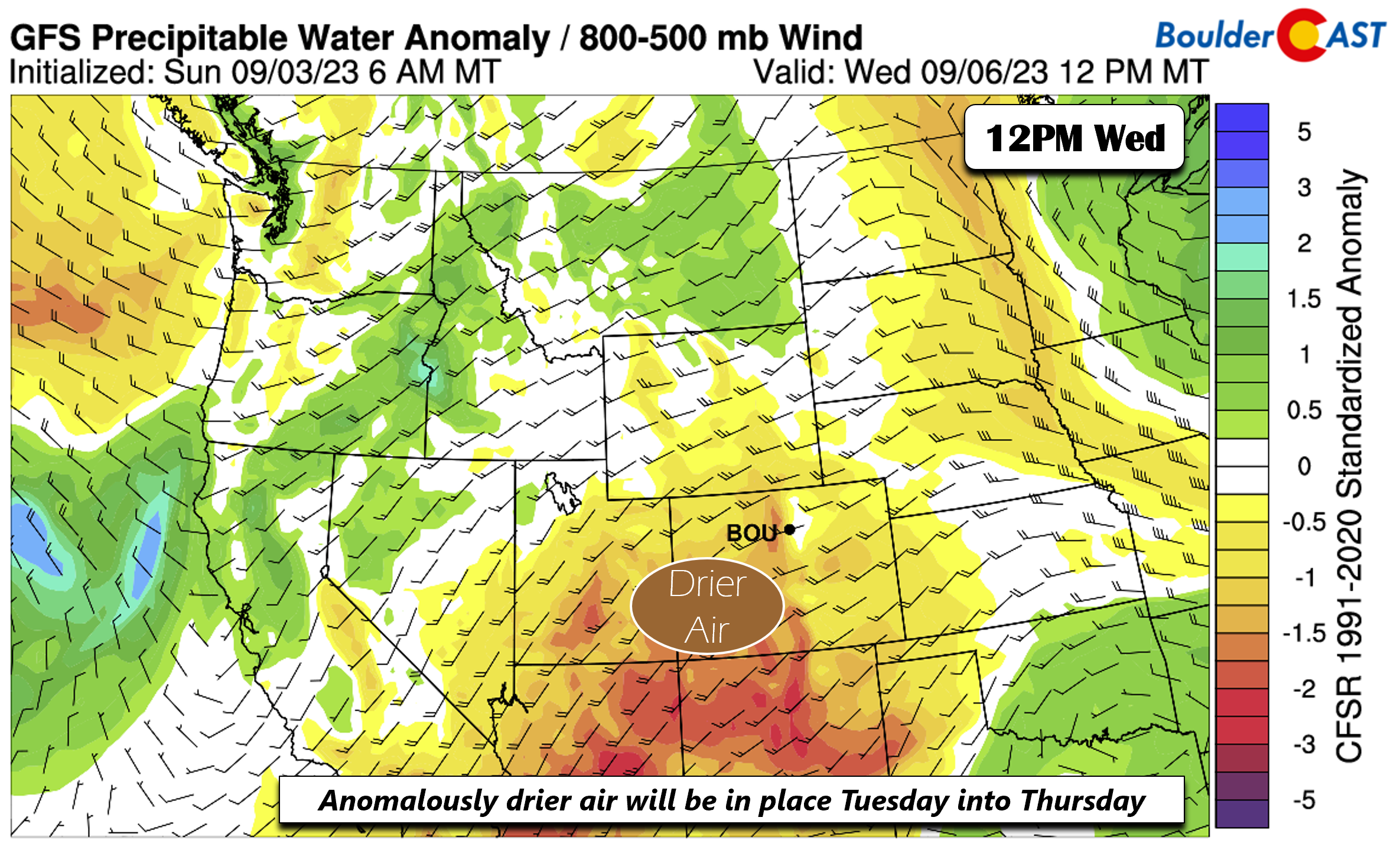
During the period from Tuesday through Thursday, a quasi-zonal flow will favor fairly dry air over the area, with limited moisture for storms. Although some disturbances will traverse from west to east, they will have limited forcing and moisture to work with such that we should stay dry.
By Thursday, the ridge to our south remains in-place and a westerly zonal flow continues. Temperatures should continue their upward trend to above normal getting very close to 90 degrees.
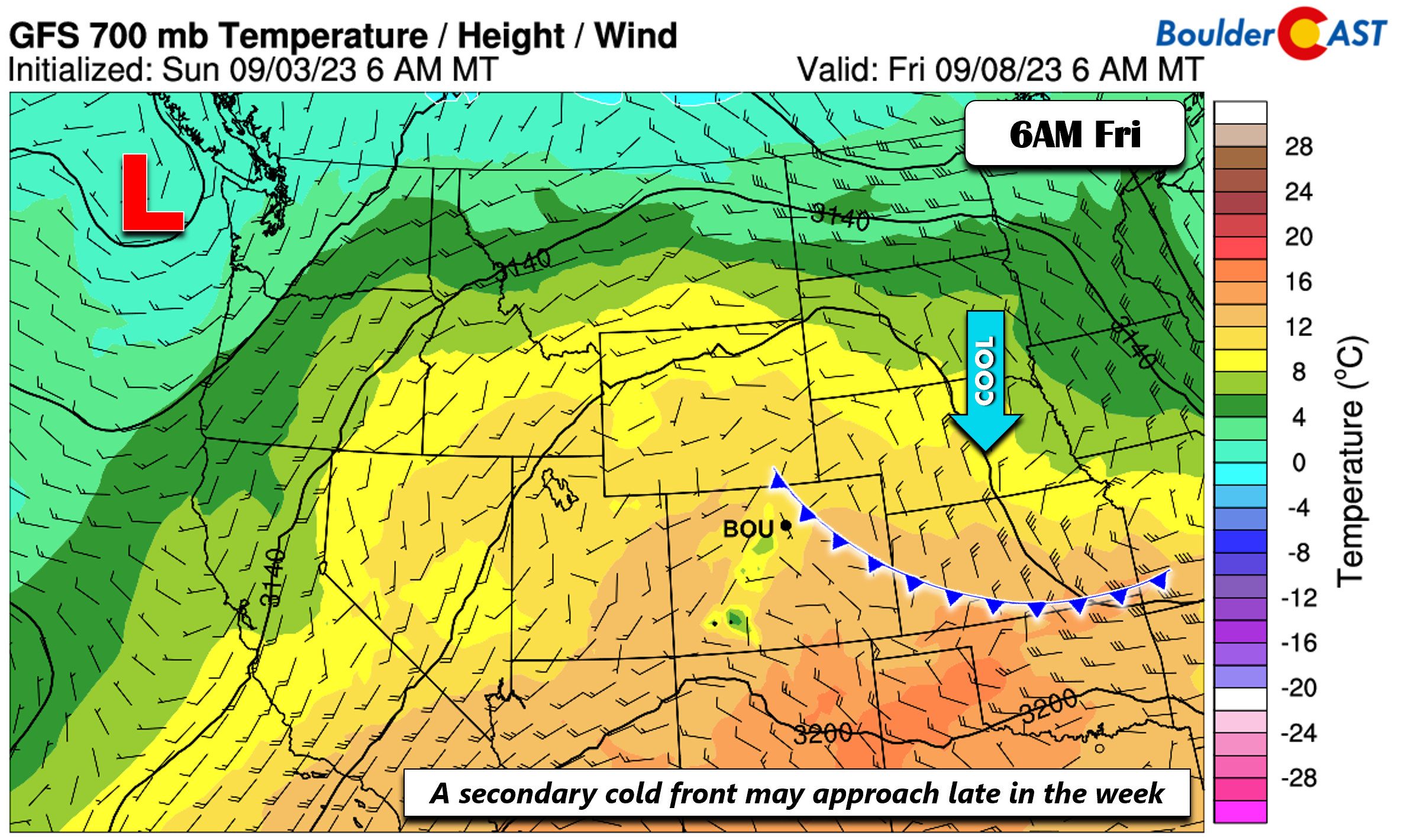
There are some hints that a late-week secondary cold front will drop down early Friday to keep our area in that pattern of highs in the mid/upper 80s. The front may also combine with increasing moisture to bring the return of chances for storms. The confidence at this point is low so only slight chances are warranted at this point.
Enjoy the once again warm and mostly dry week!
Forecast Specifics:
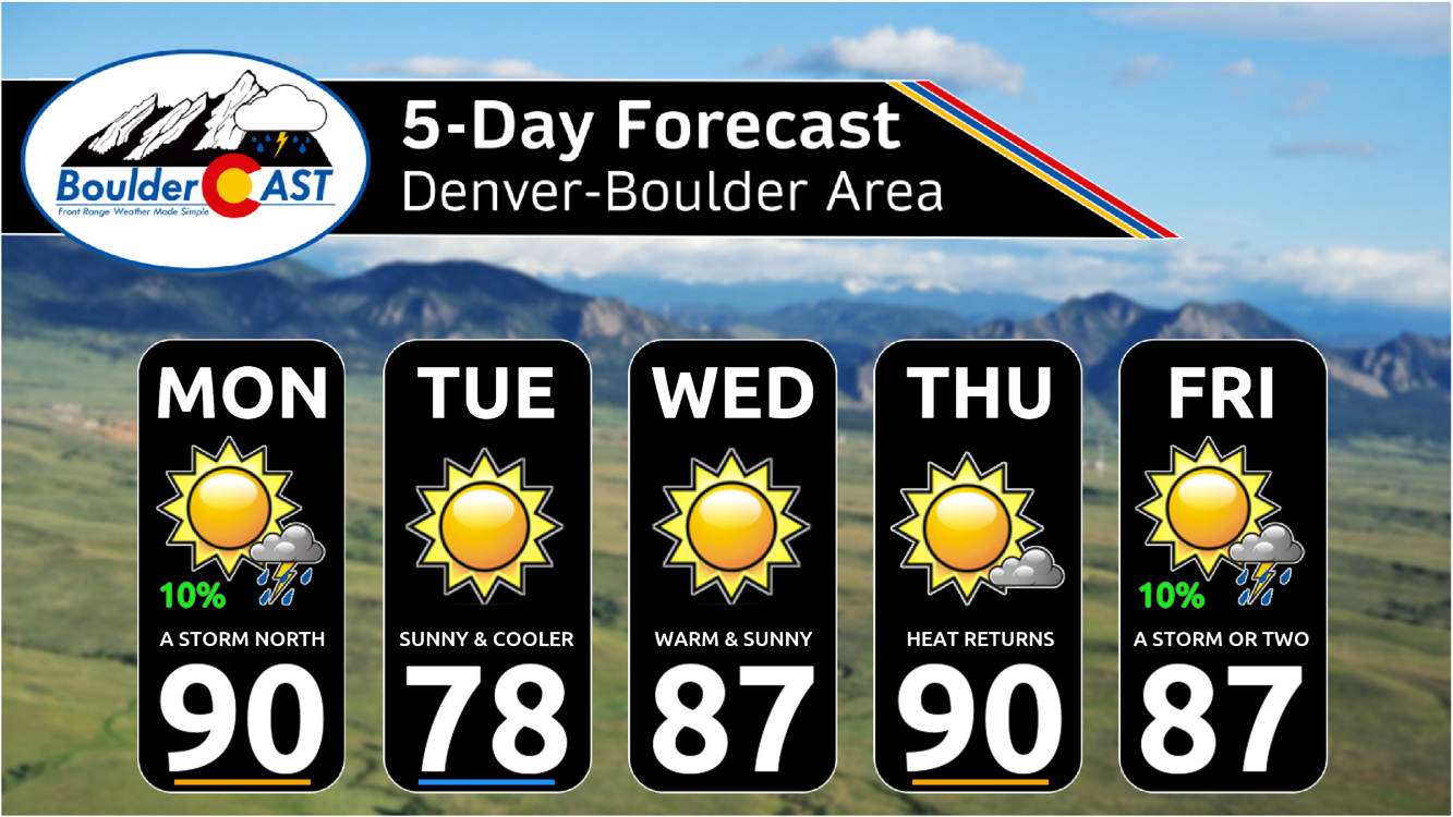
Monday: Mostly sunny with a 10% chance of late-day storms. Best storm chances will be north of I-76 and east of I-25. Highs in the upper 80s to near 90 on the Plains and upper 70s to near 80 in the Foothills. Southwest winds become breezy in the afternoon with gusts of 10-20 MPH common.
Tuesday: Sunny and cooler with upper 70s to near 80 on the Plains and upper 60s to near 70 in the Foothills.
Wednesday: Mostly sunny and mild with highs in the middle to upper 80s for the Plains and middle 70s in the Foothills.
Thursday: Partly cloudy and warmer with upper 80s on the Plains and mid 70s in the Foothills.
Friday: Morning sun, followed by a slight chance of late-day or evening storms. Highs in the mid to upper 80s for the Plains and middle 70s in the Foothills.
DISCLAIMER: This weekly outlook forecast is created Monday morning and covers the entire upcoming week. Accuracy will decrease as the week progresses as this post is NOT updated. To receive daily updated forecasts from our team, among many other perks, subscribe to BoulderCAST Premium.
Daily Forecast Updates
Get our daily forecast discussion every morning delivered to your inbox.
All Our Model Data
Access to all our Colorado-centric high-resolution weather model graphics. Seriously — every one!
Ski & Hiking Forecasts
6-day forecasts for all the Colorado ski resorts, plus more than 120 hiking trails, including every 14er.
Smoke Forecasts
Wildfire smoke concentration predictions up to 72 hours into the future.
Exclusive Content
Weekend outlooks every Thursday, bonus storm updates, historical data and much more!
No Advertisements
Enjoy ad-free viewing on the entire site.
Get BoulderCAST updates delivered to your inbox:
Enjoy our content? Give it a share!




You must be logged in to post a comment.