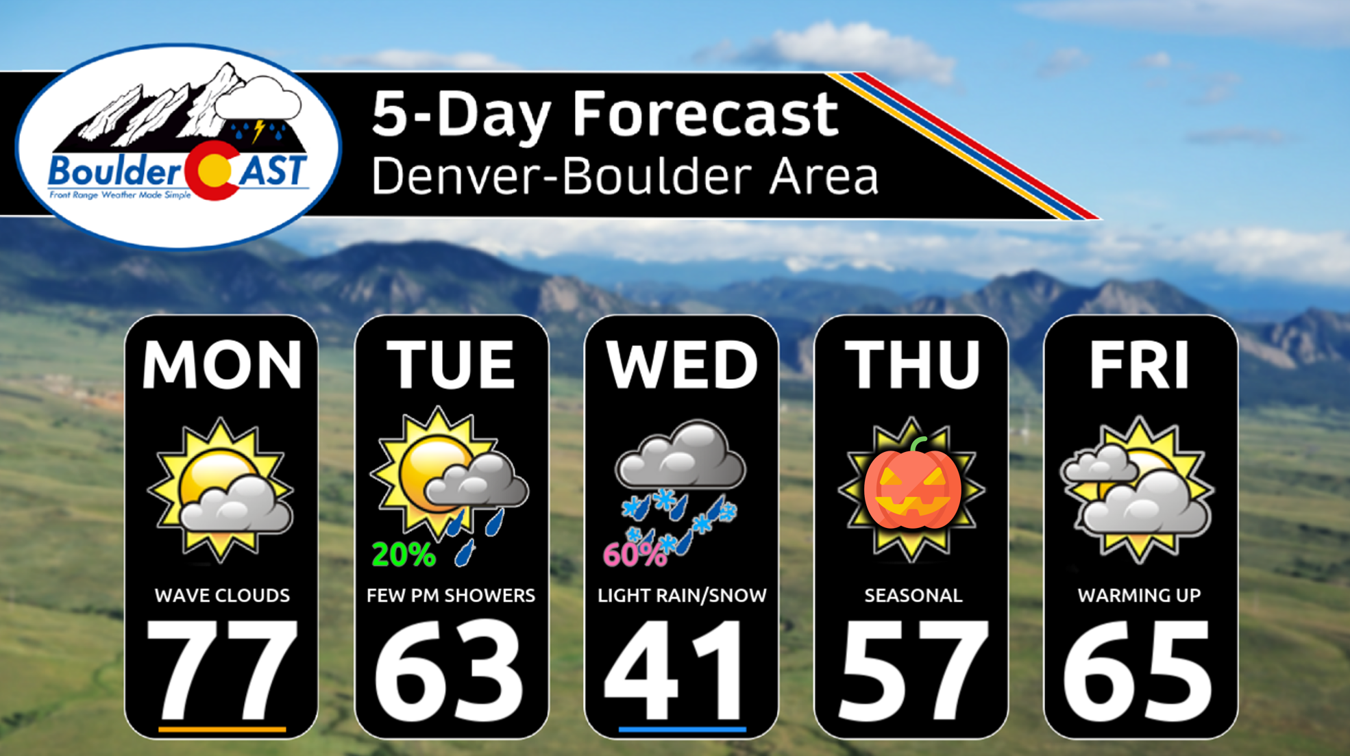
Front Range weather will be tame to start the week with above normal temperatures for our Monday but under extensive wave clouds. However, all eyes are on a developing storm system moving onshore Monday night in California. As the system tracks across the Four Corners and into our area, it will bring the Mountain snowfall, as well as the chance of rain ending as wet snow late Tuesday night into early Wednesday in the Denver Metro area. While the midweek storm will offer a decent chance at our first flakes of the season, amounts are expected to be rather light. We break it all down for you, including the probabilities and our preliminary snowfall map. The first hard freeze of the season is also taking shape for Wednesday night.
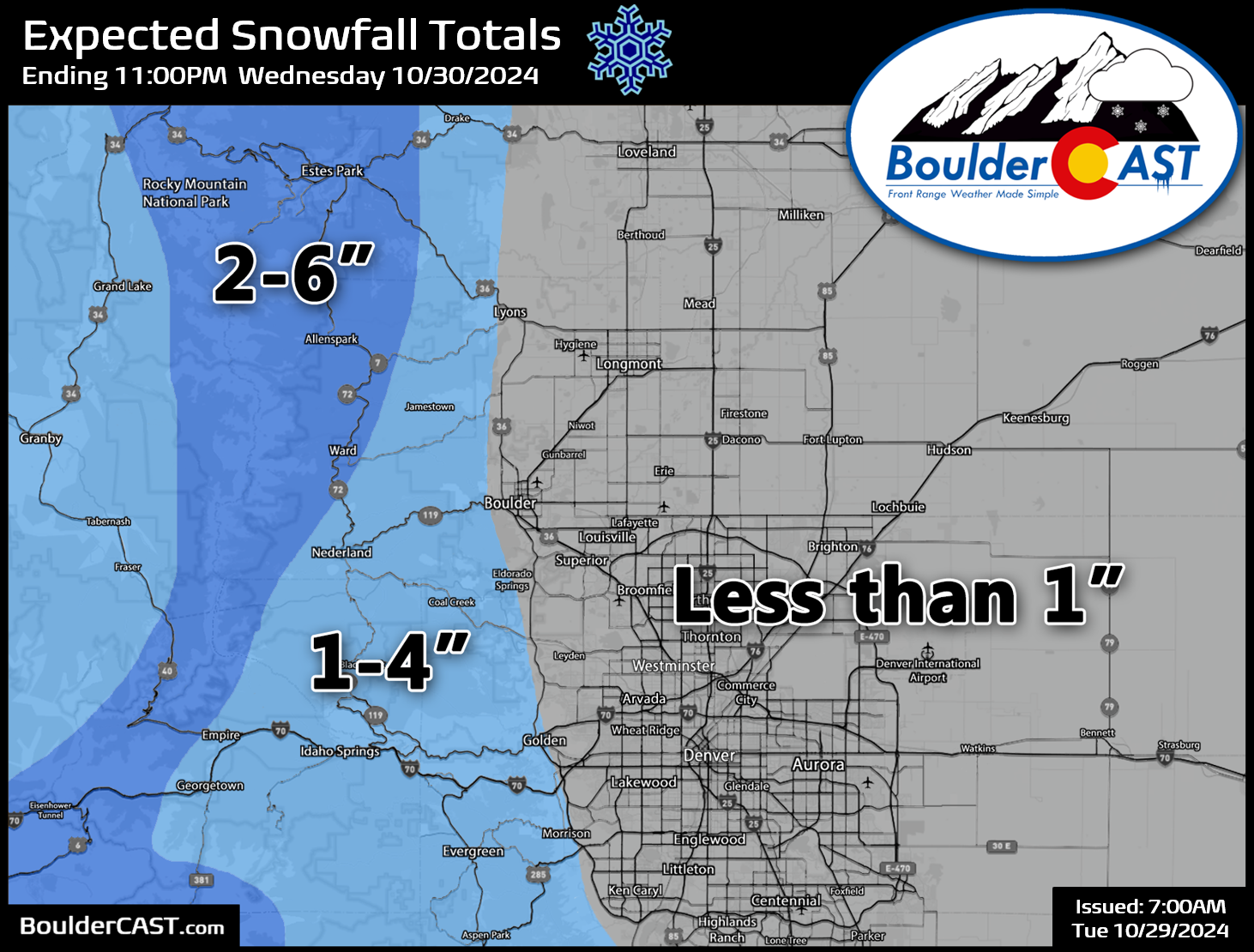
Updated (Tue 10/29/2024 7:00AM): Our snowfall map was updated to align with the latest guidance, with details discussed in our Premium update HERE.
This week’s highlights include:
- Midweek Snow? A vigorous upper-trough will track through Tuesday into Wednesday, with scattered rain showers and eventually some snow favored. Snow amounts will be unimpressive for the Metro area, but will be slightly higher over the Foothills and Mountain areas.
- Up and Down Temps: Well above normal temperatures on Monday will trend quickly below normal Tuesday and Wednesday. Seasonal temperatures are expected for Halloween and Friday.
- Hard Freeze Inbound! A hard freeze is nearly guaranteed for the lower elevations Thursday morning with temperatures dropping into the 20s. We may see another hard freeze Thursday night.
- Trick or Treat? Halloween will be sunny and dry across the Front Range with highs in the 50s. Temperatures will fall into the 40s during mass candy collection hours in the evening.
DISCLAIMER: This weekly outlook forecast is created Monday morning and covers the entire upcoming week. Accuracy will decrease as the week progresses as this post is NOT updated. To receive daily updated forecasts from our team, among many other perks, subscribe to BoulderCAST Premium.
Daily Forecast Updates
Get our daily forecast discussion every morning delivered to your inbox.
All Our Model Data
Access to all our Colorado-centric high-resolution weather model graphics. Seriously — every one!
Ski & Hiking Forecasts
6-day forecasts for all the Colorado ski resorts, plus more than 120 hiking trails, including every 14er.
Smoke Forecasts
Wildfire smoke concentration predictions up to 72 hours into the future.
Exclusive Content
Weekend outlooks every Thursday, bonus storm updates, historical data and much more!
No Advertisements
Enjoy ad-free viewing on the entire site.
All eyes on a midweek storm and its snow potential
We will keep the discussion for our Monday rather short as it is quiet to start the week. Much like we have seen this past weekend, highs will be well above average in the mid to upper 70s.
We can expect also some wave clouds at times on Monday. The wave clouds were particularly thick yesterday (Sunday) over eastern Boulder County:
Another stunning fall weekend… perhaps the last one for a while. Enjoy this time lapse of a Chinook arch wave cloud over #Boulder. Happy Sunday! #cowx pic.twitter.com/jliDXLWULh
— BoulderCAST Weather 🏔️❄️ (@BoulderCAST) October 27, 2024
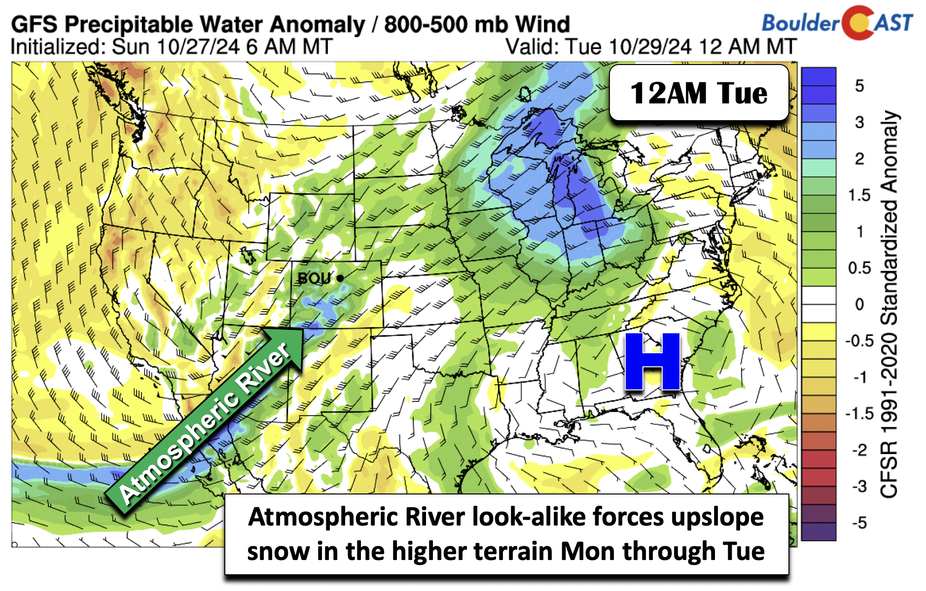
The main story for the week ahead a strong mid-level system taking aim on the region Tuesday through Wednesday. The system has been trending in the “white” direction, meaning we may indeed see our first snow of the season as October closes out. Before the system moves onshore, which is expected to happen Monday night, an narrow stream of deep Pacific moisture, akin to but not officially an atmospheric river, will stretch from Baja California into southwest Colorado tonight. So while we are dry on Monday here in the Front Range, snow will begin in southwestern parts of Colorado.
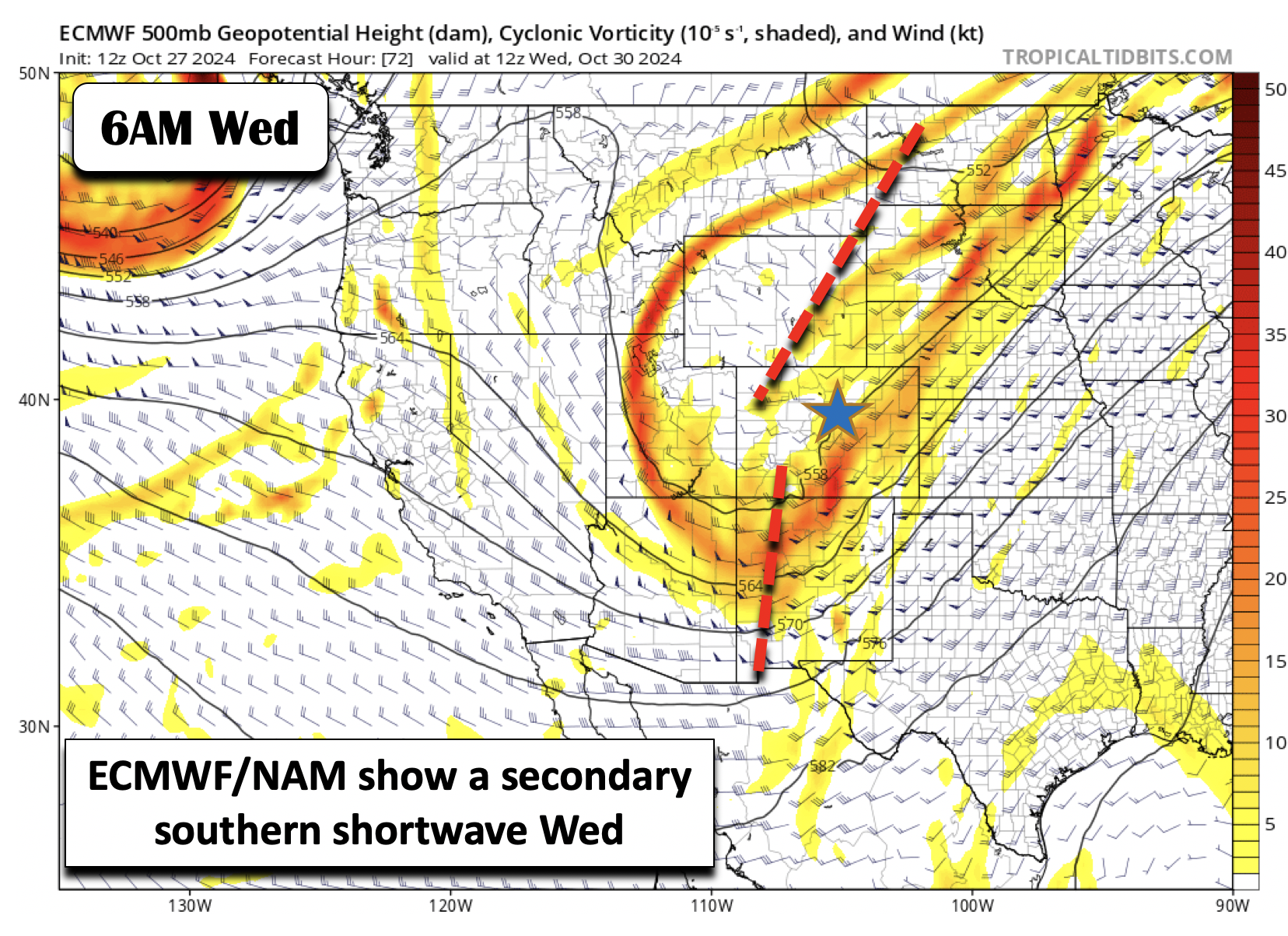
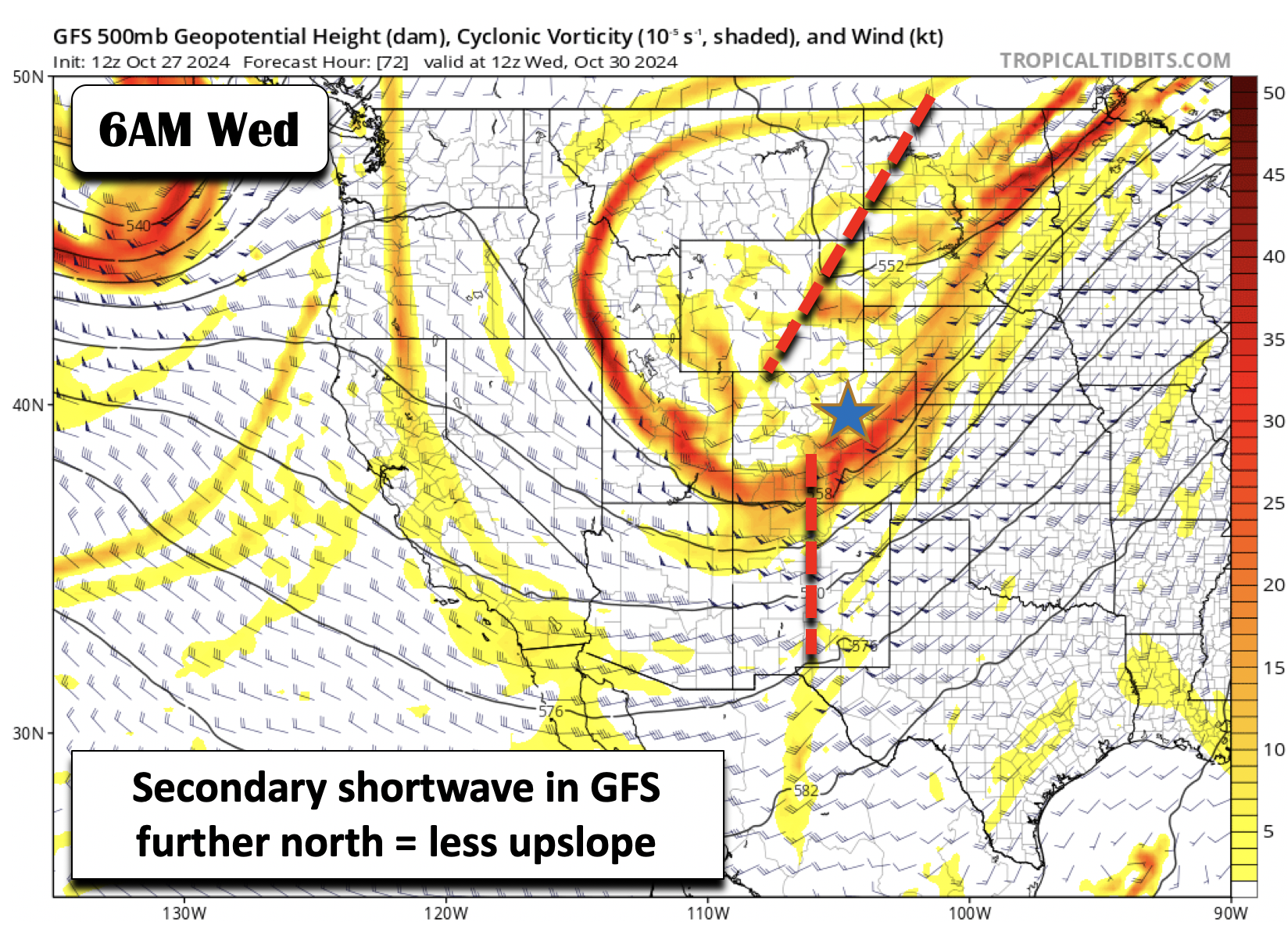
As the system tracks east, there is good consensus in the guidance that the trough will be two-pronged. A first shortwave will track into northeast Utah and southwest Wyoming Tuesday into Tuesday night. A secondary shortwave will then move through late Tuesday night into late afternoon Wednesday. As shown by the Euro (below), this second wave will pass across the Four Corners and track towards northeast Colorado. Our shot of snow is not with the first wave, but the second one.
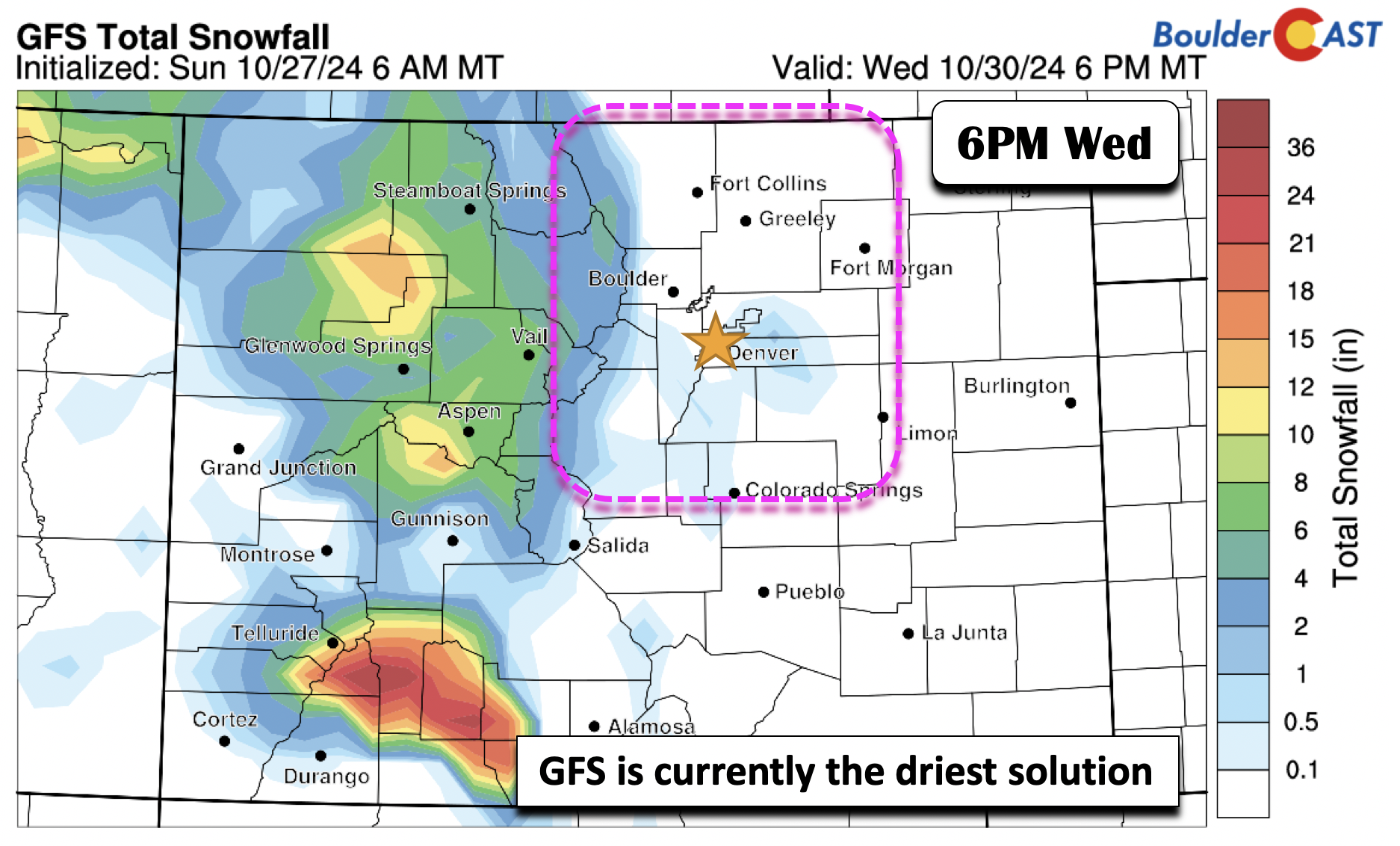
This is the subtle difference in the guidance between the Euro and GFS. The GFS agrees on the first wave and its track, which would bring a slight chance of rain scattered showers to the Metro area Tuesday afternoon and evening. The second wave in the GFS is further north, over southern Colorado, contrary to Arizona and New Mexico in the ECMWF and also NAM (not shown). The result of the GFS is less upslope on the backside Wednesday morning and less snow potential for us.
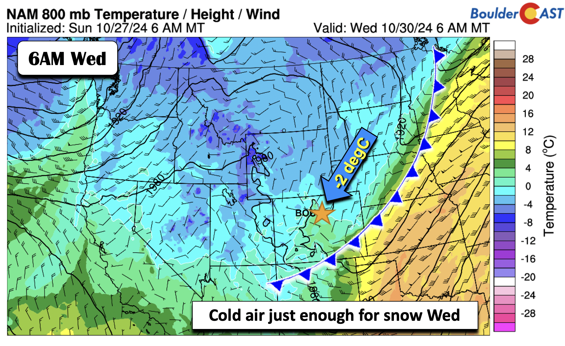
A cold front moves through Tuesday afternoon, with temperatures dropping into the 60s to 50s for highs. Again, we have that chance of showers Tuesday evening, but most of us will see more dry time than wet weather. As the shortwave tracks northeast, colder air will build down early Wednesday. The further south solutions show a more favorable upslope pattern for us Wednesday morning, with the NAM showing -2°C in the low-levels, cold enough for snow.
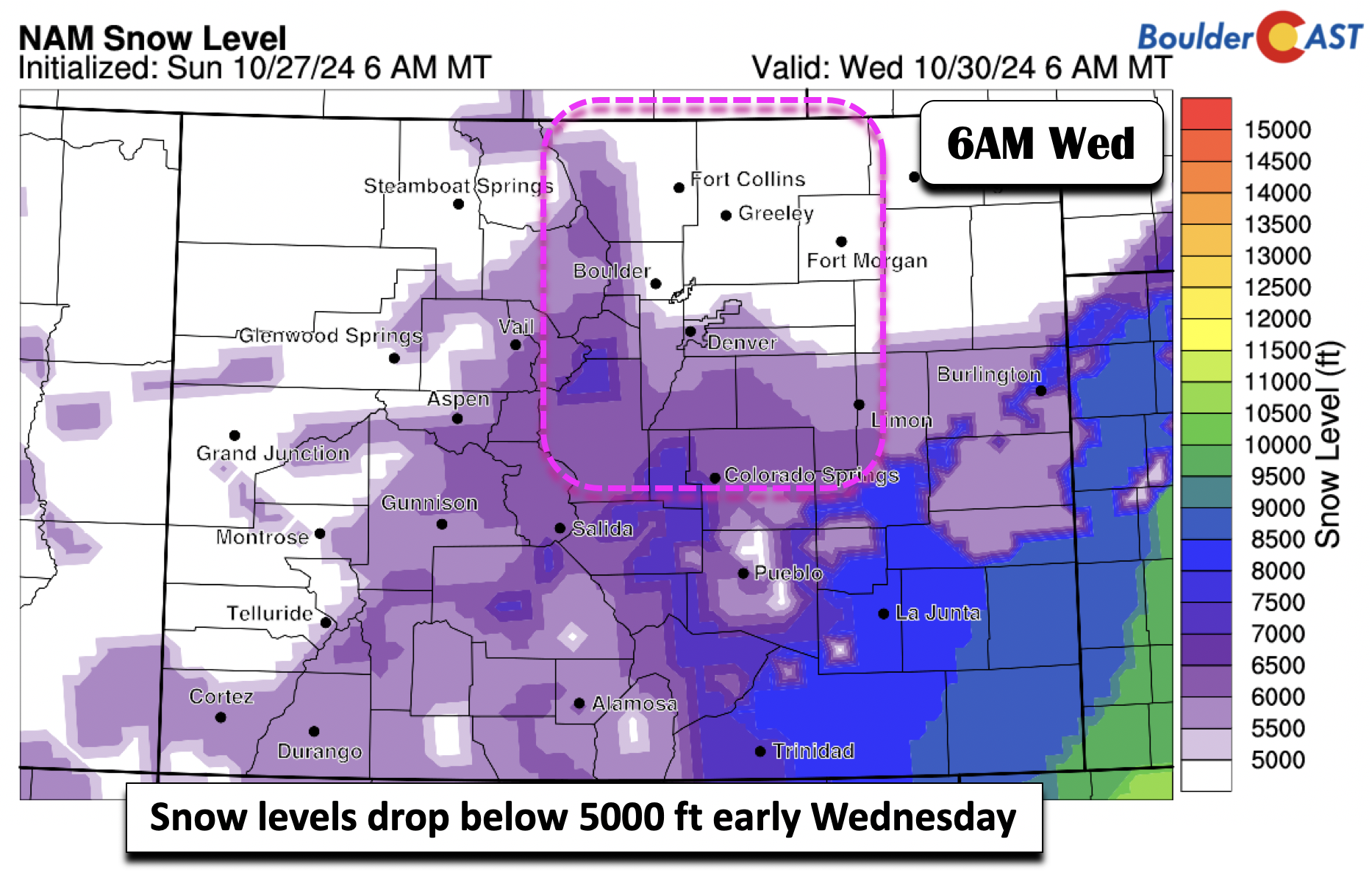
Even the further north GFS shows similar snow levels as the NAM below, with those falling below 5500 feet elevation in the early morning hours Wednesday.
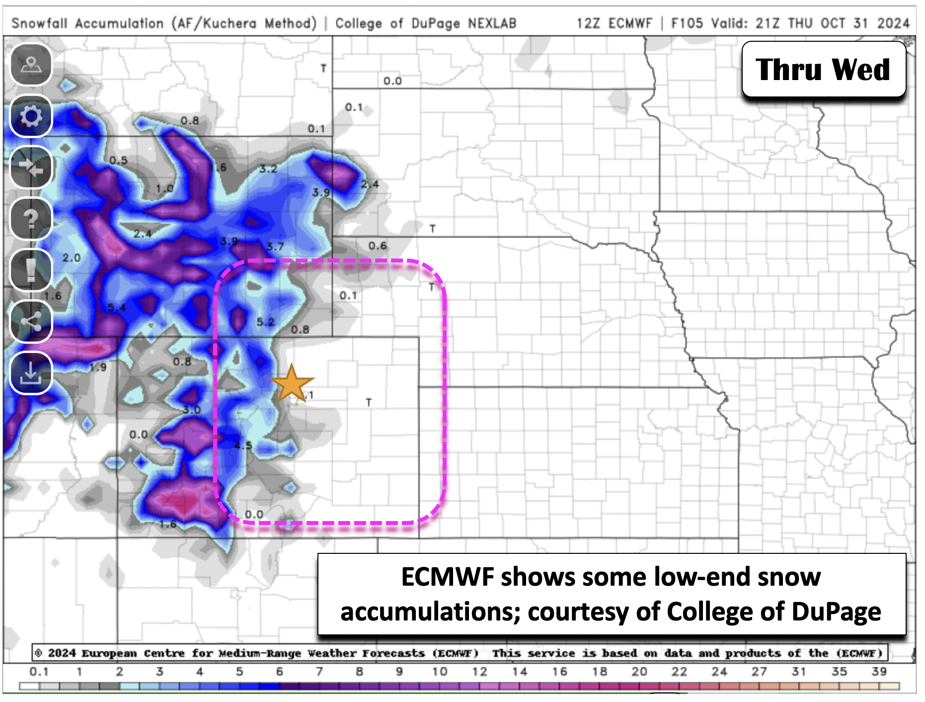
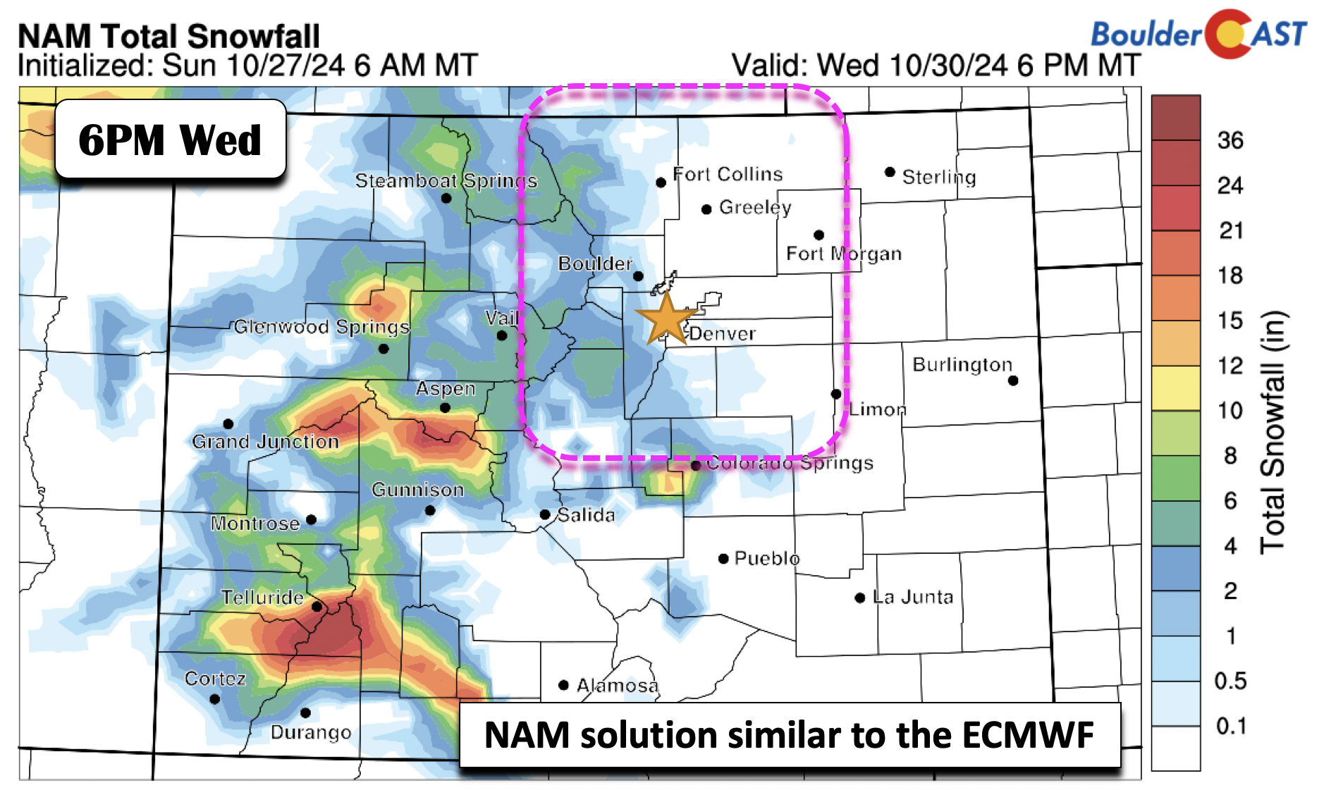
Here, we show the varying snow accumulations among the ECMWF, NAM, and GFS before going into our thinking and ensemble probabilities. The ECMWF is actually pretty similar to the NAM, which shows some 2-5 inches possible in the Foothills, and a trace to maybe up to 2″ on the Plains. The star is Denver.
The NAM, not surprisingly, is similar to the ECMWF, showing perhaps 1″ in Boulder, and a trace to an inch in Denver, with higher amounts toward the Palmer Divide and Foothills (1-5″).
The GFS, being the furthest north with the shortwave, and resultant limited upslope, shows most snow accumulations confined to the High Country and Foothills. We get a dusting or less of snow this solution.
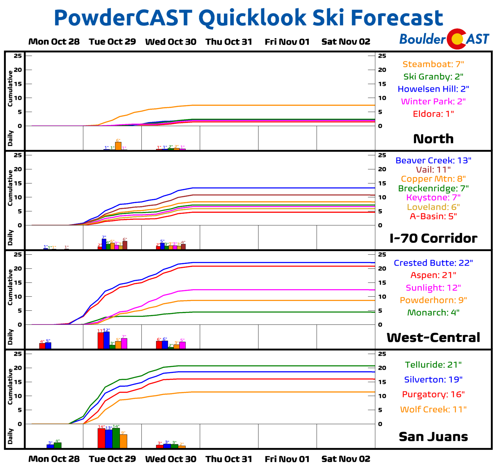
No matter how you slice it, the Mountains of western and southwest Colorado, regardless of model, are going to get pummeled with the white stuff. PowderCAST has several Colorado ski resorts (most still not open yet) receiving over a foot of snow from this one-two punch of a trough!
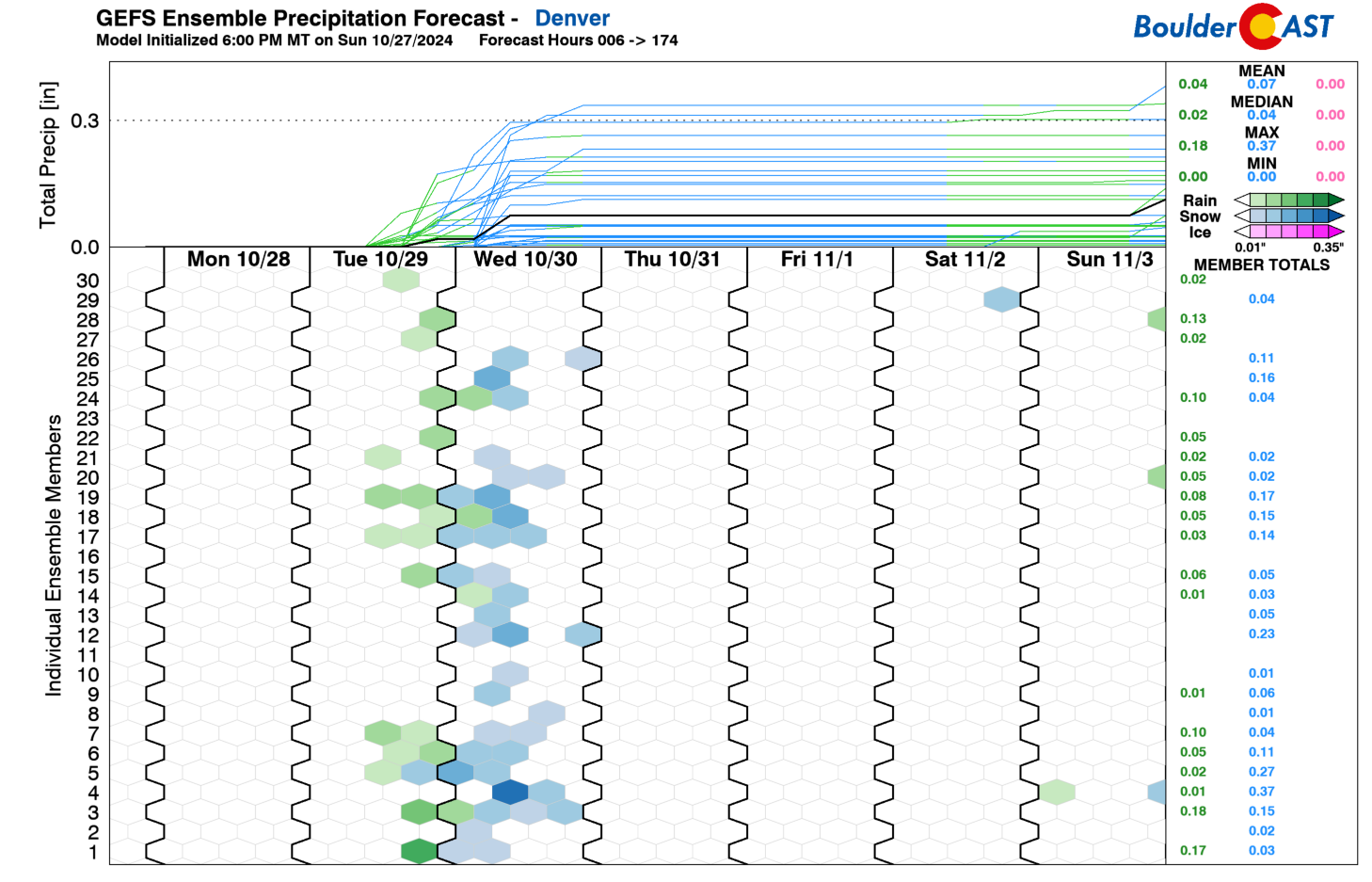
A look at the GEFS ensemble plumes shows that there is still mild uncertainty in regards to potential snow amounts in Denver. The highest members show 0.3 inches of liquid equivalent precipitation, with the lowest members having nothing. The average is just under 0.1 inches of liquid equivalent. This really is a low-end event for us — only worth mentioning due to it potentially offering our first flakes of the season.
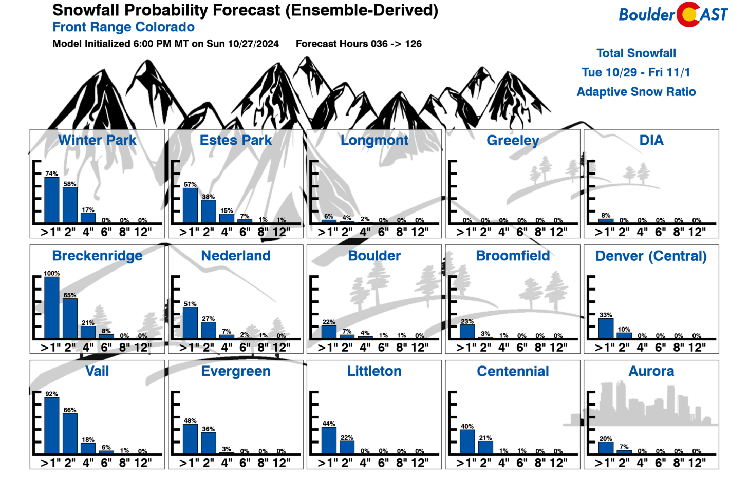
This mean accumulation would agree with the ECMWF/NAM snow amounts of generally less than 1″. As for our latest Snowfall Probabilities, there’s about a 30% chance of an inch or greater in Boulder/Denver, but less than 10% chances to see 2″. So as it stands now, while there is a good probability of snowflakes, it looks marginal for much accumulation thus far. The higher probabilities for snow are over the Mountains, with a ~60% chance of 2+ inches in Vail, Breck, and Winter Park.
We certainly will be updating the forecast between now and Wednesday, but here are our preliminary thoughts:
- Tuesday will see highs in the lower 60s
- Tuesday into Tuesday night will see widely scattered quick-moving rain showers, with amounts on the low end (less than 0.1″ of rain). Temperatures will fall into the low to middle 30s late Tuesday night into Wednesday morning.
- Our shot of snow will come with a secondary wave (its track a little less certain) Wednesday morning
- A more southern track of the storm will favor a better upslope, while a further north one would favor little if any for our area.
- Current best estimates would suggest low-end snow amounts for the Plains of 1″ or less with 1-3″ in the Foothills.
- A hard freeze with lows in the 20s is favored Thursday morning. Drain above ground pipes and disconnected any hoses!
- Our preliminary snowfall forecast map for the midweek storm is shown below (Updated Tue 10/29/24 7:00 AM). We may update and fine-tune this map sometime on Tuesday. Stay tuned!
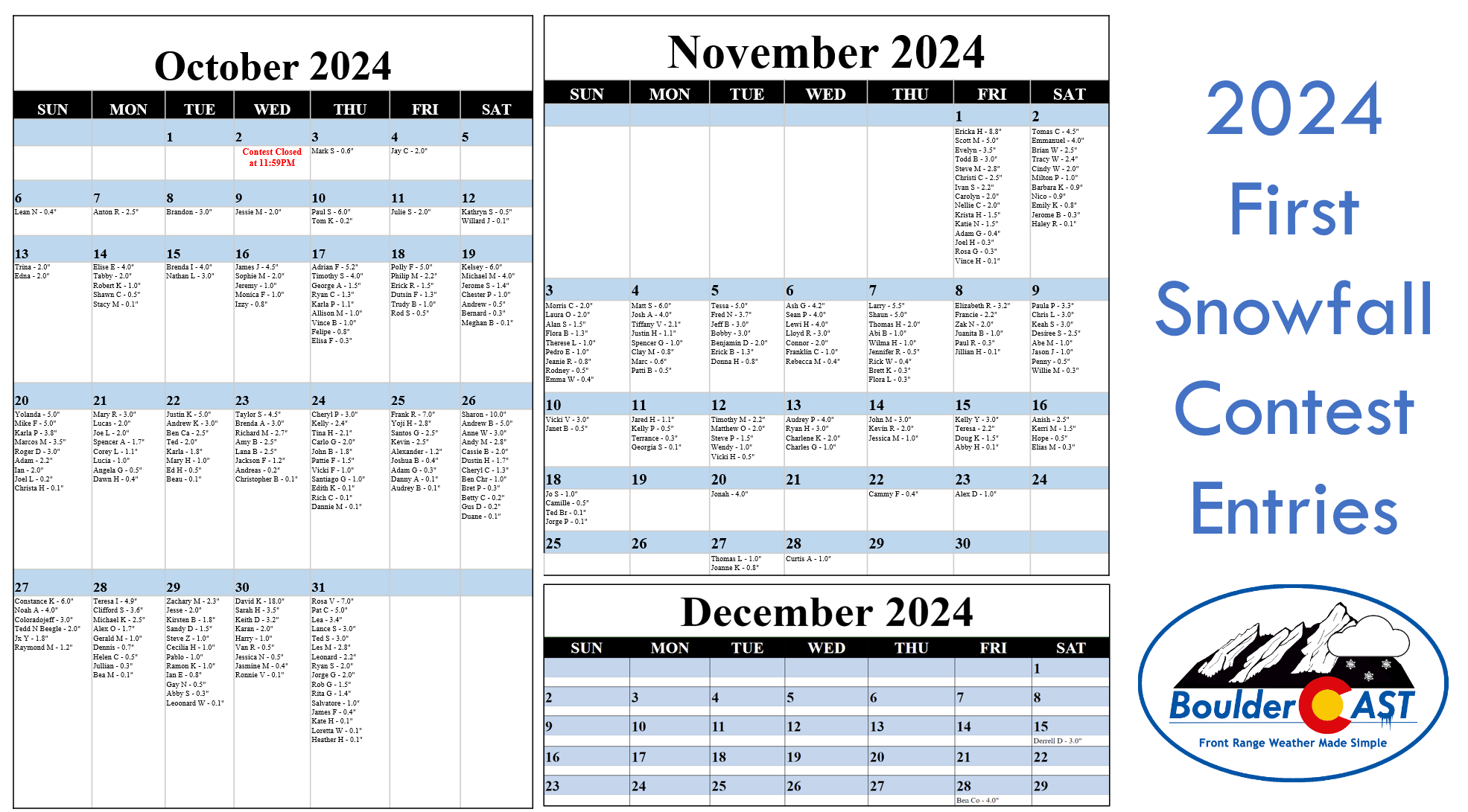
Our 2024 First Snowfall Contest remains active and indeed we may be crowning a winner later this week. Check the graphic below for your entry or head over to the official Google spreadsheet for a closer look!
Seasonal & quiet to end the week
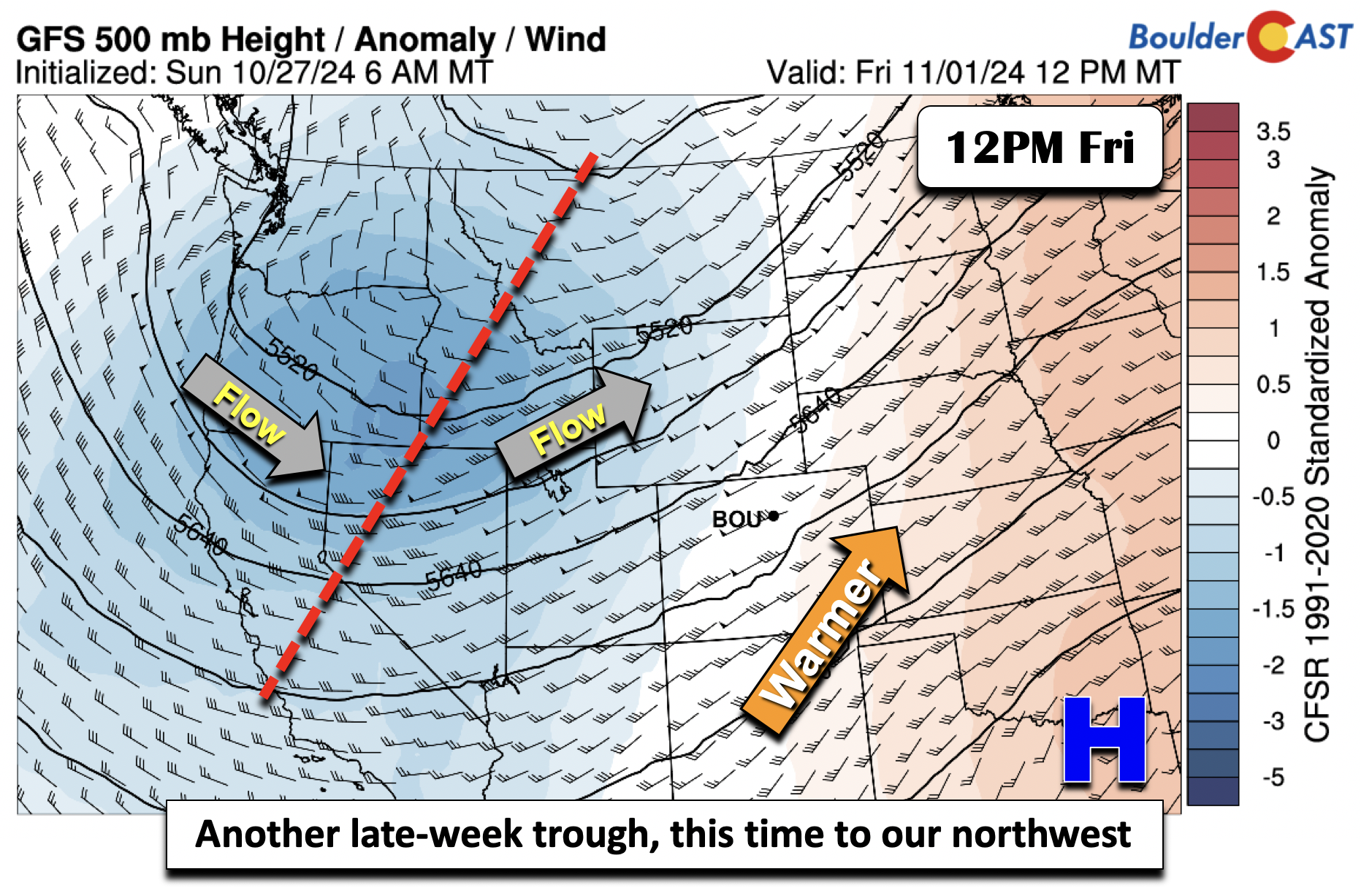
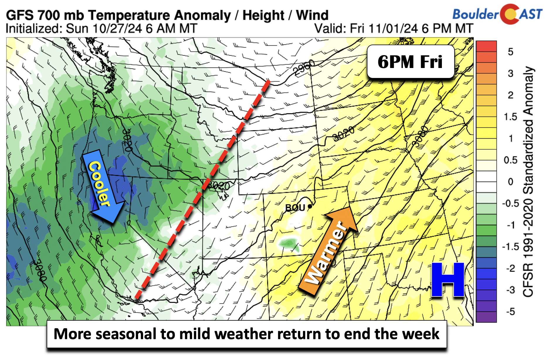
Models are less uncertain in the late-week period, though that definitely will depend on how the midweek system evolves. Nevertheless, the back half of the week looks quiet, with ridging building back westward with southwest flow. A larger trough yet again develops, this time to our northwest over Idaho and Oregon (shown below). While this location will initially spare us, how it evolves into the coming weekend and early next week will be something to watch as some ensembles are showing perhaps another shot of snow for early November.
We should end the week more seasonal in terms of our temperatures. For our Halloween Thursday, highs in the middle 50s are favored. Evening trick-or-treaters can expect temperatures to be chilly in the 40s, falling into the low 30s overnight. Conditions should be totally dry Thursday evening, though. Friday will see the return of 60s across the area.
This week’s forecast is typical for late October in the Front Range. A warm Monday will transition to cooler and unsettled weather midweek with our first accumulating snow possible, albeit only with very light amounts. Quiet weather resumes late week with a warm-up expected. Let’s hope we get a little moisture (and snow) this week. Check back for updates and enjoy!
Forecast Specifics:
Monday: A mix of sunshine and wave clouds. Highs again above normal in the mid to upper 70s over the Plains and mid to upper 60s in the Foothills.
Tuesday: Increasing clouds with scattered rain showers in the late-afternoon and evening. Highs in the upper 50s to low 60s on the Plains to upper 40s to lower 50s in the Foothills. Temperatures will fall into the 30s overnight, along with a chance of light snow.
Wednesday: Cloudy with a chance of snow or a rain/snow mix in the morning to early afternoon. Highs in the upper 30s to lower 40s on the Plains to upper 20s to low 30s in the Foothills. A hard freeze is favored Wednesday night in the 20s.
Halloween Thursday: Drying out with more seasonal highs in the middle to upper 50s on the Plains and mid to upper 40s over the Foothills.
Friday: Near normal and sunny with highs around 60 for the Plains and near 50 in the Foothills.
Get BoulderCAST updates delivered to your inbox:
DISCLAIMER: This weekly outlook forecast is created Monday morning and covers the entire upcoming week. Accuracy will decrease as the week progresses as this post is NOT updated. To receive daily updated forecasts from our team, among many other perks, subscribe to BoulderCAST Premium.
Daily Forecast Updates
Get our daily forecast discussion every morning delivered to your inbox.
All Our Model Data
Access to all our Colorado-centric high-resolution weather model graphics. Seriously — every one!
Ski & Hiking Forecasts
6-day forecasts for all the Colorado ski resorts, plus more than 120 hiking trails, including every 14er.
Smoke Forecasts
Wildfire smoke concentration predictions up to 72 hours into the future.
Exclusive Content
Weekend outlooks every Thursday, bonus storm updates, historical data and much more!
No Advertisements
Enjoy ad-free viewing on the entire site.
Enjoy our content? Give it a share!





You must be logged in to post a comment.