A boring week of weather will ensue across the Front Range as the only storm system of note skirts just to our north through Wyoming. The lower elevations will be bone dry all week long, but light snow will impact the Mountains on one occasion. Read on for our complete (though abbreviated) outlook of the week ahead.
This week’s highlights include:
- A warm Monday with plenty of sunshine statewide
- A strong storm system blows across Wyoming on Tuesday which downslopes the Front Range with gusty winds
- Dry weather is expected across the Denver Metro area all week long
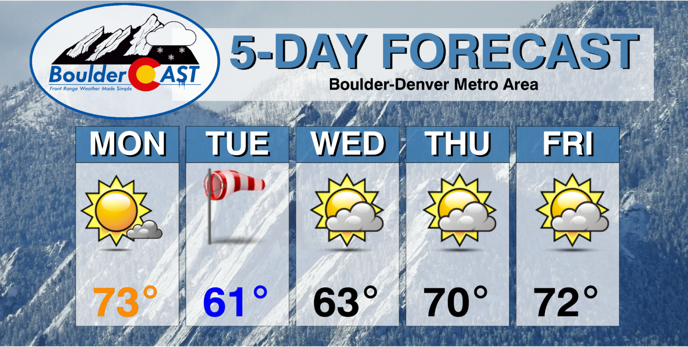
- Temperatures will be up and down from the lower 60’s to middle 70’s
- Light Mountain snow expected on Tuesday
DISCLAIMER: This weekly outlook forecast is created Monday morning and covers the entire upcoming week. Accuracy will decrease as the week progresses as this post is NOT updated. To receive daily updated forecasts from our team, subscribe to BoulderCAST Premium.
Light mountain snow, but nada for the Plains
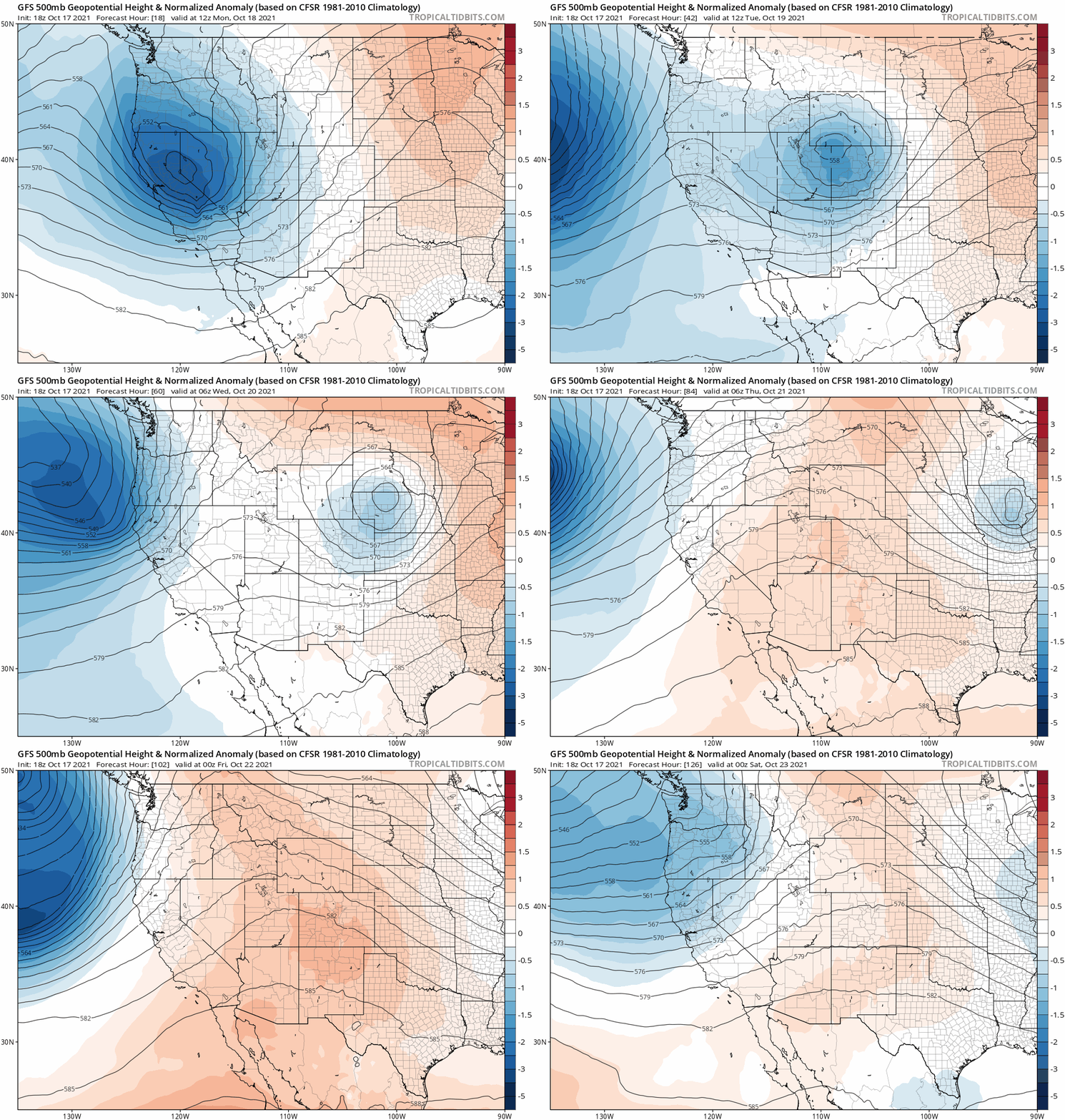
The ridge pattern which led to the mild and beautiful weather in Colorado over the weekend has already shifted east of the area as of Monday morning. The GFS 500mb height anomaly animation below spans the entire week ahead. The main storm system to watch is a vigorous cut-off low pressure which will slide from the Great Basin across southern Wyoming tomorrow. However, by Wednesday another ridge will begin to build across the Rockies bringing quiet weather back to the entire state to close out the week.
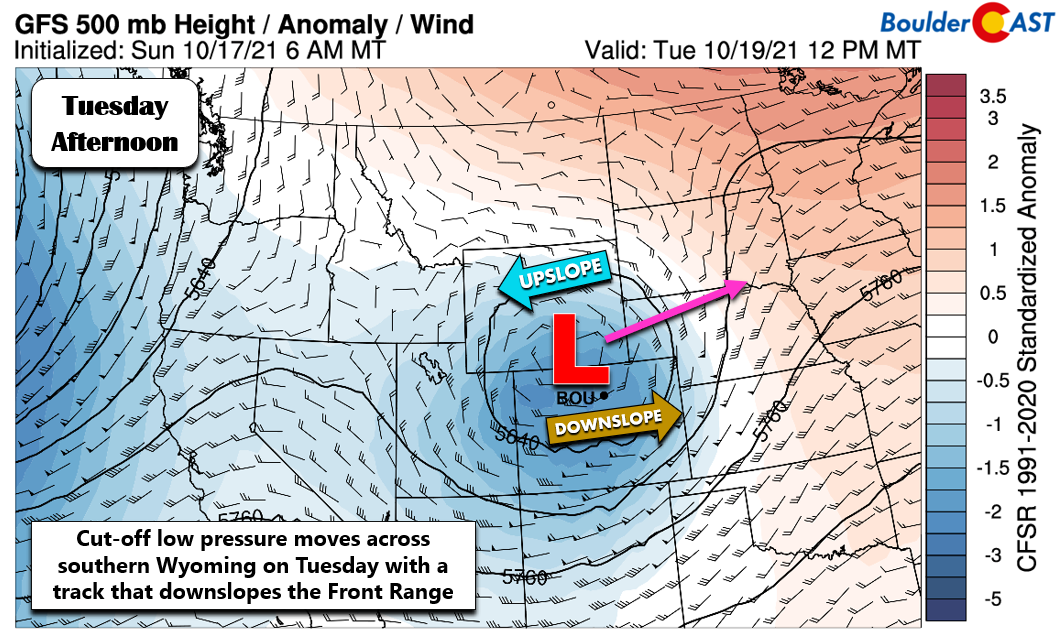
The aforementioned storm system will be near Cheyenne by mid-day Tuesday. The GFS model forecast is below. This setup will downslope the entire Front Range east of the Continental Divde so there’s no chance for rain/snow in the Denver Metro area. The interesting weather will stay north of the border in Wyoming where blustery winds, snow and rain will be widespread.
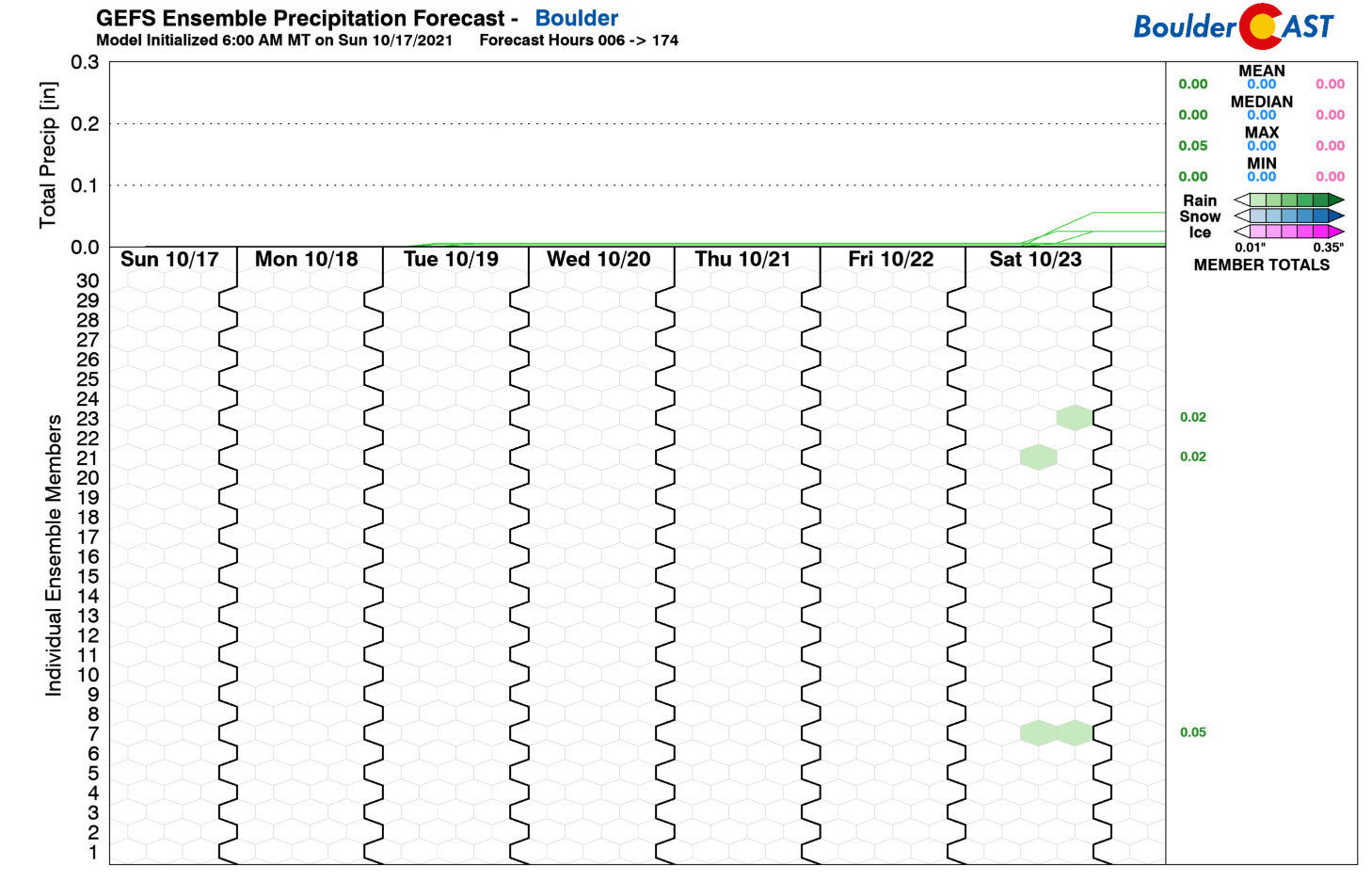
In Boulder, it will be a dry week overall with the next chance of rain (and a small one at that) holding off until the upcoming weekend. Tuesday will be breezy but still mild for this time of year as the storm passes by to the north. After a slight dip in our high temperatures they will climb right back near to above normal to end the week.
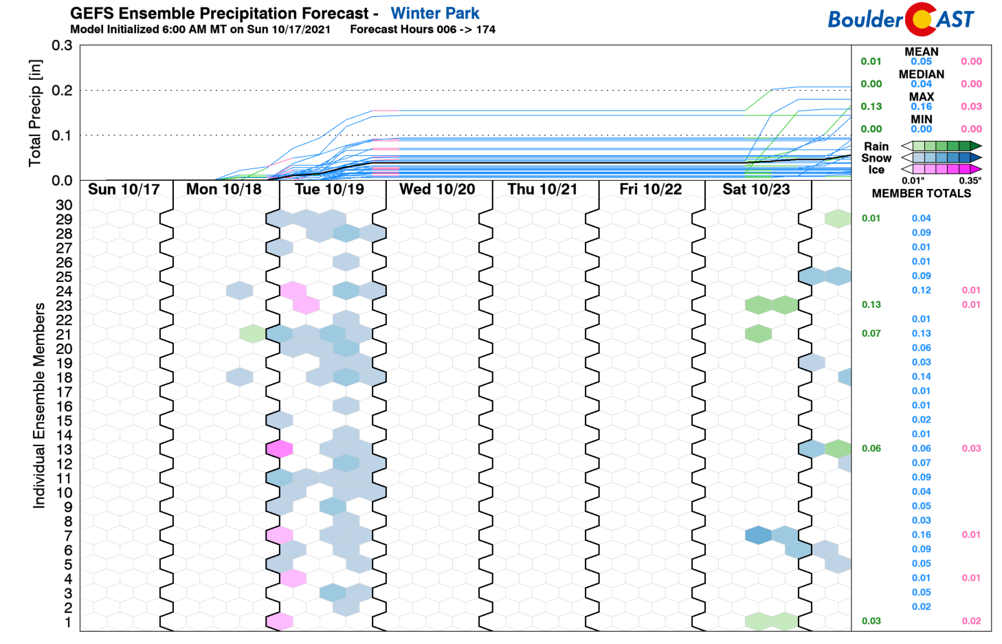
West of the Divide there will be light snow moving in Monday night through Tuesday with only minor accumulations expected (1-4″). This is associated with the moisture and westerly flow from the passing storm. The same minor dip in temperatures will impact the Mountains as well Tuesday into Wednesday but things quickly moderate as a ridge redevelops.
All in all, it will be a rather boring week in weather for us. Enjoy it…we rarely get one this quiet this time of year.
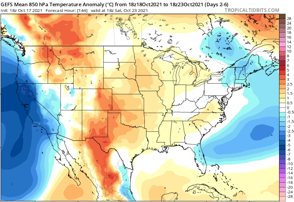
GFS 850mb temperature anomaly forecast for the entire week. Eastern Colorado will be above average through the week.
Stay up to date with Colorado weather and get notified of our latest forecasts and storm updates:
We respect your privacy. You can unsubscribe at any time.
Forecast Specifics:
Monday: Mostly sunny and warm with highs in the middle 70s on the Plains and lower 60s in the Foothills.
Tuesday: Partly cloudy and breezy with gusts of 20 to 30 MPH on the Plains and up to 50 MPH in the Foothills. Highs in the low 60s on the Plains with upper 40s in the Foothills.
Wednesday: Increasing clouds with highs in the middle 60s on the Plains and lower 50s in the Foothills.
Thursday: Partly cloudy and mild with highs in the upper 60s on the Plains and middle 50s in the Foothills.
Friday: Partly cloudy, warm and dry with highs in the lower 70s on the Plains and upper 50s in the Foothills.
Mountains: After a warm Monday, the Mountains will see some light snow Monday night through Tuesday as a storm system passes just to the north. A surge of moist west and southwest flow will produce light accumulations in the Mountains across much of the state, generally 1-4″.
Help support our team of Front Range weather bloggers by joining BoulderCAST Premium. We talk Boulder and Denver weather every single day. Sign up now to get access to our daily forecast discussions each morning, complete six-day skiing and hiking forecasts powered by machine learning, first-class access to all our Colorado-centric high-resolution weather graphics, bonus storm updates and much more! Or not, we just appreciate your readership!
.
Spread the word, share the BoulderCAST forecast!
.





You must be logged in to post a comment.