The week ahead will be mainly dry, but temperatures will be up one day and down the next. We’re also watching a series of Pacific storm systems late in the week that will bring snow to the Mountains and possibly the Plains as well over the weekend.
A
s you can see in the GFS forecast 500 mb map below, the week begins with a relatively active looking pattern across the country. Our snow-maker from last Thursday still remains in eastern Canada, while two weaker disturbances are preset across the western United States. The low in California will be trekking to our south Monday night and Tuesday. The other in Montana will pass well to our north Monday night, with Colorado remaining largely in-between the action for the early part of the week.

GFS 500 mb vorticity map for Monday morning. An active-looking pattern really won’t be active for Colorado
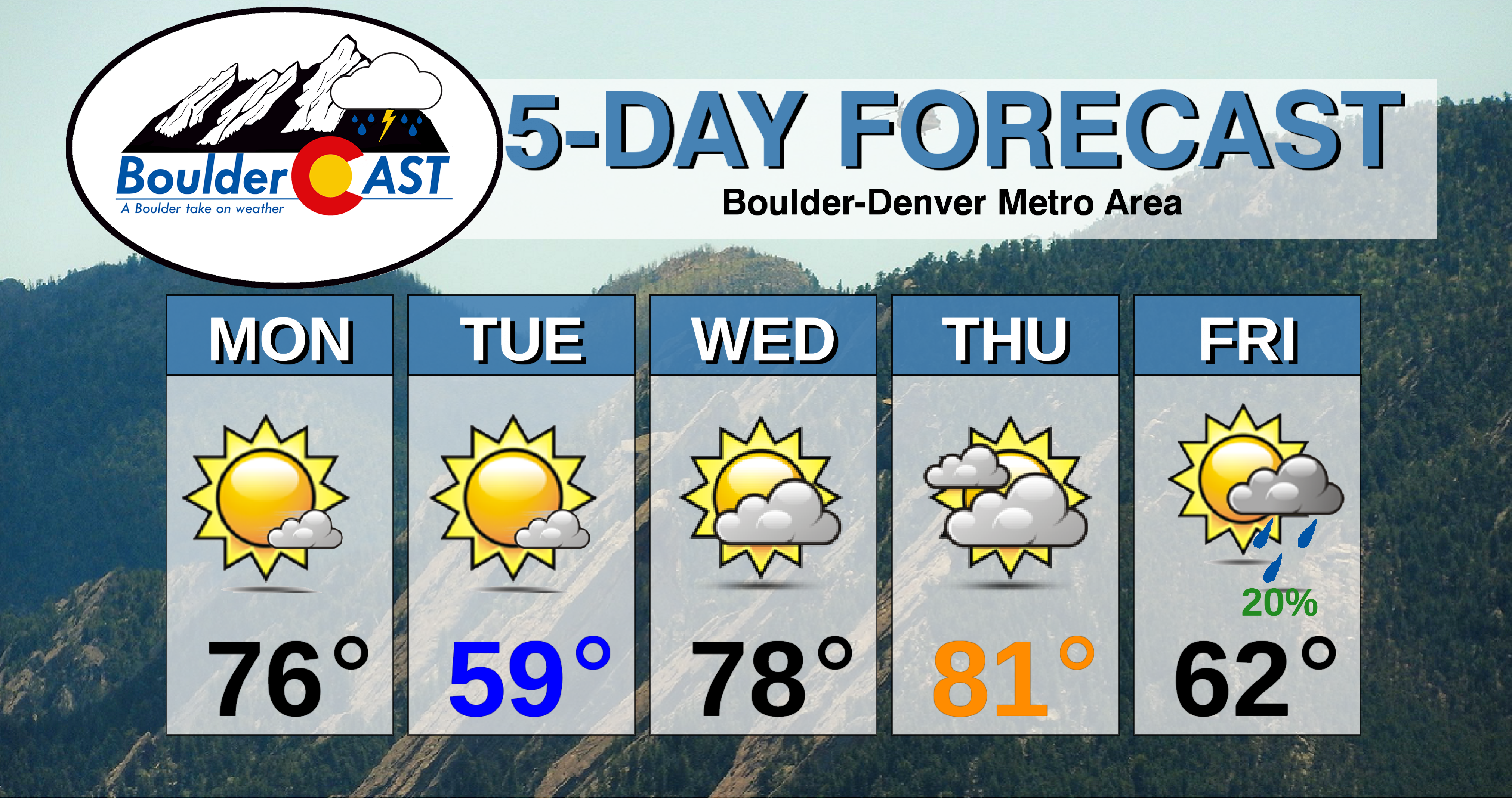
The more northern system in Montana will usher in a cold front to the area Monday evening. While it won’t be nearly as strong as the pseudo-Arctic front we endured last week, it will knock about 15 to 20 degrees off high temperatures from Monday into Tuesday in the Metro area. Look for highs in the middle 70’s Monday falling into the upper 50’s Tuesday. Both days will be dry with sunshine.

NAM 800 mb temperature and wind map for Wednesday night showing a cold front dropping into northeast Colorado
By mid-week, the aforementioned weak storm systems will have pushed off to the east with flow turning west-southwesterly across the area as a ridge of high pressure builds into the Four Corners area. This will lead to a quick warm-up as dry downslope flow takes hold as early as Wednesday morning. The resulting warm-up on the leeward side of the Rockies is visible in the 800 mb temperature map for Wednesday shown below on the right. Note the lee trough signature (dips in the contoured height lines). Temperatures on Wednesday will push back into the upper 70’s to near 80 degrees with a mix of sun and wave clouds. Thursday will be similar overall, though with likely slightly warmer temperatures and greater wave cloud coverage. Given just how dry this flow will be, fire weather concerns will be elevated across the Mountains both days.
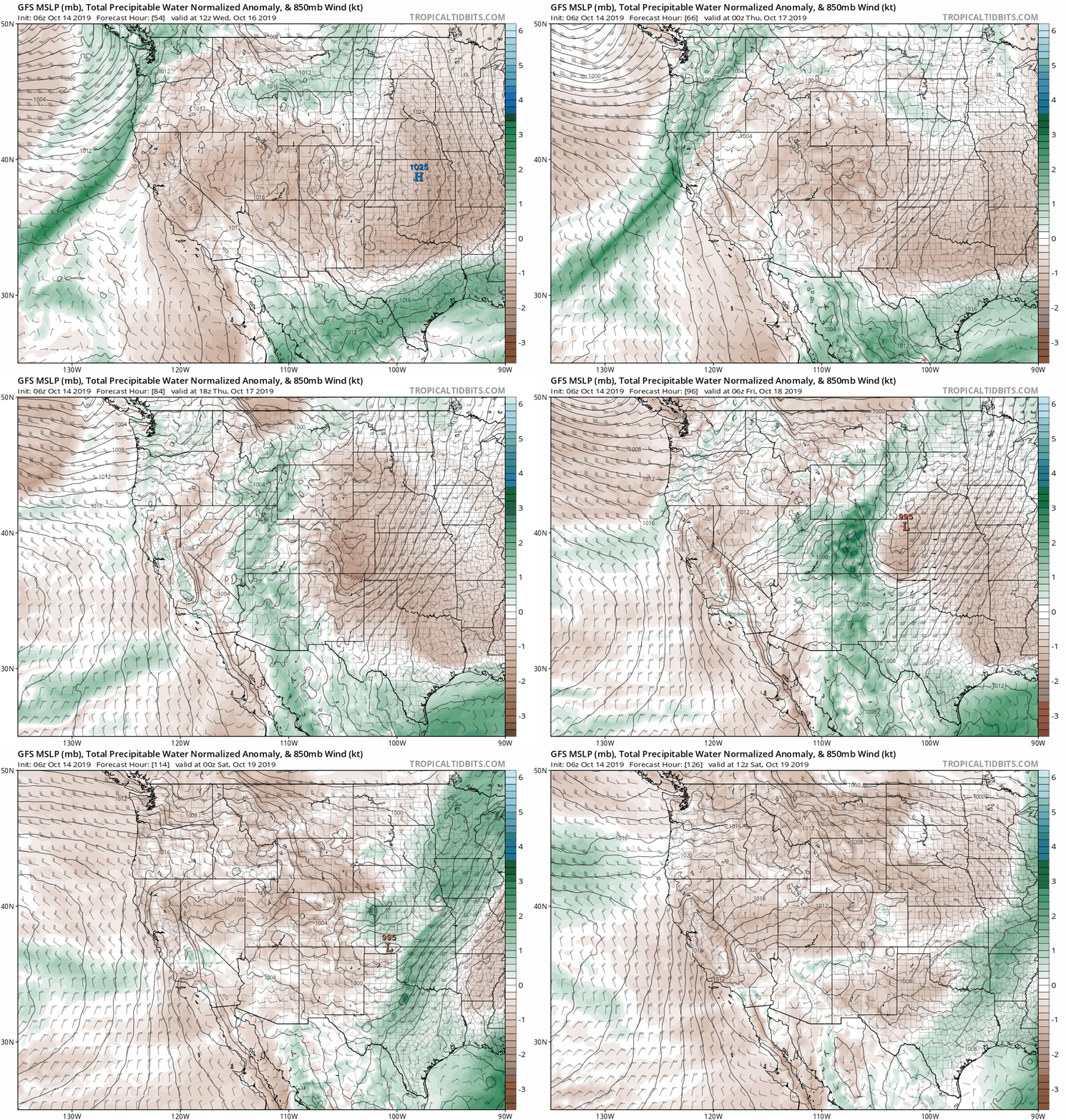
It’s not all fun in the sun this week! While a ridge of high pressure will pass across Colorado on Wednesday and Thursday, the next Pacific storm system will be entering the Pacific Northwest Wednesday night (above on the left). This trough will be sharper and have more embedded Pacific moisture as it moves across Colorado. Below is an animation of forecast moisture anomaly Wednesday through Friday night. Watch as the wave of green (elevated moisture) progresses through our area.
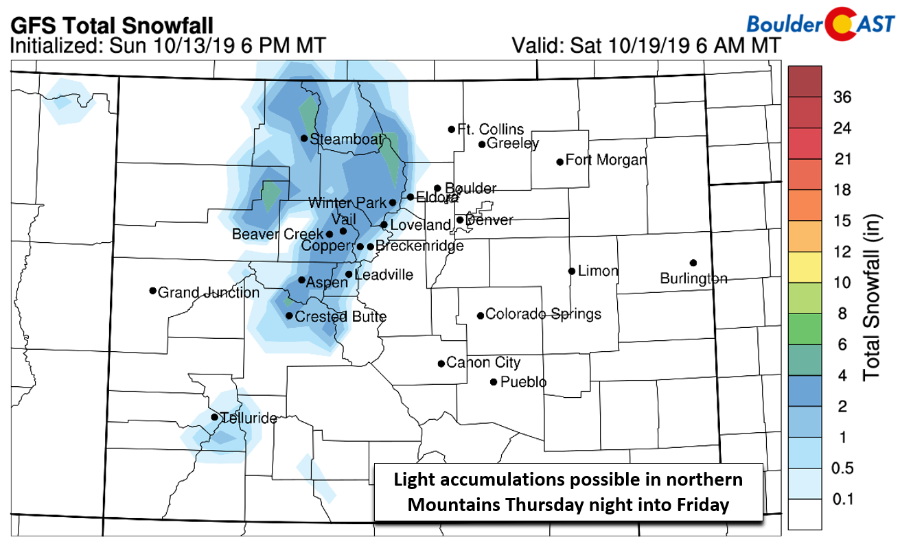
This late-week storm system should bring light snowfall to the Mountains, especially north of Interstate 70 and for areas favored by northwest flow. The latest runs of the GFS and Euro models are showing 2 to 5″ for many ski resorts. While this is nothing really to write home about, it’s nice to mix a little real snow in with the man-made stuff.
There will also be a Pacific cold front moving across the lower elevations from this system. Our best forecast on the timing of this second front is Thursday evening or night. After highs close to 80 degrees in the middle of the week, we end the work-week with highs in the 60’s with a slight chance of afternoon rain showers across the Denver Metro area.
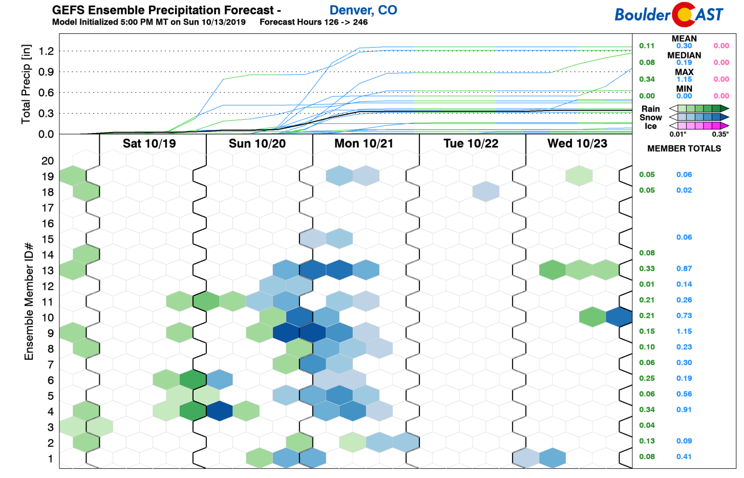
Longer-term, we are watching the potential for yet another deeper trough to impact the area Saturday night into Monday. The specifics around any precipitation and timing are uncertain for now, but there are growing signs of wintry weather for the Front Range during this time. More on this later…
Happy Columbus Day!
Forecast Specifics:
Monday: Mostly sunny, warm, and dry with highs in the middle 70’s for the Plains and lower 60’s in the Foothills.
Tuesday: Following the passage of a dry cold front, temperatures will be cooler, but mostly sunny skies prevail. Highs in the upper 50’s on the Plains and upper 40’s in the Foothills.
Wednesday: . A mix of wave clouds and sunshine but warmer. Highs in the middle to upper 70’s on the Plains and in the middle 60’s in the Foothills.
Thursday: Possibly some morning sun, then mostly cloudy with thick upper-level wave clouds. Warm, dry, and breezy across the Metro area. Highs in the lower 80′ on the Plains and upper 60’s in the Foothills.
Friday: Cooler and more unsettled with Pacific energy passing by. Expect a breezy conditions with a slight chance of rain showers for the Plains with rain/snow in the higher Foothills. Temperatures in the lower 60’s for the Plains and upper 40’s in the Foothills.
High Country: It’s going to be a sunny, quiet, and warm week in the Mountains through Thursday morning. Late Thursday, a Pacific trough moves through with an associated jet leading to a chance of rain/snow showers in the Mountains and stronger winds. Peaks north of Interstate 70 could see 2-5″ of snow from this trough. The weather remains unsettled and blustery right into and through the upcoming weekend.
DISCLAIMER: This weekly outlook forecast is created Monday morning and covers the entire upcoming week. Accuracy will decrease as the week progresses as this post is NOT updated. To receive daily updated forecasts from our team, subscribe to BoulderCAST Premium.
.
Spread the word, share the BoulderCAST forecast!




You must be logged in to post a comment.