After a few warm and quiet days, big changes arrive midweek as a southern-track storm system targets the Front Range. Initially we’ll be in the warm and unstable sector with the first severe weather outbreak of 2023 for Colorado taking shape on Wednesday. By late week, the main storm system will slowly move across the state inducing a prolonged period of upslope and soggy conditions across our area. What type of severe weather should we expect on Wednesday and how much rain (and snow) will fall this week? Let’s take a look.
This week’s highlights include:
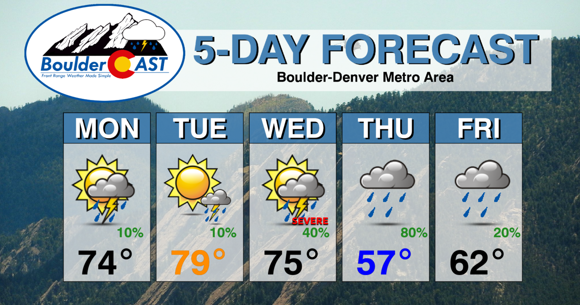
- Quiet conditions Monday and Tuesday with just isolated late-day storm chances alongside warm temperatures well into the 70s
- A southern-track storm will approach and move in by mid to late week seeding big weather changes!
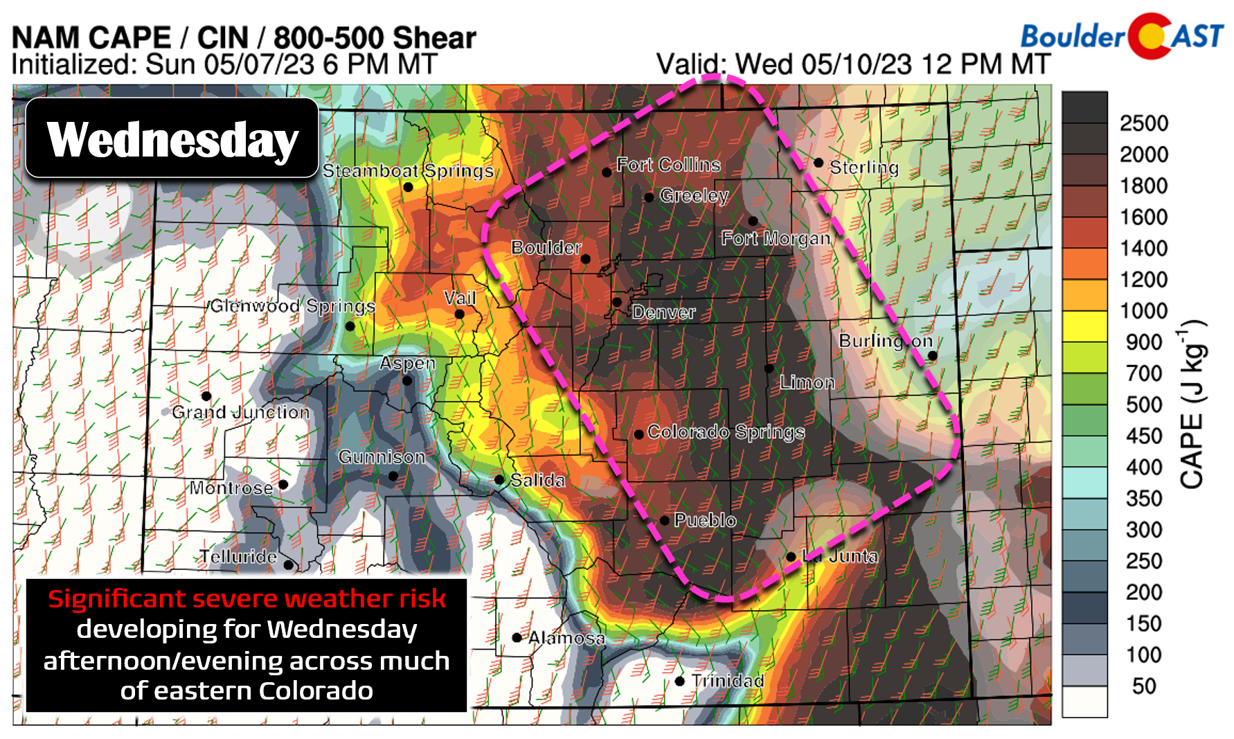
- A significant severe weather outbreak is taking shape for Wednesday as copious instability and shear align across eastern Colorado — large hail and damaging winds possible in the Metro area
- The main storm system arrives Thursday into Friday with widespread upslope rainfall developing for the entire area — greater than 0.5″ of rainfall likely, with upwards of 1-2″ not out of the question
- Minimal cold air with this system so it’ll definitely be all rain for the Plains, likely all rain in the Foothills
- The week concludes much colder with highs only in the 50s to lower 60s
DISCLAIMER: This weekly outlook forecast is created Monday morning and covers the entire upcoming week. Accuracy will decrease as the week progresses as this post is NOT updated. To receive daily updated forecasts from our team, among many other perks, subscribe to BoulderCAST Premium.
Daily Forecast Updates
Get our daily forecast discussion every morning delivered to your inbox.
All Our Model Data
Access to all our Colorado-centric high-resolution weather model graphics. Seriously — every one!
Ski & Hiking Forecasts
6-day forecasts for all the Colorado ski resorts, plus more than 120 hiking trails, including every 14er.
Smoke Forecasts
Wildfire smoke concentration predictions up to 72 hours into the future.
Exclusive Content
Weekend outlooks every Thursday, bonus storm updates, historical data and much more!
No Advertisements
Enjoy ad-free viewing on the entire site.
Relatively quiet through Tuesday
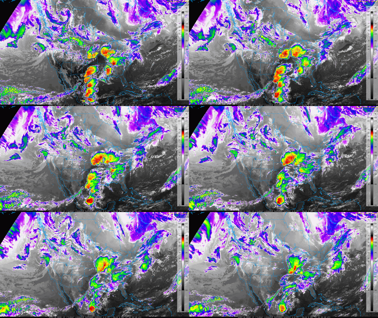
As of early Monday morning, all is quiet across the southwestern United States with mostly clear skies and calm weather, including here in Colorado. However, the same cannot be said for the northern Rockies, Pacific Northwest, and northeast Pacific Ocean which remain quite active with a highly disorganized conglomeration of low pressure systems churning away. This messy and unsettled pattern will eventually make its way into our neck of the woods around midweek with severe weather, upslope rain and Mountain snow returning to the Centennial State. More on the that later….
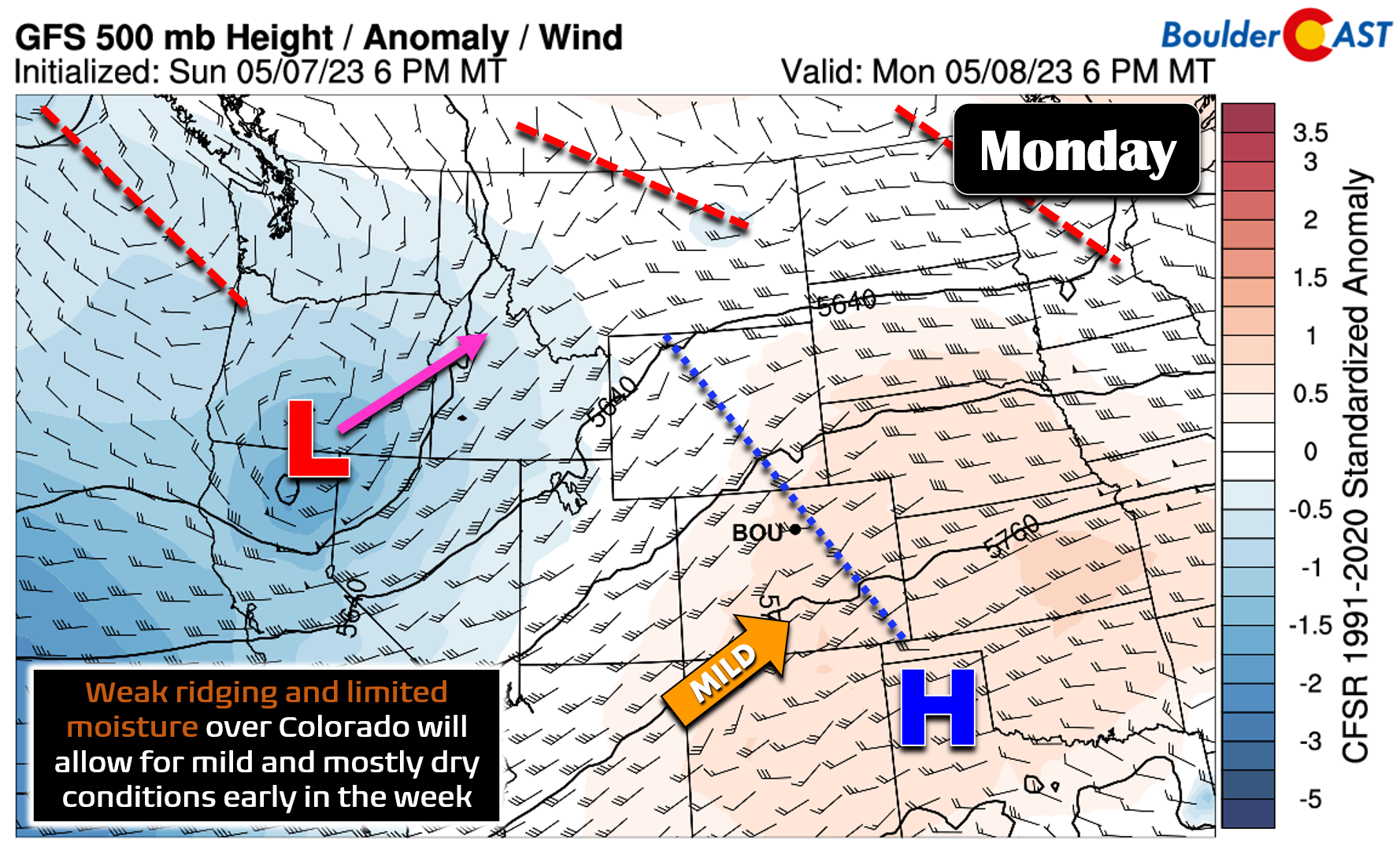
Until then, both Monday and Tuesday will be fairly pleasant across the Front Range with weak ridging present and limited moisture resulting in just isolated late-day thundershowers, mainly east of the Denver area. The complex pattern of weak disturbances to our north and west is evident in Monday’s 500mb map with several shortwave disturbances and even a closed low lined up along the Canadian border.
Expect just isolated storms for our area with 5 to 20% chances and highs in the mid to upper 70s to begin the week. The best rain chances will be east of Denver with the lowest chances towards Boulder. Some portions of the Denver area could reach the lower 80s on Tuesday. Most of us will stay completely dry these first two days of the week.
Severe and soggy weather develops midweek
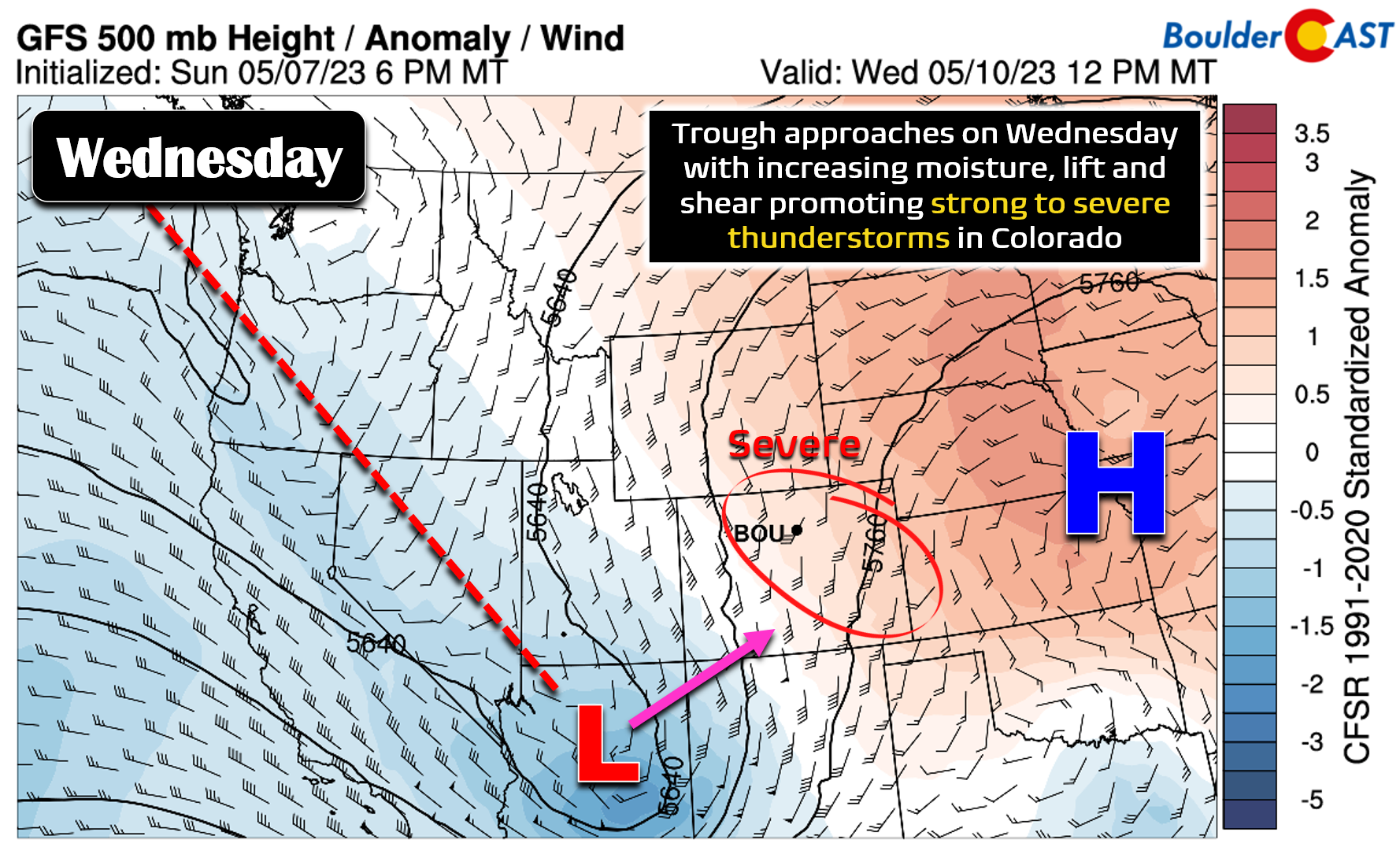
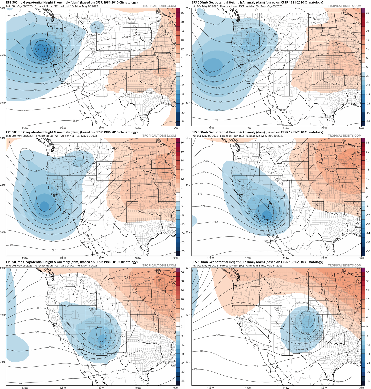
The weather begins to take a turn for the worst (better?) on Wednesday as a southern-track low pressure moves ashore in southern California and then pushes into the Four Corners region. Out ahead of its associated trough axis, moderately strong south-southwest flow aloft develops over Colorado along with enhanced lift downstream as well. This will set the stage for the first significant severe weather outbreak of 2023 across eastern Colorado!
As mentioned, mid-level winds will be strong and from the south or southwest direction on Wednesday, but low-level winds will be from the southeast — a recipe for both bulk and directional wind shear across our area. Combined with 1000 to 2000 J/kg of CAPE and there will certainly be supercell thunderstorms popping across eastern Colorado Wednesday afternoon and evening!
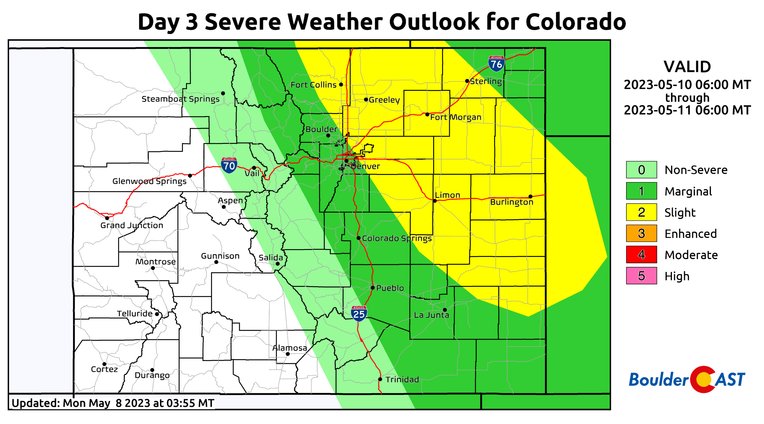
While Wednesday is still a few days out, the Storm Prediction Center is already paining a Slight Risk of severe storms over much of eastern Colorado — nearly including Boulder in this yellow swath which rarely happens. The main concerns will be very large hail (2″+ diameter) and damaging winds with these developing storms!
The forecast for Wednesday will need to be closely monitored as it is still somewhat uncertain. It’s unclear if the timing of the best mid-level forcing will coincide with peak daytime heating, or if it will come later in the evening/nighttime hours. Remember, the parent storm system is still way out over the Pacific Ocean right now. There will also likely be plenty of cloud cover around which could spoil things in the immediate Denver Metro area — as it so often does. If everything aligns perfectly as models are currently advertising, there could be more than a few Mother Nature fireworks on Wednesday. Stay weather aware!
After the severe weather threat dies down late Wednesday evening, the focus then shifts to a developing upslope precipitation event Thursday and early Friday as the storm continues to move eastward. The overall path of this southern-track storm system is still an evolving beast, but models have been drifting their solutions further south in recent runs resulting in a decent cut-off low across eastern Colorado by Thursday morning. The European ensemble mean solution shown below puts the cut-off low near Pueblo early Thursday, a location that would provide deep upslope into the Front Range — with a surge of Gulf moisture to boot! The storm would be slow to progress eastward as well. Thus whatever unfolds in our area will persist for a fairly lengthy period of time — perhaps 24 hours or more of favorable upslope conditions are in the works!
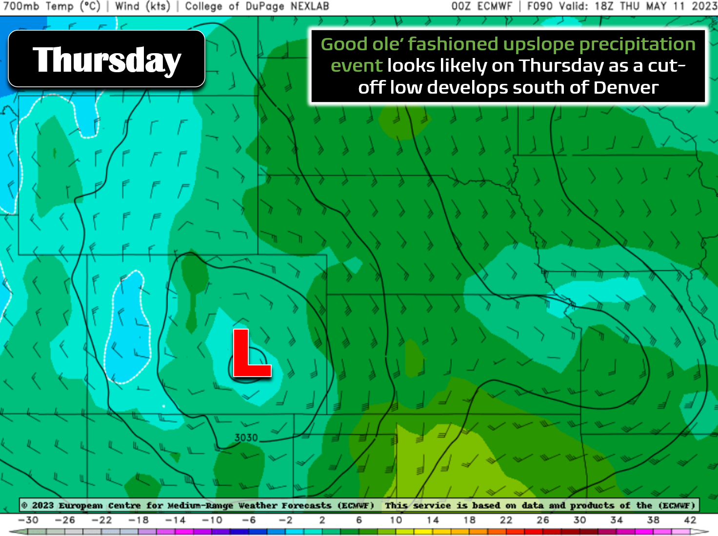
The latest European model solution looks quite promising for widespread precipitation in the Front Range much of Thursday into Friday with deep and moisture-rich upslope flow wrapping back into the area from the southeast.
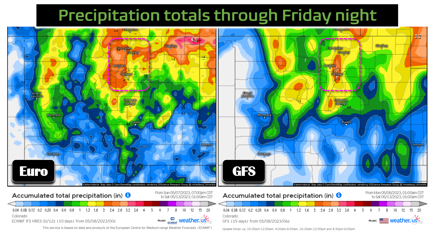
This storm certainly has the potential to deliver significant precipitation to our area — both the operational GFS and Euro models produce a widespread dumping of 1 to 2″ of precipitation for the Front Range. For what it’s worth at this early juncture, the Euro model is more favorable for our area with a further south track and overall slower storm progression.
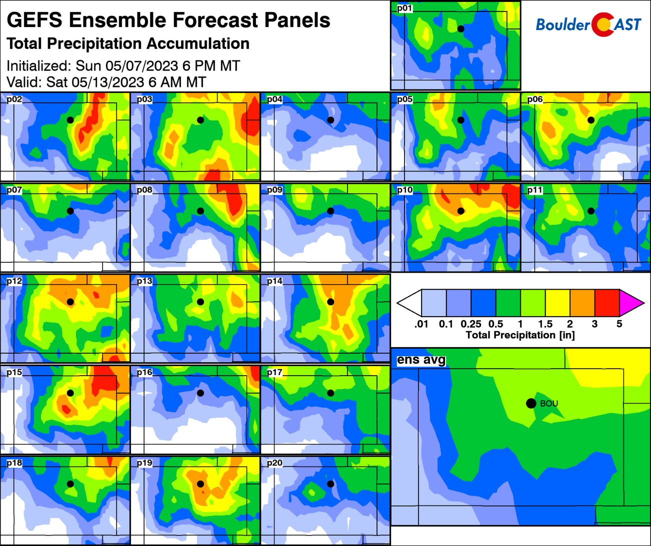
We must stress that the late-week forecast is not set in stone yet. There is still considerable variation in the ensemble outcomes, twenty of which are shown below from the GFS suite. It’s probably a good bet to say most of us will see >0.5″ of rainfall from this storm, but the jury is still out on the bigger 1 to 2″ outcome. For now expect Thursday to be much colder with highs only in the 50s with widespread stratiform precipitation across the area. The precipitation may linger into Friday as the storm really takes its time moving out of eastern Colorado. Friday should see a drying trend through the day with temperatures remaining on the cool side in the lower 60s.
One final note with the late-week upslope storm: 700mb temperatures are well-predicted to remain warmer than -2°C throughout the entire event putting snow levels generally at or above 9000 feet. This will definitely be an all-rain event for the lower elevations and likely for most of the Foothills too. Higher up, the eastern slopes of the Continental Divide could be looking at significant snow accumulations. It’s too early to say for sure, but things aren’t looking great for any May snowfall this year. Don’t forget that May snow happens more often than it doesn’t in Boulder!
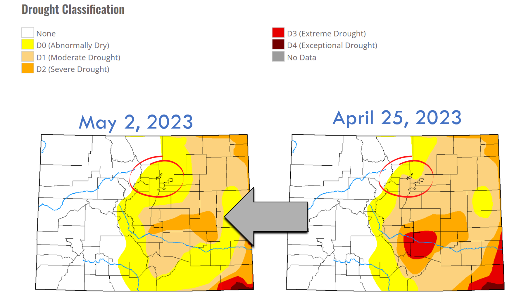
Check back for updates on the severe weather and soaking rainfall throughout the week. Keep those fingers crossed for moisture — we’ll definitely need it if we want to see continued drought improvement. Enjoy the weather!
Forecast Specifics:
Monday: Morning sunshine, then partly cloudy with isolated thunderstorms developing during the afternoon/evening, mainly southeast of Denver. Highs in the middle 70s across the Plains with lower 60s in the Foothills.
Tuesday: Partly to mostly sunny with isolated late-day thunderstorms developing, mainly east and northeast of Denver. Temperatures will be the warmest of the week near 80 degrees across the Plains with upper 60s in the Foothills.
Wednesday: A mix of clouds and sunshine with scattered to numerous thunderstorms developing. Storms moving off the higher terrain will turn severe in the Denver Metro area and areas east with large hail and damaging winds possible. Stay weather aware! Highs should reach the lower to middle 70s on the Plains with lower 60s in the Foothills.
Thursday: Overcast and likely gloomy with widespread rainfall across the area. Some thunder is possible. Much cooler with highs only in the 50s on the Plains with 40s in the Foothills.
Friday: Lingering clouds and some rain showers in the morning, then partly cloudy and cool. Temperatures top out below normal in the lower 60s across the Plains with upper 40s in the Foothills.
Mountains: Ski season is rapidly winding down across Colorado with only portions of the highest ski resorts still open. Those remaining could see some accumulation from the late-week storm on Thursday (perhaps 3-8″ of wet snow).
DISCLAIMER: This weekly outlook forecast is created Monday morning and covers the entire upcoming week. Accuracy will decrease as the week progresses as this post is NOT updated. To receive daily updated forecasts from our team, among many other perks, subscribe to BoulderCAST Premium.
Daily Forecast Updates
Get our daily forecast discussion every morning delivered to your inbox.
All Our Model Data
Access to all our Colorado-centric high-resolution weather model graphics. Seriously — every one!
Ski & Hiking Forecasts
6-day forecasts for all the Colorado ski resorts, plus more than 120 hiking trails, including every 14er.
Smoke Forecasts
Wildfire smoke concentration predictions up to 72 hours into the future.
Exclusive Content
Weekend outlooks every Thursday, bonus storm updates, historical data and much more!
No Advertisements
Enjoy ad-free viewing on the entire site.
Spread the word, share the BoulderCAST forecast!







You must be logged in to post a comment.