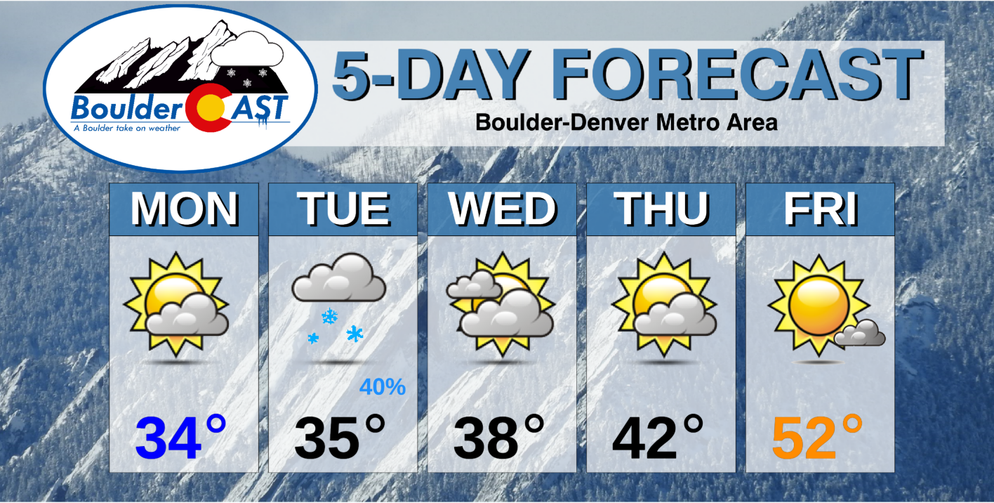
After the big winter snow storm over the weekend, the atmosphere takes a much needed breather for most of the coming work week. We are watching another chance of snow Tuesday but amounts will be light at best. More seasonal temperatures arrive by week’s end.
This week’s highlights include:
- Dry Monday as the snowstorm moves eastward
- Temperatures below normal in the 30’s through Wednesday, with a warming trend thereafter
- Watching potential light snow Tuesday, with a few inches possible
DISCLAIMER: This weekly outlook forecast is created Monday morning and covers the entire upcoming week. Accuracy will decrease as the week progresses as this post is NOT updated. To receive daily updated forecasts from our team, subscribe to BoulderCAST Premium.
Next snow chance Tuesday
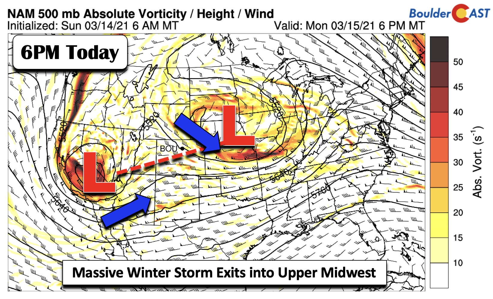
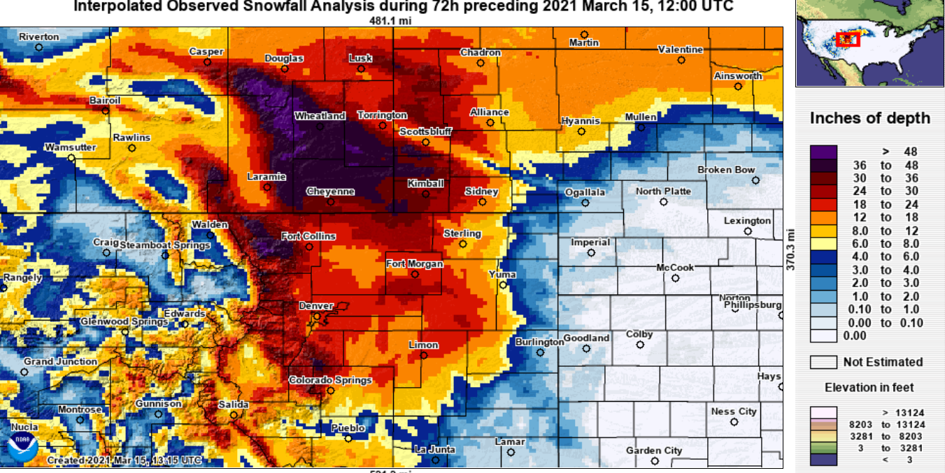
After this past weekend’s near-historic snow totals across the Front Range, the atmosphere starts to take a breather for the start of our Monday. Below shows the mid-level pattern across the nation today. The snow storm which pummeled our area over the weekend will be moving northeast this evening into eastern Nebraska. In its wake, downslope flow is starting to ensue.
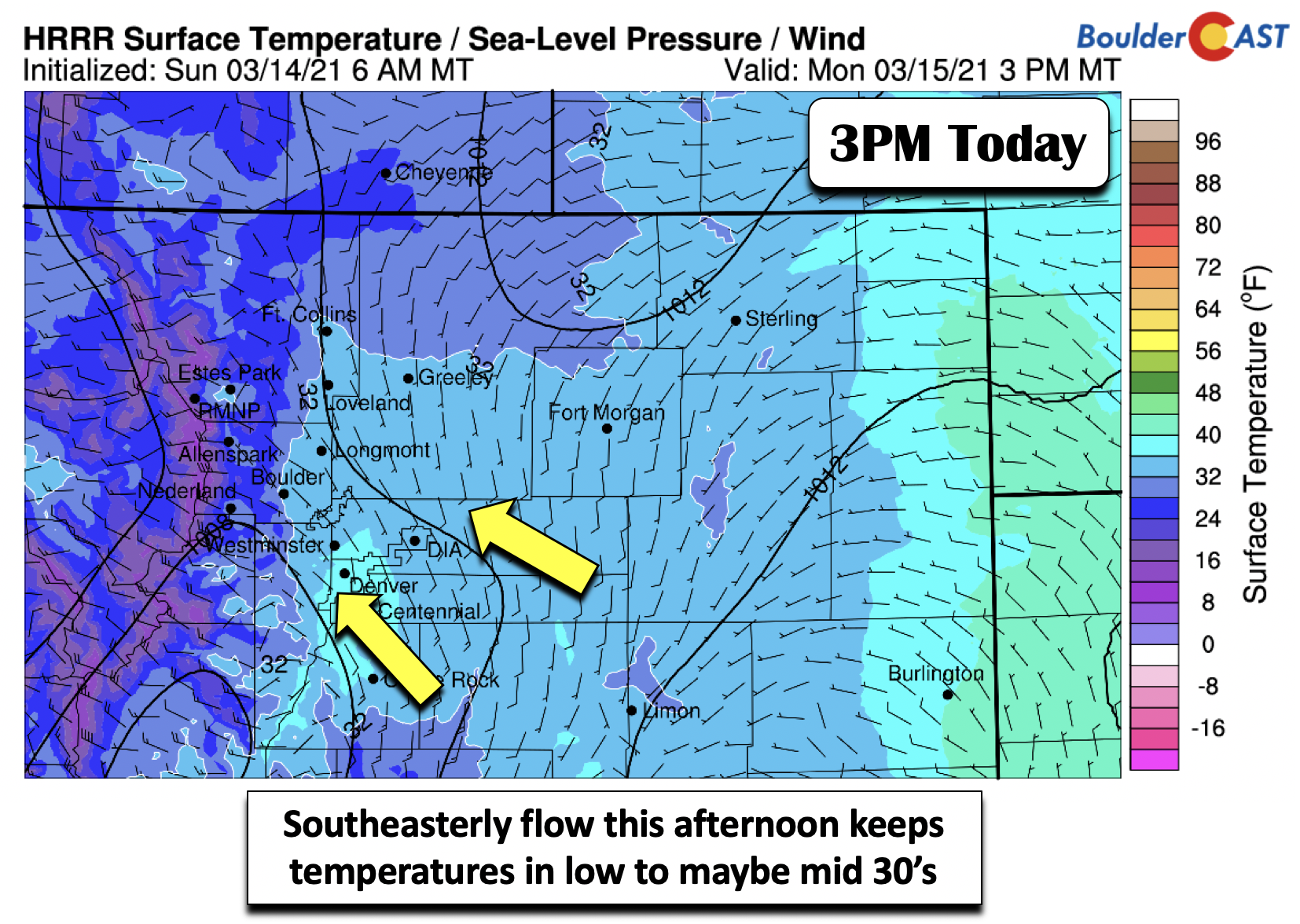
At the surface, however, east-southeasterly winds will remain through the afternoon. This upslope component in combination with the deep snow cover should keep temperatures near the lower 30’s, though some brief middle 30’s are possible in south Denver. Overcast skies should give way to partly cloudy skies later today.
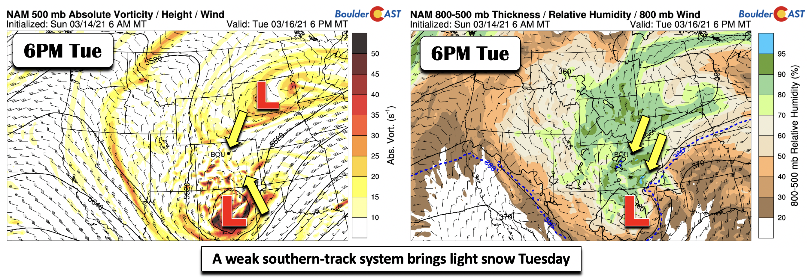
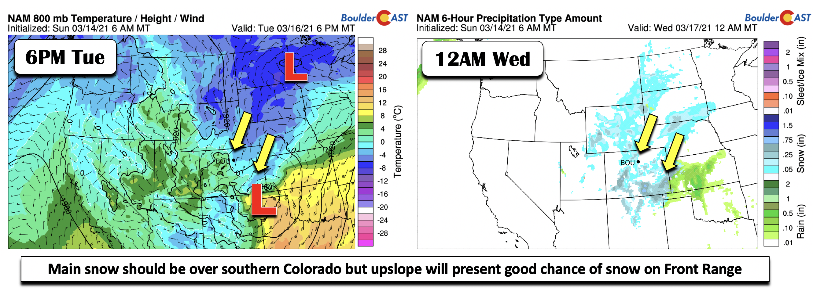
While the atmosphere takes a break today, tomorrow turns again slightly unsettled. In the mid-level pattern shown earlier, another cut-off low pressure system was over central California. This low will drift east-southeast into northern New Mexico by tomorrow afternoon/evening. While the main energy with this storm system will primarily impact the southern part of our state (below left), redevelopment of northeasterly surface upslope combined with a persistent saturated environment, will favor a period of light upslope snow Tuesday early evening in the Denver Metro area. Temperatures will likely hover in lower to middle 30’s tomorrow with clouds increasing and snow cover remaining.
This Tuesday system can largely be considered a “baby” compared to this past weekend’s event, something more typical to what we’ve seen much of the winter already. Shown below is the low-level temperature field and precipitation type forecast Tuesday night to early Wednesday. Precipitation would be all snow given cold air advection. By no means, though, do we expect another major winter storm. However, amounts of 1-2″ are possible before the system pulls out early Wednesday.
More seasonal by week’s end
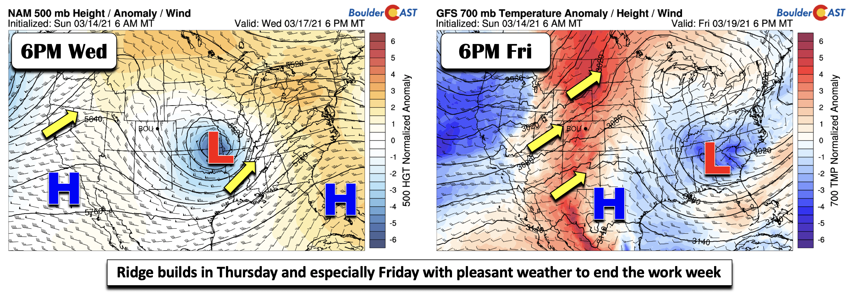
Come Wednesday, that weak system will eventually start to make its way into the Midwest (below). Wednesday will more or less be the last day of temperatures in the 30’s. We should rise to the upper 30’s by midweek as sunshine takes hold. By Thursday and Friday, a ridge developing over California will aid in pumping warmer air into Colorado late Thursday and Friday (below right). Snow cover will likely linger throughout the period and it will somewhat limit our maximum daytime highs towards the end of the week. Nevertheless, warm air advection and sunshine should get us into the lower 40’s by Thursday and possibly near 50 by week’s end, right back into the ballpark of our seasonal norm.
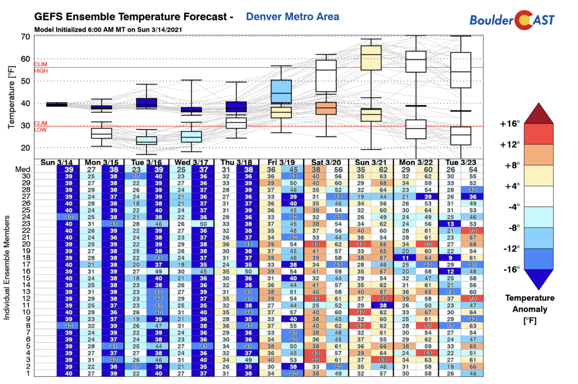
The warming trend continues into the weekend (below), with the GFS ensembles showing further warming into the upper 50’s possibly come Saturday and lower 60’s on Sunday. Clouds will likely increase at the tail end of the weekend, as guidance suggests another chance of precipitation early next week.
That’s all for now. Be sure to check back in later today or tomorrow to read our in-depth review of the departing winter storm. We’ve certainly got a lot of discuss!
Forecast Specifics:
Monday: Partly cloudy and cold. Highs in the lower to middle 30’s on the Plains and upper 20’s in the Foothills.
Tuesday: Partly cloudy becoming overcast with light snow possible in the late afternoon and evening, with 1-3″ of new snow possible. Highs in the middle 30’s for the Plains and middle 20’s in the Foothills.
Wednesday: Cloudy skies becoming partly sunny with highs near the upper 30’s on the Plains and near 30 in the Foothills.
Thursday: Partly cloudy and warmer with highs in the lower 40’s on the Plains and lower 30’s in the Foothills.
Friday: More sunshine with temperatures near 50 on the Plains and upper 30’s in the Foothills.
The Weekend: Dry weather should persist Saturday and Sunday with highs likely rising to the upper 50’s and lower 60’s, helping to melt whatever deep snow that remains.
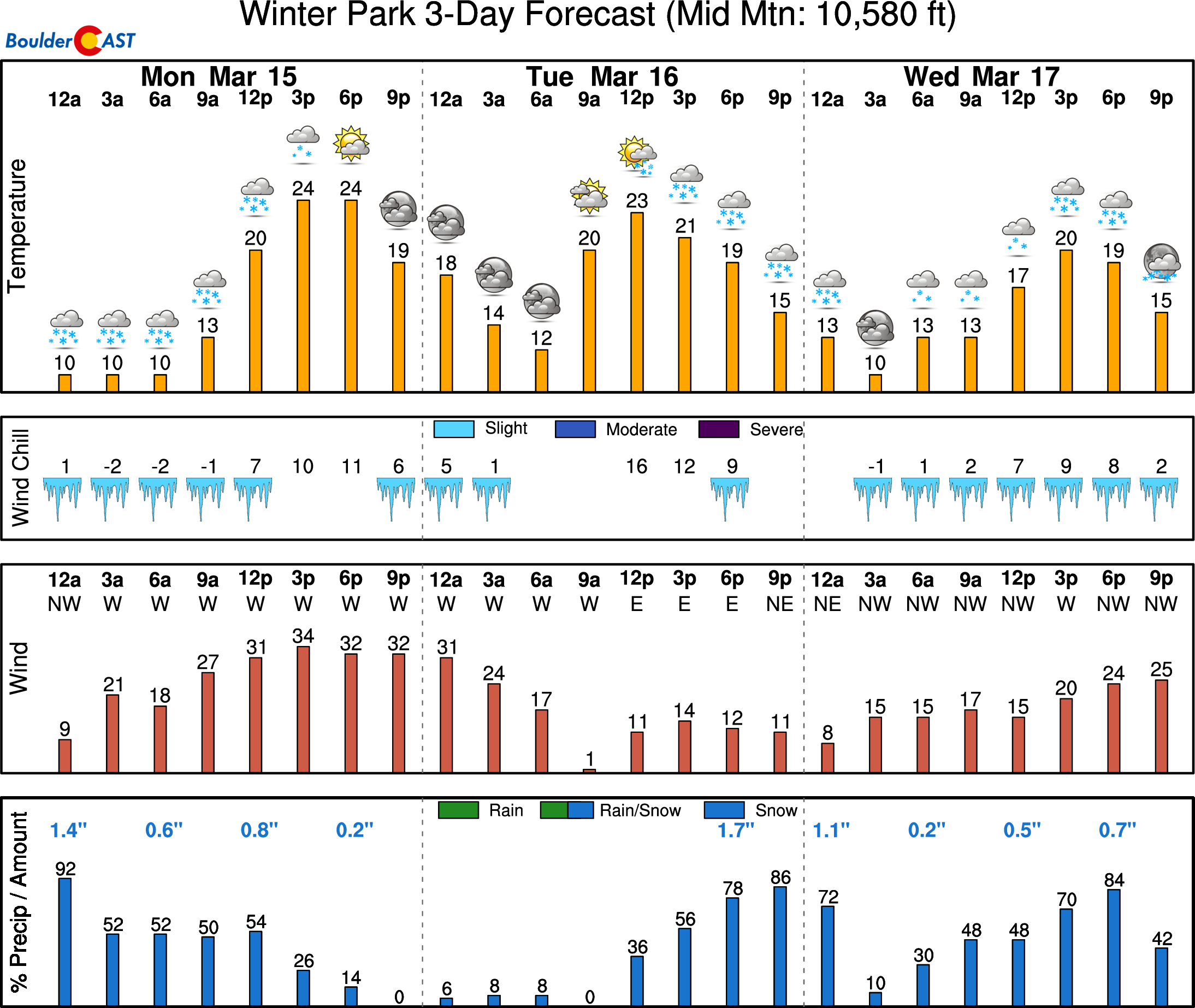
Mountains: Dry weather takes hold for the High Country this afternoon, thought avalanche danger is elevated given the recent heavy snow along the Divide. Another round of light to at times moderate snow, develops Tuesday afternoon and evening, especially across central and southern parts of the state. Drier weather takes hold late Wednesday through Friday.
Help support BoulderCAST and save 25% with promo code HEAVYSNOW (Ends 3/16/21)
Help support our team of Front Range weather bloggers by joining BoulderCAST Premium. We talk Boulder and Denver weather every single day. Sign up now to get access to our daily forecast discussions each morning, complete six-day skiing and hiking forecasts powered by machine learning, first-class access to all our Colorado-centric high-resolution weather graphics, bonus storm updates and much more! Or not, we just appreciate your readership!
.
Spread the word, share the BoulderCAST forecast!
.




You must be logged in to post a comment.