A welcomed cool-down will transpire early in the week as a strong Pacific trough moves across the Rockies. However, accompanying the cooler temperatures will be very strong winds Monday evening and night, as well as widespread rain and even some wet snow in the higher elevations. By mid-week, yet another ridge of high pressure will begin to take shape leading to a warming and drying trend for the Front Range.
This week’s highlights include:
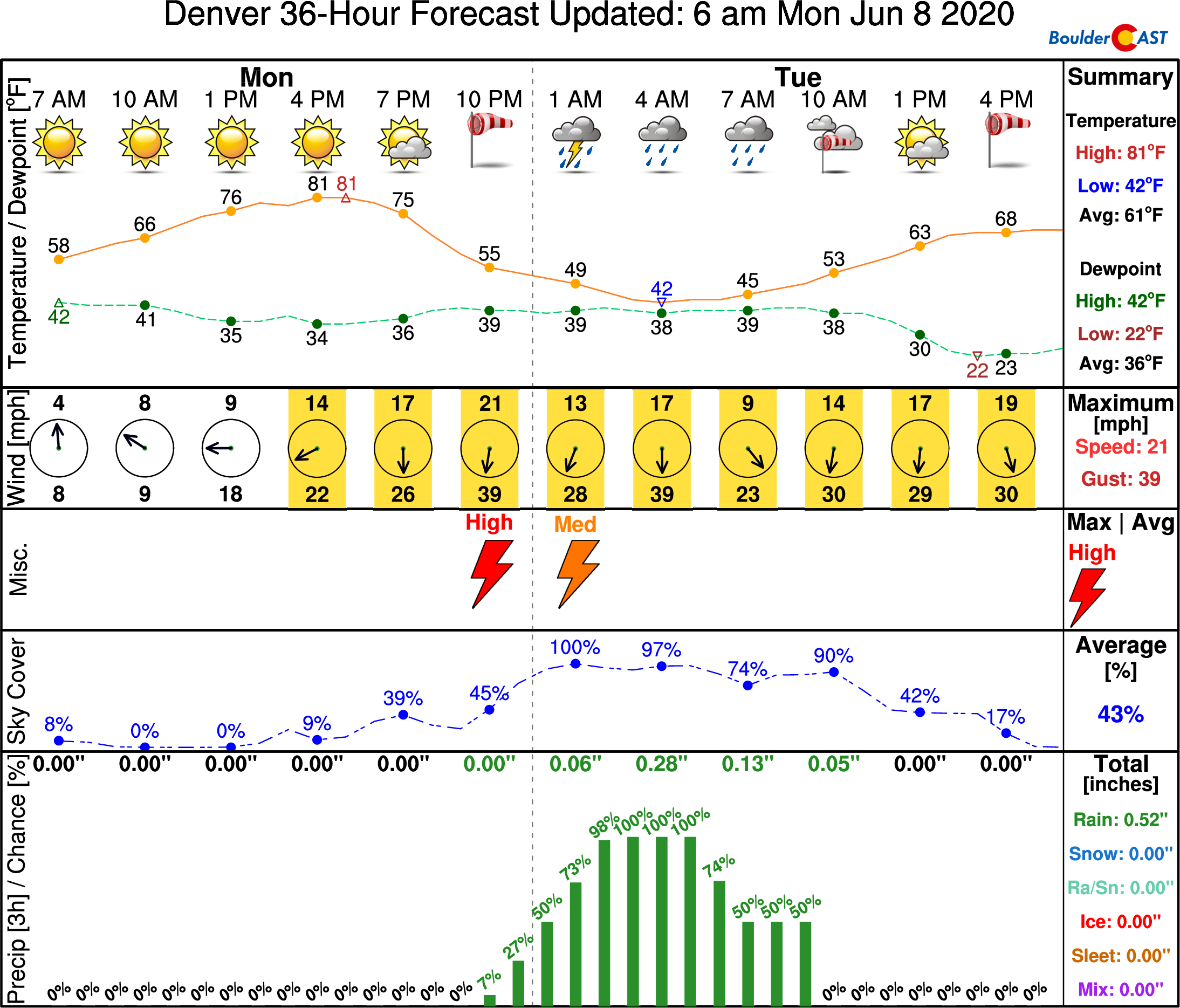
- Very windy conditions develop Monday evening into Monday night behind a strong cold front
- Widespread rain showers will overtake the Front Range Monday night into early Tuesday, some snow above 7500 feet
- Tuesday will see much cooler temperatures with highs in the 60’s alongside continued blustery conditions
- Sunny, warmer and mostly dry conditions return Wednesday and beyond
DISCLAIMER: This weekly outlook forecast is created Monday morning and covers the entire upcoming week. Accuracy will decrease as the week progresses as this post is NOT updated. To receive daily updated forecasts from our team, subscribe to BoulderCAST Premium.
A reprieve from the scorching heat Monday night, but also wind/rain/snow
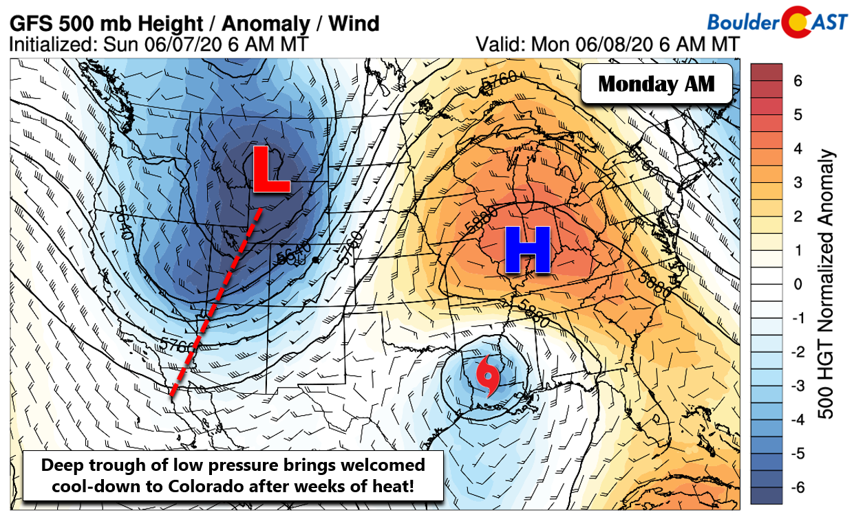
Just as expected, it’s been a very hot start to the month of June with temperatures every single day thus far registering well above normal across the area. This trend may finally end today as we see some slightly cooler air work into the region from the northwest alongside a Pacific trough of low pressure. Today’s large-scale weather map at 500mb is shown below. The ridge which facilitated the seemingly never-ending heat has shifted eastward. Tropical Storm Cristobal has made landfall near New Orleans and is moving northward through the Deep South. Closer to home, our Pacific trough is easily visible as well.
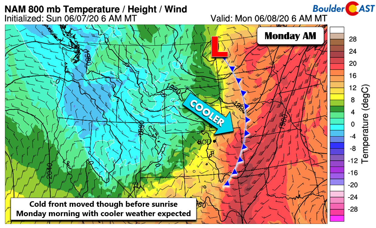
The initial cold front passed through the Front Range during the overnight hours. It was definitely quite warm last night when I was trying to fall asleep, but it did cool off nicely by sunrise. A timeline of temperature and dew point observations from BoulderCAST Station shows the front moved through around 10PM Sunday evening.
This initial front will only drop our temperatures close to normal for Monday with highs right around 80 degrees. Overall it will be a solid Monday with sunshine dominating but breezy conditions developing through the day.
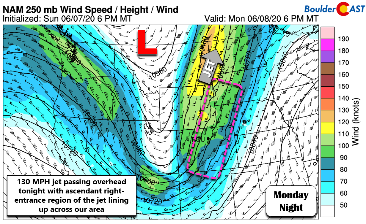
A secondary cold front associated directly with the large-scale trough axis will push through this evening with even colder temperatures on the backside. We’ll also likely see a wave of scattered to widespread showers and thunderstorms with this passage which will combine with enhancement from the right-entrance region of an overhead jet streak (shown below).
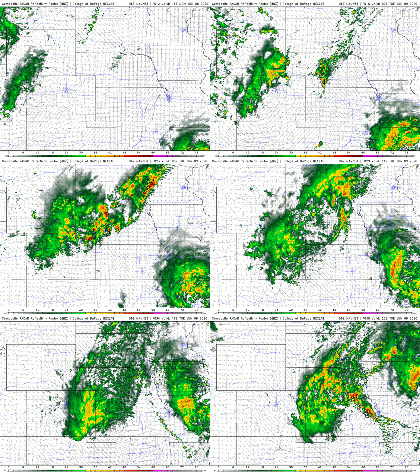
The net result will be a favorable period for rain across the Boulder and Denver area from the late evening into the overnight Monday night. A vast majority of model solutions have the rain holding off until after 10PM, so it really will be a mostly overnight event. However, with the jet approaching, it wouldn’t be surprising to see a few storms fire a little earlier, especially further north in the higher terrain near the Wyoming border. In any case, the overnight period into early Tuesday will offer a good chance of rainfall region-wide.
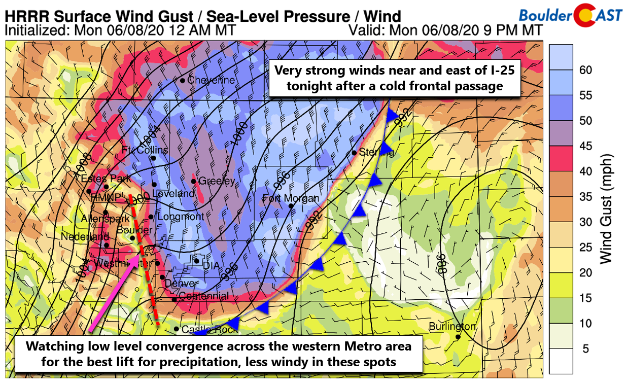
This secondary front will also usher in strong, subsident flow to the Front Range with wind gusts of 35 to 65 MPH expected this evening into the overnight hours. The strongest winds will reside generally east of Interstate 25 and should begin after 6PM. High-resolution models show these winds being not as strong around Boulder and Golden, but with a more northeasterly direction which will allow for some localized enhancement to the rainfall overnight in these areas due to added convergence.
For the areas that do get hammered by the strong winds later this evening, this event could actually be more damaging than the wind storm that blew through on Saturday. While the winds won’t be quite as strong at the top end, this event will last much longer… on the order of hours instead of minutes. As of Monday morning, the National Weather Service has issued a High Wind Warning for most of northeast Colorado’s Plains. However, this does not include Boulder or the western Metro area, which we showed earlier will have less intense winds.
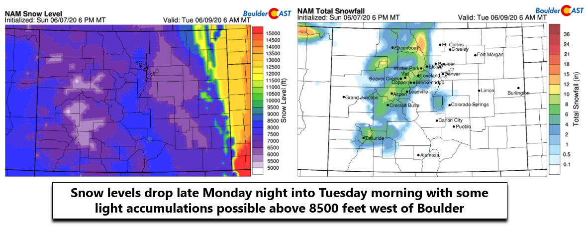
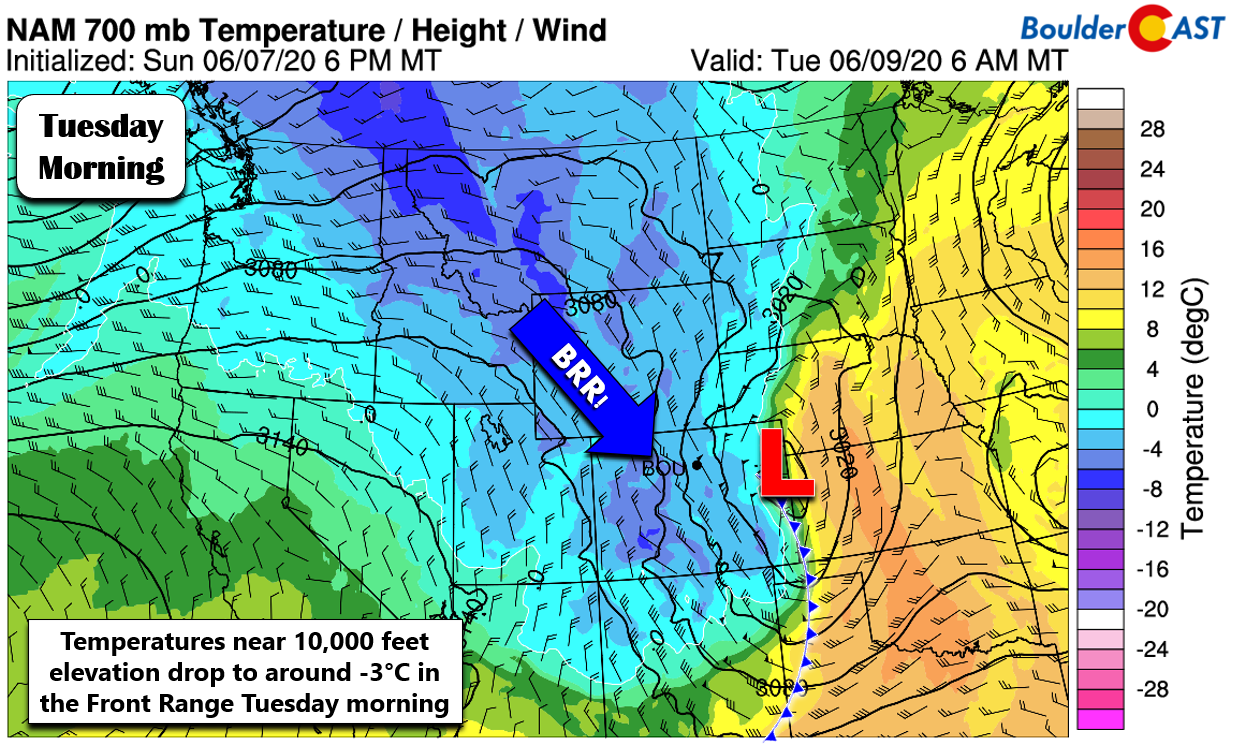
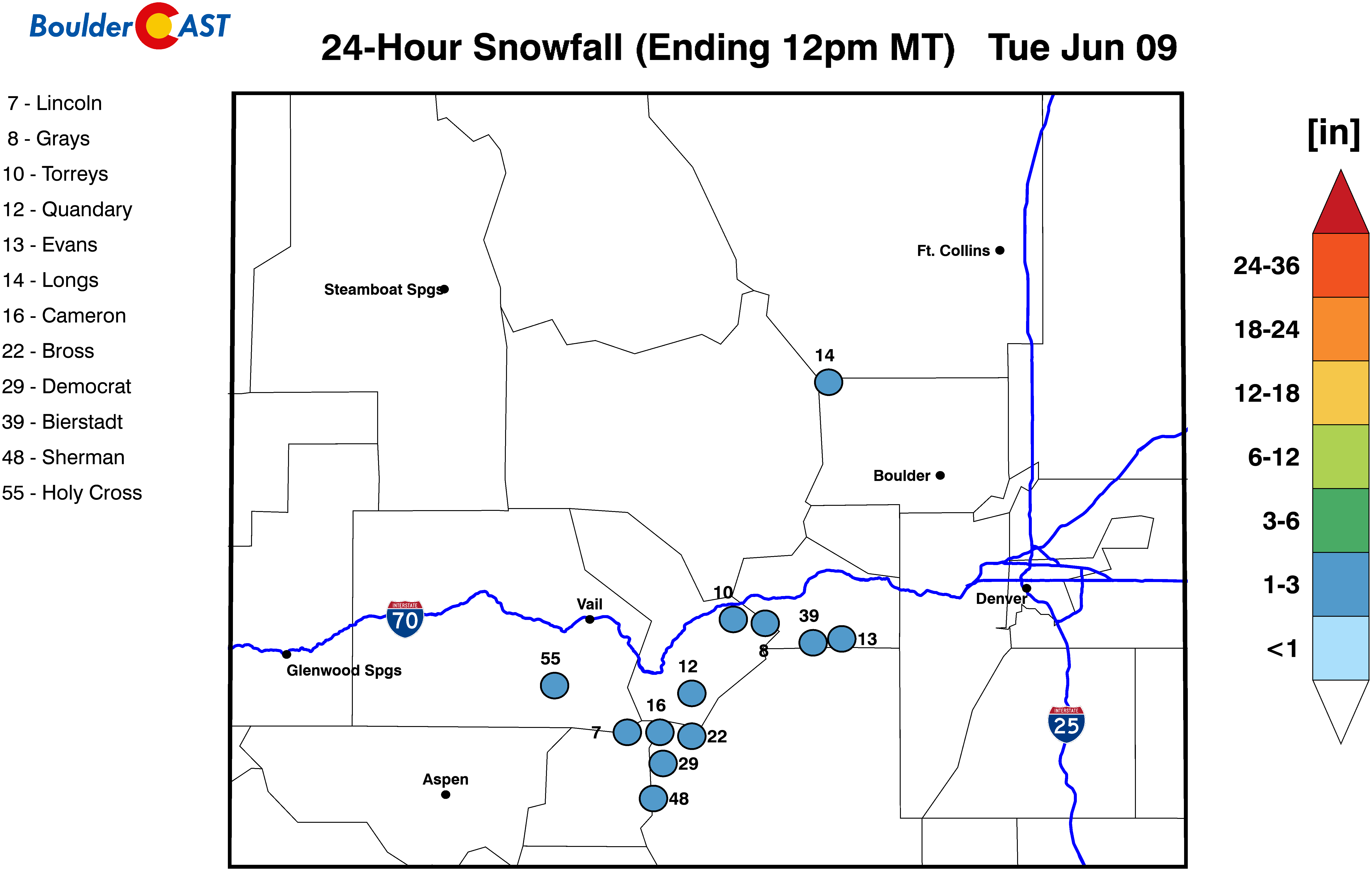
We’ll also be watching temperatures late Monday night for snow levels to come down as the cold core of the trough axis moves across the area. The overnight timing and chilly temperatures will produce several inches of accumulation above timberline (3-7″). With snow levels expected to drop to around 8000 feet or slightly lower by early Tuesday morning, the highest Foothills west of Boulder along Peak to Peak highway could see a dusting up to 2″ of June snow. The same can be said for the highest points in the Palmer Divide. If you’re traveling over any of the mountain passes late Monday night, do expect a late-season taste of winter weather on your journey.
For the rest of us across the lowest elevations, it will be just a chilly and blustery rain as temperatures cool into the 40’s, perhaps even the upper 30’s by sunrise Tuesday morning. Spotty rain and gloomy skies will be around for the first part of Tuesday as unseasonably cool northwest flow in the wake of the trough lingers over the Front Range. Models still differ on how quickly the energy from the trough will pull out. Some drier air will eventually takeover by afternoon with a mix of sunshine and cumulus clouds forced by cold air aloft. Outside of any lingering showers early Tuesday morning, the rest of the day will be dry with highs in the mid to upper 60’s. This is the cool-down we’ve been waiting for! There will be lingering gusty conditions, however, with gusts of 20-30 MPH expected.
It’s going to be a fun next 36 hours for us….
Drying out and warming back up Wednesday and beyond
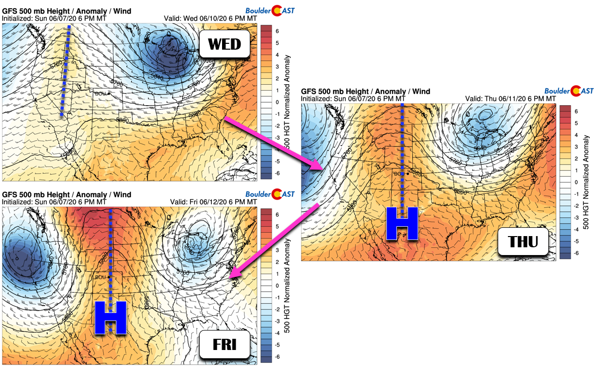
Yet another significant ridge of high pressure begins to reform across the spine of the Rockies late in the week. This is seen in both the GFS and European models. This will spell out generally dry conditions with temperatures starting to heat back up into the 80’s and eventually the 90’s. This “ridgy” pattern takes on the shape of an omega block later this week, so it ultimately could be a rather stagnant set-up that keeps us very warm for an extended period. While the upcoming weekend looks warm to borderline hot, there should at least be a chance of storms each day with the flow of moisture from the southwest beginning to increase as the ridge axis passes to our east.
Forecast Specifics:
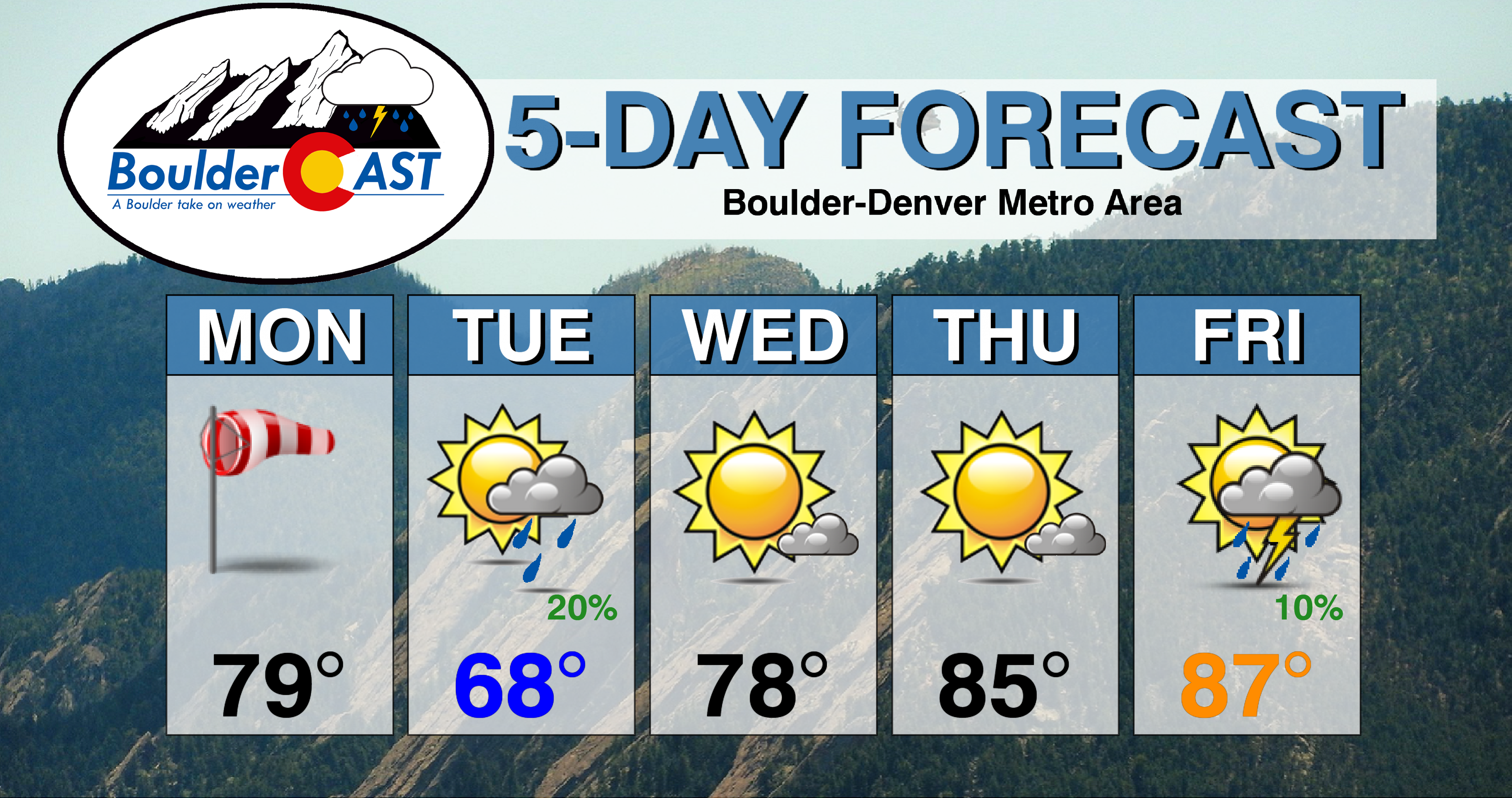
Monday: Mostly sunny and dry through the day. A cold front will plow through by evening from the northwest with strong winds gusting from 35 to 65 MPH across the area. Winds will be strongest east of Interstate 25. Widespread rain develops overnight and lingers into Tuesday morning. Some thunder is also possible. Temperatures will be cold enough overnight for snow or rain/snow in the higher Foothills with very light accumulations possible. Highs near 80 degrees on the Plains with upper 60’s in the Foothills.
Tuesday: Rain showers lingering into the morning hours, but we dry out by afternoon. Expect much colder temperatures with blustery conditions across the region. Winds gusting 20-30 MPH with clearing skies through the day. Highs in the middle to upper 60’s on the Plains and lower 50’s in the Foothills.
Wednesday: Mostly sunny and seasonal with highs in the upper 70’s on the Plains and middle 60’s in the Foothills..
Thursday: Mostly sunny and warmer with temperatures in the middle 80’s on the Plains and low 70’s in the Foothills.
Friday: Mostly sunny with an isolated shower or storm developing in the late-day, mainly across the higher elevations. Highs in the mid to upper 80’s across the Plains and middle 70’s in the Foothills.
High Country: Scattered rain and snow showers will develop Monday afternoon into Monday night with 3-7″ of accumulation possible above treeline by Tuesday morning. Below normal temperatures will be present on Tuesday, but it will be drier. Wednesday into Friday will see generally dry weather with just patchy cumulus clouds developing in the afternoon. A few isolated storms may be possible across the state on Friday as moisture begins to creep back up.
We discuss Boulder and Denver weather every single day on BoulderCAST Premium. Sign up today to get access to our daily forecast discussions every morning, complete six-day skiing and hiking forecasts powered by machine learning, access to all our Front Range specific weather models, additional storm updates and much more!
.
Spread the word, share the BoulderCAST forecast!







You must be logged in to post a comment.