Unseasonably cold temperatures will be in place throughout the week ahead with little hope for any warmer weather in the near-term across Front Range Colorado. A southern-track storm system will bring light snow totals to the Front Range for our Monday. The chance of snow will returns Tuesday into early Thursday as northerly mid-level flow sends ripples of energy to combine with weak surface upslope. Temperatures may finally get out of the 30s by week’s end, but just barely!
This week’s highlights include:
- Light snow around Monday but accumulations of just a trace to 2 inches at most (highest in the Foothills)
- A chance of snow persists Tuesday into early Thursday with several waves of energy combining with cold surface upslope
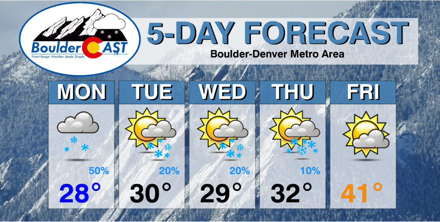
- Temperatures remain below normal in the 20s and 30s Monday through Thursday, but lower 40s possible by Friday
- The active pattern continues this weekend with snow chances remaining in the forecast
DISCLAIMER: This weekly outlook forecast is created Monday morning and covers the entire upcoming week. Accuracy will decrease as the week progresses as this post is NOT updated. To receive daily updated forecasts from our team, among many other perks, subscribe to BoulderCAST Premium.
A far south storm system brings light snow for Monday
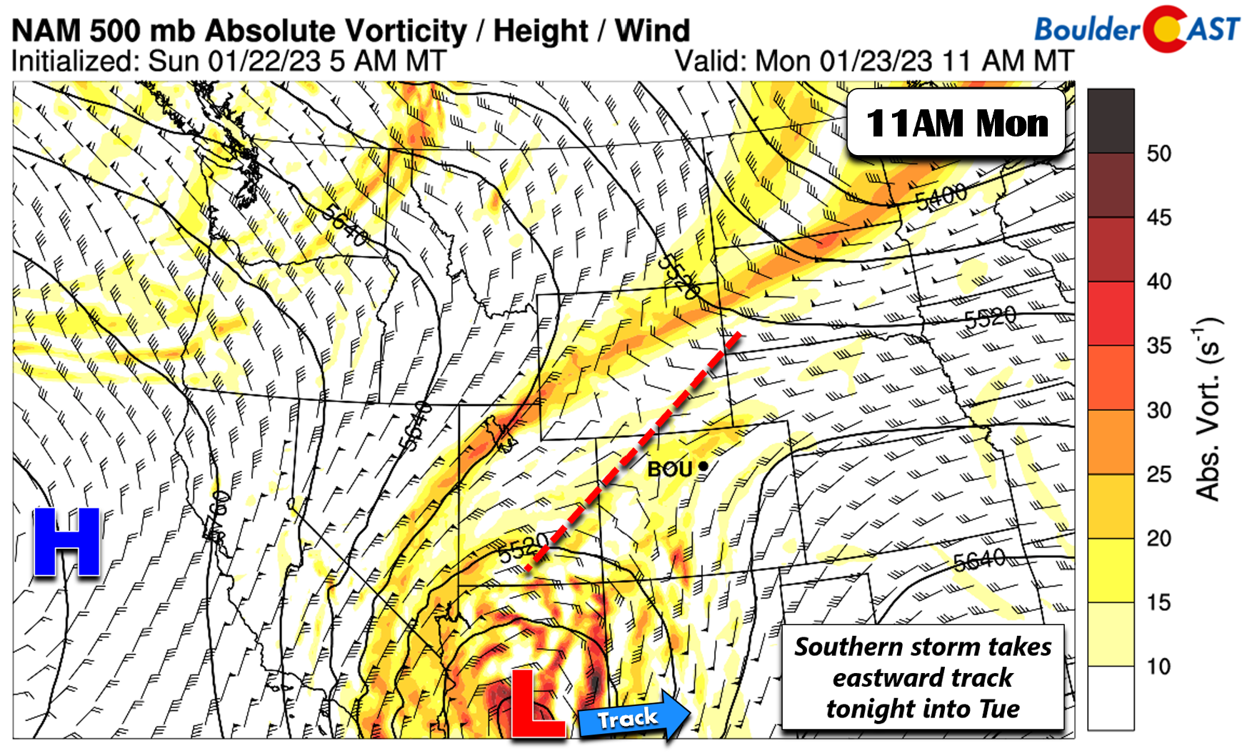
As we mentioned in our forecast on Sunday, a drastic change in a southern stream shortwave will only favor light snow today with accumulations of a trace to 2 inches in Boulder and a trace to around 1 inch in Denver. The storm system today will be over south-central Arizona. It will take a due east track into New Mexico and Texas by Tuesday and Tuesday night.
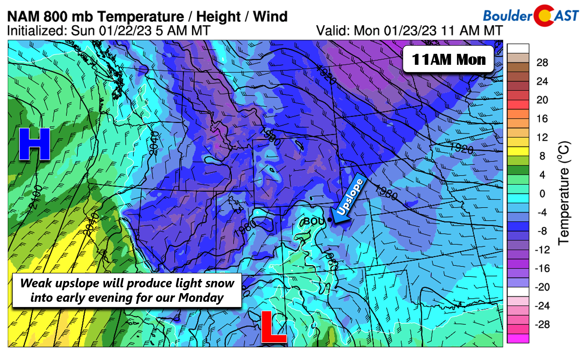
On Monday we’ll be mostly cloudy under light surface upslope (below) with temperatures in the upper 20s to lower 30s on the Plains for highs.
Periods of light snow will be around, especially in and near the Foothills, into about late-afternoon on Monday.
Cold with light snow chances Tue into Thu
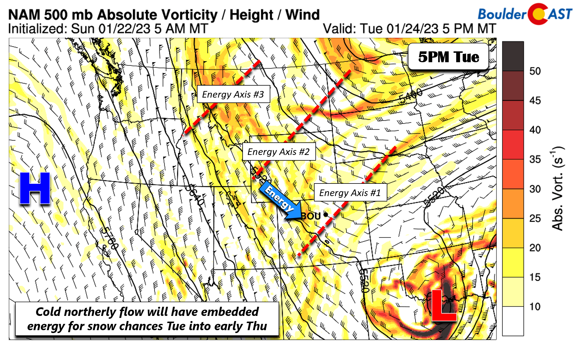
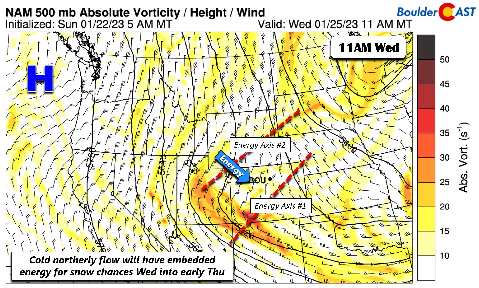
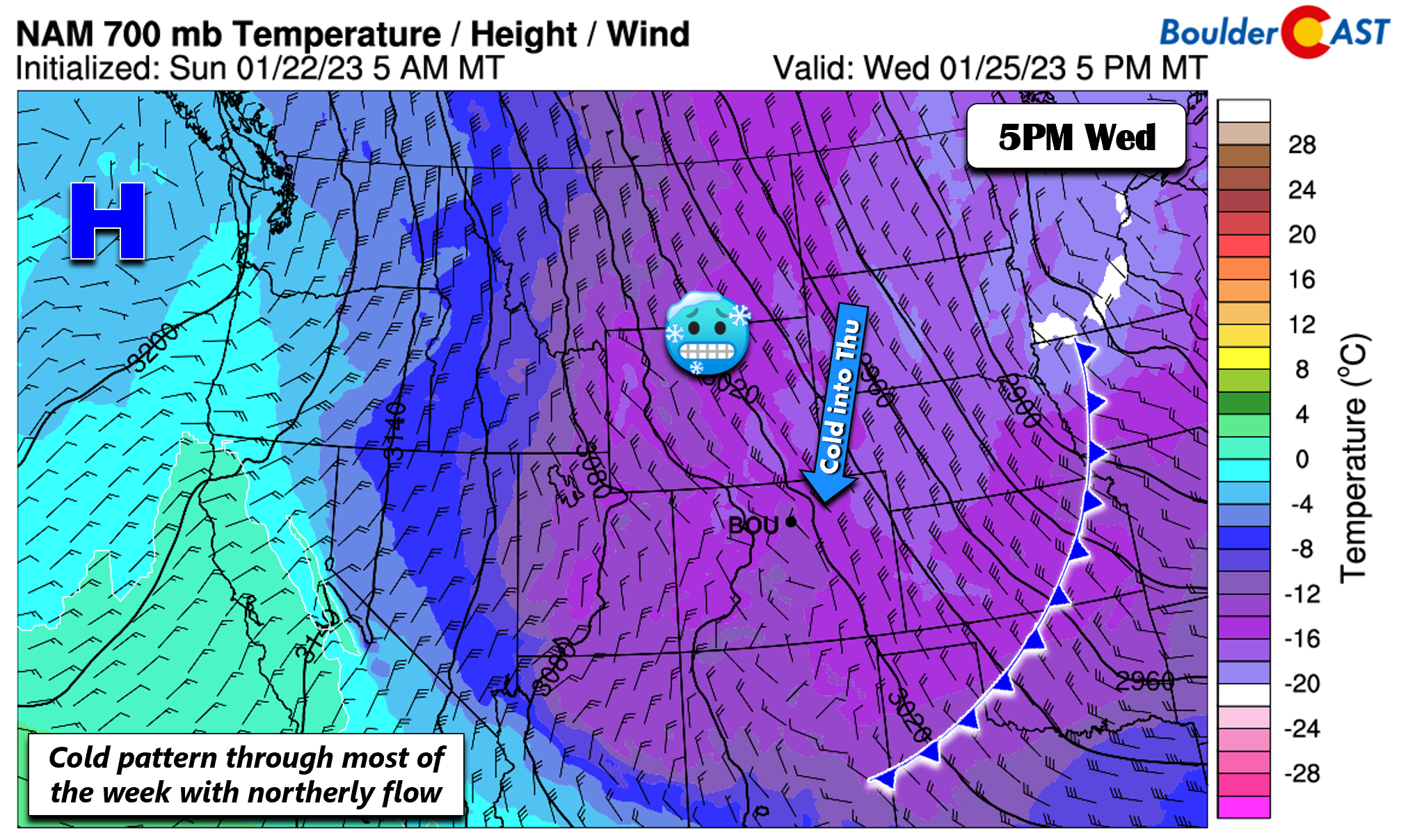
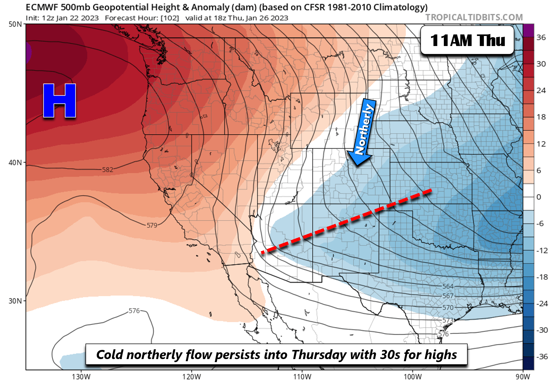
Our average highs for late January in the upper 40s. For all of this week, temperatures will be below normal in the upper 20s to lower 30s through at least Thursday. The reason is because of a persistent northerly flow over the Intermountain West thanks to high pressure offshore of California. Embedded in the northerly flow are several ripples of energy, some of which are difficult to make out. We found at least three energy axes Tuesday and Tuesday night, one in Colorado, a second in Wyoming, and a third over western Montana. Tracking these disturbances out will be more of a “nowcast” situation given how weak they are and as models seem to differ in regards to the strength/placement of each into Thursday.
By midday Wednesday, there will still be some shortwaves traversing southward from Wyoming. Each of these disturbances in the flow from Tuesday into early Thursday will favor light snow chances for our area. Ensemble guidance at this point does not show impressive amounts but we’ll need to keep an eye on these as they can be known to surprise us at times.
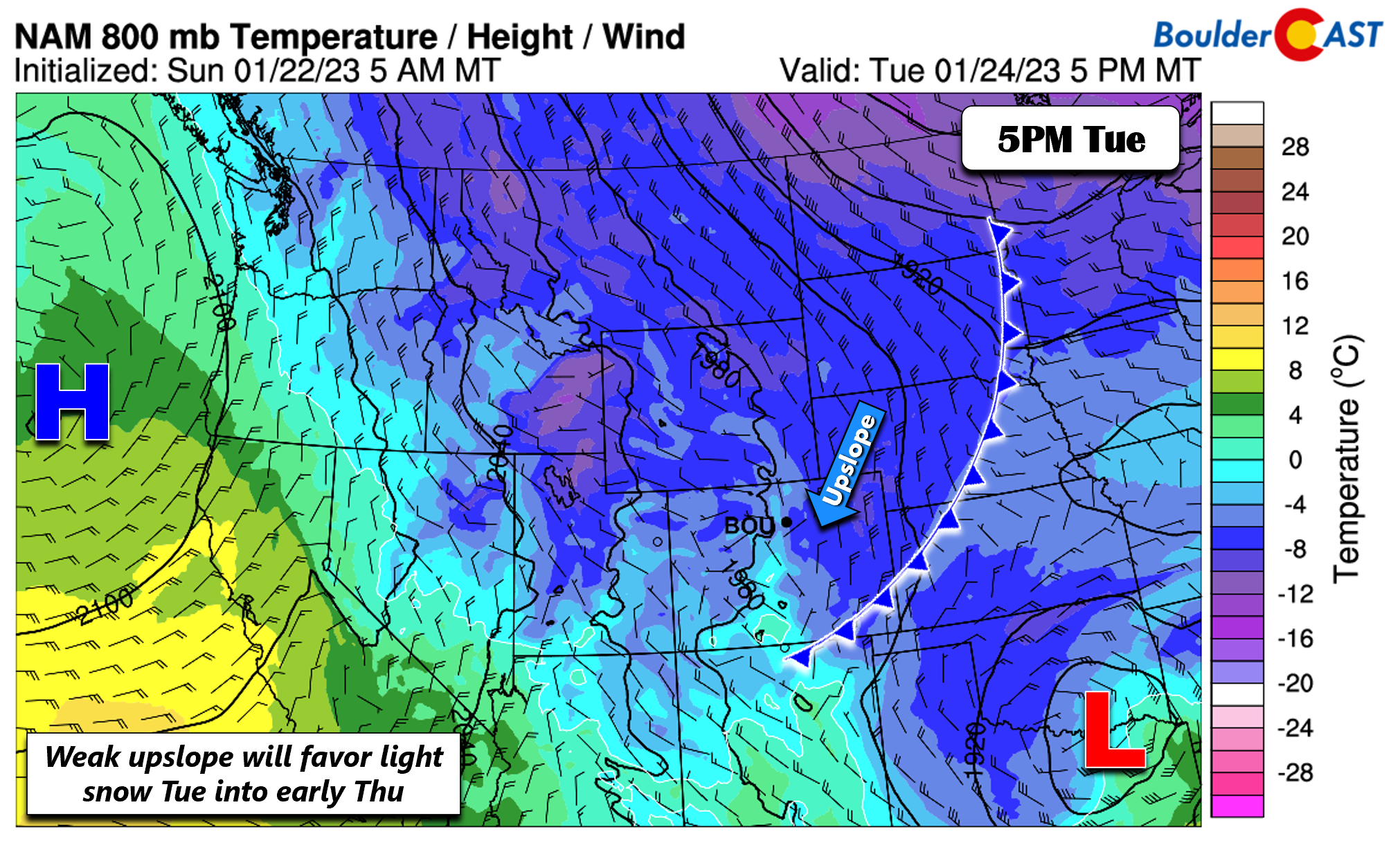
Along with the disturbances Tuesday into Thursday, a few cold fronts will pass through, reinforcing the already cold air. The first front comes through Tuesday, behind which upslope will develop and combine with the shortwave aloft for light snow Tuesday night into Wednesday.
A secondary period of light snow is favored Wednesday into Wednesday night with another system and a secondary intrusion of cold air. Wednesday will be another cold, raw day with temperatures in the upper 20s to maybe 30 degrees.
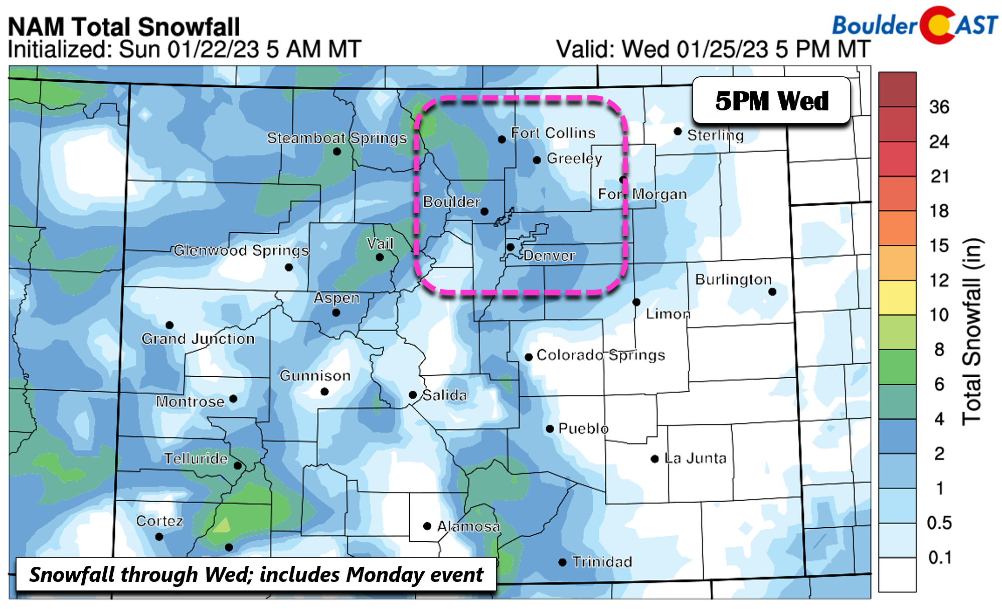
The NAM total snowfall through Wednesday is shown below — note that this includes Monday’s snowfall. The NAM is not overly excited with the two systems into Wed night, with roughly 1 to 2 inches for the Denver Metro area. Overall, the pattern favors just nuisance snow totals more than anything, but it’s something to watch in this somewhat unpredictable northerly flow setup.
An active pattern continues late weekend to early next week
Thursday will still be cold in the lower 30s as the northerly flow at mid-levels persists. The shortwave energy appears to be south and east of the region at this point, but we can’t rule out a few snow flurries in the morning. Some guidance was showing some gusty winds over northeast Colorado Thursday afternoon, in response to a jet over this area. This will be something to watch, but for now we are not seeing a strong signal for it. The ridge out west will try to move east but likely remains anchored off the Pacific Northwest.
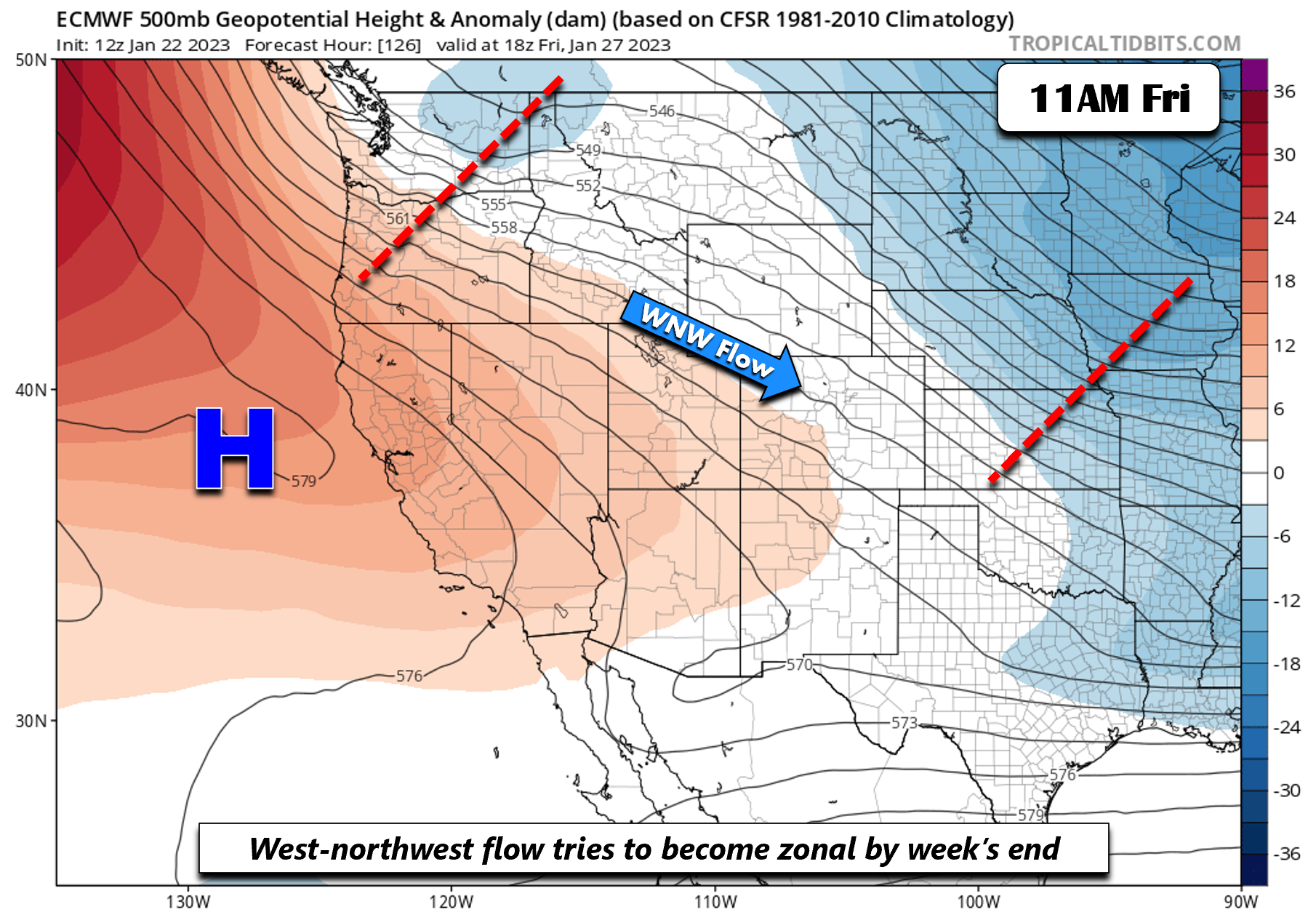
Guidance is in relatively good agreement by week’s end that the northerly flow may transition to a west-northwest flow by midday Friday. However, it doesn’t look like a pure downslope pattern as there will still be embedded systems in the fast flow. Nevertheless, rising heights should favor warmer highs in the upper 30s to around the lower 40s — a slightly warmer day to look forward to perhaps?
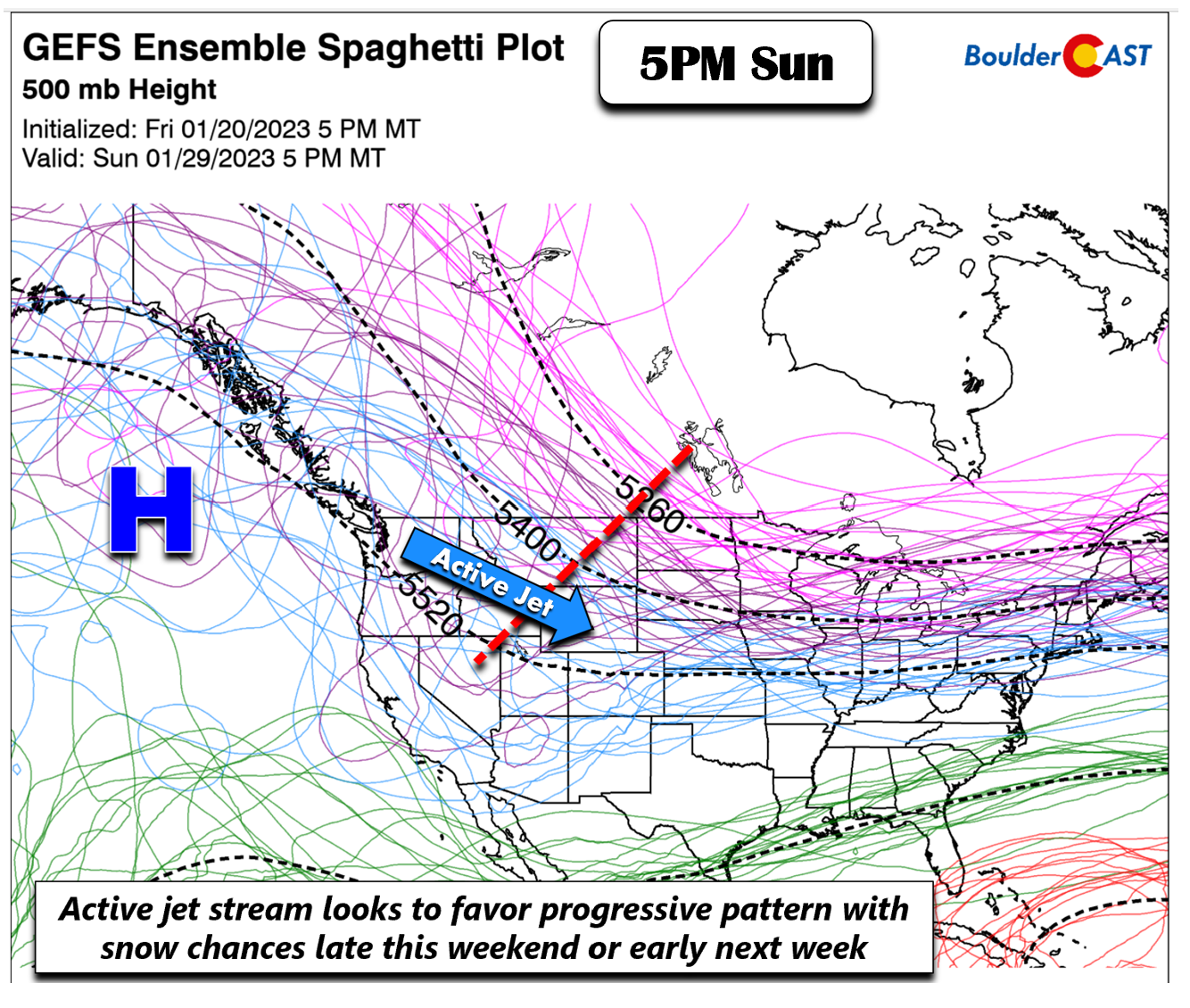
The storm track looks to stay active late this weekend and into next week. The GEFS/ECMWF/CMC all show that while a slight warming trend is favored for the weekend, the polar jet will sag back southward overspreading the area soon enough. Along with that, additional shortwaves will be embedded in the flow, favoring chances of snow sometime late in the weekend or early next week. Stay tuned.
Forecast Specifics:
Monday: Mostly cloudy with periods of light snow through the morning into the afternoon. Light snow amounts of a trace to 1″ possible, with up to 2″ in the Foothills. Highs in the upper 20s on the Plains and low to middle 20s in the Foothills.
Tuesday: Partly sunny, then mostly cloudy by evening with light snow possible (20%) into early Wednesday. Little to no accumulation expected. Highs in the lower 30s on the Plains and middle 20s in the Foothills.
Wednesday: Light snow possible in the morning and evening (20%) with light accumulations possible, generally less than 1″. Highs in the upper 20s to near 30 degrees for the Plains and lower 20s in the Foothills.
Thursday: Partly sunny with morning snow flurries possible and chilly in the lower 30s on the Plains and lower 20s in the Foothills.
Friday: Partly cloudy and warmer with highs in the upper 30s to near 40 for the Plains and upper 20s to near 30 in the Foothills.
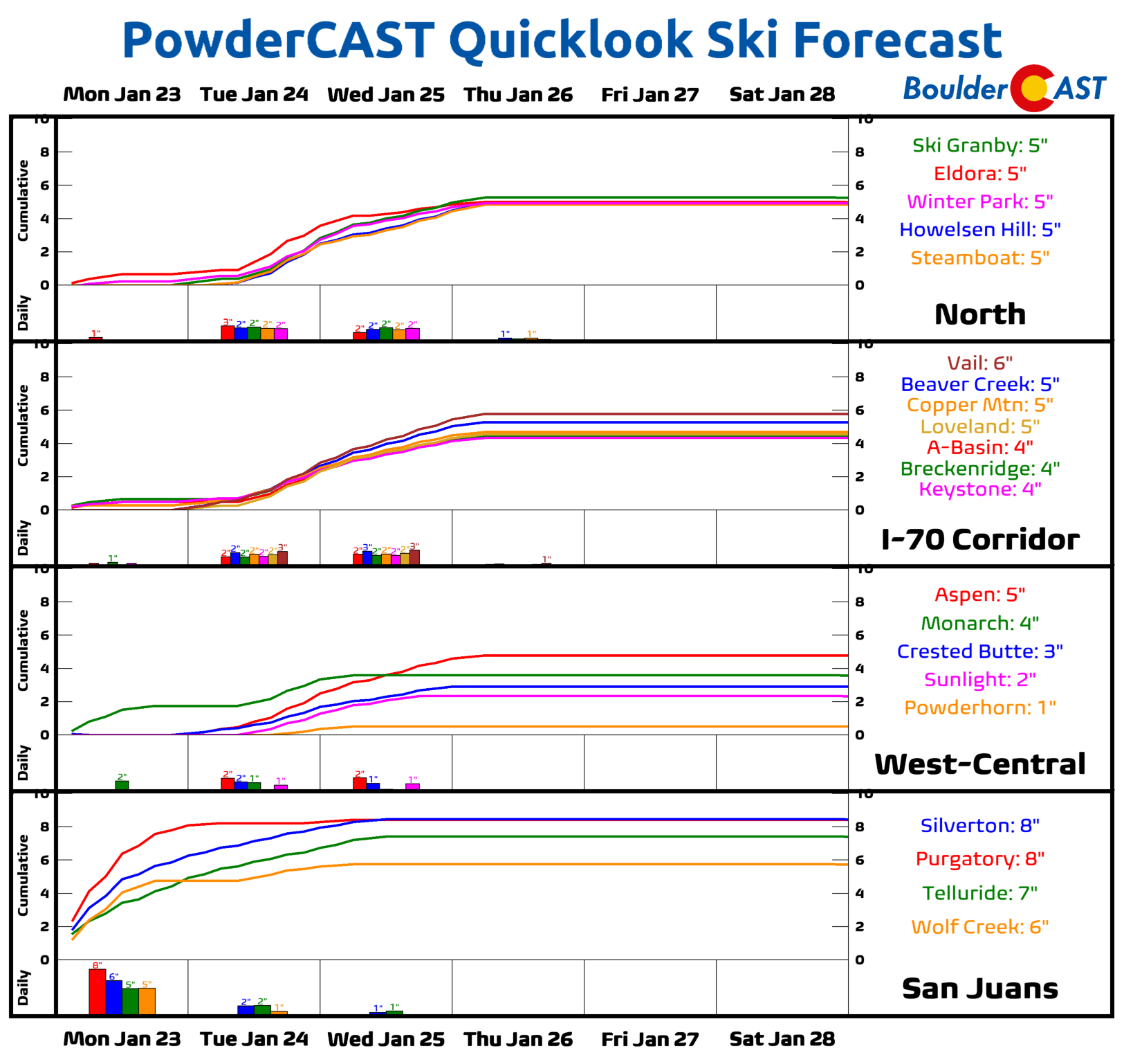
PowderCAST: A smattering of 3 to 8 inches of snow will be possible this week across the higher terrain through early Thursday. The San Juans will be favored early in the week, but the focus shifts to the central and northern Mountains for the midweek.
Help support our team of Front Range weather forecasters by joining BoulderCAST Premium. We talk Boulder and Denver weather every single day. Sign up now to get access to our daily forecast discussion email each morning, complete six-day skiing and hiking forecasts powered by machine learning, first-class access to all our Colorado-centric high-resolution weather graphics, bonus storm updates and much more! Or not, we just appreciate your readership!
Spread the word, share the BoulderCAST forecast!





You must be logged in to post a comment.