The primary weather impacts to the Front Range this week will occur on Monday. However, those impacts will be fairly limited, with the most noticeable change being much colder temperatures in the 30s for highs. The chilly weather continues into Tuesday, but milder readings will return by midweek. We are watching a late-week storm system but it currently looks to track through the area mostly dry. Read on for more details
This week’s highlights include:
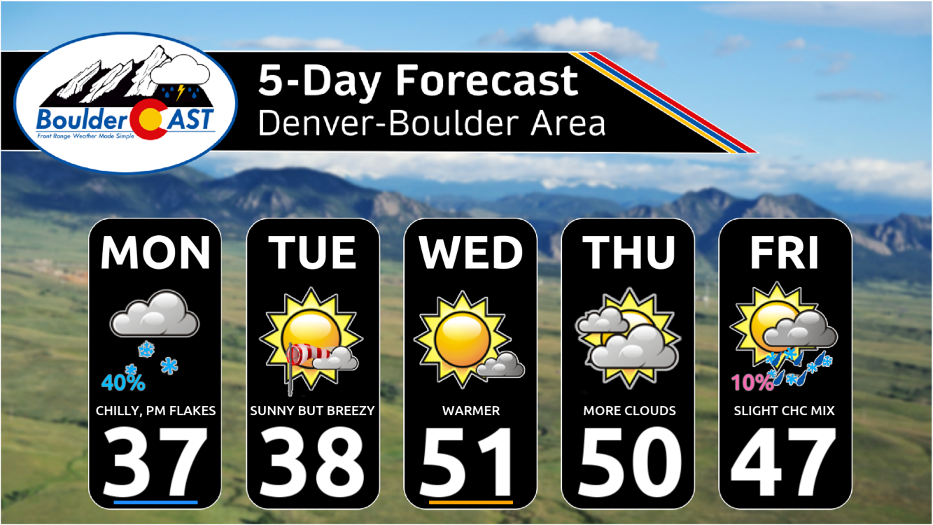
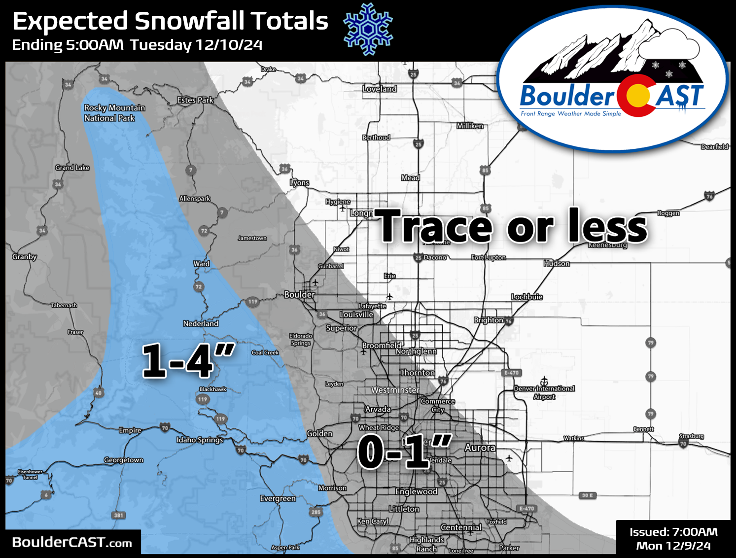
- Winter Returns Monday: A chilly disturbance will impact the region on Monday bringing much colder temperatures and light snow. Amounts are expected to be an inch or less over the western and southern Metro area (including Boulder), with up to 4 inches in the southern Foothills.
- Temperatures Fluctuate: Mid to upper 30s Monday and Tuesday, then milder Wednesday through Friday in the middle 40s to lower 50s
- Tranquil Weather: The Front Range will experience mostly quiet weather Tuesday through Thursday with no chance of precipitation.
- Late-Week System: A system in the westerly flow could be worth watching on Friday but its fairly uncertain right now.
DISCLAIMER: This weekly outlook forecast is created Monday morning and covers the entire upcoming week. Accuracy will decrease as the week progresses as this post is NOT updated. To receive daily updated forecasts from our team, among many other perks, subscribe to BoulderCAST Premium.
Daily Forecast Updates
Get our daily forecast discussion every morning delivered to your inbox.
All Our Model Data
Access to all our Colorado-centric high-resolution weather model graphics. Seriously — every one!
Ski & Hiking Forecasts
6-day forecasts for all the Colorado ski resorts, plus more than 120 hiking trails, including every 14er.
Smoke Forecasts
Wildfire smoke concentration predictions up to 72 hours into the future.
Exclusive Content
Weekend outlooks every Thursday, bonus storm updates, historical data and much more!
No Advertisements
Enjoy ad-free viewing on the entire site.
Light snow Monday for the southwest Metro area
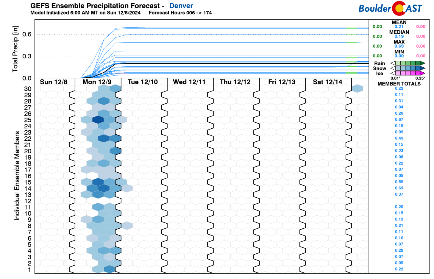
The main weather impacts for the week will be front-loaded into Monday for northeast Colorado. As seen in the GEFS snowfall plume below, the rest of the week after Monday is expected to be dry. Going into Monday’s snow chance, which we have discussed the past several days with our Premium readers, the models continue to show some variation and uncertainty. The GEFS remains bullish like the operational GFS compared to the other guidance. We’ll see in a moment that the most likely outcome is unfortunately for low-end snow totals.
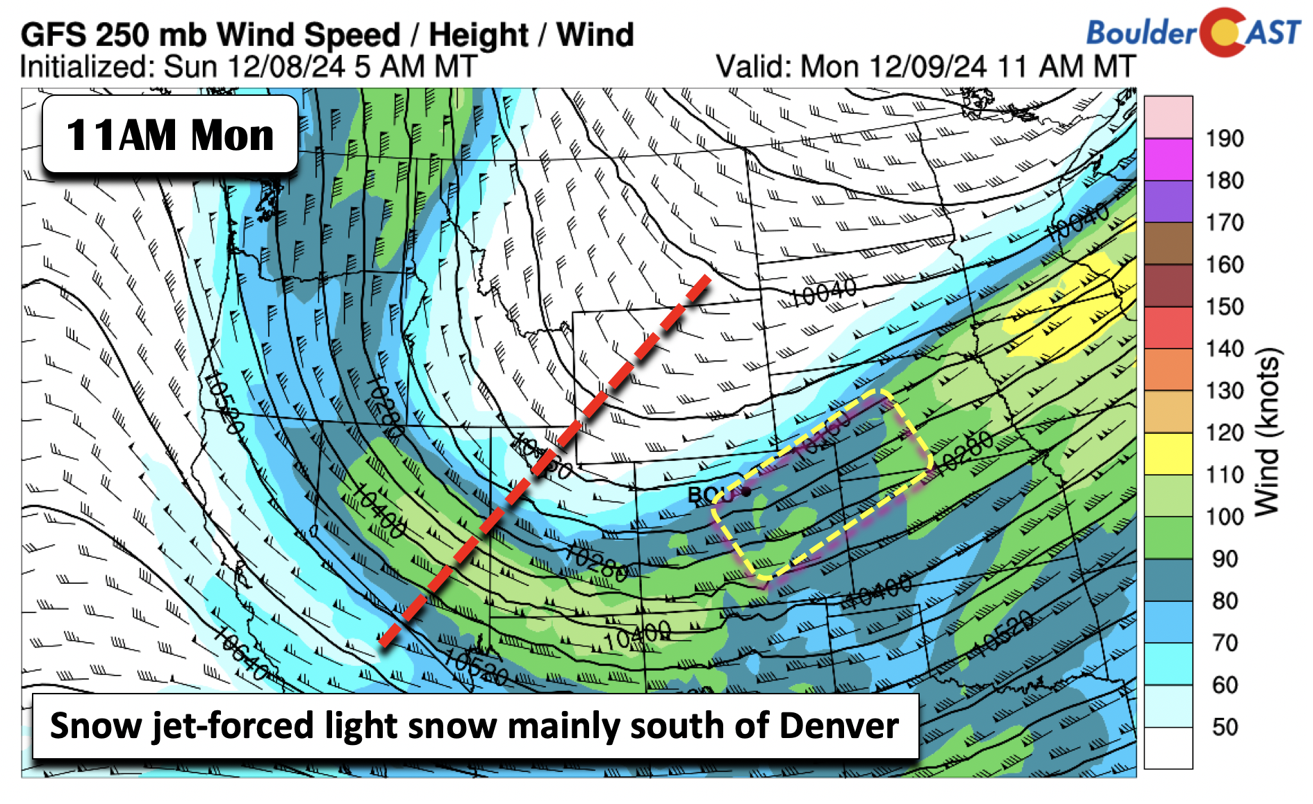
The main change early in the week will be the much colder temperatures relative to the mild and beautiful weekend we just had. We are going to see highs Monday afternoon and Tuesday in the mid to upper 30s, a near 25-degree swing in the downward direction. Nevertheless, let’s get into specifics for Monday’s system. All of the guidance shows a rather large trough moving through today and tonight. To the east of the trough, there is a window where a few jet-forced snow bands could develop Monday into Monday evening, primarily south of Denver and along the Palmer Divide. The GFS is the furthest north with this jet streak and shortwave energy relative to the other models.
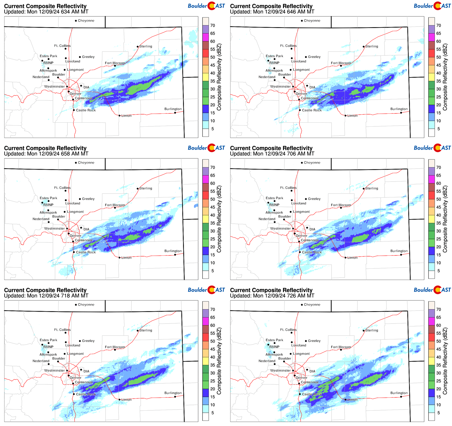
As of early Monday morning, we’re already seeing signs of this jet energy, with a few snow bands already cropping up south and southeast of Denver (see current radar animation below). It’s unlikely these bands make much progress further northward, but this is something to keep an eye on if you live or are heading south out of Denver into the Palmer Divide area.
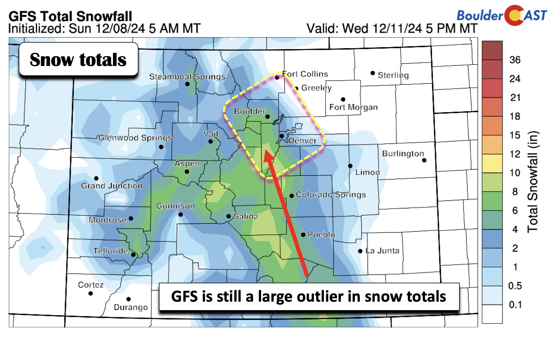
The GFS continues to be on the bullish side with snow totals from early this afternoon into late tonight. It shows about 4-8 inches in Boulder and 2-4 in Denver. We still believe that this solution is a “worst-case scenario” and, while we do not dismiss it entirely, we are highly suspect of it.
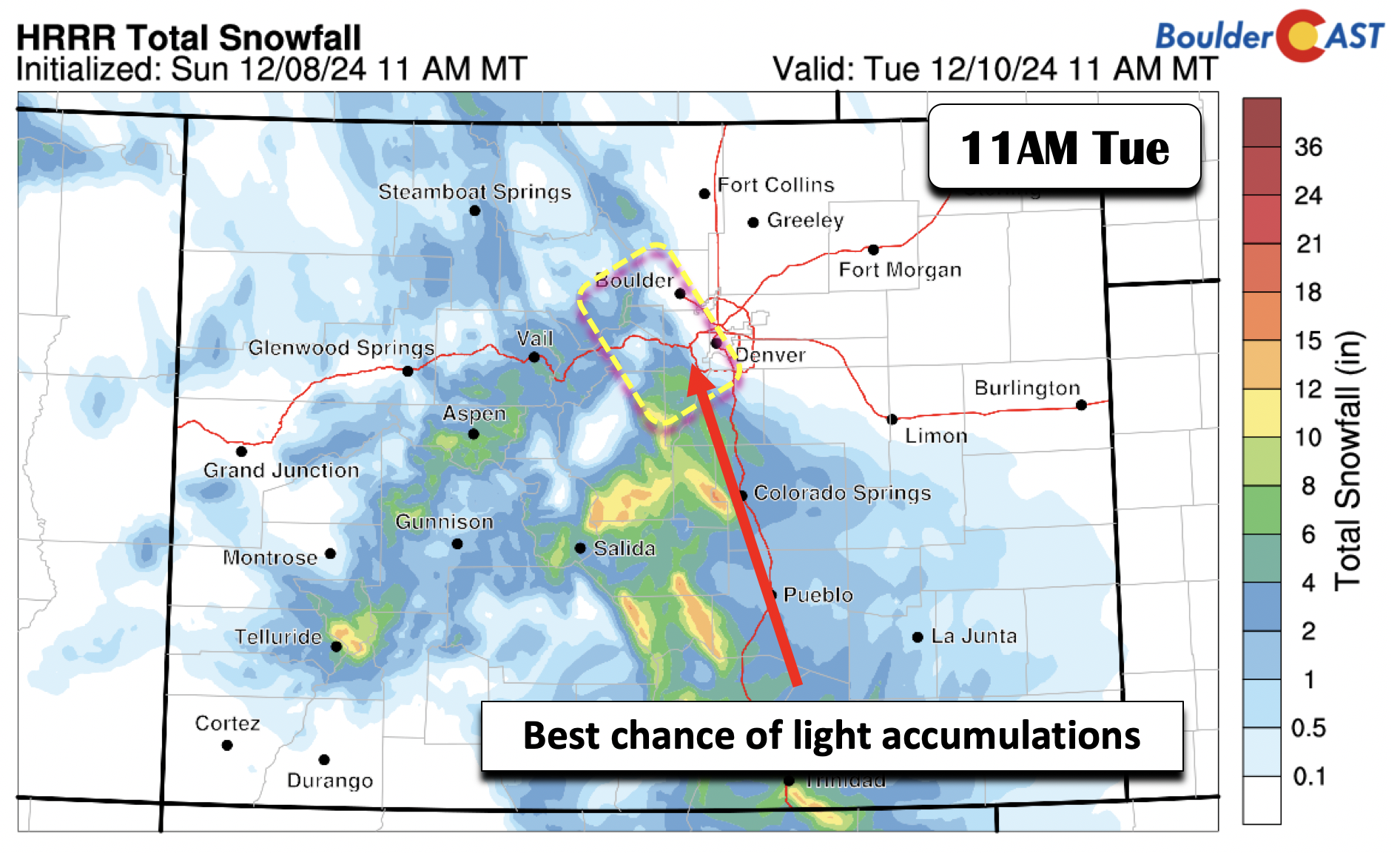
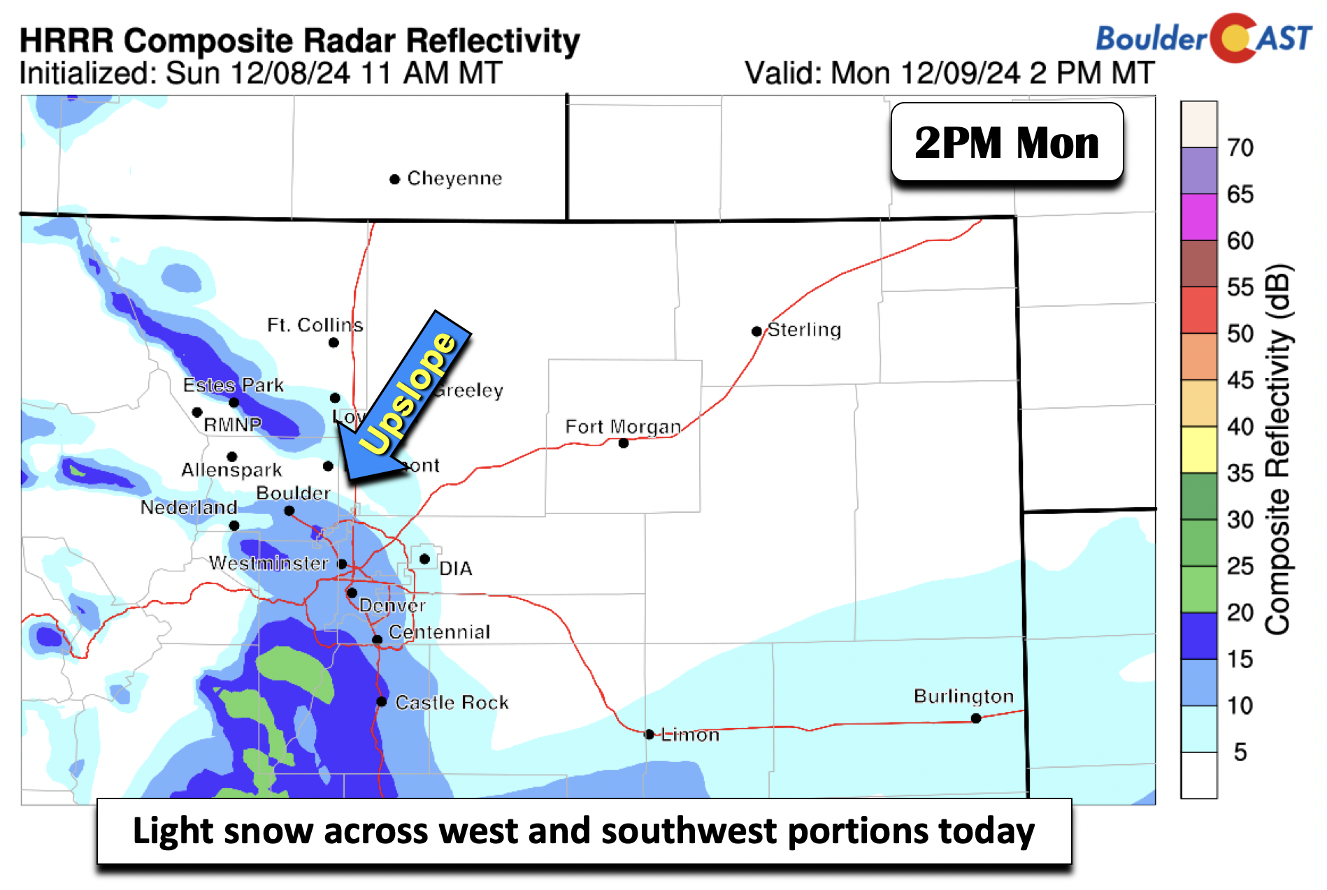
The last several runs of the HRRR follow the ECMWF/CMC global model depiction of snow totals. It shows the greatest snow totals south and west of Denver, especially towards Colorado Springs and along the Palmer Divide. Mid-level lift and upslope will combine for these snow totals. There is good agreement that this snow will focus in this area relative to snow chances in Denver. The best odds of any light snow accumulations over the Front Range will be over western and southern sections of Boulder into the eastern Foothills, as well as south and west sections of Denver, such as near Castle Rock and Centennial.
As for timing of any light snow, we believe scattered snow showers are best favored early Monday afternoon into the late evening for the Metro area (~2PM to Midnight). This will be when the surface flow trends towards upslope and will better force light snow along the terrain in the western and southern sections of Boulder and Denver.
Snow totals in these aforementioned areas will be an inch or less, with little of any snow elsewhere across the lower elevations as shown in our official snowfall forecast map below. Up to 4″ of snow may fall in the southern Foothills and along the Divide.
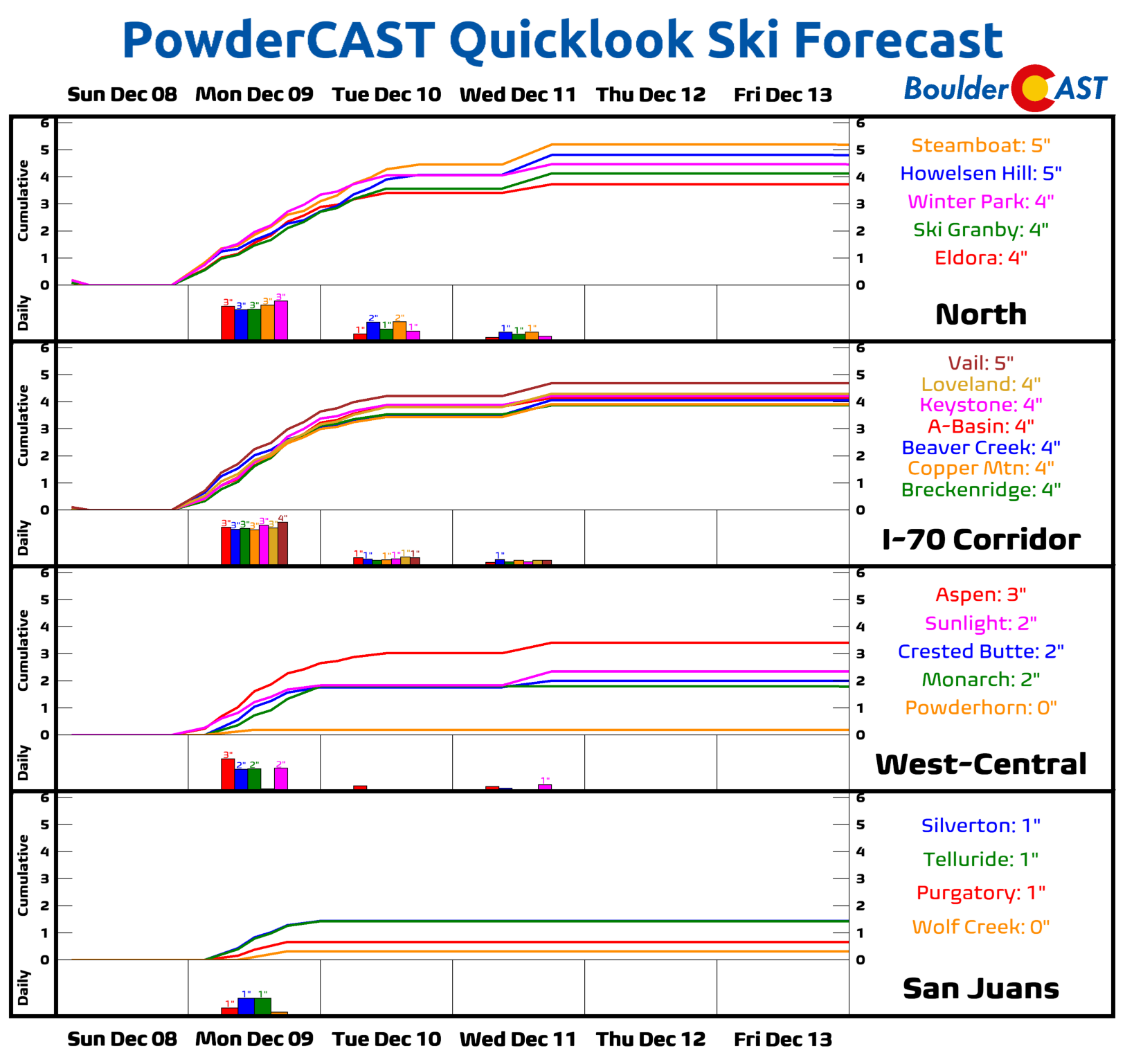
The Mountains will be the ones to really cash in on the snow early in the week, with several ski resorts seeing between about 2 and 6 inches by Wednesday morning — not a ton but every inch counts…
Quieter and (mostly) dry the rest of the week
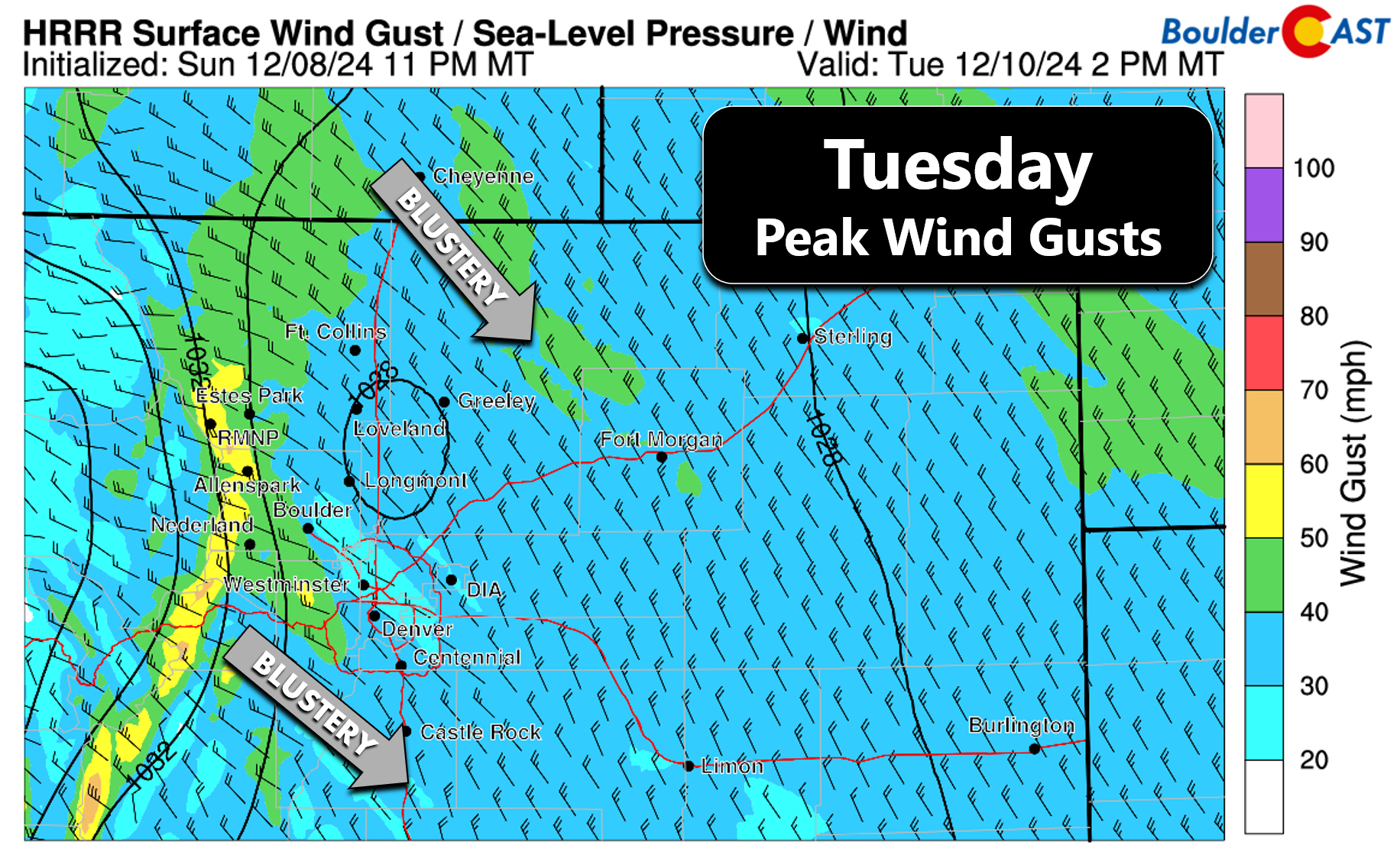
Cold temperatures will continue on Tuesday, but we will be drier and sunny with mid to upper 30s. It will perhaps feel even worse though thanks to subsidence behind the departing trough. Northwest winds will gust up to 25 MPH during the day across the lower elevations, with up to 40 MPH in and near the Foothills.
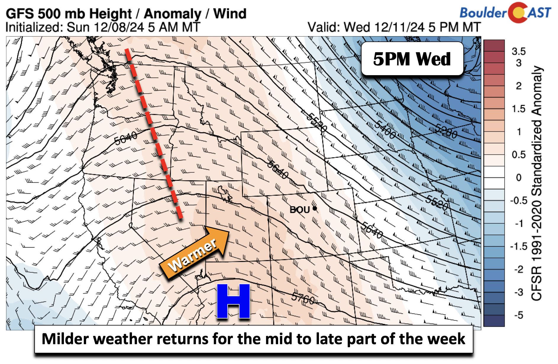
Come Wednesday and Thursday, a ridge will slide east. As it does so, it won’t maintain its strength but will more or less still promote milder weather for the Front Range. Our highs should climb into the upper 40s to near 50 Wednesday and then the lower 50s by Thursday. The Canadian model, relative to the GFS/ECMWF, shows a fast-moving shortwave tracking through and could favor more cloud cover. This is an anomaly but regardless for now we are keeping temperatures from getting too warm too quickly.
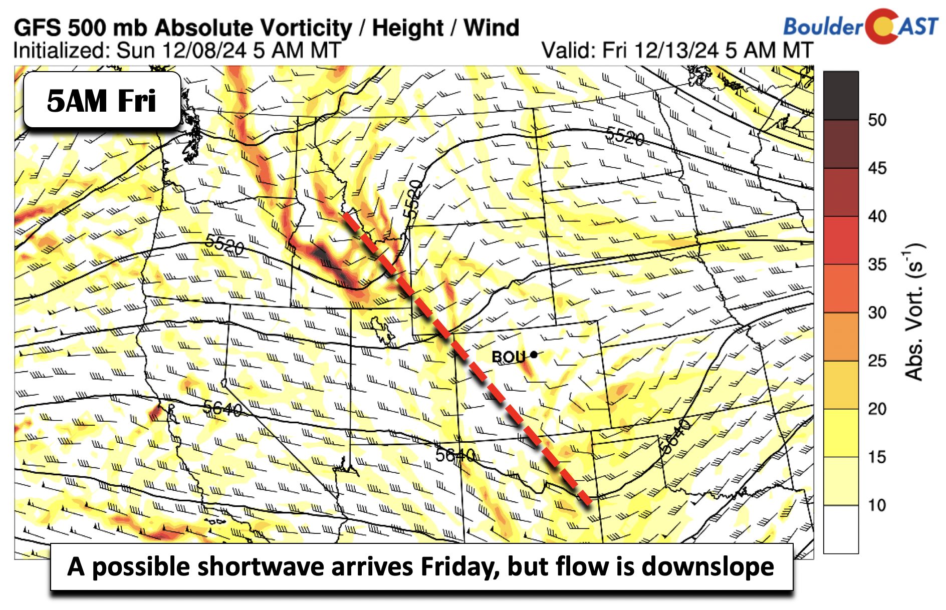
Friday’s fate is more uncertain, with models showing a shortwave trough tracking through in the westerly flow. Perhaps the ECMWF is the most developed with the system. It shows a fairly broad area of clouds and potential light precipitation for the Front Range (rain/snow mix or all snow). The GFS is weaker, seen below. For now, we will mentioned only a slight chance of rain/snow but we will continue to keep an eye on this late-week shortwave. All in all, expect highs potentially slightly cooler in the middle 40s to lower 50s for Friday.
Enjoy the week — and if you missed our retelling of the record wet November for eastern Colorado, find that HERE!
Forecast Specifics:
Monday: Brief morning sun possible, then mostly cloudy with light scattered snow showers during the afternoon and evening. Light accumulations of an inch or less possible in south and west sections of the Front Range, with up to 4″ in the Foothills of Jefferson County. Highs in the mid to upper 30s in the Denver Metro and upper 20s in the Foothills.
Tuesday: Sunny and cold with mid to upper 30s on the Plains and middle 20s in the Foothills. Breezy with northwest winds gusting up to 25 MPH during the day.
Wednesday: Staying sunny but turning warmer with upper 40s to near 50 on the Plains and upper 30s in the Foothills.
Thursday & Friday: Partly to mostly cloudy with highs around 50 degrees for the Plains and upper 30s in the Foothills. There may be a slight chance of snow or a mix Thursday night or on Friday, but this remains fairly uncertain.
Weekend: Likely staying mild, dry and sunny with temperatures in the 50s.
Get BoulderCAST updates delivered to your inbox:
DISCLAIMER: This weekly outlook forecast is created Monday morning and covers the entire upcoming week. Accuracy will decrease as the week progresses as this post is NOT updated. To receive daily updated forecasts from our team, among many other perks, subscribe to BoulderCAST Premium.
Daily Forecast Updates
Get our daily forecast discussion every morning delivered to your inbox.
All Our Model Data
Access to all our Colorado-centric high-resolution weather model graphics. Seriously — every one!
Ski & Hiking Forecasts
6-day forecasts for all the Colorado ski resorts, plus more than 120 hiking trails, including every 14er.
Smoke Forecasts
Wildfire smoke concentration predictions up to 72 hours into the future.
Exclusive Content
Weekend outlooks every Thursday, bonus storm updates, historical data and much more!
No Advertisements
Enjoy ad-free viewing on the entire site.
Enjoy our content? Give it a share!




You must be logged in to post a comment.