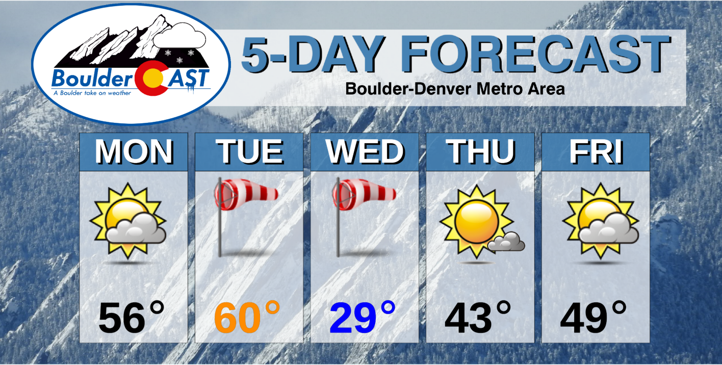
After a breezy last couple of days, the holiday week starts out calm and mild for the first official day of winter. A midweek cold snap will ensue, along with a slight chance of snow showers. The Christmas forecast is looking dry, although there are signs that a more active pattern could develop for late December.
This week’s highlights include:
- A ridge of high pressure settles in for the beginning of the week
- A fast moving system Tuesday night ushers in a brief cold snap and possible light snow
- Christmas Day is looking dry at the moment with temperatures seasonal
DISCLAIMER: This weekly outlook forecast is created Monday morning and covers the entire upcoming week. Accuracy will decrease as the week progresses as this post is NOT updated. To receive daily updated forecasts from our team, subscribe to BoulderCAST Premium.
High pressure settles in for the start of the holiday week
This past weekend’s gusty westerly winds will be taking a break for the next couple of days.
We've only reported wind gusts up to 33 MPH at our station in Boulder today, but the winds are REALLY ripping in the Foothills and along Hwy 93 in west Arvada…up to 60 to 85 MPH in some cases.
More current obs: https://t.co/bg05MBitWz#COwx #HighWindWarning #Windy #Boulderwx pic.twitter.com/cVMW0TR7kL
— BoulderCAST Weather (@BoulderCAST) December 20, 2020
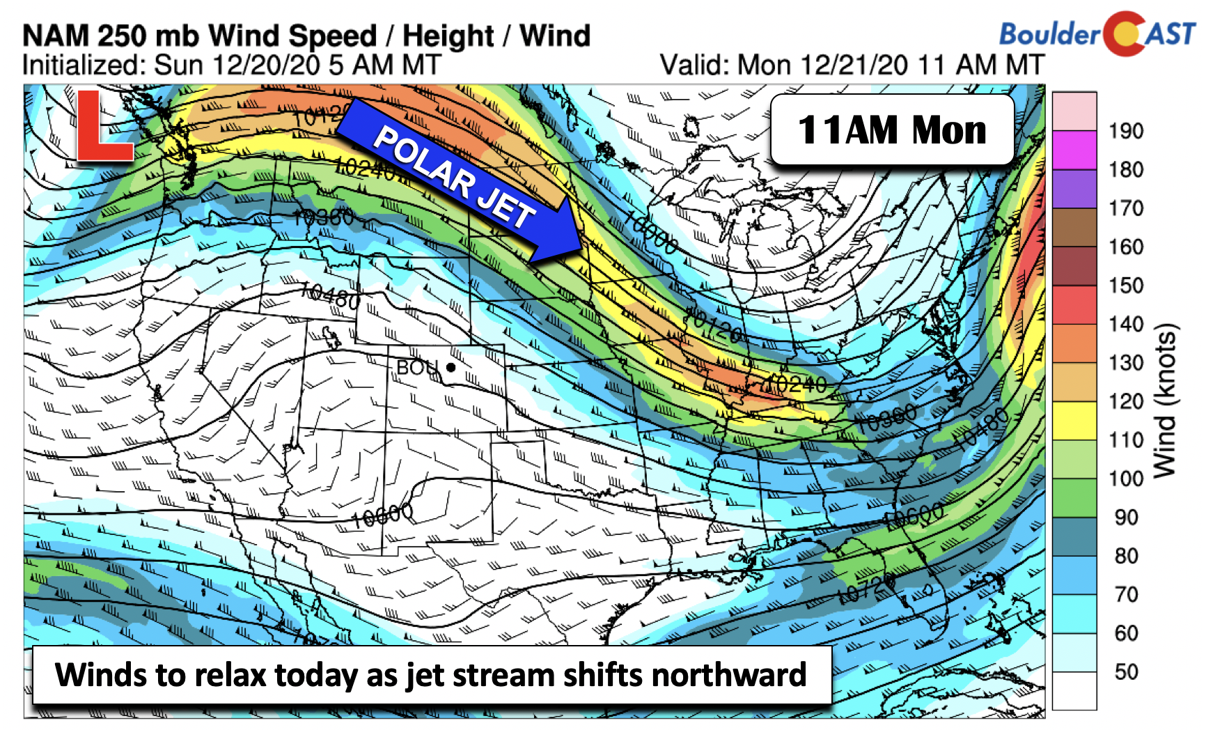
The close proximity of the polar jet stream, which led to the breezy conditions, will be shifting northward this afternoon through early tomorrow (below). While some gustiness is possible for the early part of today, winds will weaken this afternoon and with skies remaining partly cloudy.
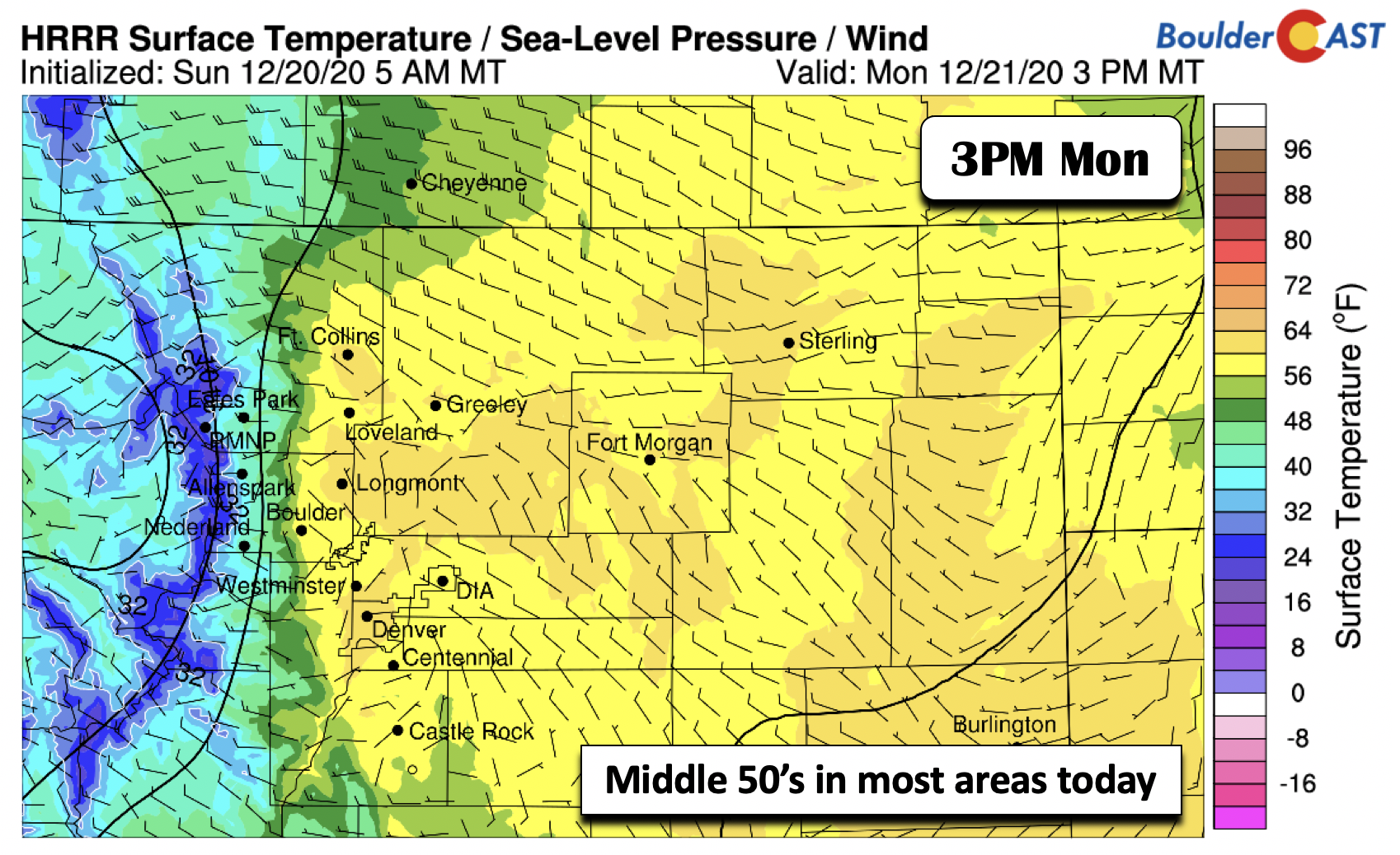
A downslope flow pattern will also take hold to begin the week. Sunday, highs were in the lower 50’s. With the airmass warming a tad today and tomorrow, highs these next couple days will be in the mid to upper 50’s, to even near 60 degrees on Tuesday. This will put us about 15 degrees above average for first official day of winter. Get outside and enjoy the nice weather while you can!
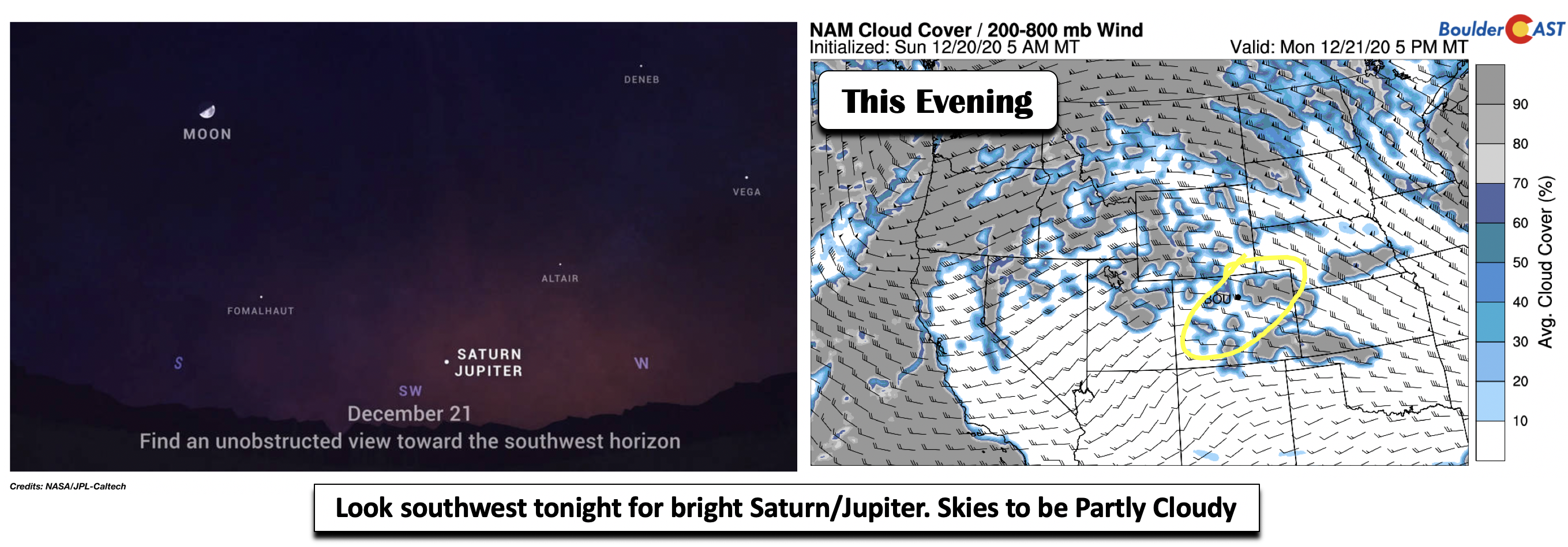
If you have a chance to step outside tonight after sunset, look to the southwest to see what has been known as the “Christmas Star”, a great conjunction of Jupiter and Saturn. It has been 400 years since the planets passed this close to each other in the night sky, and almost 800 years since this occurred at night. You should have no issues seeing this with your naked eye, but a telescope is always helpful. Skies will see a mixture of clouds but should be clear enough to get a decent view on this night of the winter solstice.
A midweek cold snap
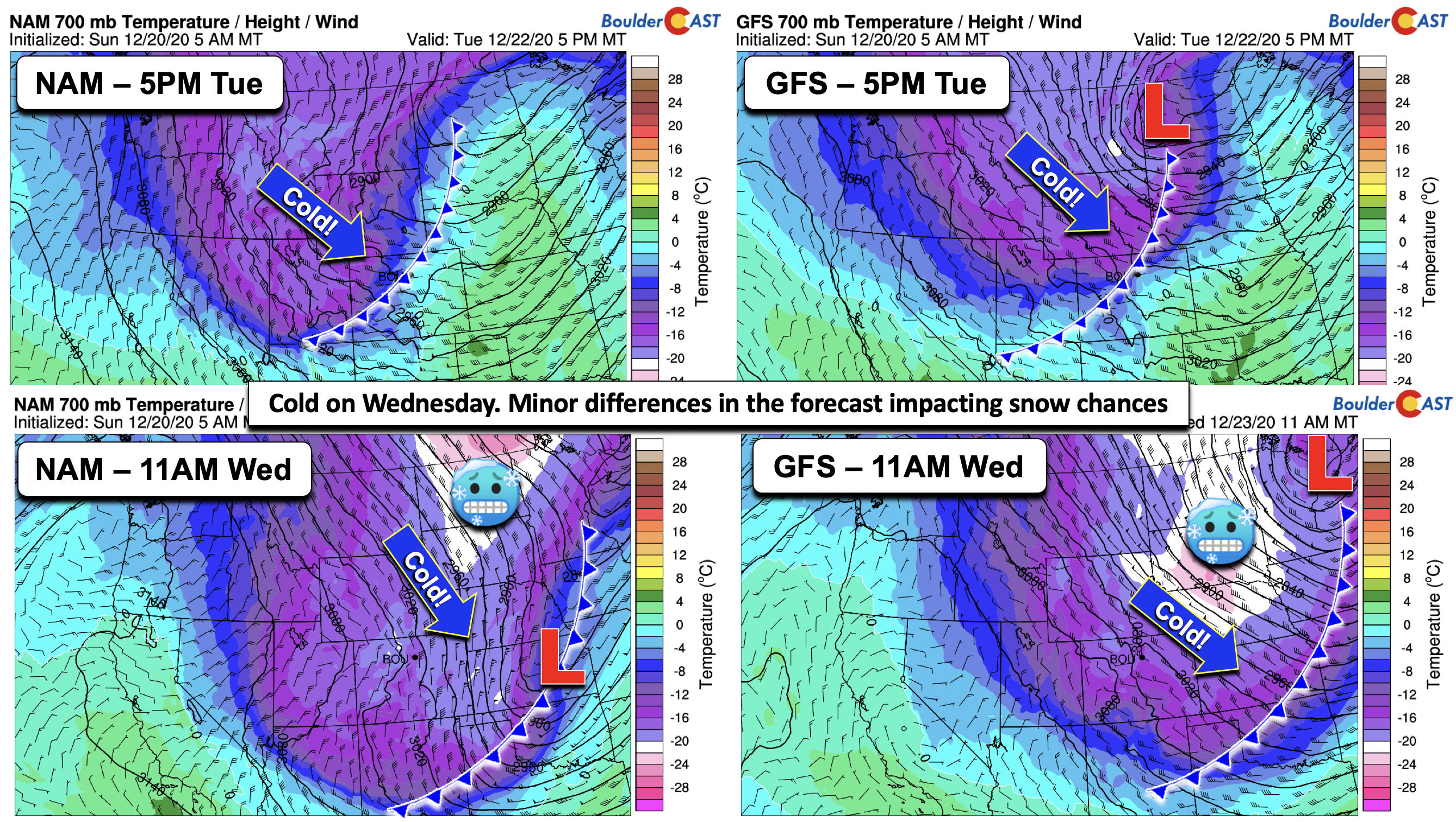
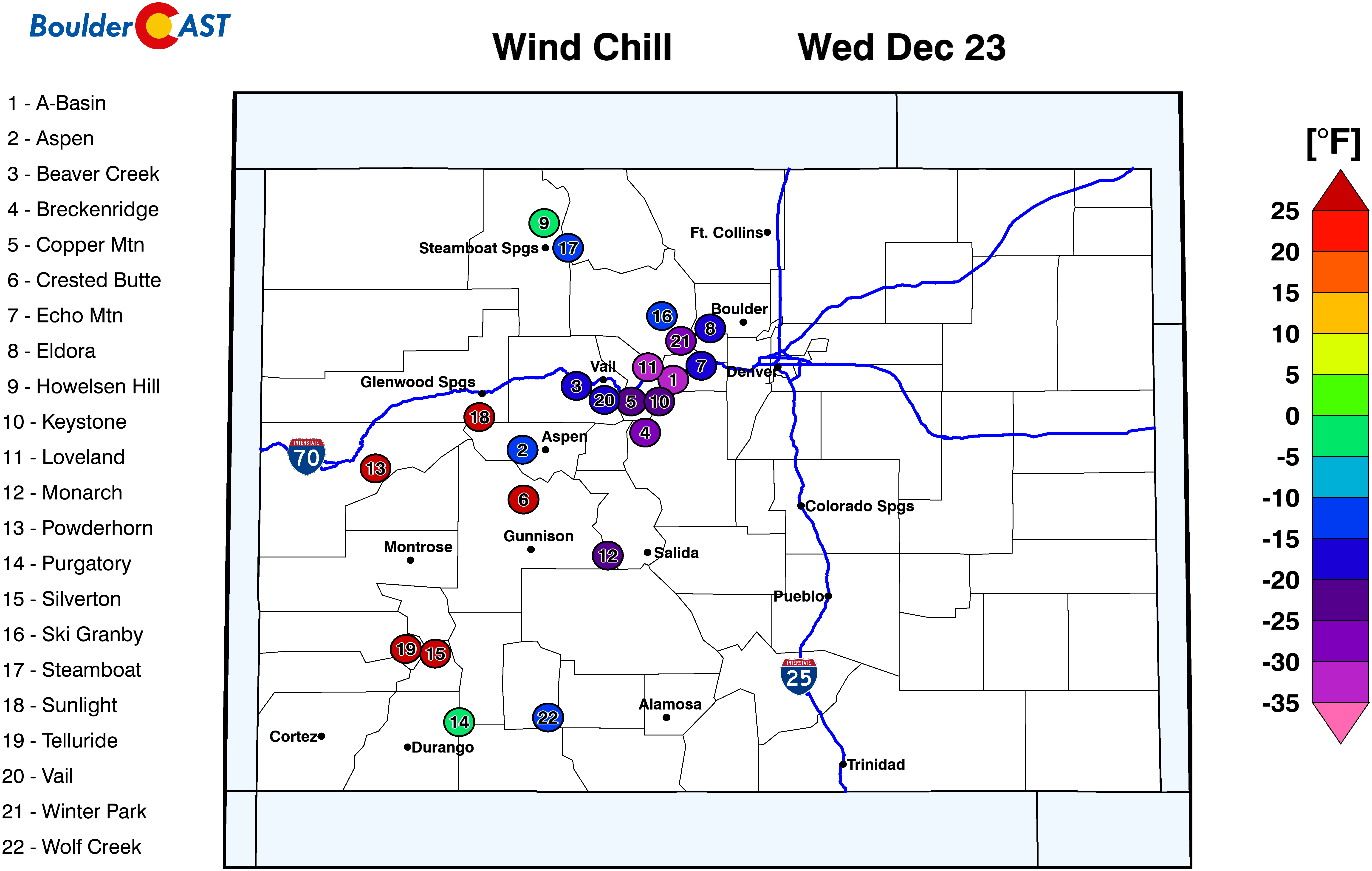
A dip in the jet stream returns late Tuesday and Wednesday. Thus, after temperatures near 60 on Tuesday, the bottom will fall out Tuesday night. While the forecast guidance agrees overall on the cold snap midweek, there are some slight differences in how the models portray the frontal passage and the resultant wind flow pattern. As early as 24 hours ago, the models were quite different so it is nice to see better agreement. Nevertheless, the GFS and NAM models still show some discrepancies worth noting. The GFS (top right panel in below figure) shows a low pressure over North Dakota Tuesday night, while the NAM (top left panel) just has the cold front. By Wednesday morning, the GFS continues to show a deep area of low pressure over the upper Midwest (bottom right panel), while the NAM has a weak area of low pressure over Kansas.
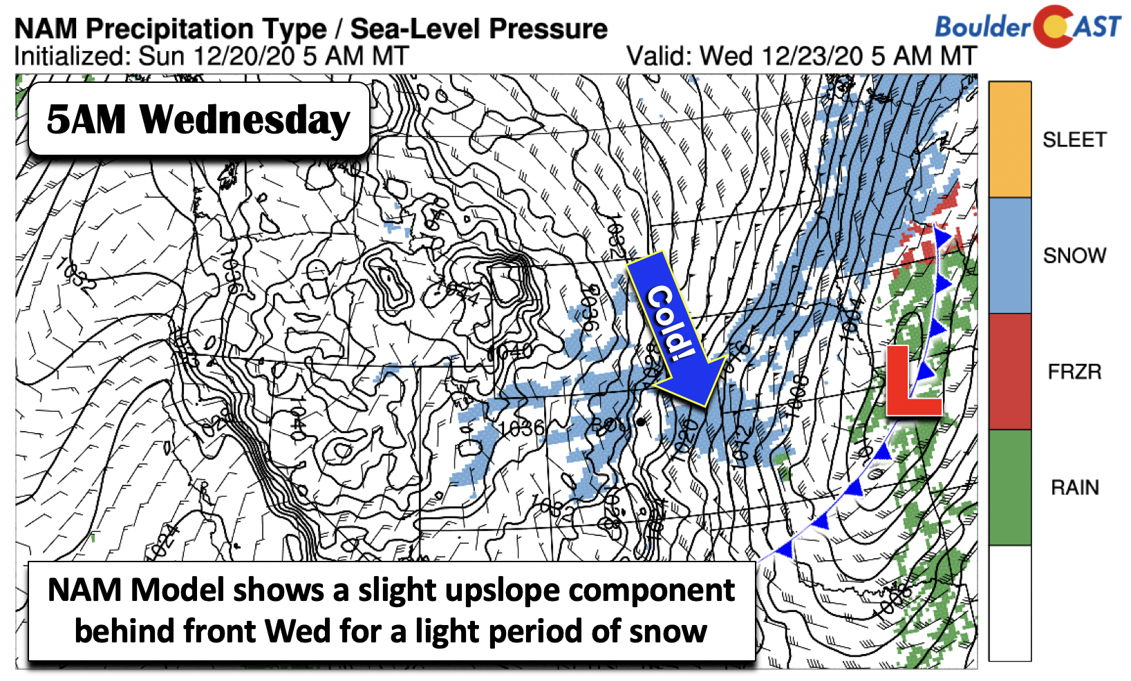
While these differences may seem subtle, the exact placement and orientation of the pattern will largely dictate our snow chances Tuesday night and early Wednesday. It is going to be cold no matter what, with gusty winds returning Tuesday night and highs likely in the upper 20’s on Wednesday. As for our snow chances, the GFS is much faster with the trough and exhibits a more west-northwest downslope flow for the Denver Metro area, largely sparing us from snow. The NAM largely shows this pattern as well, but it has a slight upslope component during the morning hours on Wednesday (below), leading to a short period of light snow.
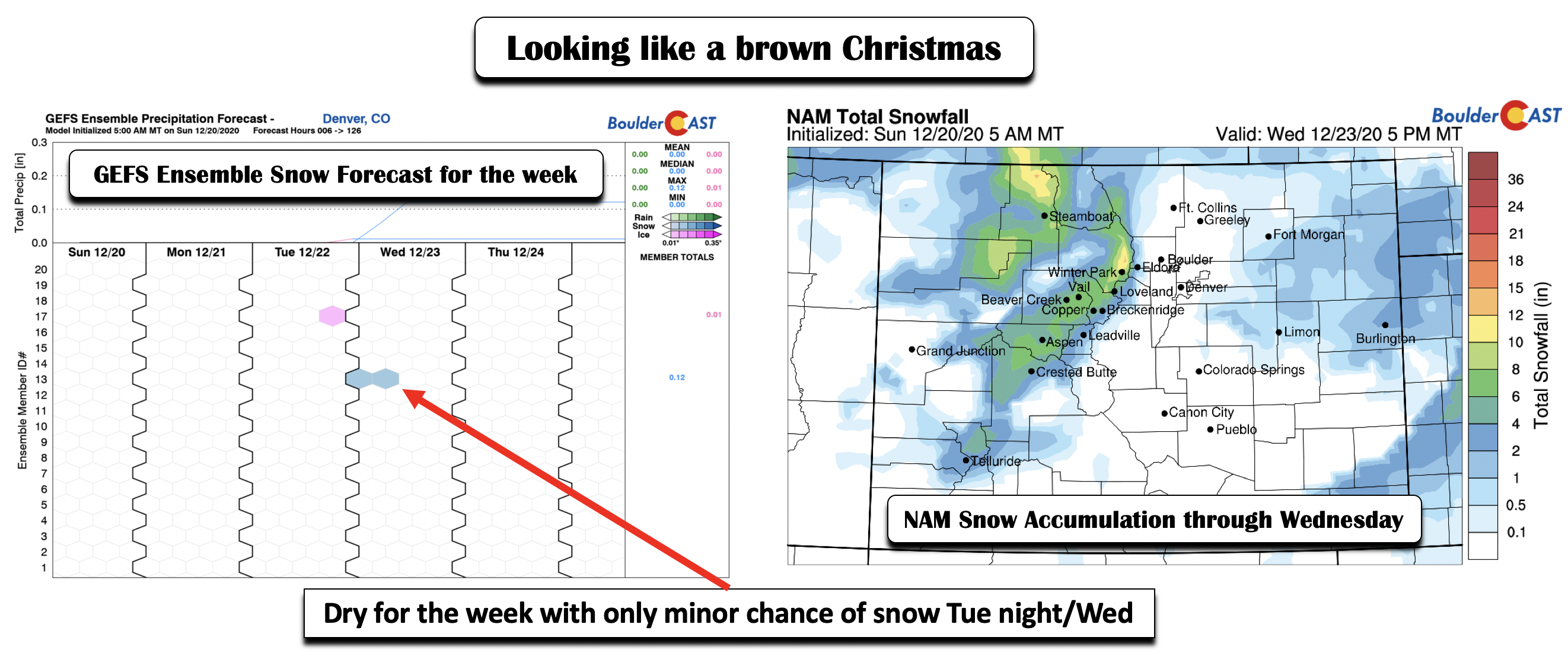
Even with these differences, the NAM’s total snowfall forecast through Wednesday (below right) keeps the snow east and south of the Denver Metro area. The ensemble snowfall forecast for the week is also rather devoid of snow chances (below left). Thus, at best, a 20-30% chance of snow is possible late Tuesday night and very early Wednesday given the current unfavorable track. However, a slight change in the overall pattern could mean a difference between a trace and a few inches of snow. At this stage, we think that is unlikely but we will continue to monitor it.
Christmas looking dry at the moment
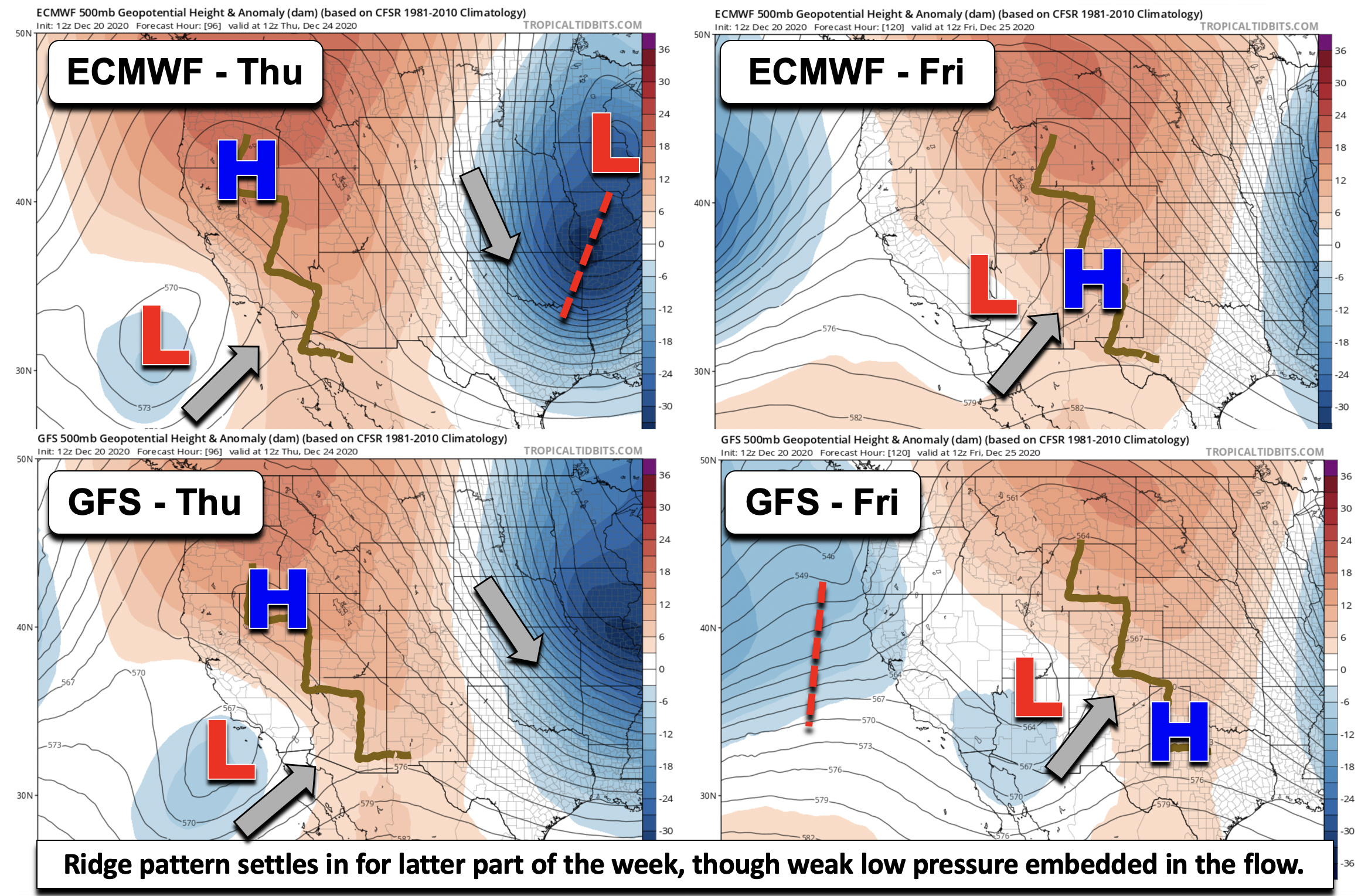
After the midweek cold snap, another weak ridge of high pressure settles in for Thursday and Christmas Day. However, as we saw with some differences in the forecast Wednesday, there are subtle variants by Christmas as well. Shown in a 4-panel figure below is the comparison between the ECMWF and GFS forecast models for Thursday (left panels) and Friday (right panels) using the 500-mb height and anomaly pattern. There is good agreement that the trough that brought the cold late Tuesday and Wednesday will shift east into the Midwest by Thursday. In its wake, temperatures should moderate into the lower 40’s with sunshine. Come Christmas day, both models have weak ridging stretching from Wyoming into New Mexico. Yet there is a weak cutoff area of low pressure over Arizona that will more or less undercut the ridge. This will likely lead to increasing clouds on Friday and possibly a chance of snow for the weekend as the polar and subtropical jet streams become more active with moisture returning.
Will it be a White Christmas this year? Most likely not, though there is plenty of snow on the ground already in the Mountains west of the Continental Divide. Look on the bright side…any holiday travel plans should go unhindered across the lower elevations this year.
If we don’t catch you before the end of the week…
From all of the BoulderCAST Team,
we wish you a Happy Holidays!
Forecast Specifics:
Monday: Morning clouds giving way to partly cloudy skies. Temperatures in the middle 50’s over the Plains and lower 40’s in the Foothills.
Tuesday: Mostly sunny and mild to start with highs near 60 on the Plains and middle 40’s in the Foothills. Breezy and much colder Tuesday night with a slight chance of snow showers.
Wednesday: A slight chance of light snow in the morning, otherwise partly sunny, breezy, and chilly with highs in the upper 20’s on the Plains and upper teens for the Foothills.
Thursday: Mostly sunny and cool with highs in the lower 40’s for the Plains and lower 30’s in the Foothills.
Friday: Increasing clouds with highs in the mid to upper 40’s on the Plains and middle 30’s in the Foothills.
Mountains: Some lingering snow showers will persist for a portion of the day Monday. Otherwise, dry weather takes over. Snow showers, gusty winds, and colder temperatures arrive Tuesday and Wednesday, with snow totals in the 3-6″ range along and west of the Divide. Drier weather takes over for Thursday and Christmas day.
Help support our team of Front Range weather bloggers by joining BoulderCAST Premium. We talk Boulder and Denver weather every single day. Sign up now to get access to our daily forecast discussions each morning, complete six-day skiing and hiking forecasts powered by machine learning, first-class access to all our Colorado-centric high-resolution weather graphics, bonus storm updates and much more! Or not, we just appreciate your readership!
.
Spread the word, share the BoulderCAST forecast!
.





You must be logged in to post a comment.