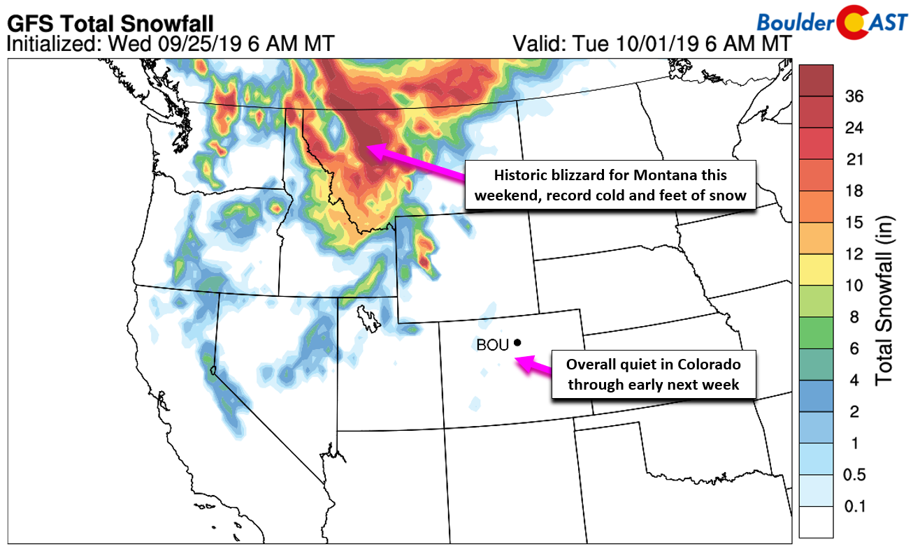
An extraordinary winter storm is taking aim on the northern Rockies this weekend. Fortunately (unfortunately?), the feet of snow in the forecast are not for Colorado. We take a look at this classic upslope event and also discuss the impacts that this historic system with massive breadth will have on our area.
T
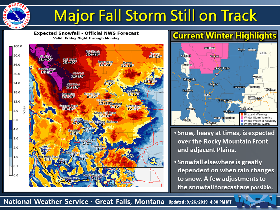
he first winter storm of the season will drop sternly into the Pacific Northwest over the next few days and it’s shaping up to be a MAJOR one. A blob of very cold Canadian air will topple snow levels in many areas beginning Friday evening, with a large portion of the northern Rockies and Cascades set to see their first significant snowfall of the season. Areas near and east of the Continental Divide are bracing for 2 to 4 feet of upslope snow.
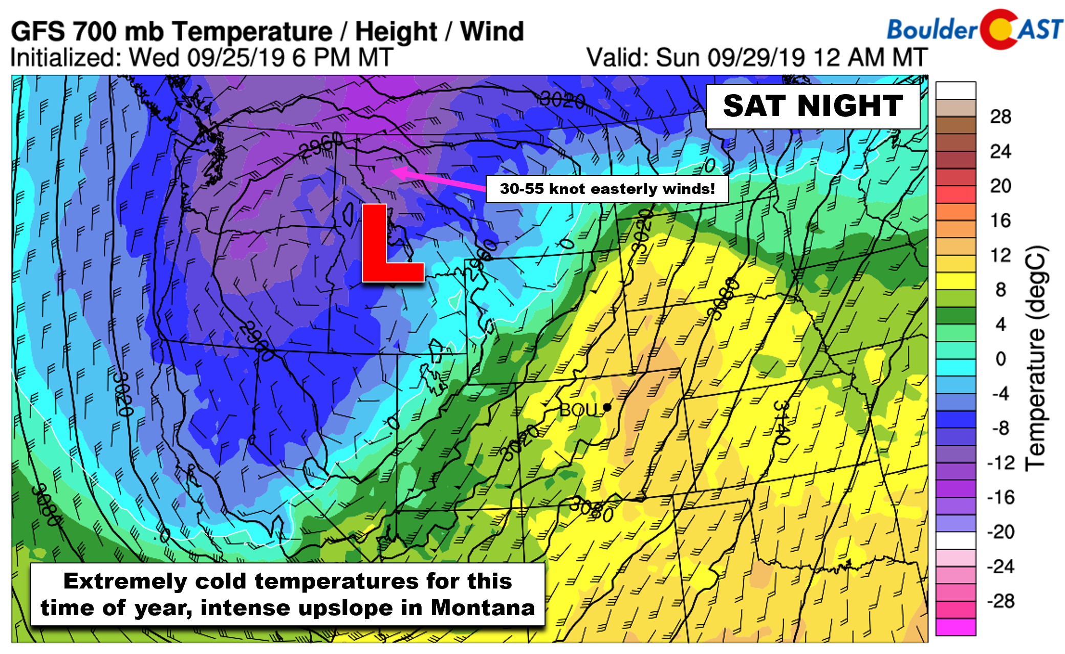
The “eye” of the storm is a very deep and cold low pressure, with an incredible setup developing around it for heavy wet snow and possible blizzard conditions in western Montana and Alberta. Moist southwest flow aloft will combine with intense northeasterly upslope for nearly the entire weekend ahead. It’s truly shaping up to be a historic storm, not just for being so early in the season in September, but for any time of year. And yes, this is the exact breed of storm that could absolutely dump feet of snow over Boulder and Denver, you know….if it had maneuvered about 600 miles further south.
The latest bulletin from the National Weather Service in Great Falls is getting folks prepared for the worst, which in some cases is more than 50″ of snow…
URGENT – WINTER WEATHER MESSAGE
National Weather Service Great Falls MT
301 PM MDT Thu Sep 26 2019Heavy snow expected. Blizzard conditions possible.Total snow accumulations of mostly 15 to 36 inches on the plains, but even higher amounts expected in the mountains. North to northeast winds of 15 to 30 mph could gust as high as 40 mph, causing dangerous wind chill temperatures of zero to 10 degrees above zero.
Extreme impacts possible. Widespread tree damage is possible with wet heavy snow and strong winds impacting trees with foliage. Downed power lines are also possible, resulting in widespread power outages. Agricultural interests; outdoor recreational interests, including camping and hunting activities; and travel will also be negatively impacted.
This has the potential to be a historically significant early-season snow event. Now is the time to prepare for the winter-like weather!
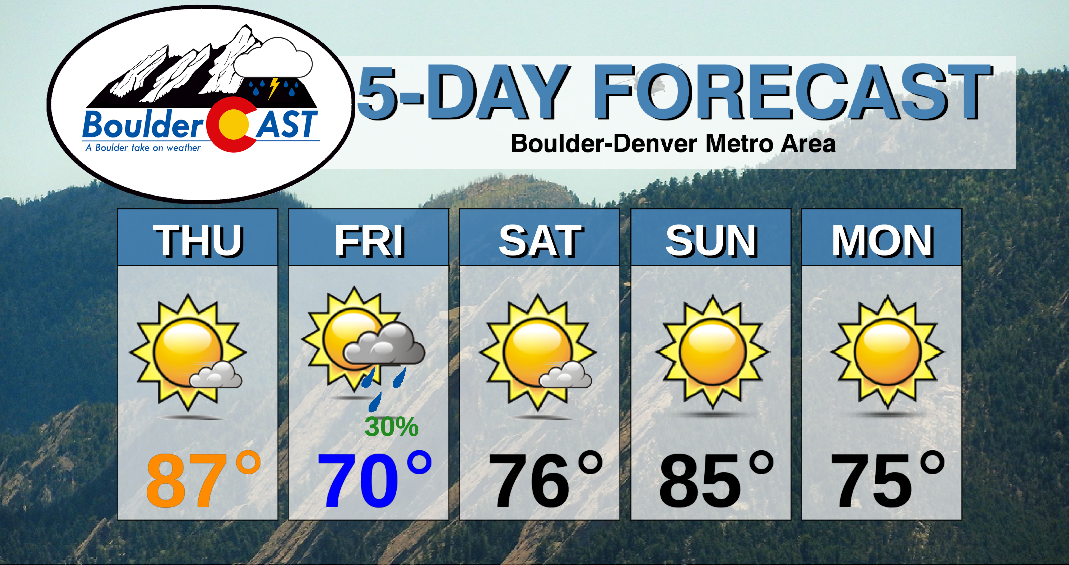
The historic storm system unfortunately won’t make much eastward progress in time. A blocking high pressure over the southeast United States has another opinion on the matter. Outside of a few gloomy rain showers Friday evening in the Metro area and some late-day spotty showers in the Mountains this weekend, weather in Colorado will remain pleasant into early next week. It’s a massive storm and Colorado will largely stay in the warm, windy, and dry downslope sector over the weekend.

Four-panel GFS forecast plot for next Tuesday morning. The historic storm will be held at bay by a blocking high, but cooler more seasonal air will filter into Colorado.
Nonetheless, eventually by Monday or Tuesday of early next week, a strong jet will be over northern Colorado and a series of autumn cold fronts are likely to push through. Boulder hasn’t had a day with high temperatures in the 60’s since mid-June. We promise you…that will happen sometime next week! If things go as planned, we could also be looking at our first frost around the mid to latter part of next week compliments of the storm system at-hand.
Share this winter weather story:
.


You must be logged in to post a comment.