Welcome to the month of July! Read our forecast for the upcoming week, including details on the Fourth of July holiday’s chance for thunderstorms.
Tag: wildfire (Page 1 of 4)
Thanks to several occurrences of localized jet-forced banded snow, the month of February saw stark differences in snow amounts across the Metro area. We recap the month and also take a look at the current standings in the 3-Month Snowfall Forecast Contest.
Beginning last Friday, snowfall has been falling intermittently across the Mountains of Colorado resulting from several shortwaves and pockets of moisture hanging out in the northwest flow. The most recent pulse which occurred from Monday morning into Tuesday afternoon generated snow totals of 7 to 15″ across much of the High Country. For the first time this winter, skiing was actually decent on Tuesday! Despite this, snowpack remains disconcertingly low statewide. We check-in on the status of our snowpack and provide our thoughts on another system eyeing the Front Range this weekend.
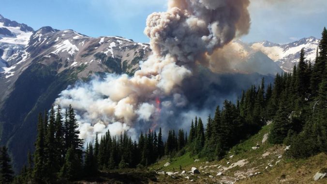
Historical warmth and persistently dry conditions have spawned numerous wildfires across the Pacific Northwest and British Columbia over the past few weeks. With a change in our synoptic flow direction yesterday, thick smoke has pushed into the Denver Metro area creating reduced visibility and air quality. We examine how the smoke got here and how the forecast for the weekend is shaping up.
After experiencing near-record snowfall last winter with a historically strong El Niño in place, the better part of the last year has seen below normal precipitation across most of eastern Colorado. Drought has continued to expand and intensify through the winter season. However, a fruitful pattern shift is ahead, beginning with our first spring storm of the year! Continue reading as as we provide an update on the drought and our thoughts on the upcoming storm.
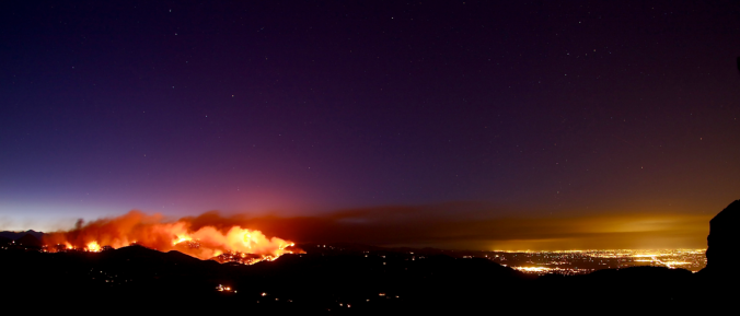
Happy First Day of Spring! As smoke spewed from the mouth of Sunshine Canyon yesterday, the extent of the wildfire threat become more obvious than ever. The fire ignited late Saturday night following what has been more than three weeks in Boulder without measurable precipitation. We have some good news…the week ahead should offer some reprieve for the extremely dry weather of late. In fact, we have a chance of precipitation in the forecast each and every day this week. We’re also tracking a potential spring storm late in the week. Continue reading for our complete weekly outlook including our thoughts on the potential for accumulating snow.
With another month behind us, we once again have to talk about record warmth and continued drought for the Front Range. Is the weather pattern finally set to change as we begin the month of December? Read on as we examine Boulder’s climatology and consider the current state of the atmosphere to give our outlook for the next month. We also touch on the potential for a snowstorm next week.
We’ve had quite an unbelievable stretch of weather the past several weeks. However, the bad news is that there hasn’t been any rain in a long time. In fact, Boulder County is once again under a fire ban. We really could use rain or snow, but this week will unfortunately not bring any respite from the dry spell. This first half of the week will focus on a weak shortwave and mountain snow, with the latter week featuring warmer weather and a potential cold front. Read on for our full forecast.
© 2026 Front Range Weather, LLC


