In today’s forecast, we cover a quick-hitting Pacific trough set to bring cooler temperatures and gusty winds to the Metro area today. We also provide an update on the major spring storm eyeing Colorado late in the week.
Tag: rain (Page 2 of 2)
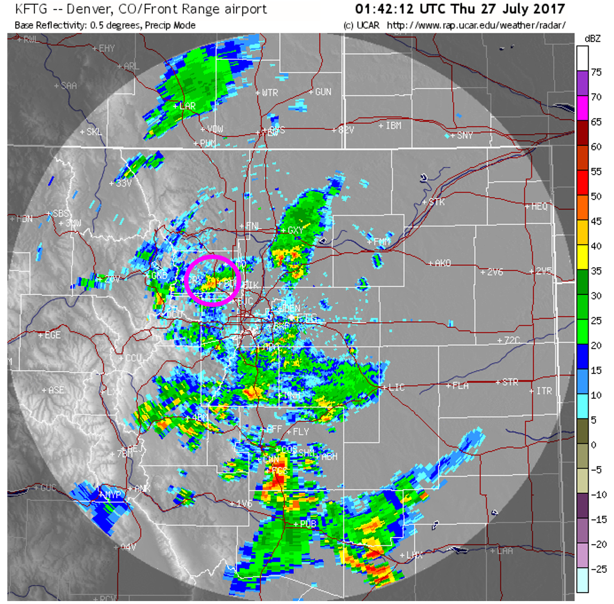
How about that slow-moving monsoon storm last night in Boulder….definitely our most intense rainfall since late last summer. Between 7and 9 PM, 0.5 to 1.0″ of rain was recorded as torrential rain pounded the city. The radar image from 7:42 PM is below, with the storm that affected Boulder circled in pink.

Radar image from Wednesday night at 7:42 PM. Monsoon storms!
Yesterday had a lot of solid meteorology working together to produce the heavier rainfall. Today we will not see quite as favorable of conditions. Moisture has dropped and the frontal boundary has pushed well south and east.
After morning sun, expect partly cloudy skies in the afternoon and storms forming after 2PM, first across the higher elevations. We expect storm coverage to be isolated across the Metro area, with scattered activity in the Foothills (especially south and west of Denver). Highs will remain cool in the lower 80’s.
Unsettled conditions will remain through the upcoming weekend, with at least isolated chances of storms each day.
Fujiwhara Effect!
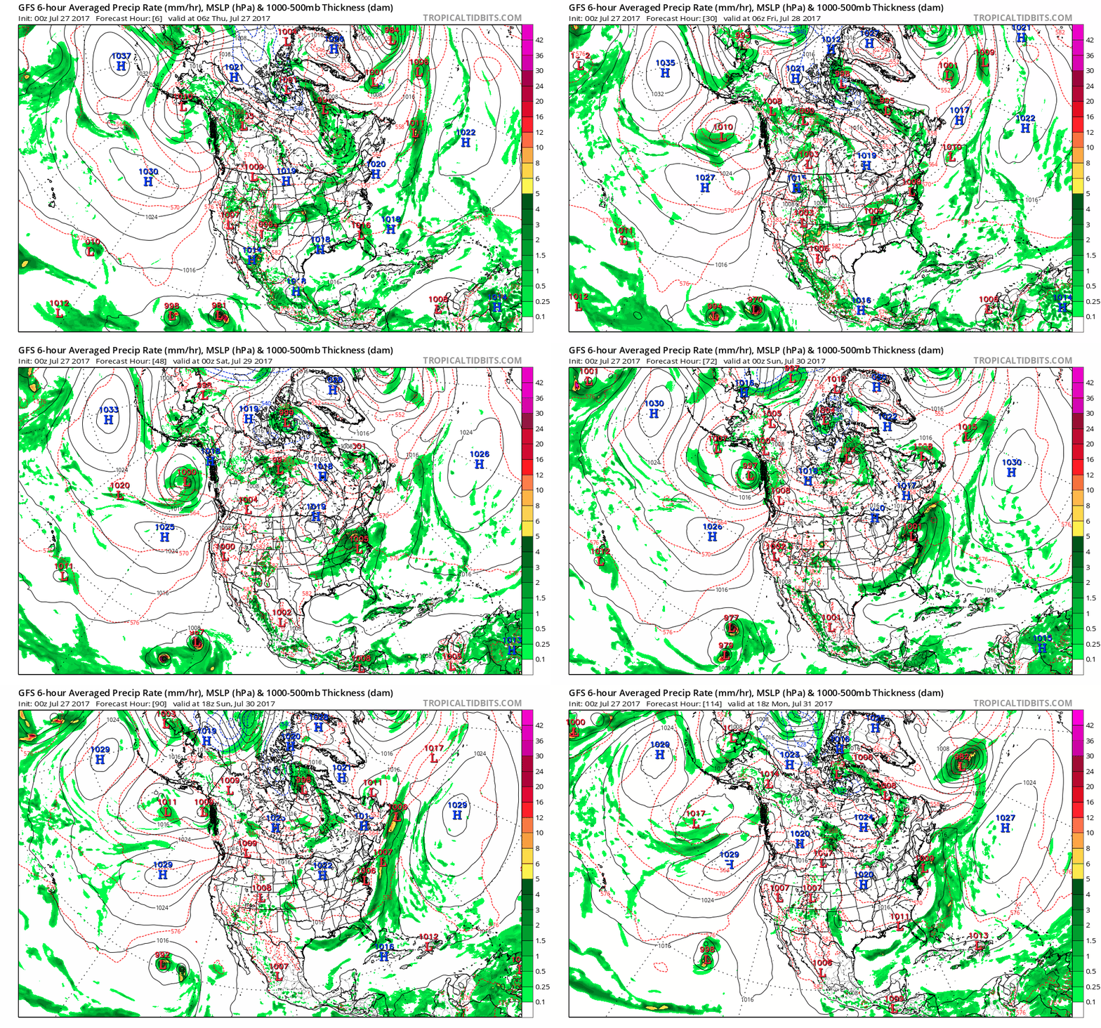
While checking the health of our monsoon flow for this forecast, I noticed a rare phenomenon in the models that is expected to happen between two tropical systems off the western coast of Mexico in the coming days. It is known as the Fujiwhara Effect and it happens when two nearby low pressure systems (normally tropical cyclones) orbit each other and spiral closer together. You can see this happening in the animation below between Tropical Storm Irwin (left) and Hurricane Hilary (right). Here is some additional reading from Wikipedia on this rare effect if you are interested.

Animation showing a likely Fujiwara interaction between two tropical cyclones off the western coast of Mexico this weekend.
Remember, these daily forecasts are Premium content. Periodically, we open this forecast up to all of our readers. Today is one of those days!
Sign up today to get the best BoulderCAST experience, including these forecasts every day, extended and enhanced graphical forecasts, chat room and forum access, complete 6-day hiking forecasts, early viewing of select content and much more!
Through the end of the month, in celebration of the launch of SummitCAST, use the promo code SUMMIT to receive 33% off an annual subscription to BoulderCAST Premium. LEARN MORE
Much of our region has missed out on the monsoon thunderstorms so far. As we move into the last week of July, Boulder’s monthly rainfall total rests at just 0.32″. Normal for the month of July is right around 2″, so this is well below average. The week ahead will offer a resurgence of monsoon moisture to northeast Colorado. However, as always, not everyone will see the much needed soaking rains.
The first of two spring storms that we detailed in our weekly outlook arrives today and lingers into Wednesday. We provide a brief update and discuss which areas will see snow and which stay mostly rain.
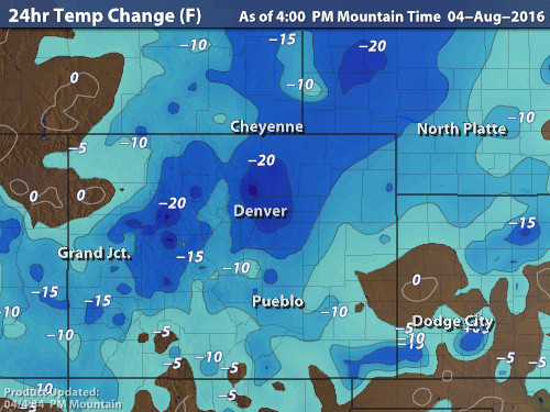
Cooler weather and beneficial rains are spreading across the Front Range as monsoon moisture collides with a cold front on our doorstep. Continue reading for rainfall amounts, timing, and when to expect that brutal August heat to return.
© 2026 Front Range Weather, LLC


You must be logged in to post a comment.