The first high wind event of the “winter” season is upon us. We touch on why these type of downslope events happen, and provide details on the timing and intensity of the strongest winds.
We alerted you to the potential for a high wind event in our weekly outlook yesterday. The models remain consistent in showing very strong winds developing across the Front Range tonight and lingering into Wednesday afternoon. High Wind Warnings are posted for northern Colorado and much of Wyoming at the moment. This includes the western Denver Metro area above 6,000 feet elevation.
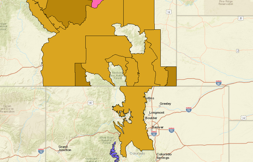
High wind warnings (light brown) and watched (dark brown) are posted across the region for tonight and tomorrow.
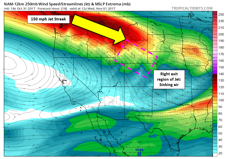
The source of these high winds is a 160 mph jet streak located to our north. Northern Colorado will be in a favorable location for sinking air in the right-exit region of this jet. This location combined with amplification from the mountains will allow these fast winds to mix downwards along the eastern slopes of the Rockies into the Foothills tonight and tomorrow. Air that normally rests many thousands of feet above ground-level will be “pushed” downwards towards the surface.
Fun fact: During snowstorms, we want to be in the left-exit region of the jet, where rising motion is enhanced. This will produce added lift to enhance snowfall rates and in some cases, jet-forced heavy snow bands. For wind storms, we need to be on the opposing side where sinking air is favored.
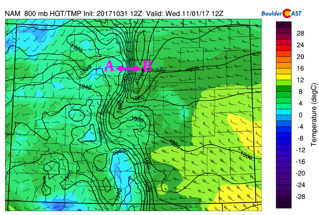
One parameter we like to use to forecast the intensity of wind storms for the Denver Metro area is the 800 mb geopotential height difference between Granby and Boulder (points A <-> B on the graphic below).
Geopotential height is “math-heavy” quantity that meteorologists use to forecast winds in the atmosphere, among other things. For the purposes here, consider geopotential height akin to pressure. Winds move from higher to lower heights, and the larger the gradient, the faster those winds move. A difference of 60 meters between Boulder and Granby is often enough to create strong winds. When this difference approaches 100 meters, the effects can be quite significant in the Foothills.
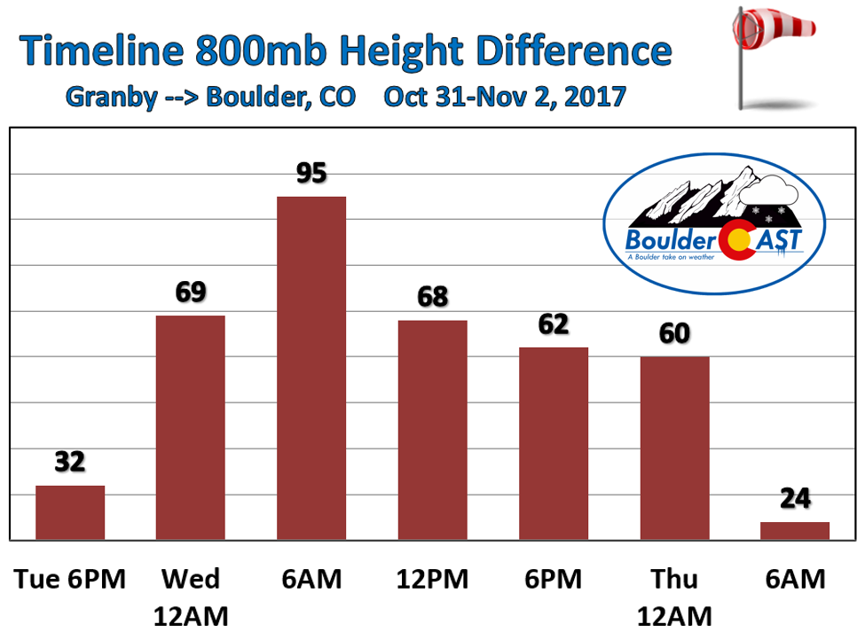
The timeline of the 800 mb height difference is shown below. We’ll exceed 60 meters before midnight tonight and this continues into Wednesday evening. The height difference peaks around 95 meters before sunrise Wednesday morning.
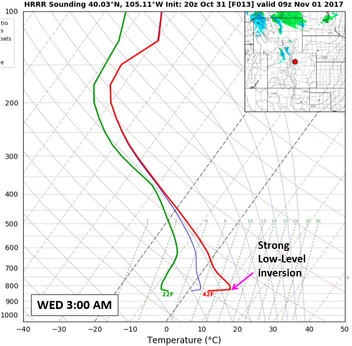
We’re expecting sustained winds of 30 to 50 mph with gusts to 70 mph overnight and early Monday morning in the Foothills. For the lower elevations, a strong low-level inversion from yesterday’s shallow cold front will protect us from a bulk of the action (see below).
Because the air about 1,000 feet above the surface is much warmer than ground-level, this will counteract some of the strong subsidence in the region, preventing those fast-moving winds from fully mixing down into Boulder and Denver. However, by late morning and early afternoon on Wednesday, solar heating will work to remove the inversion and bring down gustier winds to the Metro area. This will be towards the tail-end of the event, but we still expect a blustery day on Wednesday with winds gusting to around 40 mph at times. And hey, you sure can’t beat 70 degrees for the first day of November!

Wednesday forecast for Boulder (4:00 AM to 3:00 PM). Expect winds to pick up late morning and during the afternoon.
.




You must be logged in to post a comment.