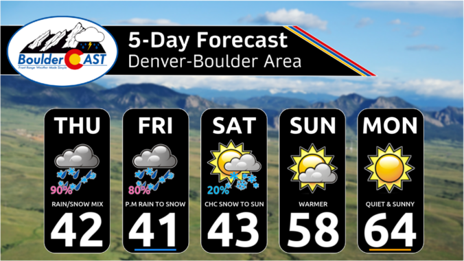
Today’s gloomy mix of rain/snow remains on-track for the Front Range, spreading into the area quickly this afternoon before ending around midnight. Most of the actual snow accumulation will occur in/near the Foothills, with minor travel impacts in the higher terrain where slushy roads will occur. Another similar round of mixed precipitation will unfold again Friday afternoon into Friday night, with light accumulations possible as well, especially after the sun goes down Friday evening. We discuss the latest forecast details, inbound snowfall potential and when warmer weather will return.
This content is for BoulderCAST Premium members only. Join Premium now to get access to our detailed forecast discussions for Boulder and Denver every single day, plus a bunch of other cool perks!
Daily Forecast Updates
Get our daily forecast discussion every morning delivered to your inbox.
All Our Model Data
Access to all our Colorado-centric high-resolution weather model graphics. Seriously — every one!
Ski & Hiking Forecasts
6-day forecasts for all the Colorado ski resorts, plus more than 120 hiking trails, including every 14er.
Smoke Forecasts
Wildfire smoke concentration predictions up to 72 hours into the future.
Exclusive Content
Weekend outlooks every Thursday, bonus storm updates, historical data and much more!
No Advertisements
Enjoy ad-free viewing on the entire site.


You must be logged in to post a comment.