It has been a dismal start to the snow season for the mountains and ski resorts. However, there is good news on the horizon as a strong low pressure system moves in tomorrow with several locales in the High Country seeing snowfall. How much? Will it be enough for a powder day? Read on for our first PowderCAST forecast of the season.
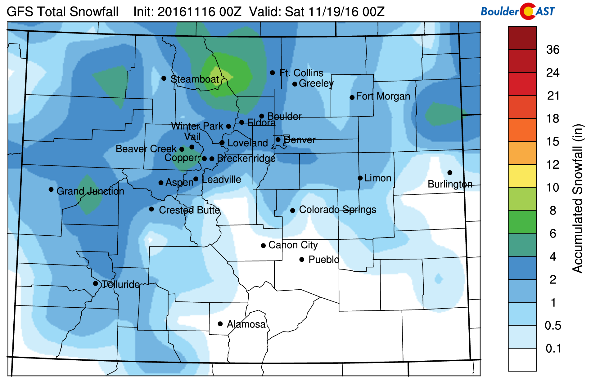
A strong low pressure system moves across Colorado Thursday and Friday, with snow beginning in the mountains Thursday morning. The system is a fast mover, moving out by late Friday night. Below shows the accumulated snowfall from the GFS from Thursday through Friday. It shows a large swath of snow across much of the high country, which includes several ski resorts. The GFS forecast would suggest the pontential for 3-7″ over the mountains. The GFS model is also indicating our first potential snow over the Plains. More details on that will be in a later post today…so stay tuned for that!

GFS accumulated snowfall through Friday
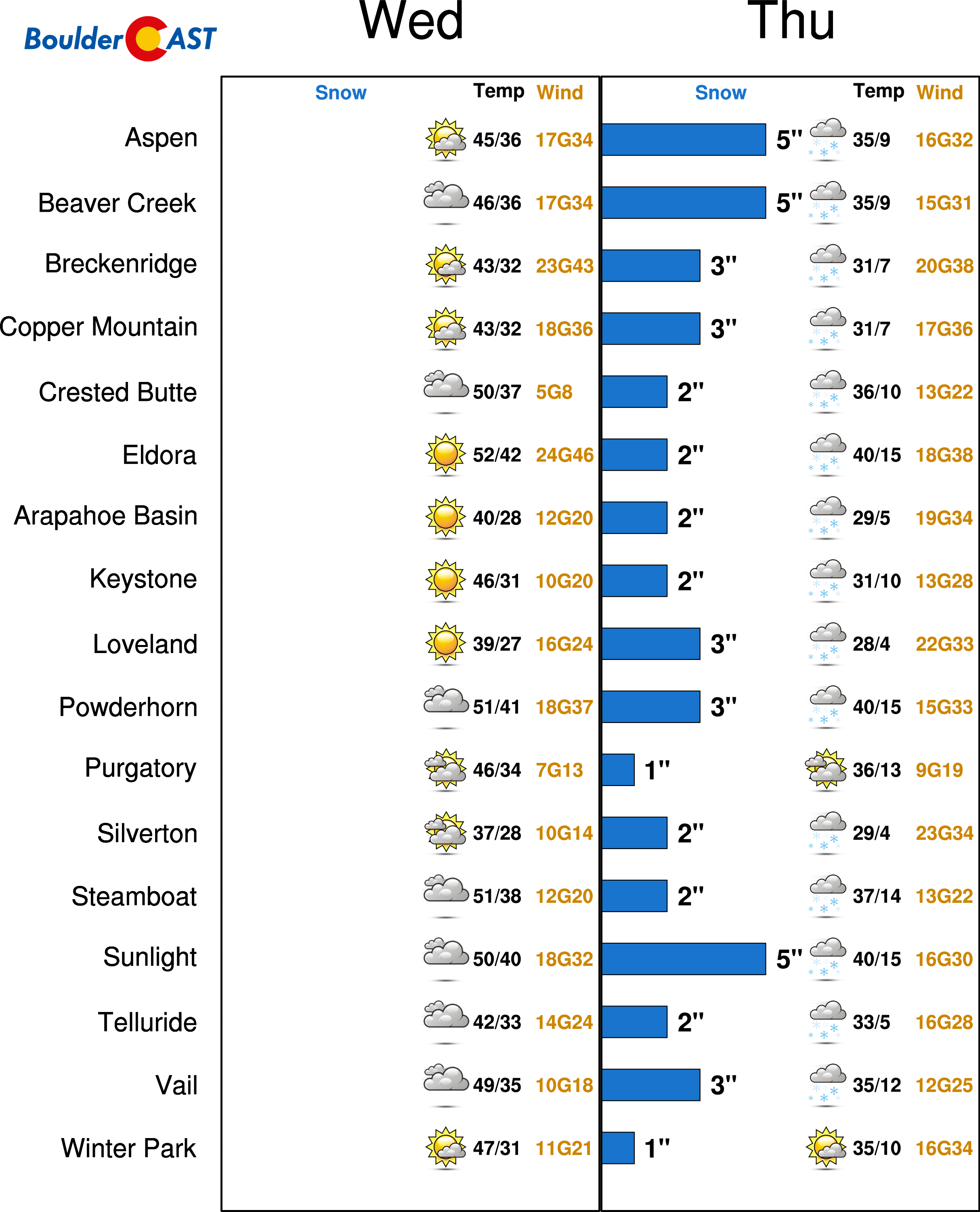
For a more in-depth comparison to see which resorts will get the most snowfall, here is a breakdown of the forecasted snow, high and low temperatures, weather conditions, and wind speeds for all the big resorts in Colorado. This product is a sign of a new feature set to launch here on BoulderCAST in the very near future: real-time PowderCAST forecasts updated four times per day for your skiing needs! Stay tuned! Our particular forecast today is showing anywhere from 3-5″ over several of the resorts. We would suggest skiing Friday as a result, which looks to be a good powder day! Unfortunately, with the lack of snowfall we have received this fall, conditions will likely not be ideal, but we will take what we can get. Besides, only a couple resorts are open so far anyways. Have a great day and happy snow!


You must be logged in to post a comment.