
Page 76 of 568

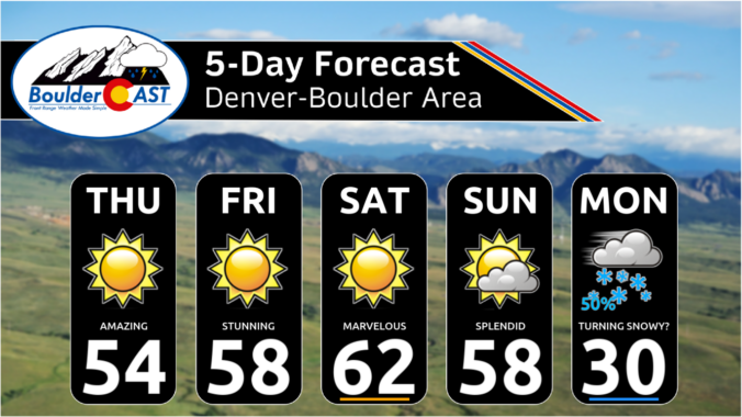

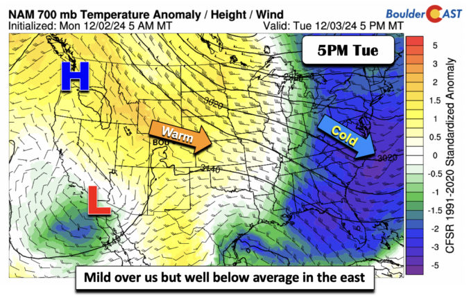
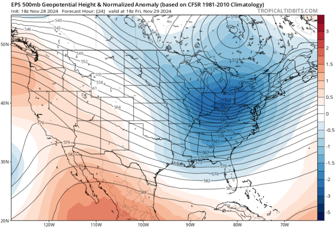
As we step into the first week of meteorological winter, the Front Range will feel like anything but. This week will feature pleasant weather thanks to a persistent and strong ridge along the West Coast. While the primary storm track remains off to the east, Colorado will enjoy above normal temperatures and dry conditions, day in and day out. Read on for all the details.


Live View of Boulder

Current Conditions

Live Radar

Recent Premium Posts

BoulderCAST Daily – Sat 05/30/26 | A stray shower today as most activity resides well east of Denver
🌦️ Spotty showers today, mainly well east of the Denver Metro area, where …
BoulderCAST Daily – Fri 05/29/26 | A Marginal Risk of Severe Isolated Storms
🌦️ Spotty showers this afternoon, mainly noon and 4 PM, with highs in …
This Weekend in Colorado Weather: Unsettled but Manageable as Low-End Storm Chances Hang Over the Front Range
🌎 Omega block holds through early next week, but slowly shifts toward the …
3-Day Forecast

Trending Content

© 2026 Front Range Weather, LLC