



Page 47 of 585
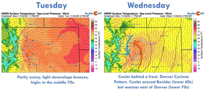
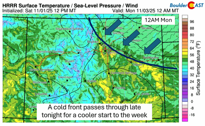
Sunday’s record-breaking November heat will give way to a dramatic cooldown on Monday, with temperatures plunging 20 to 30 degrees and wave clouds rolling in over the Front Range. The week ahead stays dry and mostly mild, but a few weak cold fronts will stir up some wind and day-to-day temperature swings. And while the forecast looks quiet for now, ensemble models are starting to hint at a colder, potentially snowier shift next week.
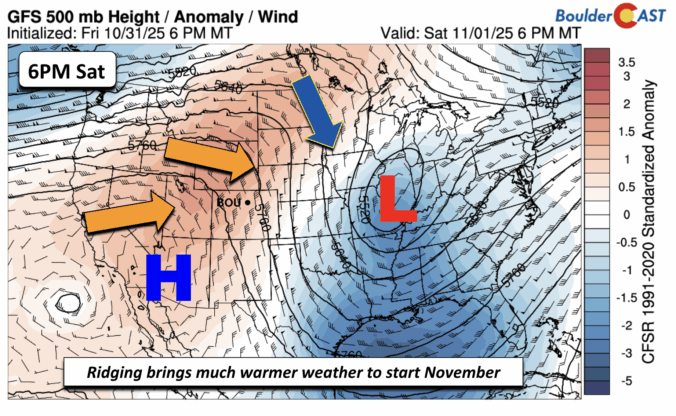
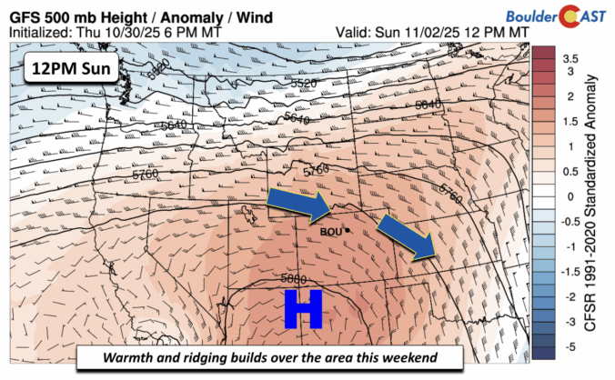
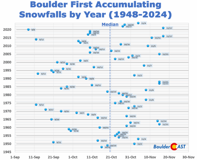
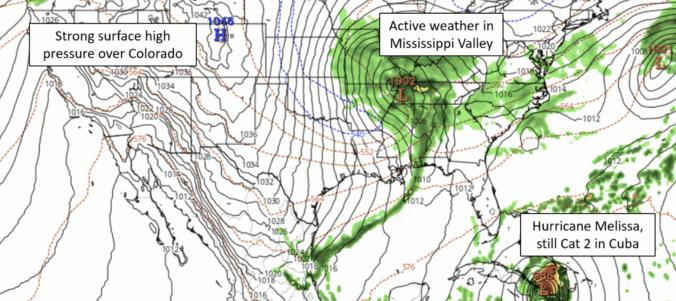
After a stretch of crisp, dry days to end the week, our weather is gearing up for a big warm-up this weekend, with near-record highs favored by Sunday. This developing warm and unfortunately dry pattern looks likely to stick around well into November. With each passing day, the odds grow that Boulder might challenge its record for the latest first snowfall.

Live View of Boulder

Current Conditions

Live Radar

Latest Smoke Forecast

Recent Premium Posts

BoulderCAST Daily – Sun 09/27/26 | A Mild Sunday, Followed by Wet Weather This Week
☀️ Mild Sunday — Highs well into the lower 80s with a few …
BoulderCAST Daily – Sat 09/26/26 | Quiet Weather, But Wet Weather Is Brewing Next Week Tied To A Tropical System
☀️ Weekend calm — Weather is quiet this weekend in the lower 80s …
BoulderCAST Daily – Fri 09/25/26 | A Stormy Friday, Followed by a Quiet Weekend
🌧️ Friday storms — Another wave brings afternoon scattered showers and storms ☀️ …
3-Day Forecast

Trending Content



© 2026 Front Range Weather, LLC