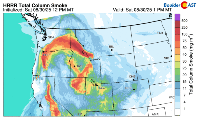
September kicks off with a mellow vibe across the Front Range — warm days and mostly dry skies are expected. But don’t let the quiet start fool you. Between drifting wildfire smoke, sneaky cold fronts, and a potential tropical system by the weekend, there’s more nuance in our forecast this week than meets the eye. Read on as we break down what to expect day by day, plus what might shake things up by the weekend.

Page 20 of 550
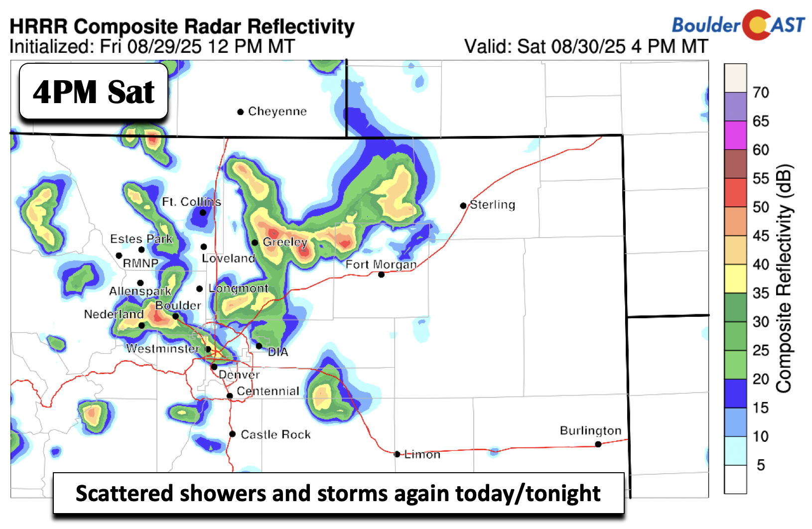

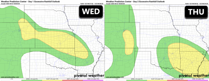
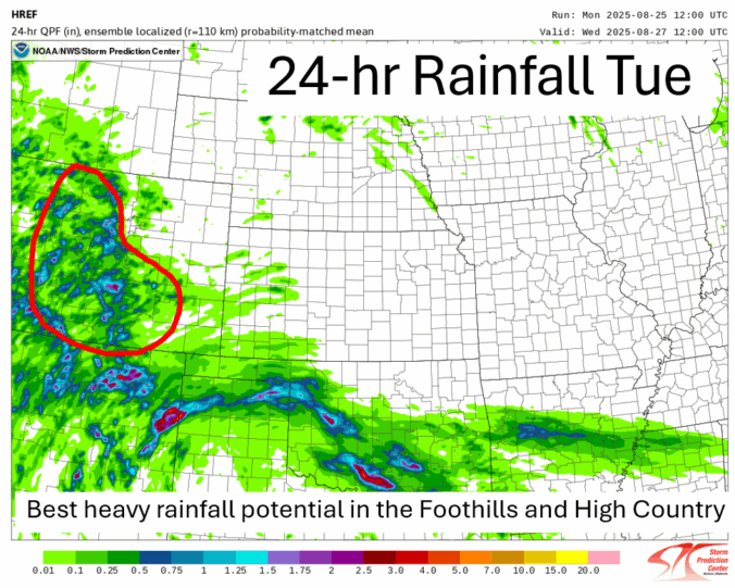
The unsettled weather pattern isn’t done with us just yet—and that’s good news for the rain-starved Front Range. While recent days have underdelivered in most areas, this week still holds promise for more moisture and continued cool weather. We break down when and where the best rain chances will line up this week, why optimism is cautious, and what to watch for as the pattern turns warmer and drier heading into Labor Day Weekend.

Live View of Boulder

Current Conditions

Live Radar

Recent Premium Posts

BoulderCAST Daily – Sun 01/11/26 | A mild Sunday with readings reaching the 50s
🌤️ Mild & Melty Sunday: Light winds and patchy clouds, with lingering snowpack …
BoulderCAST Daily – Sat 01/10/26| Widespread sunshine and moderating temperatures this weekend as our recent snow melts off
🌤️ Calm Saturday: Winter storm systems have departed the state, leaving behind a …
BoulderCAST Daily – Fri 01/09/26| Snow ends quickly this morning with a quieter weekend in store
❄️ Overnight snow bands: A second push of upslope after midnight sparked narrow …
3-Day Forecast

Trending Content

© 2026 Front Range Weather, LLC