
Page 17 of 550
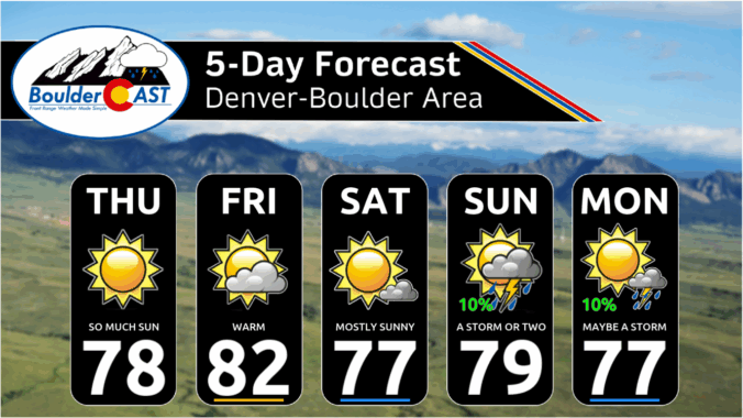
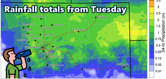
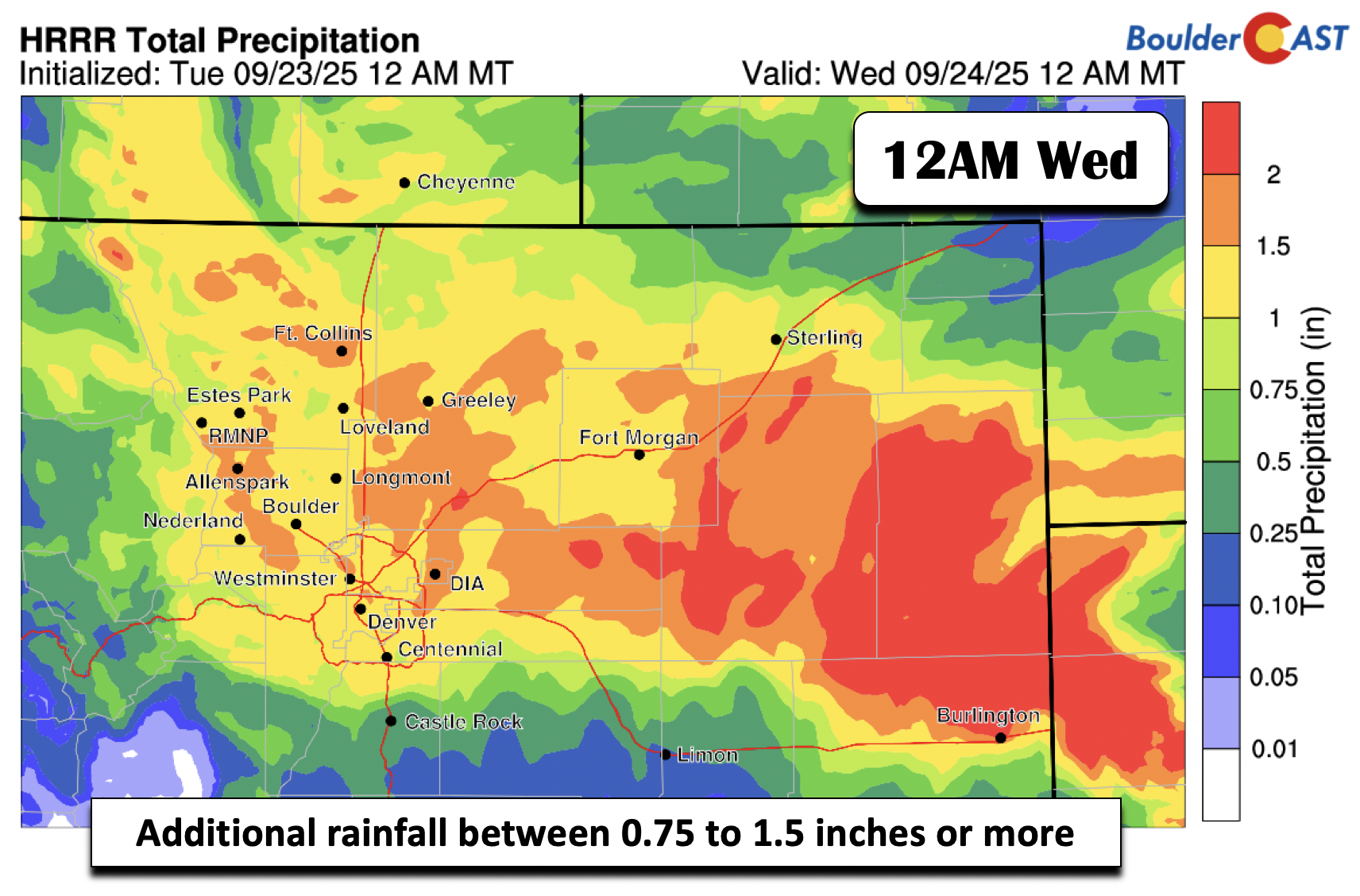
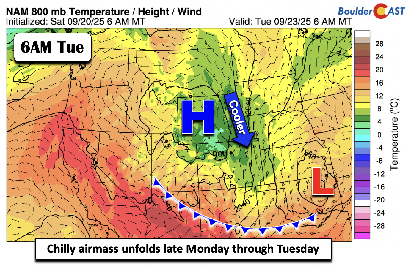
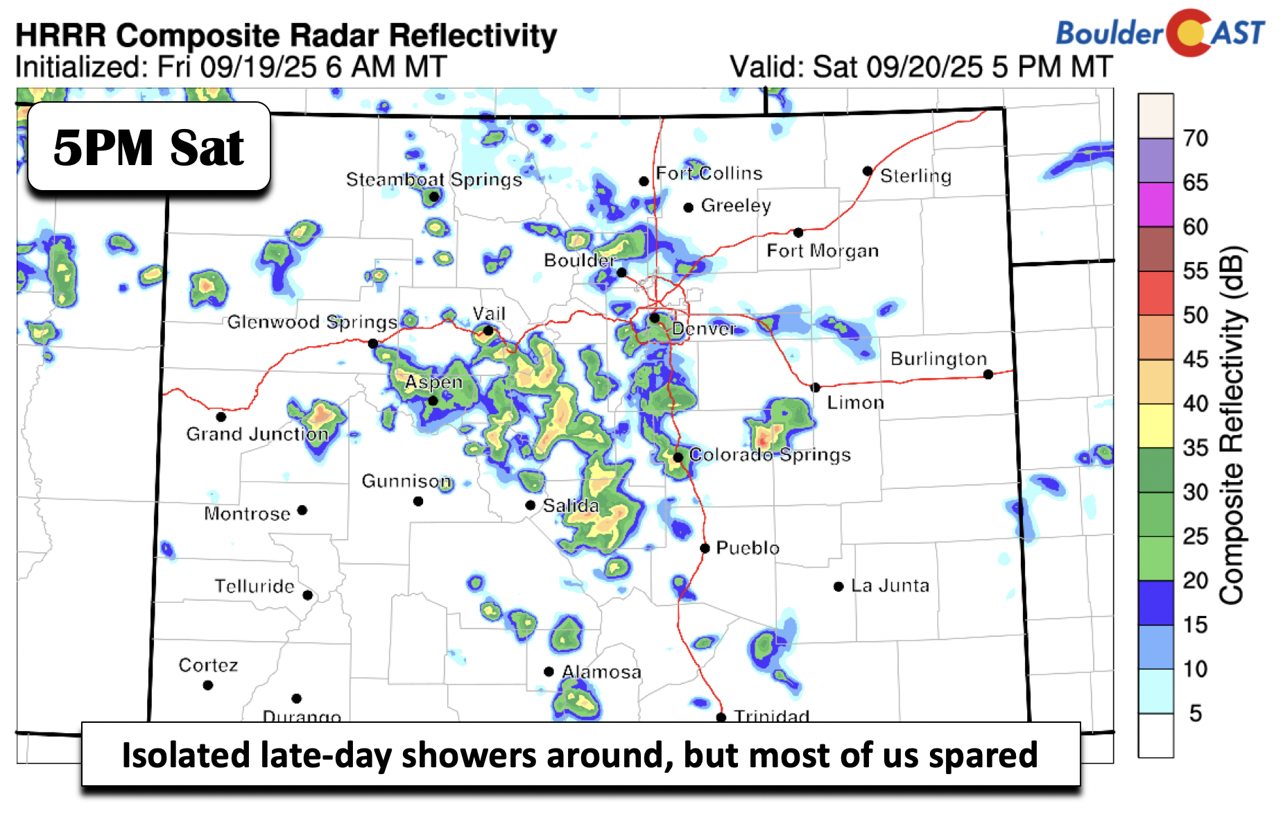
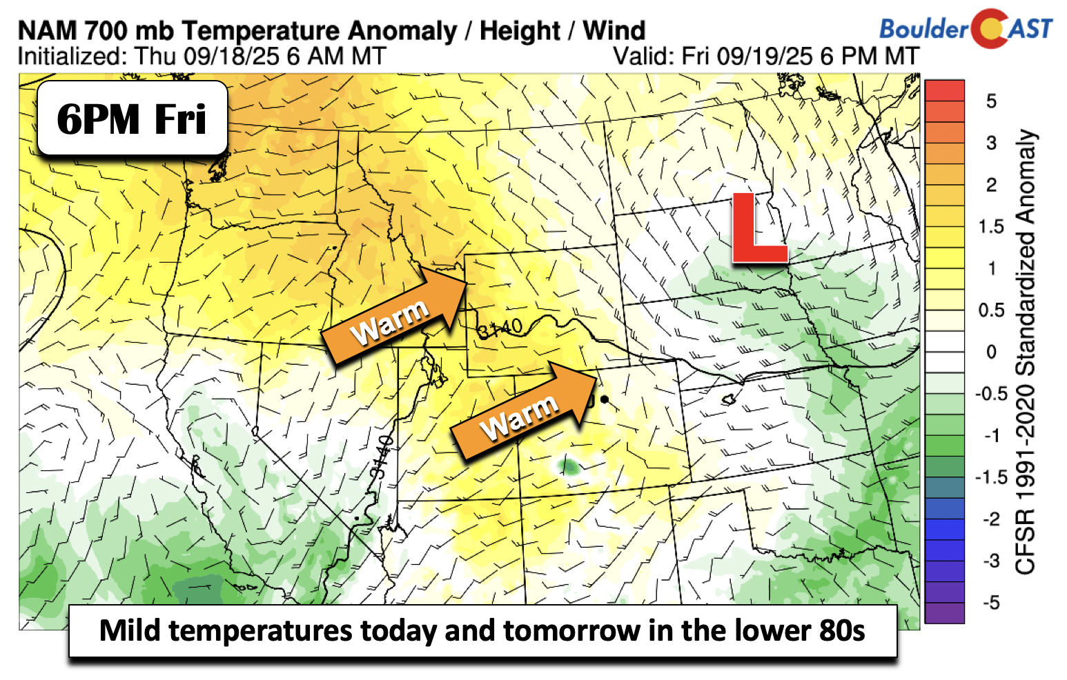
This week’s weather kicks off with a dramatic autumn shift—widespread rain, clouds, and a serious temperature drop that will bring snow to the High Country. A strong cold front and upper-level system will make Tuesday feel more like late October, with highs stuck in the lower 50s. But don’t worry, sunshine and warmth are on the horizon again. By midweek, we’ll rebound into the 60s and maybe even flirt with 80 by Friday. Curious about how much soaking rain we’ll get—or where that snow might land? Read on for all the details.


Live View of Boulder

Current Conditions

Live Radar

Recent Premium Posts

BoulderCAST Daily – Sun 01/11/26 | A mild Sunday with readings reaching the 50s
🌤️ Mild & Melty Sunday: Light winds and patchy clouds, with lingering snowpack …
BoulderCAST Daily – Sat 01/10/26| Widespread sunshine and moderating temperatures this weekend as our recent snow melts off
🌤️ Calm Saturday: Winter storm systems have departed the state, leaving behind a …
BoulderCAST Daily – Fri 01/09/26| Snow ends quickly this morning with a quieter weekend in store
❄️ Overnight snow bands: A second push of upslope after midnight sparked narrow …
3-Day Forecast

Trending Content

© 2026 Front Range Weather, LLC