Get ready for round two of severe weather late Friday afternoon into the evening hours with large hail the primary threat to end the week. We also discuss the weekend forecast which includes plenty of storms and the potential for more hail.
Happy Fourth of July! Join hundreds of others and become a BoulderCAST Premium member today and save 25%. Use promo code 1776. Offer ends Sunday July 7th.

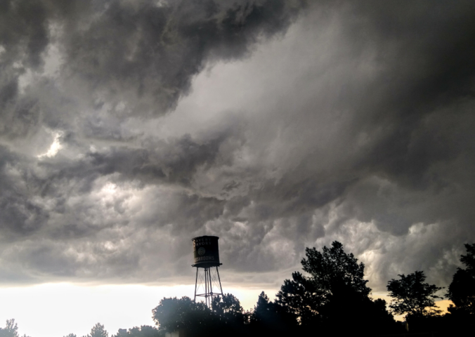
Independence Day storms
Did you manage to stay dry during the holiday yesterday? It probably wasn’t as easy as you had planned. Guidance from the various weather models had a rough time pinpointing the location of a surface frontal boundary which had major implications on the weather in our area. The cold front ended-up pushing much further south and west than expected, banking up against the Foothills early Thursday morning. This completely changed the airmass across our area and led to the most significant severe weather outbreak for us so far this year.

Radar image from around 730PM Thursday evening. The cells near Boulder prompted a Severe Thunderstorm Warning.
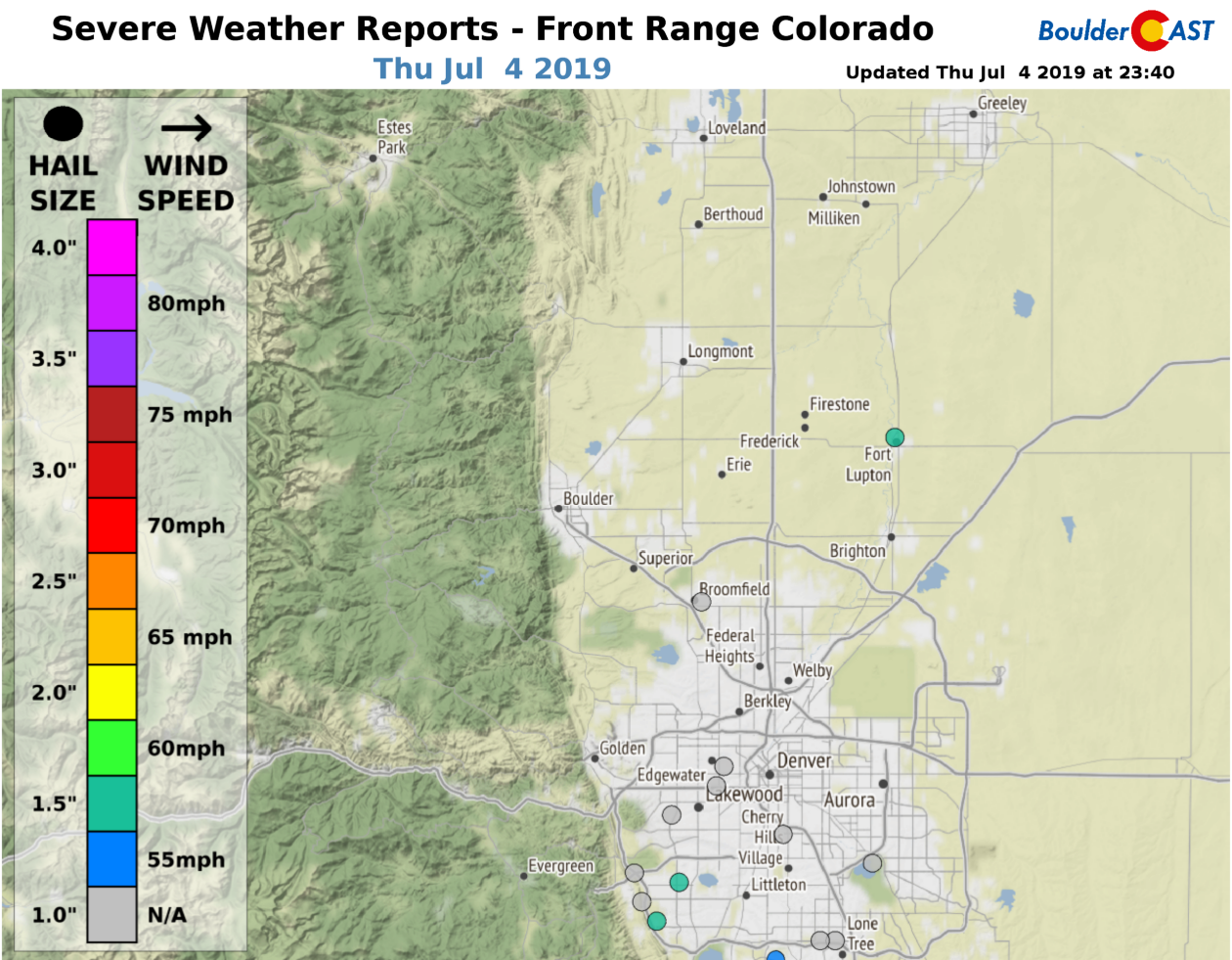
Along with brief bursts of heavy rainfall, there were many hail reports in the Denver Metro area with diameters ranging between 1 and 1.5″. Check our Severe Weather Reports page for up-to-date storm reports, even from today.
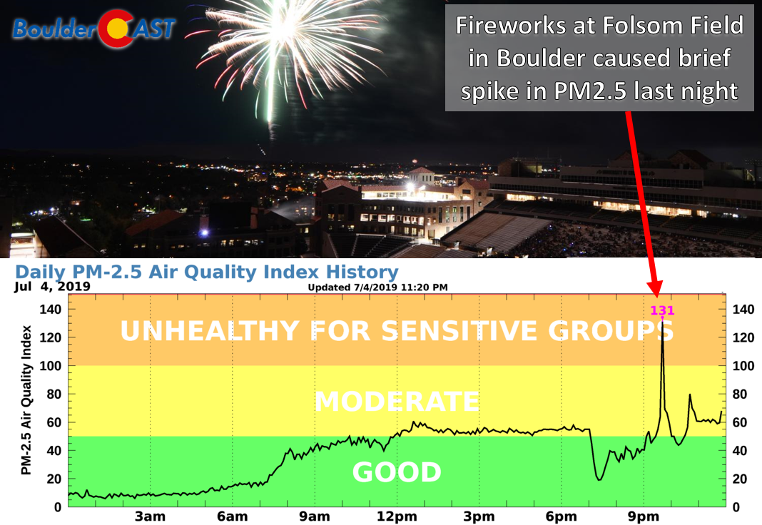
Finally, our recently installed laser air quality sensor was able to detect a brief but noticeable deterioration in PM2.5 air quality following last night’s fireworks at Folsom Field in Boulder. After the brief spike to unhealthy levels around 9:45PM, it took about four hours for air quality to return the pre-fireworks show levels.
More severe weather expected Friday & maybe Saturday
The weather set-up for Friday remains very similar to Thursday across the Front Range. The Denver Metro area resides in the cooler but juicier northern side of this front.
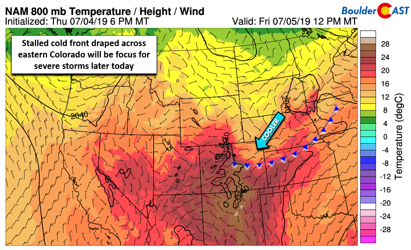
NAM 800 mb temperature and wind forecast for Friday afternoon
Low-level winds are upslope in this regime (see above), but aloft they are completely opposite. At 500 mb (see below), winds are beteween 20 and 30 mph out of the west-southwest direction…not too shabby for early July! This translates into decent bulk shear paving the way for more supercells later today.
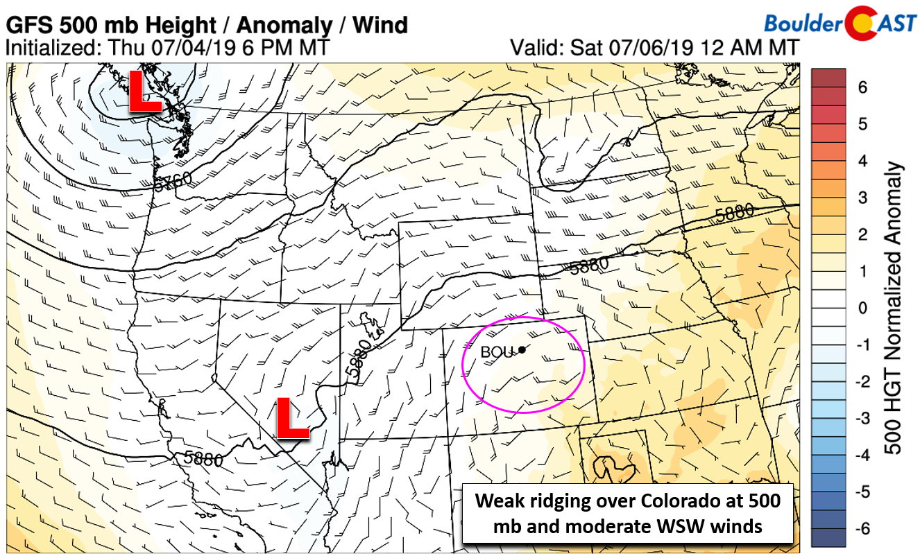
GFS 500 mb height anomaly forecast for Friday
There is plenty of moisture available across eastern Colorado. The front pushing south has allowed deeper moisture to build into the state from Kansas and Nebraska.
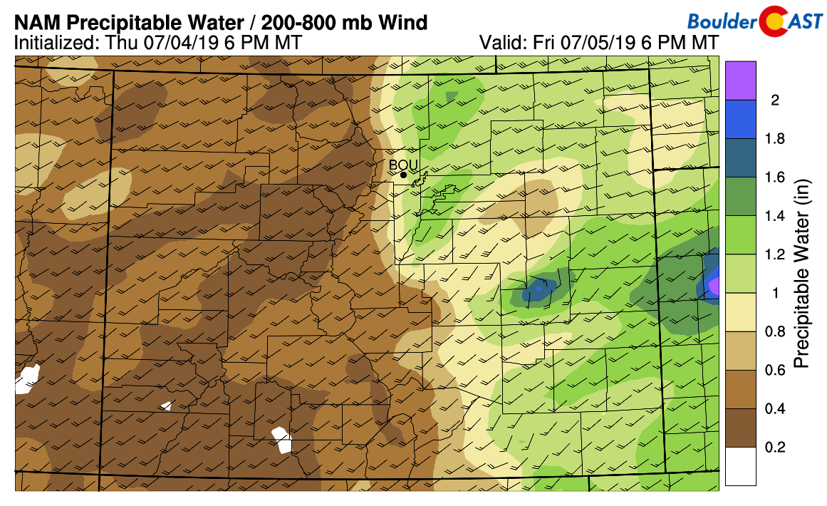
NAM precipitable water forecast for Friday evening
Despite the presence of a decent capping inversion, sunshine peaking through as the day wears on will allow us to realize 1500 to 2500 J/kg by late afternoon and early evening with another round of explosive supercell development near and east of the Front Range expected.
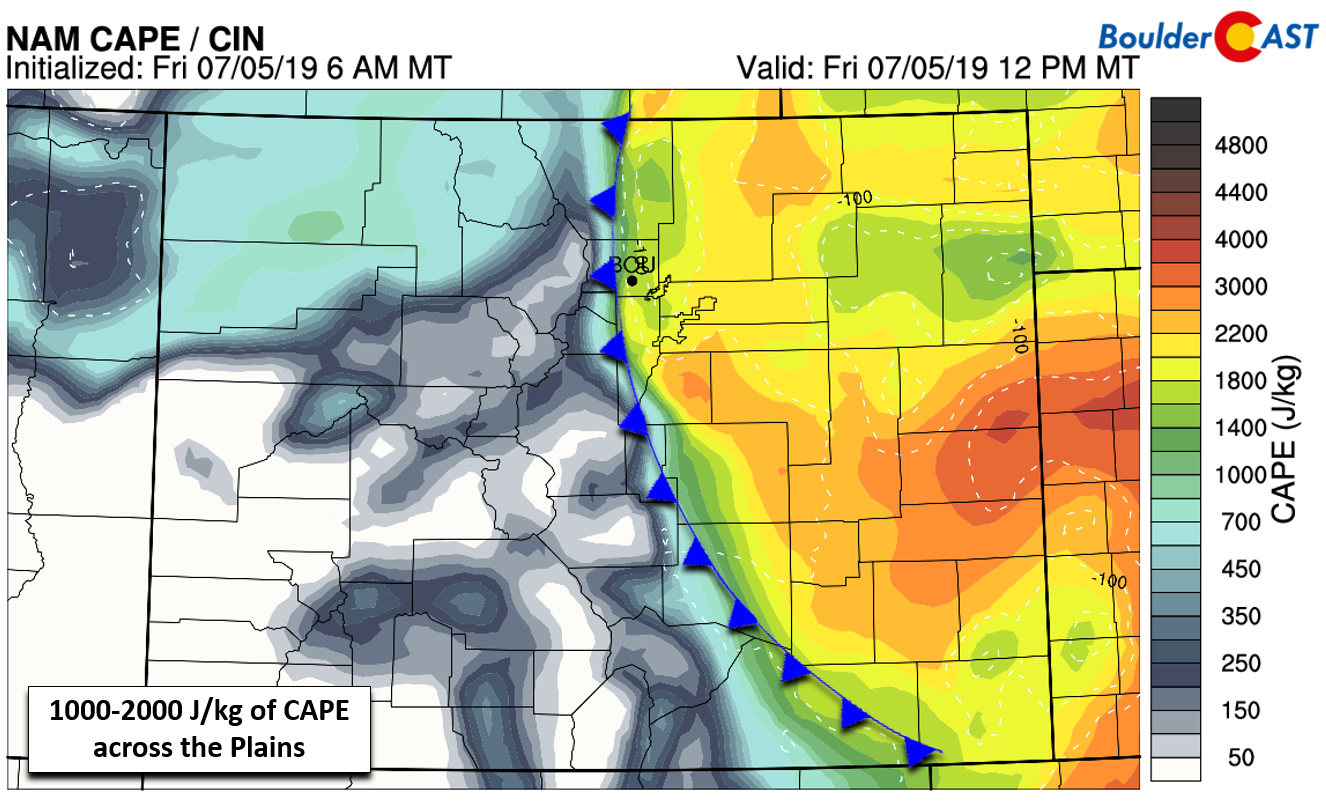
NAM CAPE forecast for Friday afternoon
Just like yesterday, directional shear is not substantial, so the main concern today will again be large hail 1.0 to 2.0″ in diameter, heavy rainfall, and lightning. There is a possibility of a tornado or two somewhere in eastern Colorado, but that isn’t a guarantee. Given ideal conditions, we could see one or two cells drop even larger hail. There were a few reports of softball-sized hail (4.25″) yesterday in southeast Wyoming.
We anticipate storms to begin firing after the cap breaks, sometime around 3:00 PM with scattered storms, some of which will be supercells, lingering through much of the evening. As long as the stratus deck clears out by early afternoon, we should be right on track for the outbreak. Things will die down after midnight as the airmass stabilizes.
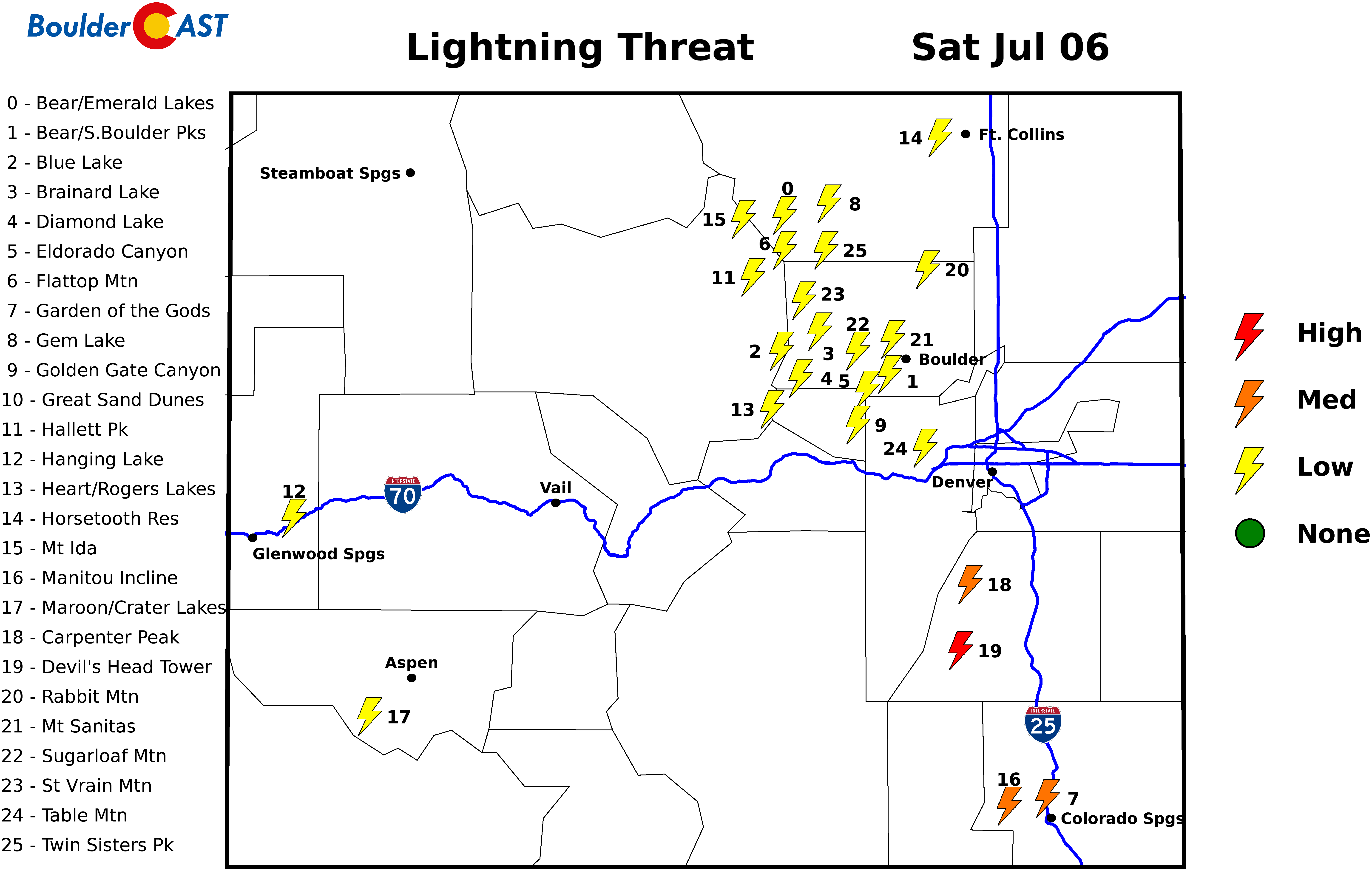
The weekend…
Saturday: The start of the weekend will include the threat of severe storms for us again, albeit with reduced odds. Lower-level easterly upslope will persist across the Front Range continuing the influx of deeper moisture from Kansas. Aloft the same west to southwest flow will exist as well. This sets the stage for another day of afternoon and evening thunderstorms in our area. Given the shear, it’s likely that some of these will be strong to severe supercells producing hail 1.0 to 1.5″ in diameter. Highs in the lower 80’s.
Sunday: Easterly flow relaxes at the surface which should allow drier air to work into the Front Range. Models are not in complete agreement on this facet however. Storm chances will be lower, but not entirely erased. We still expect at least isolated to widely scattered storms for the region Sunday afternoon into the evening. Severe storms seem unlikely at this time due to a lack of shear. Highs reach the mid to upper 80’s.
That’s all for now. We’ll be back Monday with our weekly outlook. Have a good holiday weekend. If you’re heading to the High Country, check our Mountain Forecasts.
.
Happy Fourth of July! Join hundreds of others and become a BoulderCAST Premium member today and save 25%. Use promo code 1776. Offer ends Sunday July 7th.
Spread the word about the severe weather. Share our forecast:
.


You must be logged in to post a comment.