
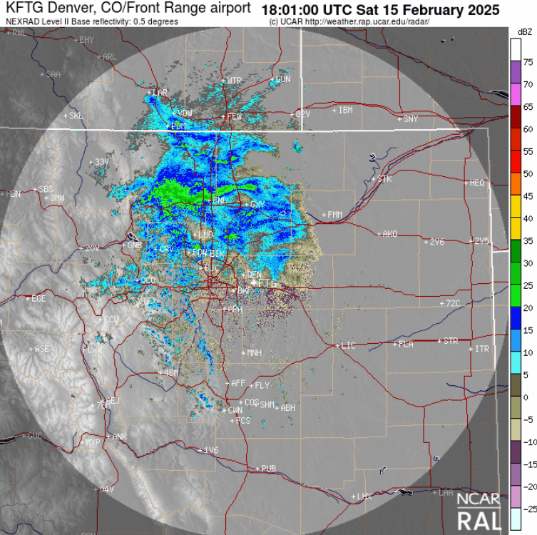
A several hour period of banded snowfall impacted the entire Front Range during the daytime hours on Saturday as a weak system, with embedded jet energy, moved across the area from the northwest. We briefly review both the snow totals from this single storm and the seasonal ones.
S
now developed quickly across the area from north to south late Saturday morning, lingering into the early evening hours before coming to an end. Our forecast was generally for a dusting to 4″ of snow across the region, but totals up to 5″ were possible for areas hit hardest by repeated bands of snow.
Busy radar heading into midday here. Quick hit of snow bands this afternoon into early evening. Won't last long, but snowfall rates of 1" per hour in these bands will allow for some lucky areas to pick up 3-5" of snow. Most of us see a dusting to 3". #COWX pic.twitter.com/4NsXw311Wx
— BoulderCAST Weather 🏔️❄️ (@BoulderCAST) February 15, 2025
The radar animation from 11AM to 7PM on Saturday is shown below. The banded nature of this particular event is evident in the radar, with any of the dark green-colored snow bands offering snowfall rates great than 1″ per hour. Some parts of the Metro area were under these bands for hours, while others only caught a few minutes.
Our snowfall forecast map issued Saturday morning is shown below with storm totals overlaid. Green values indicate our forecast verified, Yellow values mean the observed total was just outside our forecast, while Red was a busted forecast (more than 1″ off). In general, much of the area received their allocated snowfall, or slightly more in many cases. Those aforementioned heavier snow bands, some of which trained over portions of the northern Denver and Boulder areas, led to locally higher totals than forecast.
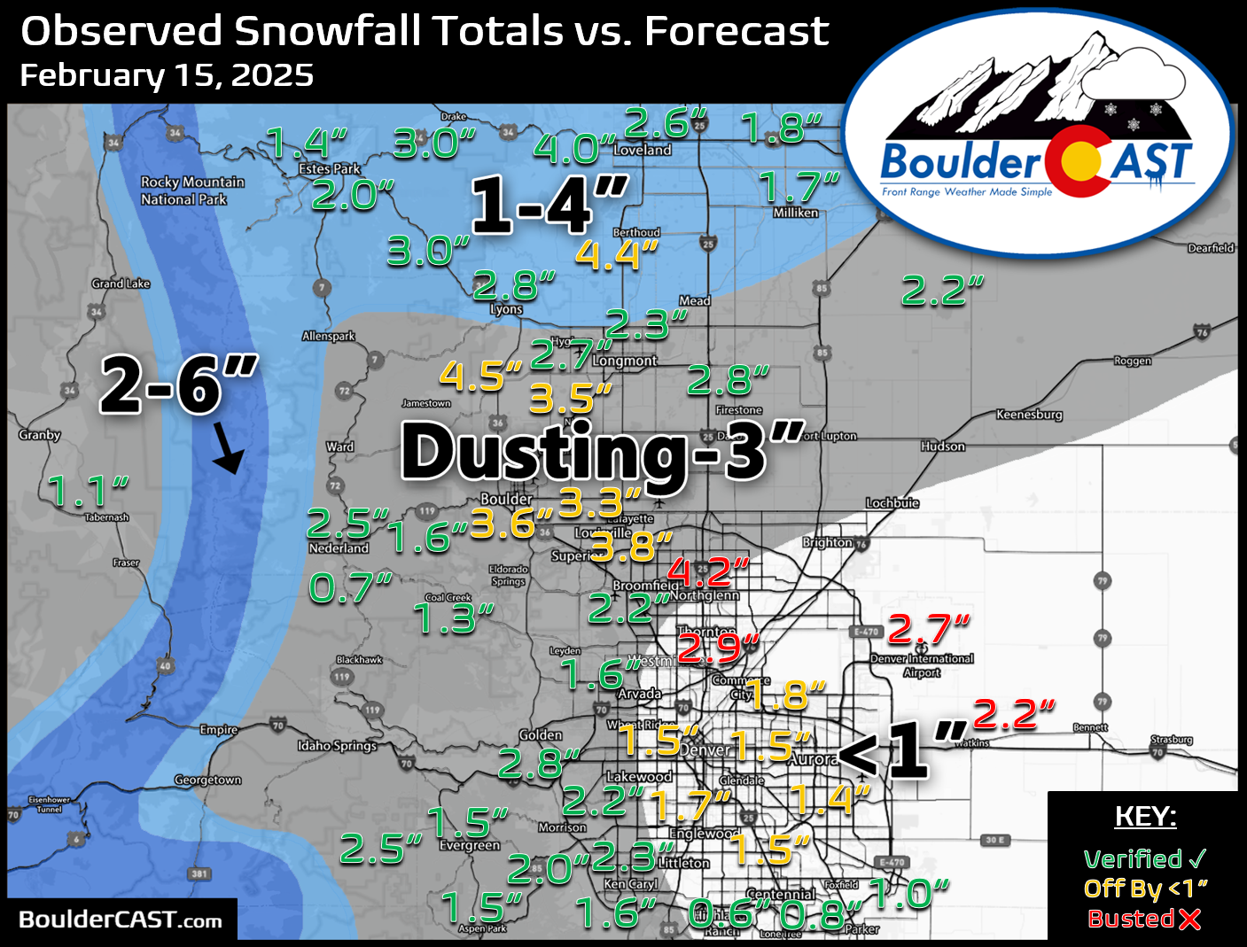
Officially 3.6″ of snow fell in Boulder, with 2.7″ in Denver at DIA. Downtown Denver saw about half as much snow, closer to 1 or 1.5″. We’re just pointing this out because everyone always seems to think DIA is way less snowy than Denver proper. The truth is, DIA is 15 miles away and it’s going to see a differing amount of snow, simple as that. It could be more or less — it will depend on the particular event.
Seasonally Boulder has received 53″ of snow, about a foot more than Denver.
| Seasonal Snow Totals (Updated February 16 2025) |
|---|
| Boulder | Denver |
|---|---|
| 53.1" | 41.9" |
You can find a recap of all the winter storms so far in the 2024-2025 snow season HERE.
By the way, additional light snow is likely during the upcoming work week tied to another Arctic Blast Tuesday night, but we’re currently not expecting it to amount to much…


You must be logged in to post a comment.