Snowfall amounts in Boulder County through 8am MT Friday range from 2 to 24”. Where does your neighborhood fall?
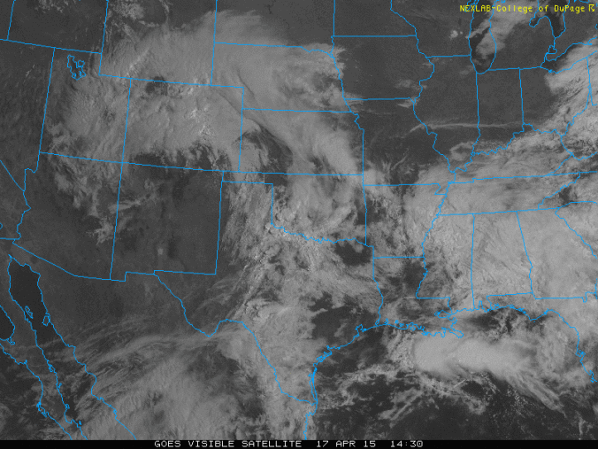
The current weather pattern over Colorado is one you may not see for a while — an occluded low with a beautiful comma shape (see visible satellite above). An occluded system is the dying stage of a storm — where the warm sector becomes separated from the core of the storm . The area just east of the Rockies is generally a place where storms first develop, aided in their formation by a natural, topographically-created trough. Few storms meet their demise in this region, so this instance is quite atypical.

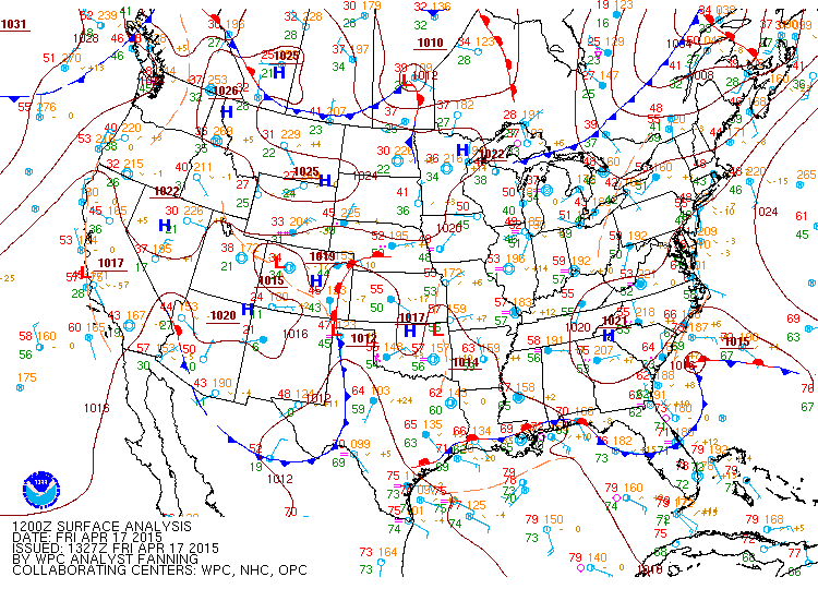
Surface map from 6am MT on Friday, showing what is essentially an occluded low pressure, with associated warm and cold fronts.
The rain/snow mix observed last evening in some areas of the Plains changed over to all rain everywhere by about 3am. A few places were able to pick up a few inches before the change over, including Superior and DIA. Alas, accumulating snow below 6,000 feet is finished for this storm. The focus will be continued light to moderate rain on the Plains and heavy snow in the Foothills through this evening. The air mass over NE Colorado today is a tad unstable, so a few rumbles of thunder and small hail will not be out of the question in some of the heavier rain and snow bands. All of Boulder County has picked up at least 1.5” of (liquid) precipitation, with areas from Boulder west in the 2-2.5” range already. The lower elevations briefly accumulated 2-6” of snow before melt took over, with the Foothills piling up 14-24” so far. Expect an additional 6 to 12” in areas above 7,000 feet through the day today.
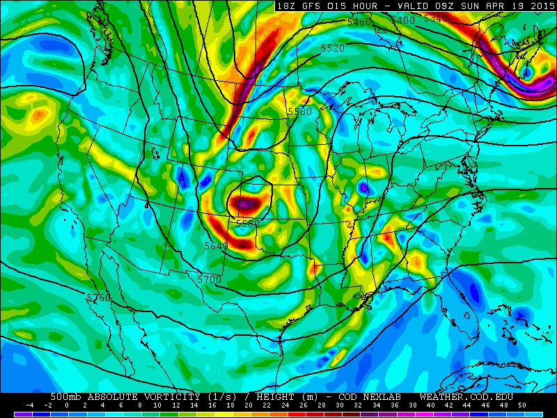
This slow moving storm will be with us a few more days as it makes its way eastward, with lingering intermittent rain and mountain snow through the weekend . It’s looking like things will drastically start to improve Monday into Tuesday as the jet stream absorbs the cut-off low, so hang in there!


You must be logged in to post a comment.