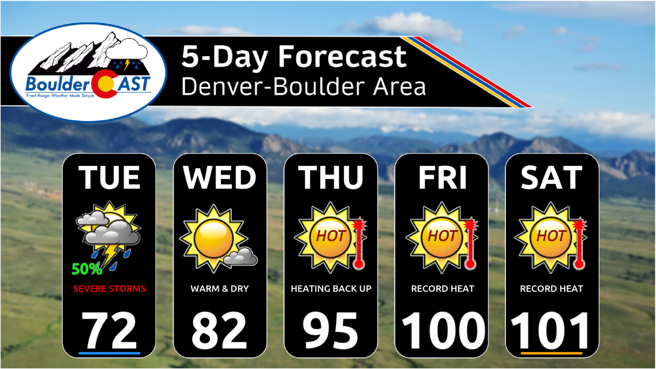
The anticipated reprieve from the heat has arrived! Low clouds blanket the Front Range Tuesday morning, and exactly how quickly they burn off today will be the key to unlocking explosive severe thunderstorm development this afternoon over our area. We discuss the latest forecast details surrounding the severe risk today, including our team’s lingering concerns, the timing of the risk, and which areas stand the best chance to see big hail Tuesday afternoon.

Go Premium, get all the perks.
Daily Forecast Updates
Get our daily forecast discussion every morning delivered to your inbox.
All Our Model Data
Access to all our Colorado-centric high-resolution weather model graphics. Seriously — every one!
Ski & Hiking Forecasts
6-day forecasts for all the Colorado ski resorts, plus more than 120 hiking trails, including every 14er.
Smoke Forecasts
Wildfire smoke concentration predictions up to 72 hours into the future.
Exclusive Content
Weekend outlooks every Thursday, bonus storm updates, historical data and much more!
No Advertisements
Enjoy ad-free viewing on the entire site.
L
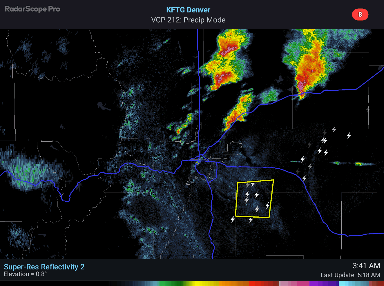
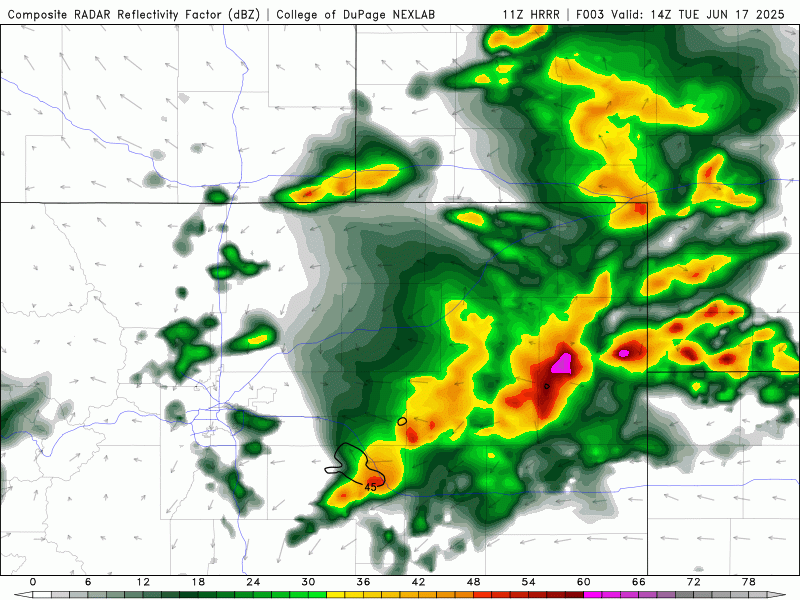
ast night brought some unexpected weather excitement to northeast Colorado, as a broken line of severe thunderstorms developed overnight. Here in Boulder, we only got a few rumbles of thunder and a brief spat of light rain, but things were a bit more intense to the east—with hail, strong winds, and heavy downpours making an appearance. The area around Lafayette received more than 1″ of rain in a short period of time with localized urban flooding reported.
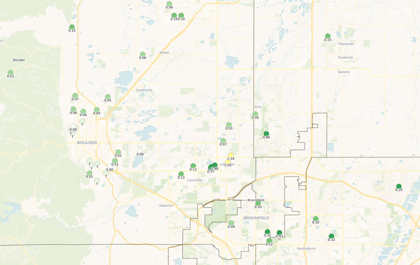
Overnight rainfall totals. Did Lafayette float away?
The radar animation below covers the nocturnal storm action from about 3:30 AM onward.
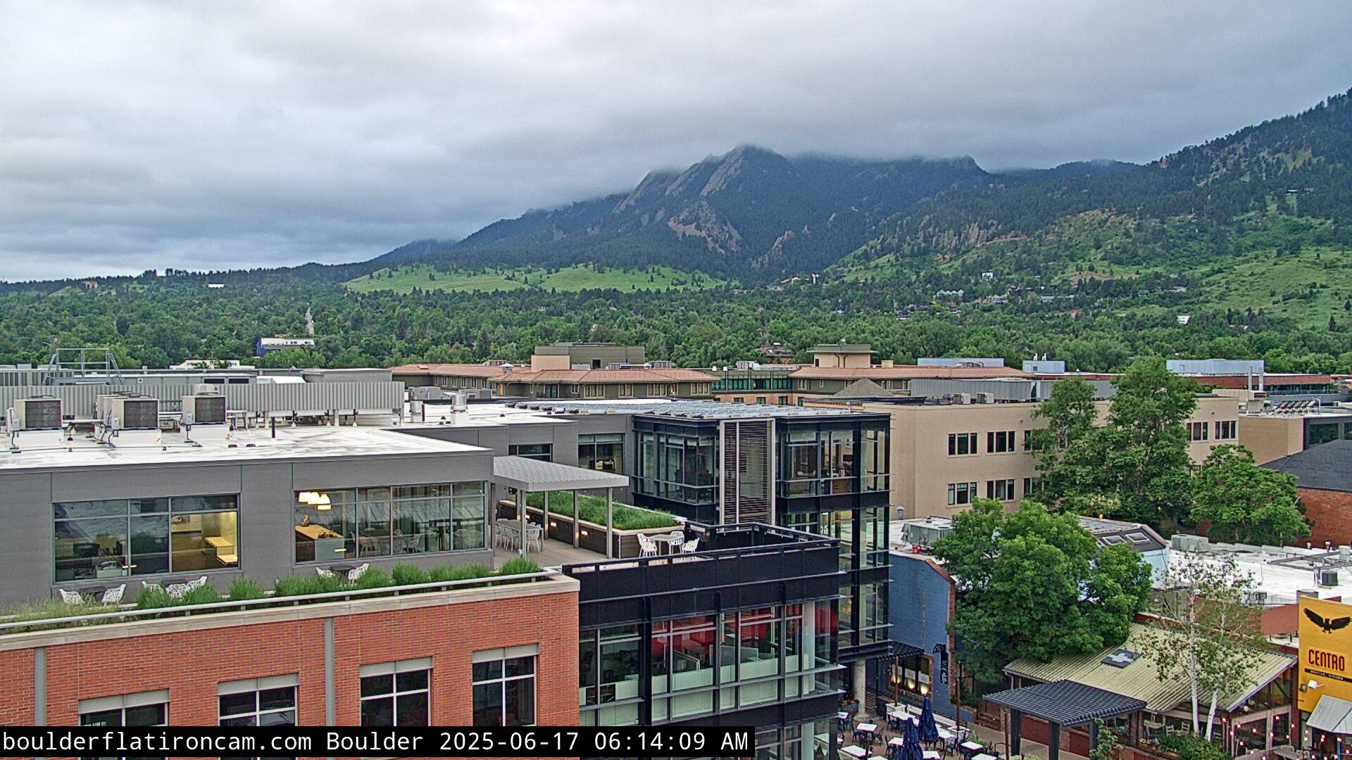
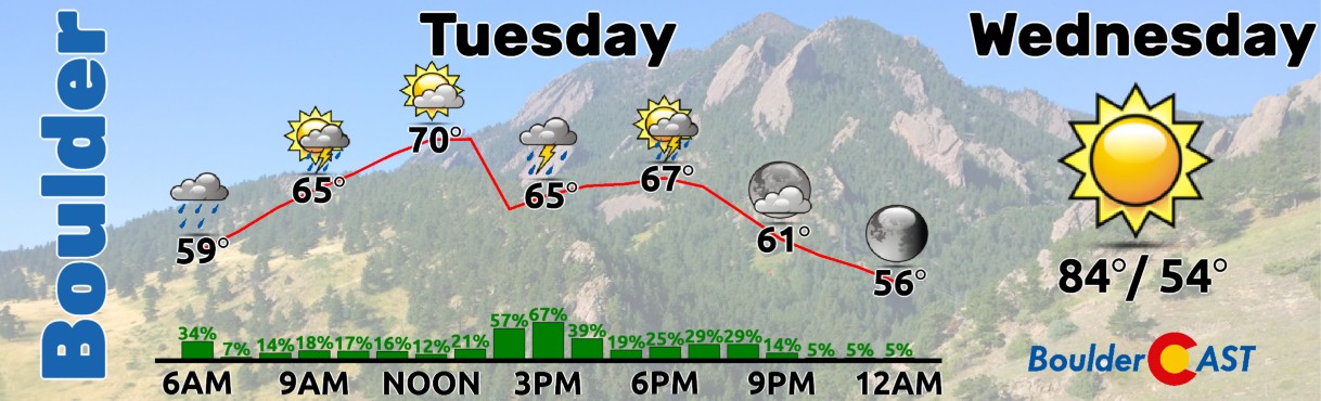
Now, while last night’s storms weren’t fully anticipated, today’s cloudy conditions across the Boulder-Denver area were right on cue. A moist cold front moved through overnight, leaving us blanketed under a thick layer of stratus clouds. The Flatirons are currently lost in the mist, and while it’s not the sunniest start to the day, some of you might actually welcome the break from the scorching 90-degree temps we’ve had lately.
The big forecasting challenge today is how quickly these stubborn morning clouds burn off. That’s the key to unlocking the severe storm potential, which—on paper—is quite high, though likely brief. As we mentioned in yesterday’s forecast update, this is a tricky setup, and we’re still working through the details. Right now, a shortwave is pushing in from Utah and should reach the Denver area around lunchtime. Ideally, we’d want it to arrive later in the day when temperatures are at their peak, but with all this cloud cover, the timing might throw a wrench into the storm potential.
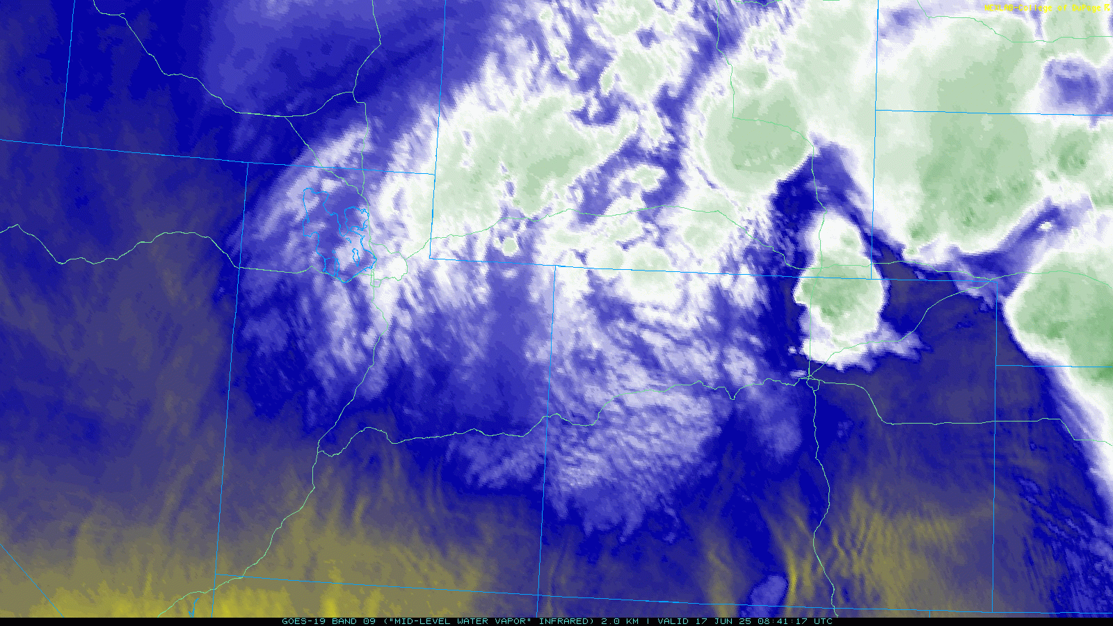
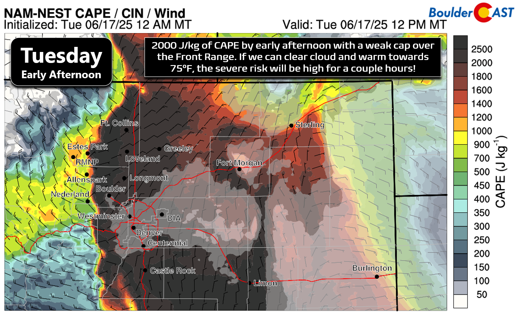
It’s going to take time for the low clouds to lift and burn off across the area. The earlier they dissipate, the warmer we’ll get and the higher the risk for severe storms. Based on the latest guidance, we expect clouds to begin breaking up by mid to late morning Tuesday giving way to partly cloudy skies. This should allow some or most of the Metro area to warm into the 70s, though we still have some concerns whether this will really happen and perhaps some areas may be stuck in the 60s. Low-level moisture is sitting in higher than initial model projections, with dew points in the mid to upper 50s right now, downright soupy by Boulder standards! Thus, even temperatures in the low to middle 70s would allow for CAPE values over 2000 J/kg this afternoon as the chilly shortwave passes aloft. The energy is certainly there for explosive storm development if we can get those pesky clouds to clear out! It’s funny how this exact type of setup almost always occurs on our best severe weather days. We only get this type of low-level moisture content from strong frontal pushes coming from the east, but unfortunately those frontal pushes also tend to blanket us in low clouds due to the upslope component. It’s just another facet unique to Front Range weather!
High-resolution models are showing some enthusiasm for today’s setup, sparking a round of severe storms early this afternoon. A few supercells could pop up initially before the storms consolidate and race toward Kansas as a straight-line wind event.
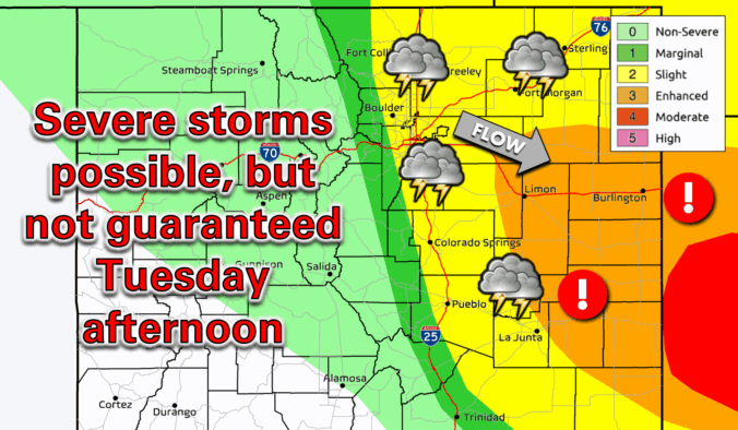
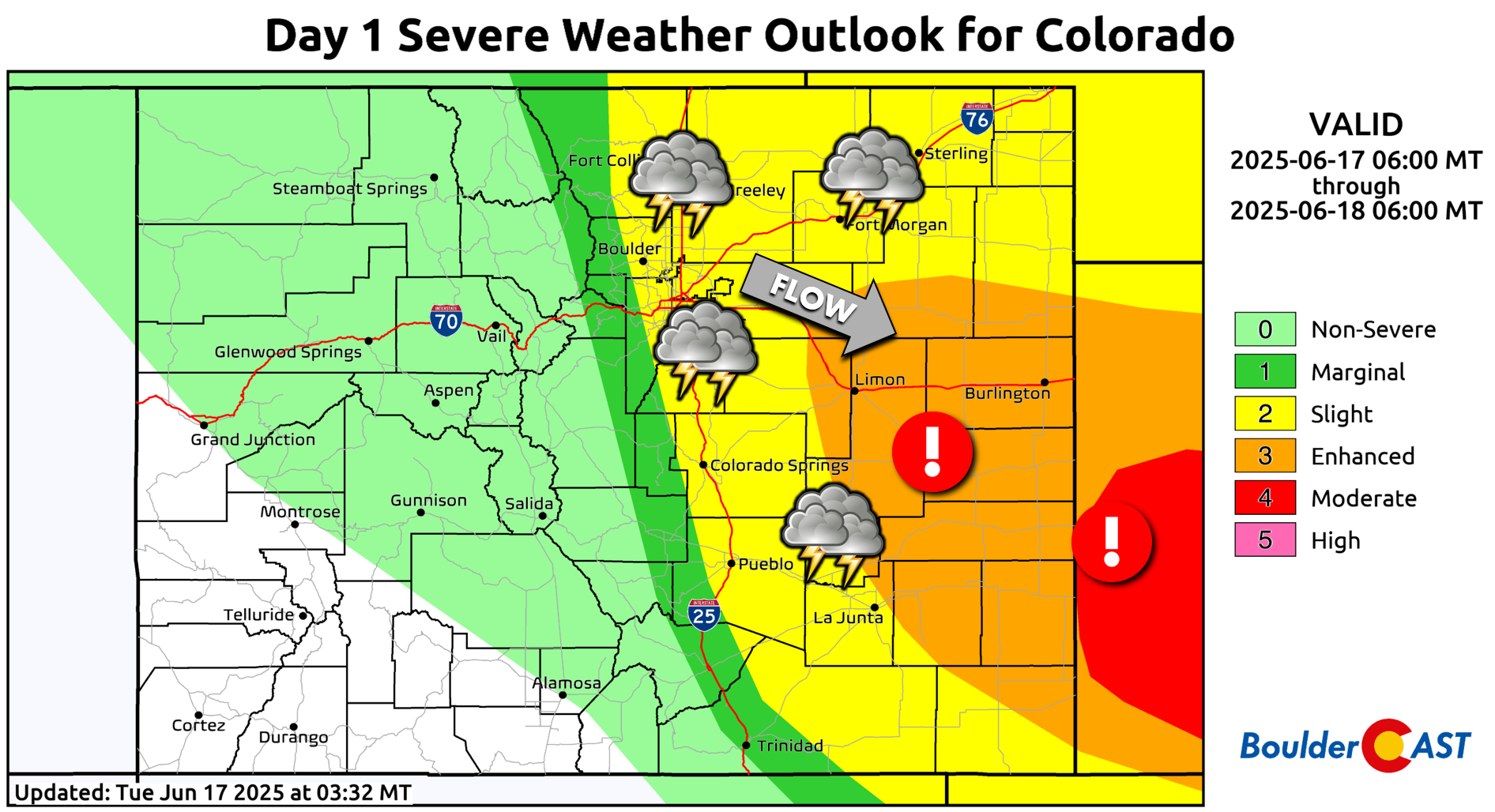
The Storm Prediction Center has placed all areas east of the Continental Divide—including Boulder and Denver—under a Slight Risk (Level 2) for severe storms. Meanwhile, our neighbors to the southeast fall under Enhanced and Moderate Risk zones, where damaging winds are nearly a guarantee later today as storms consolidate into a continuous line.
The latest discussion from the storm experts at the SPC regarding the severe risk in our area (and neighboring states) is quite interesting and worth a read:
So, where does that leave us? Well, we’re still unsure how things will play out for Boulder and Denver, since the morning cloud cover could limit storm development and keep action below severe criteria. If things do get popping, as we believe will be the case, the primary window for severe weather comes between noon and 4 PM, with storms quickly pushing east afterward. If storms do fire up this afternoon, large hail will be the main concern—potentially exceeding 2 inches in diameter, especially east of I-25. A few lingering thundershowers may hang around into the evening, but they’ll likely lose their punch as instability fades. Definitely keep an eye to the skies and stay weather-aware through late afternoon!
Looking on the bright side, while damaging hail is generally considered to be bad, the cooler rainy weather today will offer a welcomed break from the heat. We’ll all be missing it by the end of the week when triple-digit temperatures will be cooking the Front Range. Enjoy!
Enjoy our content? Give it a share:


You must be logged in to post a comment.