Mother Nature never disappoints us! Just when it looks like another quiet weather-week in Colorado, snow is on the horizon! We talk timing, amounts, and model uncertainty for wet snow beginning Friday morning. Read on for details.
UPDATE (FRIDAY 6AM): We are seeing better agreement among the models this morning. Better, but still not great. We have increased snow totals slightly and that is reflected in our included snowfall map.
Snow enters the forecast unexpectedly
It’s hard to believe that we are talking snow to end the week for the Front Range. Back on Monday when we issued our weekly outlook, the odds of it snowing on Friday were basically zero. We’d even go as far to say they were negative if that was statistically possible…
Shown below are two 500 mb height anomaly forecasts for Friday from the GFS model. The one on the left is what the forecast was showing back on Monday. The one on the right is the latest forecast. A BIG difference…one that translated to the difference between 60 degrees and snow!
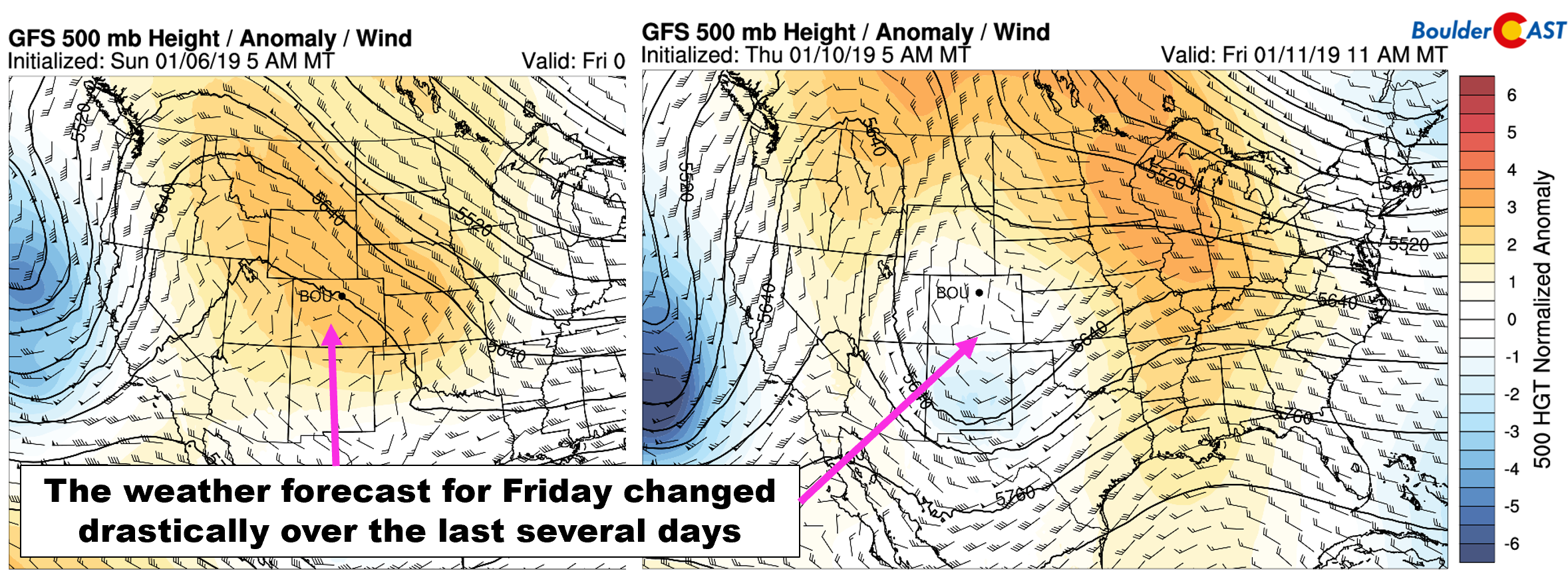
GFS 500 mb height anomaly forecasts for Friday. The one on the left is from Monday (4 days lead time). The one of the right is from Thursday (1 day lead time)
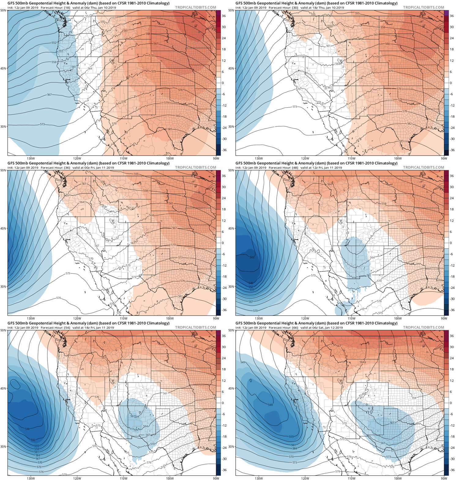
Whoa! Where did that trough come from? As it turns out, it literally developed out of nowhere…
In the animation below, watch as the trough forms along the northern fringe of the large ridge over Colorado….the ridge that has kept things pleasant the last few days here.
Thus, whether you like it or not, we’re back with another snowfall forecast!
Models are in poor agreement
We preface our forecast discussion today by saying the major models are in rather poor agreement for how much snow may fall across Denver with the incoming storm system. However, they do seem to be converging towards a reasonable solution in the last few runs. With this in mind, our confidence overall is somewhat low in the forecast.
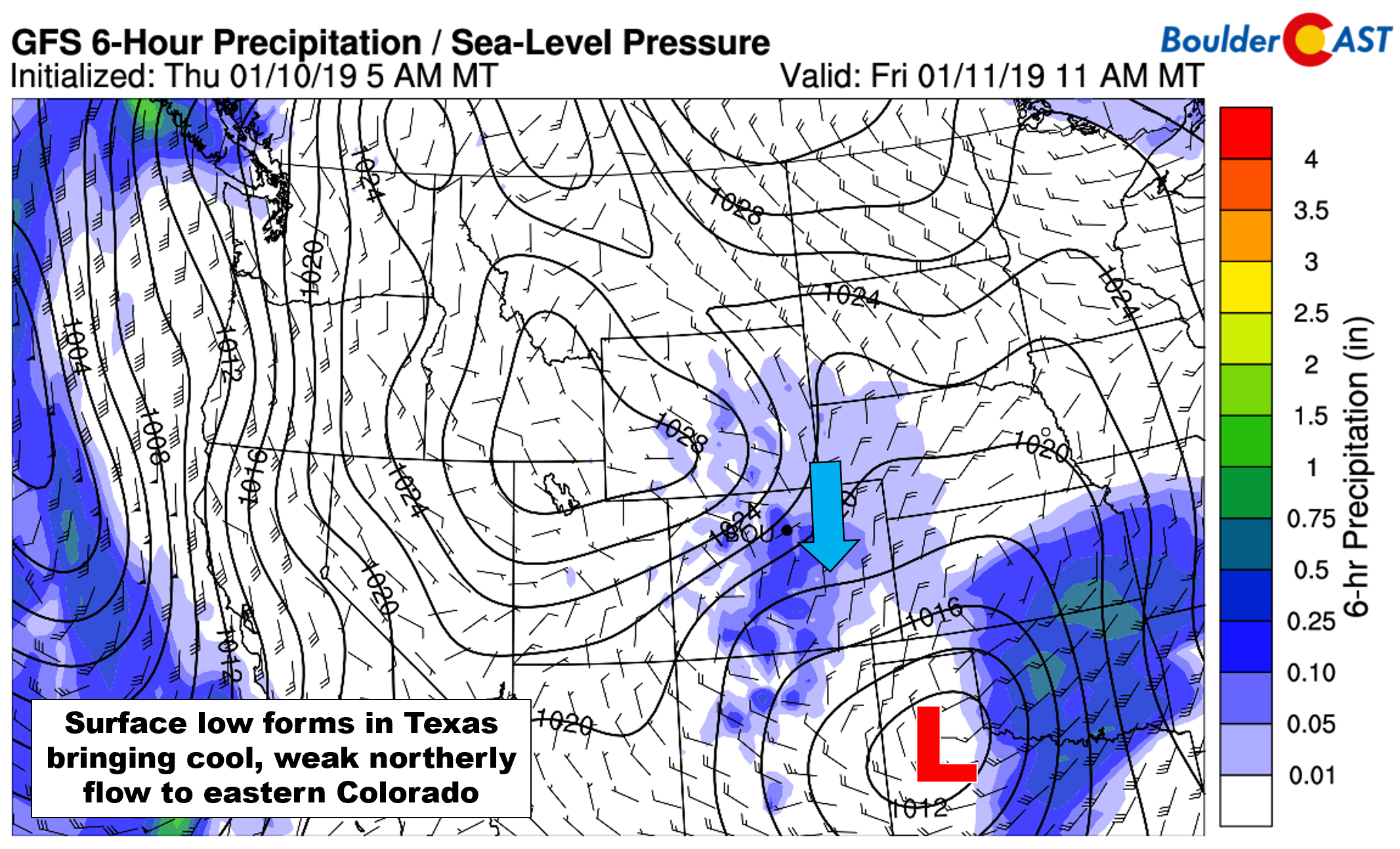
As the aforementioned short-wave trough digs into Colorado over the next 24 hours, weak lift will move across the state beginning late Thursday night and continuing into Friday night. A surface low is forecast to develop Friday morning well south and east of Colorado, likely in the Texas Panhandle (see below). This will lead to northerly flow in the Front Range and slow and gradual cooling into the 30’s on Friday.
Model discrepancies in snow amounts for this event appear to originate from stark differences in the direction of the low-level winds throughout the duration of the storm. The NAM produces upwards of 6″ of snow for most everyone in the Front Range. It’s also the model which has a suspiciously strong upslope component to the wind fields (i.e. deep northeasterly upslope much of the day Friday, see below). The GFS and Euro models are showing more modest totals of 1 to 3″ for the Metro area and have winds sticking closer to northerly for the event.
The comparisons below at 700mb and 800mb between the GFS and NAM show the quarrel in wind direction quite well. Despite the large-scale agreement in the storm’s positioning, the resulting winds across the Front Range are vastly different.
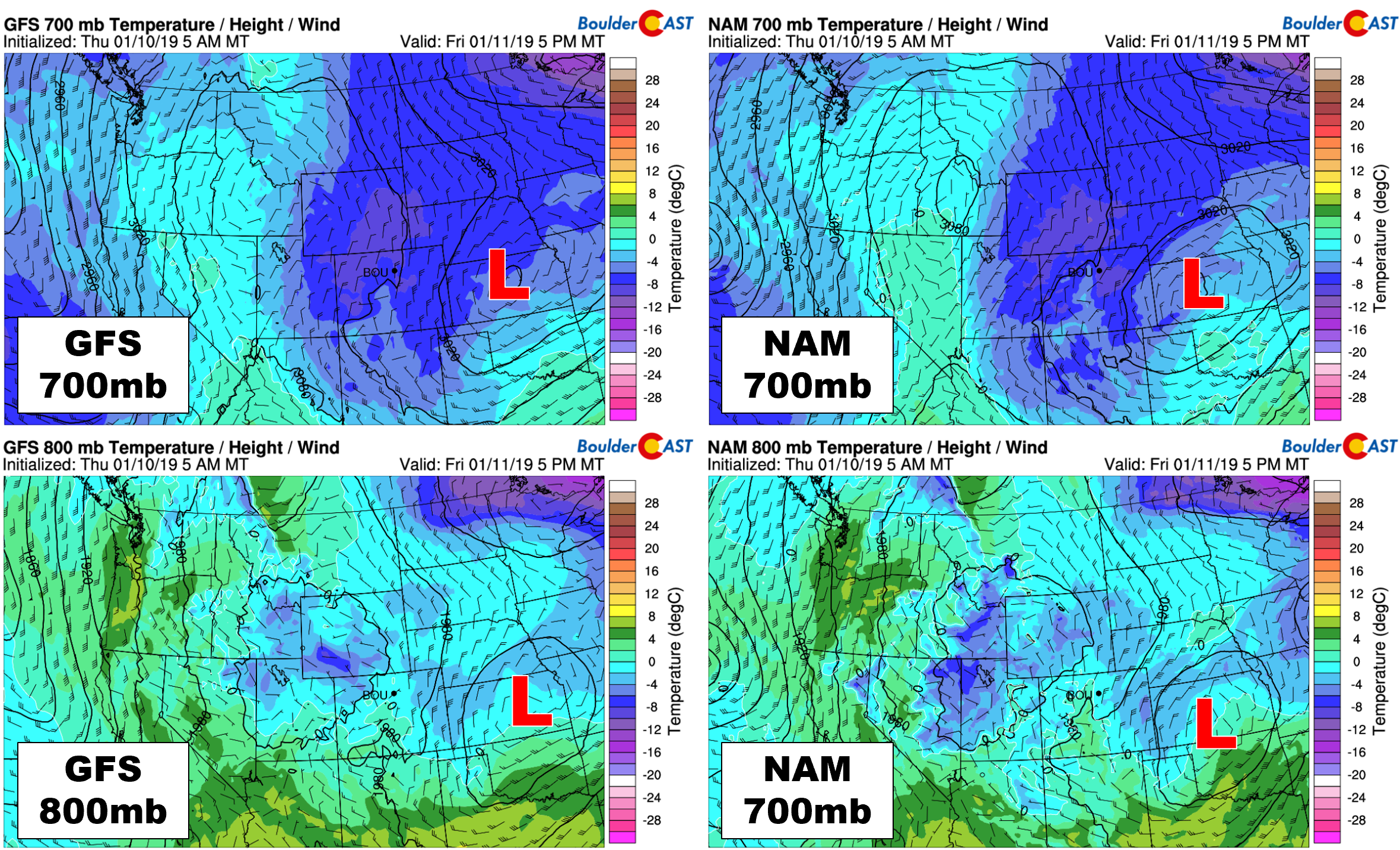
700 and 800 mb temperature and wind forecasts from the GFS (left) and NAM (right). Notice the clear differences in winds around Boulder/Denver
The graphic below gives insight into how these differences would impact the snowfall amounts in the Front Range area specifically.
With the surface low so far south in Texas, winds historically do tend to end-up rather northerly for the Front Range. For this reason, our forecast will stick closer to that of the GFS and European models at this time. While a foot of snow across the Palmer Divide and 8 inches in Boulder sounds great, it’s just not entirely believable at this time.
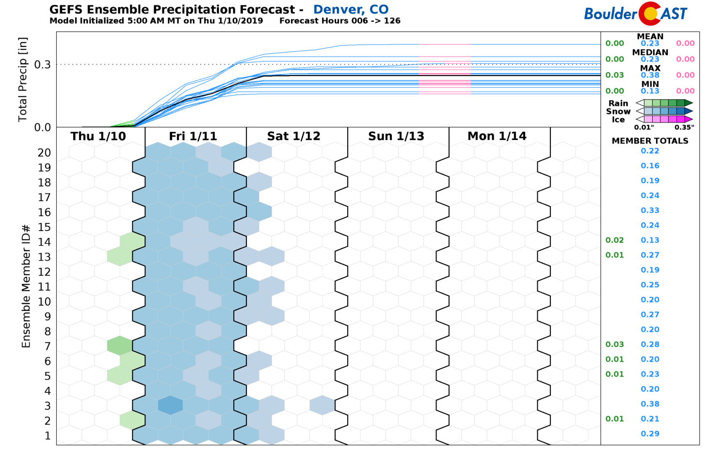
GFS ensemble precipitation forecast for the storm in Denver. About 0.25″ of liquid is indicated, mostly falling as snow
Too warm for snow in January? No way!
Another aspect of this storm adding to the uncertainty is the lack of cold air and the storm’s timing during the daylight hours. Both of these facets will ultimately be a hindrance to snow accumulation. That is, what falls may not necessarily be what sticks.
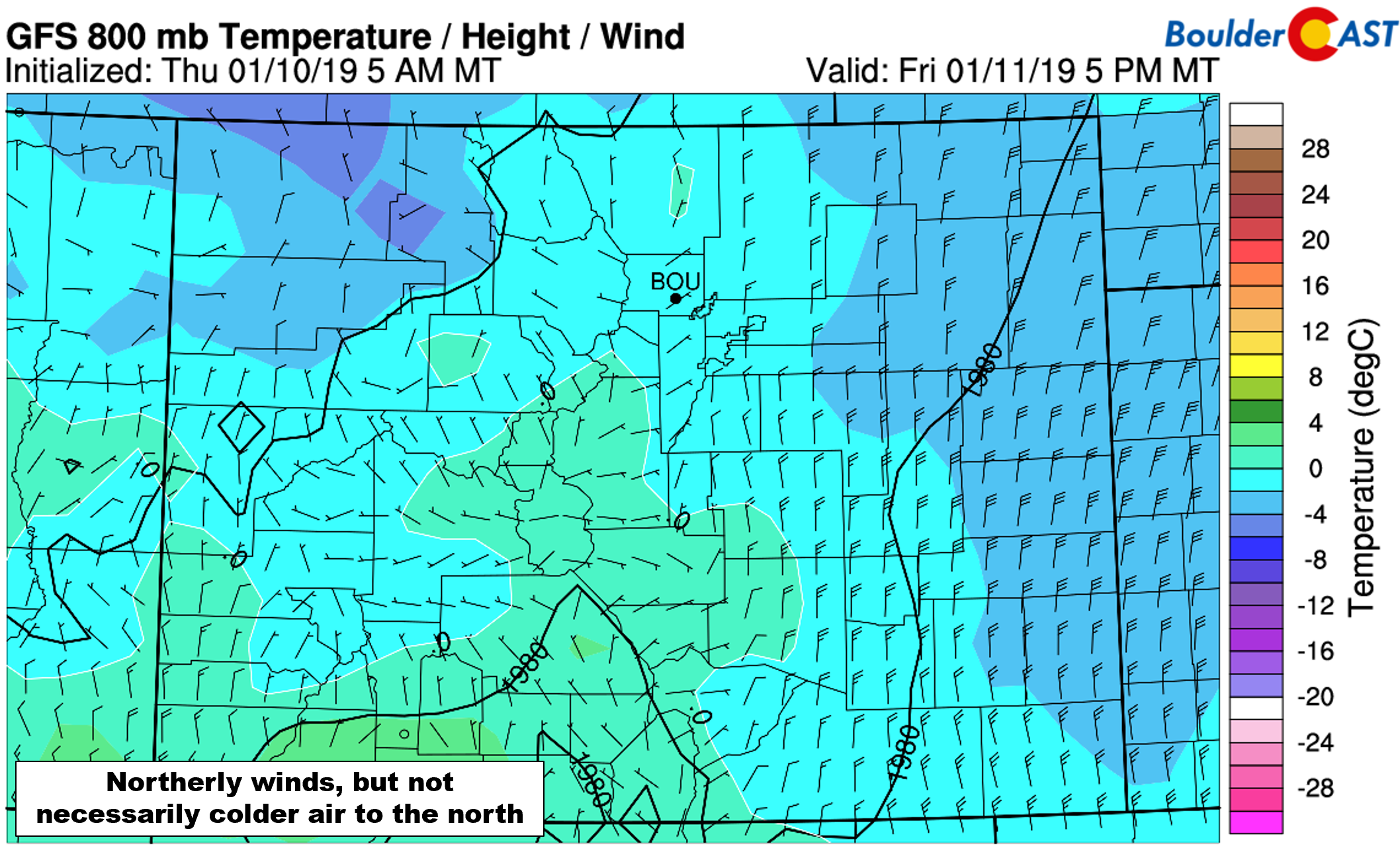
Borderline temperatures for snow rarely are a consideration this time of year. However, in this case, the surface low develops so far south that the draw of cold air into our region is weak and gradual. The 800 mb temperature map below shows very minimal temperature gradients across all of eastern Colorado. Winds are northerly, but the air to the north isn’t any colder. For those of you that participated in our recent Weather Learning Quiz, you know this doesn’t bode well for cold air advection.
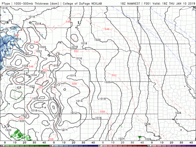
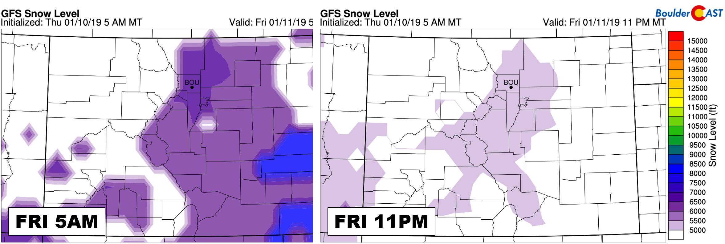
With no pathway for much cooling, this means temperatures will be rather steady or only fall slightly through the day Friday…likely remaining in the middle 30’s for most areas. It will be so warm that precipitation may begin as light rain for the low elevations early Friday morning. For areas near 5000 feet and lower (Longmont, Fort Collins, Greeley), there may be a persistent rain/snow mix lingering through the day, especially considering that those northerly winds will add a degree or two of downslope warming from the Cheyenne Ridge. As you can see below, snow levels will be near 6000 feet before sunrise Friday and then hover near 5000 feet through the day.
Furthermore, warm ground temperatures and the daylight won’t be helping with accumulation either. Despite most folks seeing all snow during the day Friday, travel should remain just fine with only wet roads. Things may get a little dicey late Friday night however, especially in the higher elevations.
We’ll also add that the higher resolution models are stubbornly holding onto the idea that this storm will be more rain than snow for Denver and Boulder. We will hopefully see these models trend snowier in the next several runs. Substantial rainfall in January for us would be quite the rarity….
Amounts & timing
We expect precipitation to develop across the Front Range before sunrise Friday as the ingredients come together for us. It may begin as rain for the lower elevations, or at least a rain/snow mix, but should turn to all snow quickly through the morning hours. As mentioned, marginal temperatures could keep the rain/snow mix going much of the day far north and east of Denver.
Light snow will continue through the day, falling on a warm ground and accumulating mainly on grassy and elevated surfaces. Snow will linger into the evening and night-time hours, especially from Denver southward. Slushy accumulation may start to occur on roadways in spots, but it shouldn’t be all that bad.
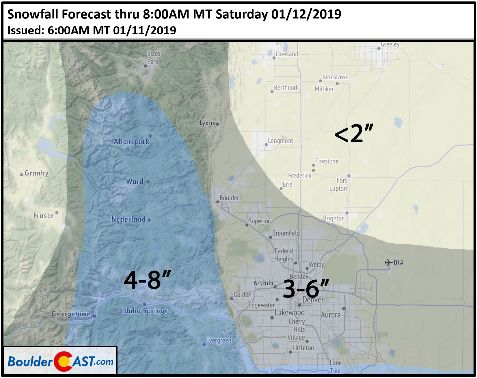
Understanding that the uncertainty is elevated for this particular storm, our snowfall forecast map is shown below. These would be the totals for snow falling Friday morning into Friday night…a rather long duration of time. With no jet in play and weak forcings, snowfall rates should remain light.
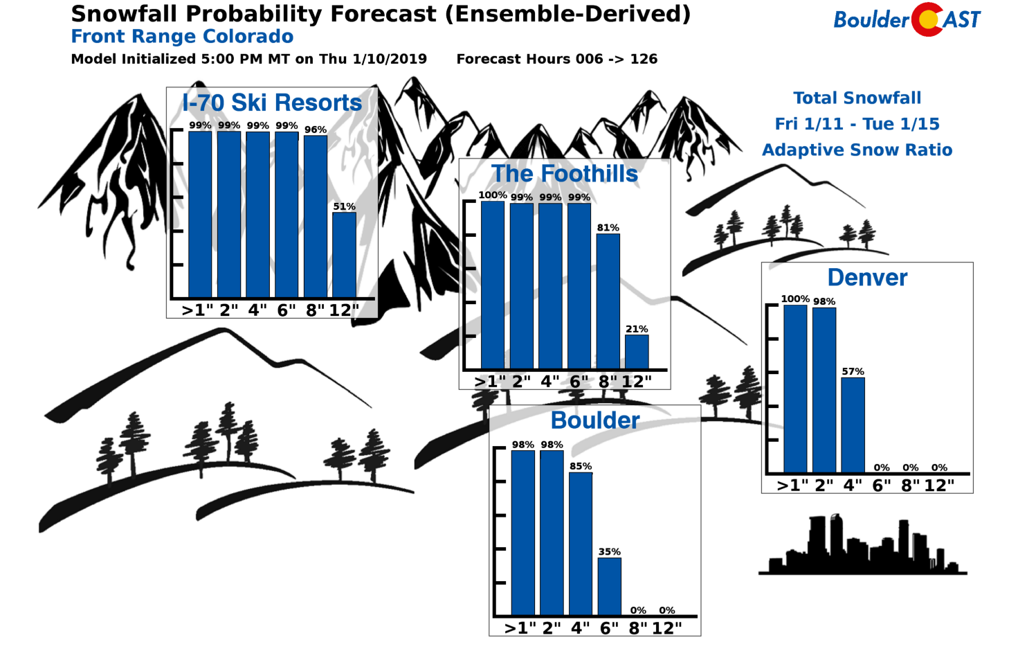
Here is a look at our latest snowfall probabilities:
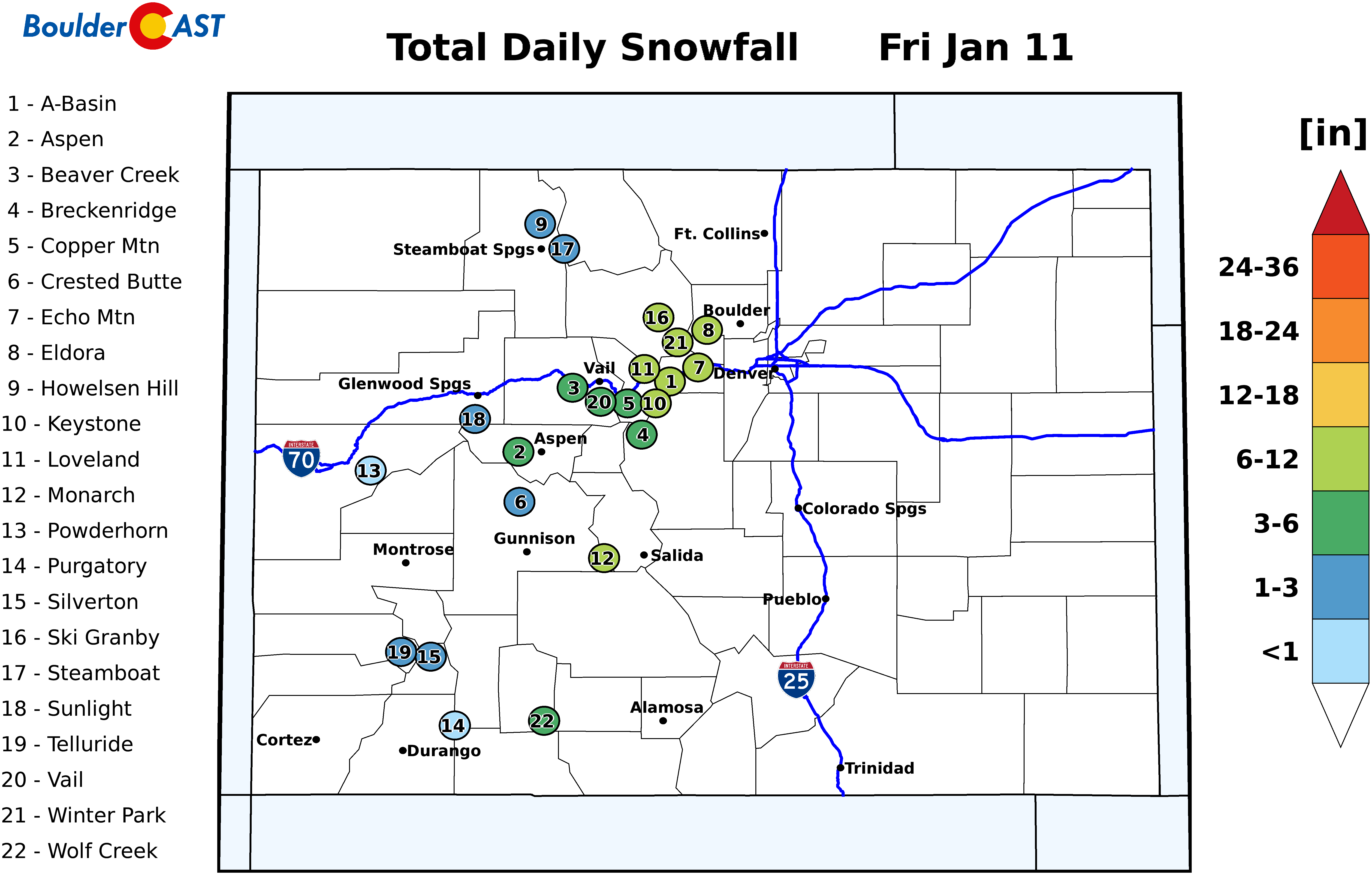
And of course, we can’t forget about the skiers. Probably not enough fresh powder to warrant a “sick day”? Find forecast specifics for each resort over at PowderCAST.
Finally, you can follow along with the storm’s latest developments over on our SnowTracker page. That’s all for now. Color us impressed that Mother Nature was able to spin-up a little “taste of winter” for us on such short notice! Cross your fingers that we catch as much moisture as the models are showing. We definitely need it.
Thank you for supporting BoulderCAST by sharing our forecast:
.




You must be logged in to post a comment.