On Saturday, the NHL’s Stadium Series continues in downtown Denver as the Avalanche host their long-time rival, the Detroit Red Wings, at Coors Field. Many locations across northeast Colorado will be flirting with record heat, possibly making tomorrow’s game the warmest outdoor regular season NHL game ever played. Read on for our full forecast!
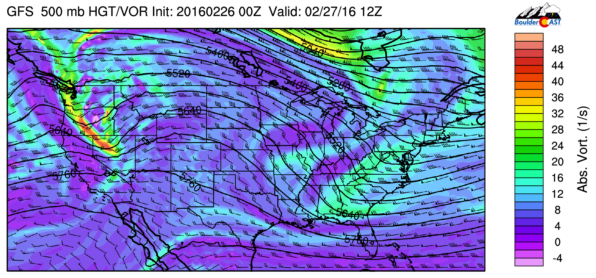
The pesky ridge that has been parked over the western U.S for most of February will produce near-record warmth across the region on Saturday. The ridge can be seen below in the GFS 500mb forecast.

GFS 500mb vorticity map for Saturday, showing the ridge across the area. Our next storm, which will only bring some snow to the Mountains overnight into Sunday, can be seen across the Pacific Northwest
Some of the warmest air in the entire country is along our ridge axis, stretching from central Texas, into Kansas and northeast Colorado.
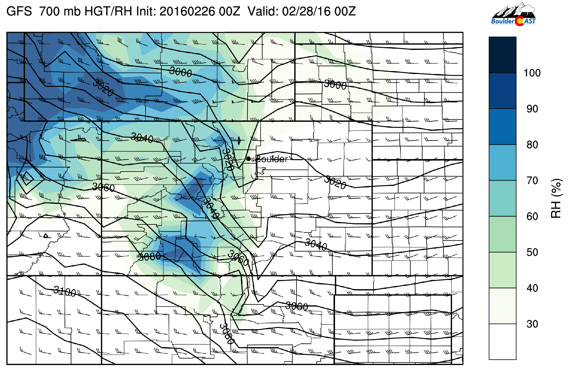
As you would expect, dry air and large-scale descent within the ridge will continue to support abundant sunshine tomorrow across the region. The 700 mb relative humidity forecast for 5pm tomorrow is seen below. We often use this map (among others) to gauge the potential for cloud cover. The very low RH over the Denver Metro spells a very sunny day and mostly clear skies for the game, which begins at 6pm.
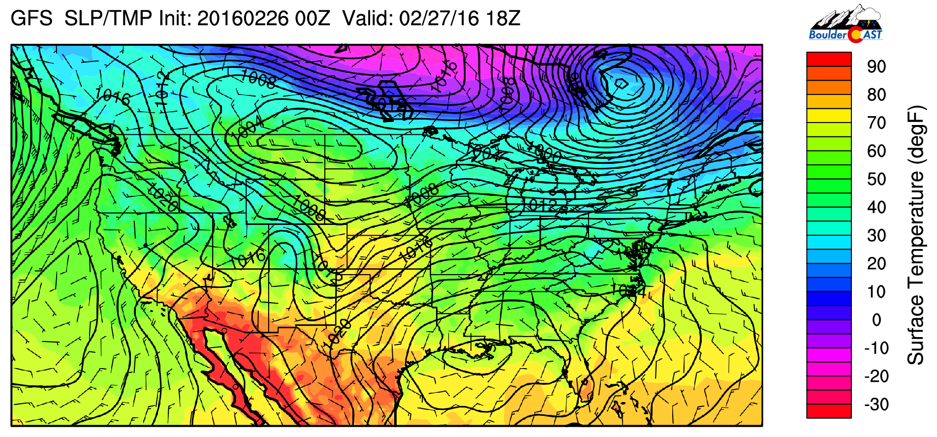
With the approach of our next storm, the jet will be overhead tomorrow evening into early Sunday morning. Unfortunately it looks to arrive sometime during the Avalanche game, which could make for some gusty winds. Take note of the 700 mb wind speed in Denver above. At 5pm, winds are around 10 knots. Compare that to the map below, just six hours later at 11pm.
A 700 mb wind speed increase to 50 knots is evident, as well as the beginning of snow in the Mountains. This will create wind gusts in excess of 30 mph at times, particularly during the latter half of the game. In the Mountains and Foothills, gusts of 60 mph will be possible. The NAM is even more progressive, so winds could pick up sooner.
Denver’s record high for February 27th stands at 73 degrees, dating back more than 100 years (75 degrees is the mark to hit in Boulder)! While it will be close, we think tomorrow will come up a few degrees short. Our forecast calls for an afternoon highs in the low 70’s!
Game-time Forecast
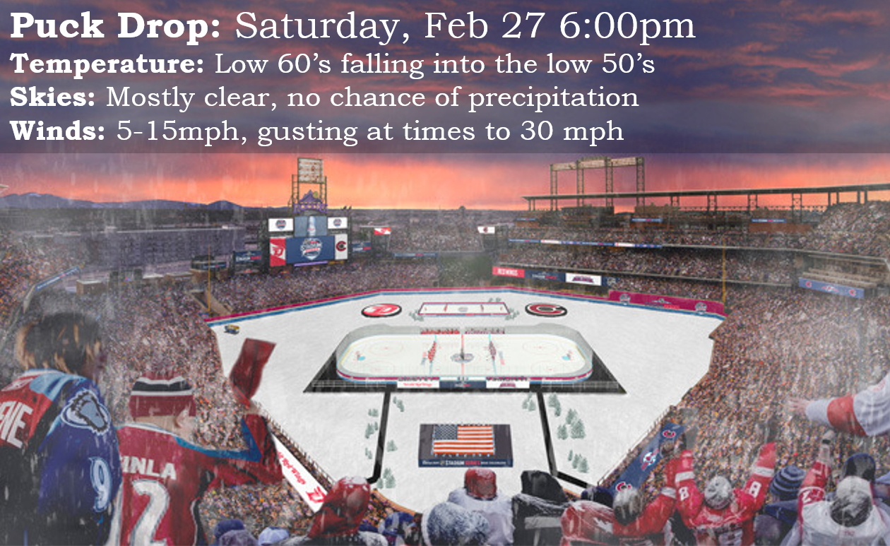
By the time the game starts at 6pm, temperatures will be in the low 60’s, falling to near 50 degrees by the time the game concludes around 9pm. The temperature at faceoff may make tomorrow’s game the warmest ever NHL regular season outdoor game. The temperature to beat is 63 degrees, which was achieved one year ago at the Sharks/Kings outdoor game in Santa Clara, CA. 50-degree weather used to create issues with the ice in these games, but the NHL’s outdoor rink set-up has come a long way in the last eight years. Hopefully the ice holds up to the warmth this time around.
Winds will be light to start, though increasing with some gusts of 30 mph possible by the game’s end. Expect mostly clear skies with nothing to mention in the way of rain/snow.
If you are headed out to the game, enjoy! It could be a while before outdoor hockey returns to Denver. Go Avs!


You must be logged in to post a comment.