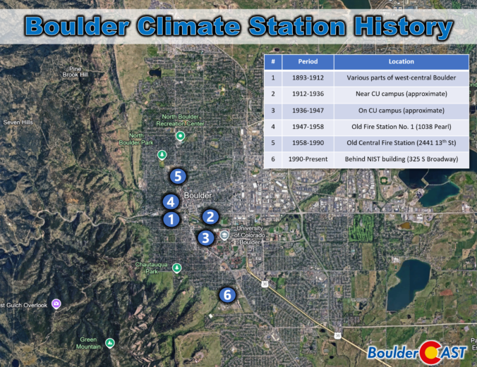
Boulder’s “official” climate record has never lived in one place for long. Over the past 130 years, the instruments that track our temperature, precipitation, and snowfall have been relocated again and again—sometimes only a few blocks, other times miles away into landscapes with completely different quirks and microclimates. Each move left its own imprint on the long‑term dataset we use today, subtly shaping how we compare modern conditions with the Boulder of decades past.
Category: Weather in the News (Page 1 of 16)
These posts cover interesting weather phenomena from around the world, and won’t be specific to Boulder County. However, Earth is very diverse in the world of weather, so you will surely learn a thing or two.
Wednesday may have felt underwhelming across the lower elevations of the Front Range, where lingering low clouds kept things calm and cool for much of the day — but just west of Boulder, up in the sunshine-soaked Foothills, something rare and striking took shape Wednesday afternoon. A graceful funnel cloud twisted above the mountain peaks in a spot where such phenomena almost never occur. We explore why tornadoes (and their funnel-shaped precursors) are so uncommon in Colorado’s higher terrain, and take a closer look at what makes broader Boulder County particularly adverse to tornado development.
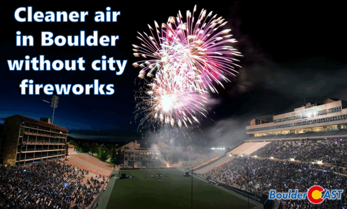
While fireworks once lit up Boulder’s Fourth of July, the city has moved on from the tradition due to rising fire risks, noise concerns, crowd issues, and high costs. But there’s another reason to consider: air quality. This year’s air quality data from across the Denver Metro area revealed that Boulder’s lack of a city-run fireworks show resulted in noticeably lower pollution levels compared to neighboring cities.
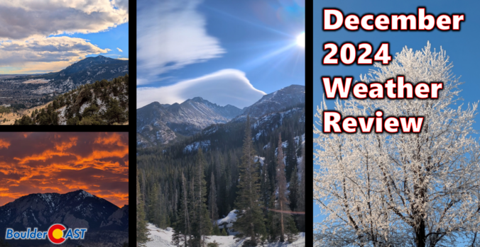
After a definitively wet November in the Front Range, Mother Nature did a complete one-eighty with December landing one of the warmest and least snowy on record in many locations, topped off with our first rainy Christmas in 82 years! Here’s a quick and colorful graphical recap of our weather during December and how it relates to climatology.
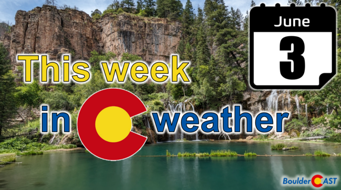
After a mostly quiet and warm weekend, things will more-or-less remain unchanged for the first full week of June. Temperatures will stay warm to hot with only a small chance of rainfall this week. We’ve managed to dodge the nineties so far in 2024, but that bout of good fortune will run out later this week with multiple days soaring above 90 degrees. Read on for all the details.
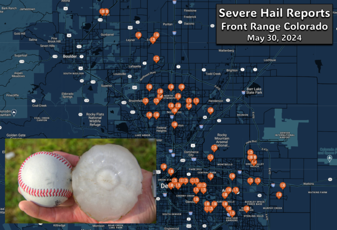
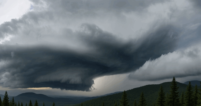
A pair of severe, supercell thunderstorms exploded across the northern Front Range late Thursday evening with very little advanced notice for residents. Hail larger than baseballs caused significant property damage on the northern and northeastern Metro area — roofing, siding, car windows and gardens stood no chance against the onslaught. The hail repair and insurance scammers are probably already knocking on doors this morning or making cold calls! We take a look at where the largest hail fell and why the forecast was so poor.
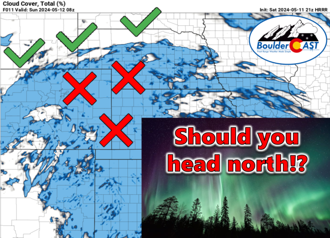
In extremely rare fashion, Mother Nature’s incredible showing of the Northern Lights Friday night extended across nearly the entire continental United States, including a shimmering display of pink and green hues over the Denver area. If you somehow missed the exceptionally infrequent sight Friday night, you have a second chance Saturday night as severe geomagnetic storming is set to continue across planet Earth for at least one more night. Unfortunately, you won’t be able to see much in the Front Range this time around due to cloud cover. However, a couple hours of interstate driving should be enough to reach clear skies in order to take in round number two Saturday night. Let’s discuss!

Live View of Boulder

Current Conditions

Live Radar

Recent Premium Posts

BoulderCAST Daily – Wed 01/28/26 | An overcast but mild Wednesday; Friday’s late-day cold front may bring very light snow
🌤️ Staying calm today: A quick‑moving ridge brings quiet weather, but clouds thicken …
BoulderCAST Daily – Tue 01/27/26 | Early morning clouds will give way to a sunny Tuesday
🌤️ Clouds Clearing Fast — Early morning mid‑level clouds from northwest flow fade …
BoulderCAST Daily – Sun 01/25/26 | Light snow develops later today into this evening
❄️ Light snow this afternoon and tonight: A fast-moving clipper type system brings …
3-Day Forecast

Trending Content

© 2026 Front Range Weather, LLC