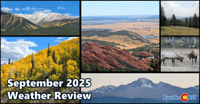
September 2025 brought a classic Colorado blend to Boulder and the Front Range: near-normal temps, wetter-than-average skies, and a lively mix of sunshine and storms. A standout precipitation event around the 23rd delivered soaking rain in the lowlands and the first real coating of snow to the Mountains. The month eased us gently into autumn, with crisp mornings, comfortable afternoons, and brilliant foliage lighting up the higher terrain. And yes—who could forget that dramatic wave of Canadian wildfire smoke that swept through, reminding us how connected we are to the broader arid landscape of western North America. Here’s a quick and colorful graphical recap of our weather during September and how it relates to climatology.
Category: Verification (Page 2 of 51)
These posts take a look back at recent weather events, like snow storms or severe weather outbreaks, and evaluate how the forecast played out. We evaluate how well the models predicted what actually occurred, and offer insight into what can be learned and applied moving forward.
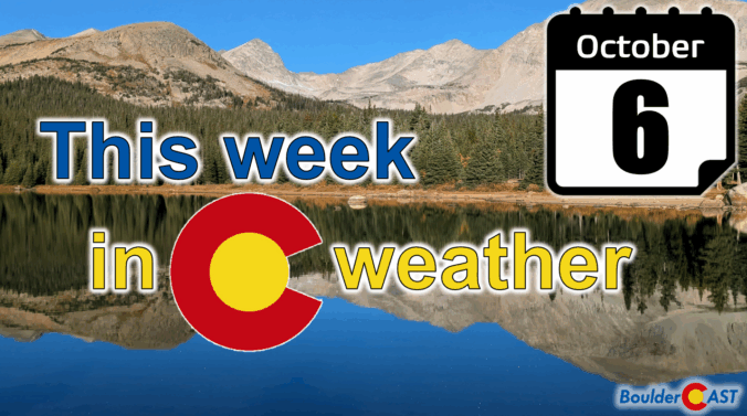
This week’s weather in the Front Range will be a bit of a rollercoaster. After Sunday night’s soaking rain and snow, Monday kicks off with fog, drizzle, and stubborn clouds before a midweek warm-up brings back the sunshine. But don’t get too cozy: frost season is knocking on the door, and snow signals are starting to flicker in the long-range models. Read on for the full breakdown, including what to expect today, what time rain showers will return later in the day Monday, and when late-season gardeners should start watching for frost and snowflakes.
P.S. Don’t forget to submit your entry to our 2025 First Snow Contest which closes Tuesday night at midnight!
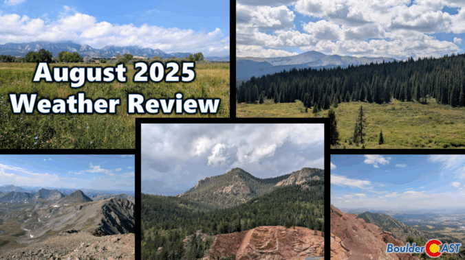
August 2025 was on track to be our third scorcher in a row — hot, dry, and smoky — until a late-month shift brought in a welcome stretch of cooler, wetter weather. That pattern change helped balance things out across the Front Range, with most areas landing close to average for rainfall and just slightly warmer than normal overall. Still, it wasn’t all relief: the month packed in plenty of wildfire smoke and a few record-breaking heat days that served to remind us that summer wasn’t done yet. Here’s a quick and colorful graphical recap of our weather during August and how it relates to climatology.
NOTE: This monthly recap was delayed due to missing data in the August 2025 climate record for Boulder which has since been partially filled with best-guess approximations.
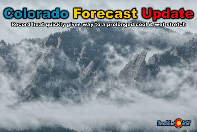
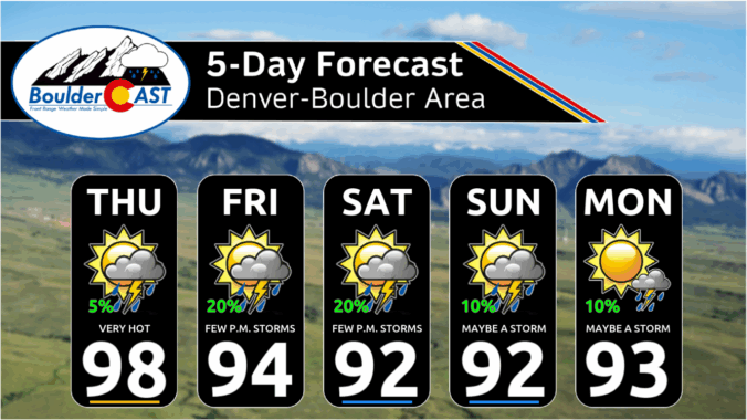
Thursday marks the final chapter of our late-summer heatwave, with record-challenging highs expected across the Front Range — but big changes are on the horizon. A cold front arrives tonight, ushering in cooler temps, a return of thunderstorms, and a wetter, more active pattern that could stick around well into next week. From sizzling heat to damaging hail, monsoonal moisture, and a long stretch of below-normal highs, today’s forecast update has a little bit of everything.
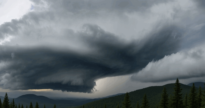
Wednesday may have felt underwhelming across the lower elevations of the Front Range, where lingering low clouds kept things calm and cool for much of the day — but just west of Boulder, up in the sunshine-soaked Foothills, something rare and striking took shape Wednesday afternoon. A graceful funnel cloud twisted above the mountain peaks in a spot where such phenomena almost never occur. We explore why tornadoes (and their funnel-shaped precursors) are so uncommon in Colorado’s higher terrain, and take a closer look at what makes broader Boulder County particularly adverse to tornado development.
Monsoon season may have officially started earlier this month, but it’s off to a sluggish and lack-luster beginning across Colorado. Boulder has seen frequent storms—yet little meaningful rain—and wildfire smoke from the Western Slope and neighboring states is starting to pool to our west. A cold front arriving Tuesday night will bring cooler temps and a bump in thunderstorm chances for Wednesday, followed by a promising shift toward a more classic monsoonal setup Thursday through the weekend ahead with continued daily storms. This week, we’re tracking some heat, smoky haze, and hopefully, a few solid soakings of rain.

Live View of Boulder

Current Conditions

Live Radar

Recent Premium Posts

BoulderCAST Daily – Wed 01/07/26 | Quiet today but snowflakes are on the horizon tomorrow
⛅ Quiet Weather Today: Highs will be mild in the upper 50s in …
BoulderCAST Daily – Tue 01/06/26 | Critical Fire Conditions Today
🔥Critical Fire Conditions: Fire Weather conditions could be critical today with gusty winds …
BoulderCAST Daily – Sun 01/04/26 | Red Flag Warning in effect for some
🌤️ Mild but Red Flag Warning in effect for some of us: Highs …
3-Day Forecast

Trending Content

© 2026 Front Range Weather, LLC