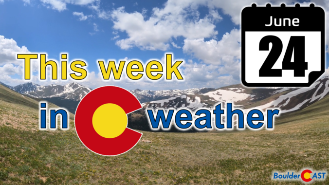
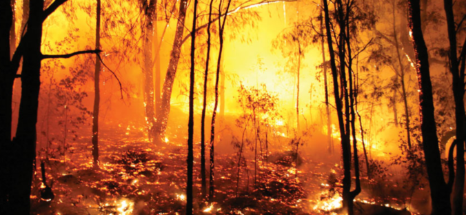
After days of scorching heat, this week will fortunately trend cooler and wetter with the return of monsoon moisture to Colorado — perfect timing considering severe drought has now returned to the area and fire danger continues to explode. Following one more toasty outing on Monday, temperatures will tumble below normal by midweek with daily chances for monsoon thunderstorms, some of which could be severe. We review the ongoing heatwave, the recent Dinosaur Fire in Boulder, why the pattern is now shifting and look ahead to which days will offer the best chance of rain this week.
Category: Severe Weather (Page 7 of 21)
The posts contain discussion of severe weather in our region, including forecasts, outlooks, and recaps of events involving large hail, damaging winds, and tornadoes.
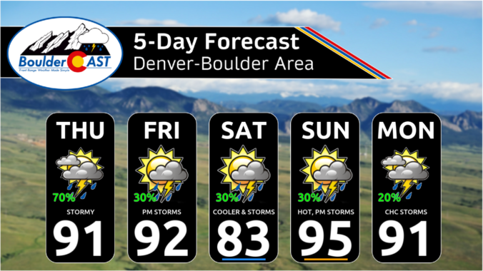
This week’s weather in Colorado will be dominated by a potent ridge of high pressure setting up shop across New Mexico. Although chances of storms will exist for Monday and Tuesday, model guidance shows better agreement for more numerous thunderstorm activity during the latter part of the week as a few weak fronts move into the region and moisture levels increase across the Front Range. High temperatures will be close to record values early in the week, but trend downward slowly by week’s end. Read on for more details.
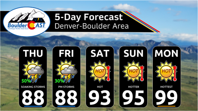
As the Front Range races towards near-record high temperatures on Thursday, the weather pattern is evolving to offer a short-lived reprieve on Friday with a chance of severe thunderstorms and cooler temperatures accompanied by well-mixed smoke blowing in from Mexico. While the blistering heat will ramp back up again over the weekend, we are tracking a potential dip towards more comfortable temperatures next week. Here’s the latest!
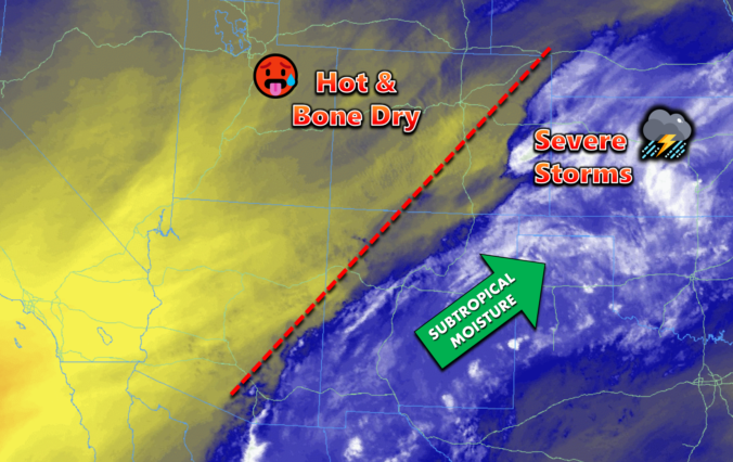
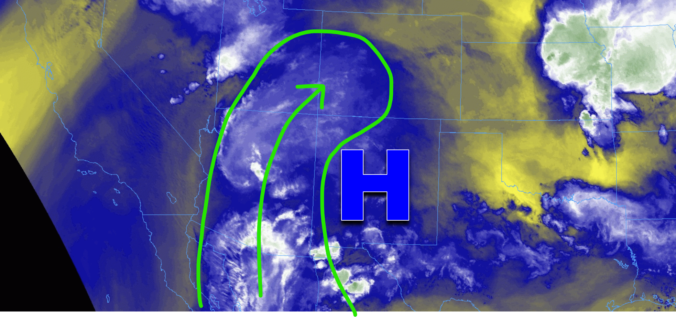
This week in the Front Range will feature two scorchingly hot days sandwiched between chances for thunderstorms. For the most part, the severe risk looks to be low throughout the extended, but we will need to monitor things late in the week as a surge of subtropical moisture may support more numerous storms and torrential rainfall rates. Read on for all the details.

Live View of Boulder

Current Conditions

Live Radar

Recent Premium Posts

BoulderCAST Daily – Sun 01/11/26 | A mild Sunday with readings reaching the 50s
🌤️ Mild & Melty Sunday: Light winds and patchy clouds, with lingering snowpack …
BoulderCAST Daily – Sat 01/10/26| Widespread sunshine and moderating temperatures this weekend as our recent snow melts off
🌤️ Calm Saturday: Winter storm systems have departed the state, leaving behind a …
BoulderCAST Daily – Fri 01/09/26| Snow ends quickly this morning with a quieter weekend in store
❄️ Overnight snow bands: A second push of upslope after midnight sparked narrow …
3-Day Forecast

Trending Content

© 2026 Front Range Weather, LLC