The shortwave disturbance which brought a wave of weak showers and storms to the area yesterday has exited off to our south and east, just barely clinging to the far southeast corner of Colorado as of early this morning. Behind this system, a fetch of drier air is working into the region from the northwest and this will lead to …
Ahighly anomalous moist atmosphere will build into the Front Range this afternoon and evening from the eastern part of the state. With high pressure to our east and low pressure in the desert southwest, a moist south-southeasterly flow will advect into the region precipitable water values upwards of 1.2 to 1.4 inches, about 4 or so standard deviations above normal! …
Amarginal to enhanced risk of severe storms is in place today, with the greatest severe risk east of Denver from Fort Morgan to Limon to Burlington, as shown below. A mid-level shortwave trough over Utah/Wyoming will track ESE into north-central Colorado this afternoon before reaching Nebraska and Kansas later today and tonight. At the surface, a cold front pushed through …
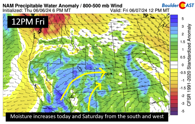
Moisture in the mid and upper levels of the atmosphere will be on the rise today and into the weekend as a south and west flow dominates. A trough to our north and closed low near Baja will favor moisture increasing from the Pacific region. This along with a southward moving cold front this evening will increase our chances of …
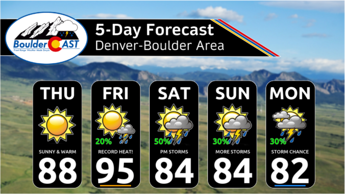
Boulder and Denver both recorded their first 90-degree days of the year yesterday reaching 90 and 91 degrees, respectively! A weak, essentially undetectable cool front moved through last night which will act to curb temperatures a few degrees today. Models have actually doubled down on the amount of cooling we will see across the lower elevations. We're now expecting temperatures …
We haven't reached 90 degrees yet in Boulder or Denver this year (Monday was a candidate, but had too many clouds), but that likely changes today for one or both cities as a pronounced ridge pattern takes hold across the West. High pressure aloft is centered over Arizona right now with hot air flowing up the western side of the …
The primary and really only shortwave system for the week moved through our area overnight and is about to exit Colorado to the east this morning. I am not seeing any reports outside of the Mountains that picked up measurable precipitation from this shortwave. It mainly brought a few surges of wind and increased cloud cover to the area. Speaking …