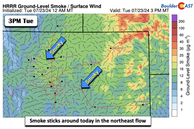
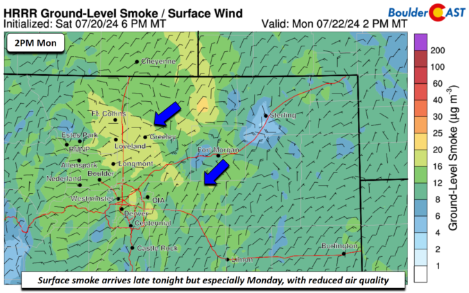
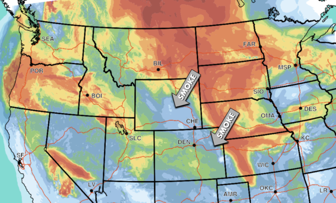
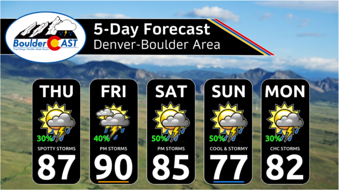
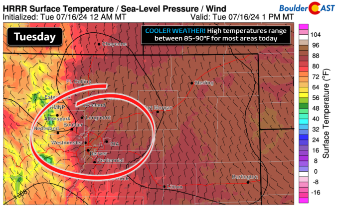
An upper-level ridge axis remains to our west today but will move slightly to the east, spelling out our highs getting back to the low 90s for most places along the Front Range. Boulder may end up just a few degrees shy in the upper 80s. The northerly flow at mid-levels will continue to bring in smoky conditions from Canada …
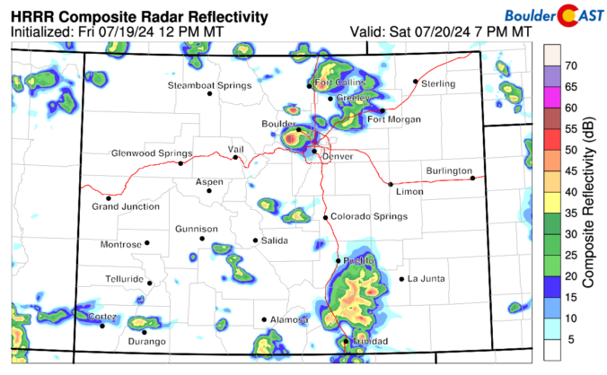
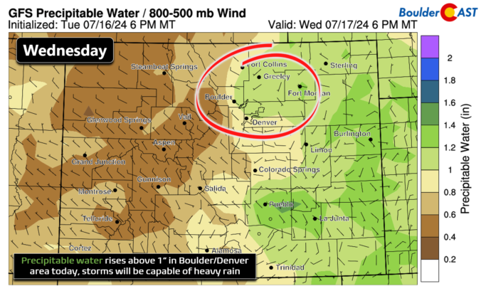
An upper-level trough axis stretching from northwest to southeast will track through from the north this afternoon and evening. Along with a northeast upslope flow at the surface and high dewpoint air (mid to upper 50s), this will fuel scattered shower and storm development once again into mid to late evening. The area to watch for flash flooding would be …
Asurface low will be over the Midwest today. As it tracks slowly to the southeast, a surface trough will extend into northern Texas. While the trough will be to our south, the northeast flow will be prominent across the Front Range today. Also, high pressure over Montana will further reinforce the northeast upslope flow. That northeast flow will favor highs …
High pressure is currently located across Arizona with north-northwest flow residing over the Front Range. This is seen in the morning GOES-East water vapor loop below. Note that despite the big high pressure, a fair amount of monsoon moisture is trapped inside the ridge. This will provide the fuel for storms today (and throughout the upcoming weekend). Furthermore, a shortwave …
Following yesterday's disappointing rain output, skies are mostly clear this morning across Colorado as seen from the GOES-East's visible satellite animation: Mostly clear is not entirely accurate, though, as there is plenty of smoke filling our skies. Check out the latest view from the Alpine Visitor Center in Rocky Mountain National Park below. Yuck! Thick smoke from wildfires in the …
Happy Wednesday, folks! Today will offer another great chance of monsoon thunderstorms during the afternoon hours. This comes after two relatively wet days already this week: https://twitter.com/BoulderCAST/status/1812959681767219257 https://twitter.com/BoulderCAST/status/1813308211610714392 The ante will be upped a tad today thanks to a cold front that moved through overnight bringing a surge of low-level moisture to our area. We've been looking forward to this …
Yesterday's late-day thunderstorms were a bit more fruitful than expected, including one particularly nasty cell which hit Broomfield and parts of Westminster with torrential rainfall, penny-sized hail, and wind. The scene below shows the storm crossing Interstate 25 around 3PM Monday. Precipitation reports show that more than 1" of rain fell from that strong storm in Broomfield, and more than …
🌤️ Storm Exit — The stubborn upper low that brought days of clouds, …
3-Day Forecast

Did You Know?
In order to maintain cabin pressure of an airplane, air is brought in from outside the plane and compressed to be adequate for breathing. Even considering the bitter cold air at 35,000 feet, this compression causes extreme warming, so much so that the air must be air conditioned before being pumped into the cabin.