Category: Premium Content (Page 92 of 451)

This content is for Premium Members only.

Premium BoulderCAST Daily – Wed 07/31/24 | The heatwave rages for at least another week as more wildfires ignite in the Front Range and smoke piles up

Boulder set a new daily record high temperature on Tuesday soaring to a cozy 99°F during the early afternoon hours. The prior record was 98°F last set in 2006. Denver hit 100° (again!) but this was not a record for the date. Fortunately Tuesday was the only day this week that we were really concerned about record heat. The overnight …

Premium BoulderCAST Daily – Tue 07/30/24 | Near-record heat once again before thick smoke from California arrives late tonight behind a “cold” front

Today's weather in the Front Range will be almost identical to Monday's with completely sunny skies and near-record highs possible as our heatwave marches on --- it's not stopping for anyone. A large swath of exceptionally dry air remains over most of Colorado today, blowing in with the west-southwest aloft. This is shown by the yellow shading in the GOES-East …

Premium BoulderCAST Daily – Sun 07/28/24 | It’s getting hot

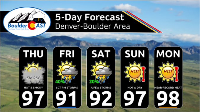
Ahot westerly flow will ensue for today and continue through much of the coming week. That is going to spell out middle 90s for us this afternoon but upper 90s to around 100 as the coming week progresses. There will be little chance of rain until later in the week. Our NowCAST shows that highs will be hottest in Denver …

Premium BoulderCAST Daily – Sat 07/27/24 | Heat starts building today

Adisturbance will be tracking through today in the southwest flow. A trough axis will be situated from Washington into California. That energy will be tracking through in the southwest flow, which is a downslope flow. As such, there will be storms around this afternoon and evening, but coverge will be highest along/east of Denver, away from the influence of the …

Premium BoulderCAST Daily – Fri 07/26/24 | Wildfire smoke exits this afternoon/evening but storms move onto the Plains

Adisturbance will be tracking through today from the westerly flow aloft and aid our best chance of storms this week. Storms will initially develop over the higher terrain and nearby Foothills. The storms will then track eastward onto the Plains in the late afternoon and early evening. Most storms will be sub-severe, but the stronger ones could certainly put out …

Premium This Weekend in Colorado Weather: Canadian smoke finally vacates the area on Friday! Unfortunately prolonged extreme heat will be its replacement…

The amplified mid-level ridge of high pressure across the West will continue to funnel smoke into Colorado today. Notice how the flow aloft is coming directly from the Canadian prairies southward into the Front Range. However, there is a closed-low pressure coming out of the Pacific Northwest along the Canadian border. This low pressure is ultimately what will cut-off the …

Premium BoulderCAST Daily – Wed 07/24/24 | Air quality improves slightly in the days to come, but worsening heat will keep things uncomfortable

We're happy to report that the end of the thick smoke is in sight across the Front Range. We should see some slight improvement today compared to Tuesday (which looks to have been the worst day of the week), with further improvement expected tomorrow before even more drastic clearing Friday into the weekend. The latest ground-level smoke forecast from the …

« Older posts Newer posts »