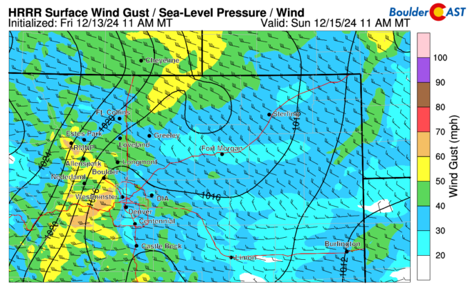
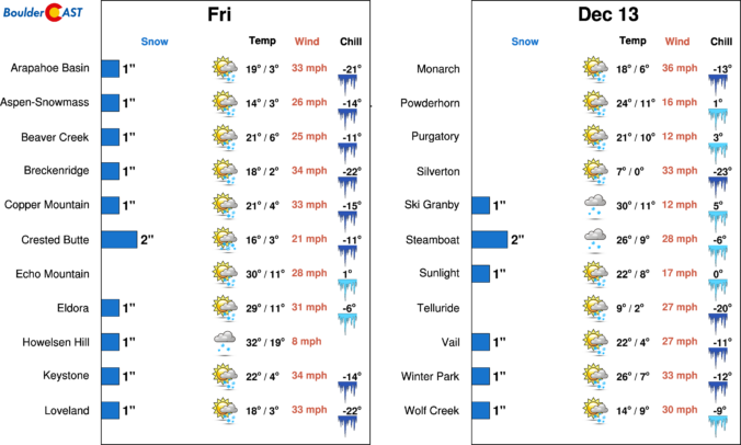
The overnight downslope windstorm evolved mostly as expected, with peak wind gusts over 65MPH across a large portion of the Foothills to the west, with peak gusts over 75 MPH in some parts of Boulder County. An impressive gradient in the strong winds set-up immediately adjacent to the Foothills. For example, the NCAR Mesa Lab in far southwest Boulder saw …
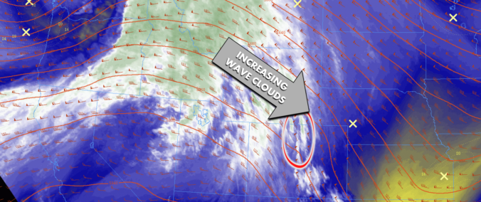
Yesterday's shortwave disturbance, which brought gusty winds to the Metro area and blowing/falling snow to the Mountains, has exited east into the southern Plains this morning, leaving moderately strong northwest flow in its wake. There's already some north-south oriented big wave clouds forming out there as the sun comes up, and that really will be the main story today as …
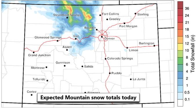
Ashortwave disturbance will zip across northern Colorado today bringing a brief wave of snow to the Mountains but just gusty winds to the east across the Boulder-Denver region. The offending system can be seen sliding across our area in the NAM 500mb vorticity forecast animation below. We will say that expected snowfall amounts have gone up a bit, with most …
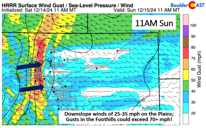
Astrong jet streak moves overhead this morning and afternoon tied to a shortwave moving over Montana and Wyoming. The jet streak over Colorado will approach 120+ mph along and west of the Divide, indicated below. While the flow is not directly perpendicular to the mountain range, it will be enough to produce gusty to very strong downslope winds on the …
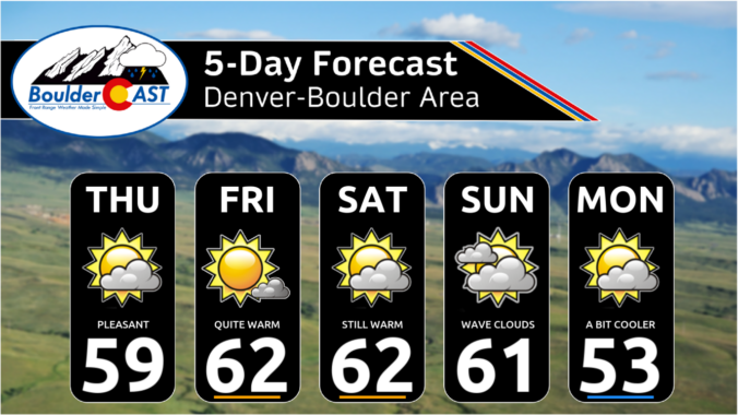
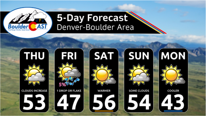
Today will feature gorgeous weather with temperatures on the mild side in the middle 50s. Some areas in Denver could reach the upper 50s. Shortwave ridging will favor lots of sunshine. After some gusty winds yesterday, we are much calmer today with light and variable winds. Winds are likely to pick up again for Sunday as guidance indicates a strong …
We have a mid-level shortwave trough that will progress across the state this afternoon and evening. It's track takes a very unfavorable path, favoring downslope on the Plains. As such, our snowfall probabilities indicate no chance of snow. We would be hard-pressed to see a flake or sprinkle, if that, given the dry atmosphere as it progresses eastward. As for …
The large-scale pattern across the West consists of weak ridging over Colorado ahead of an approaching shortwave disturbance in northern California. Both of these features can be seen in the GOES-East nighttime clouds animation below. While there will be a mix of sunshine (more) and wave clouds (less) this morning, there's a lot of upper-level moisture producing cloud-cover upstream. These …