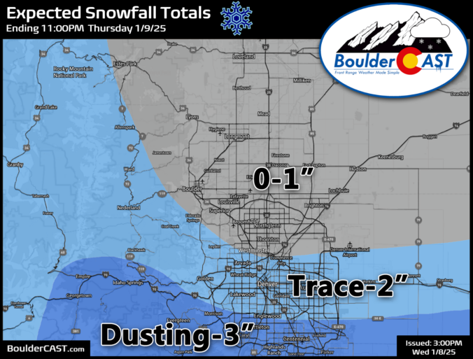
AUpdate Wed 1/8/25 3PM: Snow forecast map for Thursday's event updated. s promised, this morning has delivered the coldest temperatures of the season so far, with readings generally in the single digits to lower teens across the Denver Metro area. Further north in the lower elevation river valleys, temperatures are below zero reaching as low as -13°F in Greeley! Current …
It is a cold and dry day today. Contrary to our foggy and cold conditions and some snow yesterday, we should see the clouds and fog not be an issue for today. There could be some around in the morning, but this should lift by midday, leading to a mix of clouds and sun. But the cold air is well …
Be careful if you are going out this morning. An Arctic front draped from the Front Range into the central Plains is in place. Temperatures behind this front are in the 20s with winds out of the east and northeast. There is a high amount of surface moisture in place. Relative humidity values are near 100% in most areas. Given …
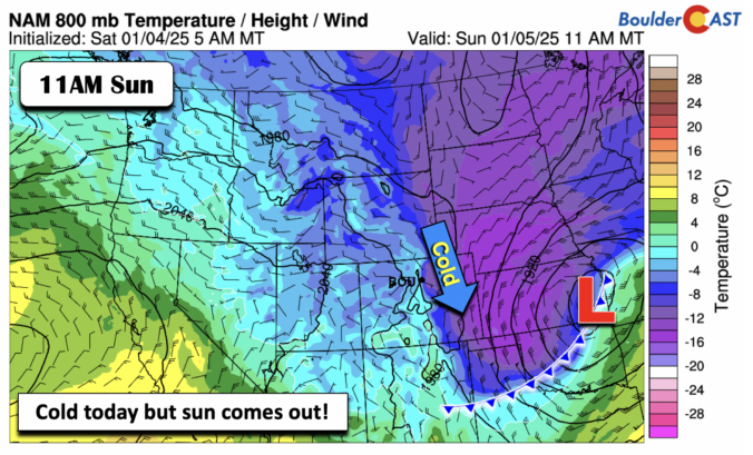
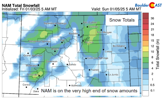
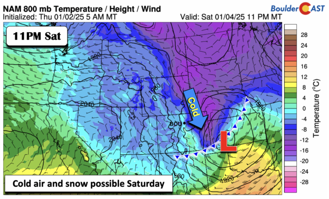
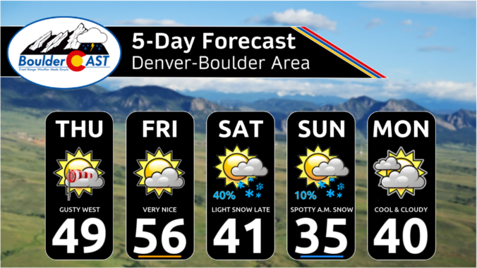
We end the work week on the quiet and mild side with ridging aloft building in. Temperatures warmest in the low 50s in metro and south Denver, with perhaps some upper 40s toward Boulder and near the eastern Foothills. We turn colder Saturday as two cold fronts move through the area. The first one moves through Saturday morning as winds …
Widespread moderate snow is falling across the Mountains this morning as yet another piece of shortwave energy moves across the state in the northwest flow. This perturbation contains jet energy and a decent amount of moisture creating both orographic snow and some jet banding in the High Country early on this Thursday. Radar shows active snow falling along the Continental …
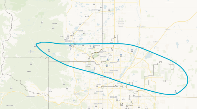
Well, we had a bit of excitement across the area last night thanks to a small, rogue snow shower in the northern Metro that spawned to create very slick travel from southeast Boulder to Westminster to Thornton to DIA during the evening hours. This snow shower basically surfed atop of weak mid-level cold front for a couple hours dropping up …
The weekend ends on the mild side and we are also quiet. Highs on the Plains should top out near 60 degrees with a mix of clouds and sunshine. We return to an active pattern on Monday as another storm system rolls across the region. The passage will mean little in the way of precipitation, but a lot in terms …
🎃 🌫️ Halloween Day starts off with fog — Seasonable temperatures near 60° …
3-Day Forecast

Did You Know?
Next time you're in an area with melting snowpack, look for suncups! These are tightly-packed, bowl-shaped depressions in the snow surface that can make the snow look like a honeycomb. Suncups form and grow when photons of sunlight get trapped within the cup itself causing increased melting.