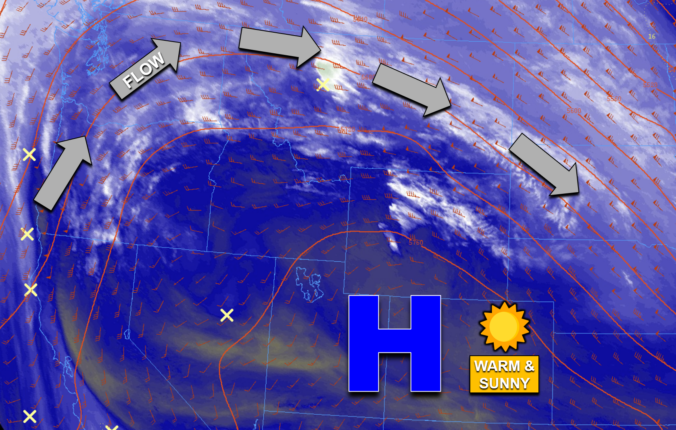
Colorado now rests within the center of the well-advertised ridge of high pressure across the central and southern Rockies. GOES-East shows us the protection offered by the ridge this morning, with copious dry air situated throughout the Great Basin, the Desert Southwest, and of course our glorious state. All of the clouds, precipitation, and faster winds are shoved well to …
Yesterday's wave clouds ended up being fairly extensive which kept a lid on temperatures during the afternoon hours. This resulted in most of the Denver Metro area staying in the mid to upper 60s, with only some northern areas cracking the 70-degree mark. High temperatures from Monday are shown below. The bigger story was the pesky downslope winds which peaked …
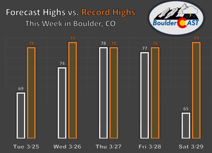
Aset of breezy next few days will be in place across the region. A persistent westerly flow aloft will be nearly perpendicular to the mountain barrier to allow for warm but breezy downslope flow. Gusts this afternoon could reach speeds over 30 mph and on Monday, gusts could exceed 35 mph. As for highs, you'll love the upcoming week. Today, …
Acold front will make its way through the region tonight, but not before some warmth and downslope gusty winds develop ahead of it. Westerly low-level flow combined with a jet streak in the upper levels will promote gusty winds between 35 and 40 mph. Highs will also be mild in the middle 60s for most of the Denver Metro area. …
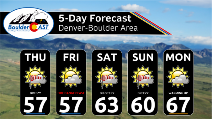
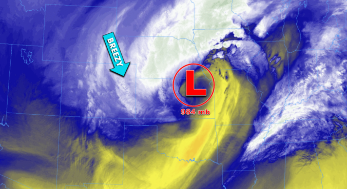
Acold front will continue to progress eastward this afternoon, making its way into the Central Plains and Midwest by later today. In its wake, we are relatively quiet. There will be a few infrequent gusts to 25 mph, but generally not strong enough for fire danger concerns. Highs should top out in the upper 50s. A Fire Weather Watch is …
The next several days will offer up seasonal temperatures and mostly dry weather across the Boulder-Denver area, while the Mountains cash in on occasional light to moderate snow and wind. This is the result an active storm track across the northern Rockies, but with limited moisture and no real organization as the storms pass through the region. There will be …
Last evening's low pressure was a bit more vigorous and developed closer to Denver than expected, but ultimately it didn't put too much of a wrench into the forecast for our immediate area. Yes, there was a brief overlap between heavy snow and strong winds creating pseudo-blizzard conditions across the Palmer Divide and areas east to Kansas. However, here in …