Category: Premium Content (Page 64 of 451)

This content is for Premium Members only.

Premium BoulderCAST Daily – Sat 04/12/25 | Red Flag Warning in Effect Today

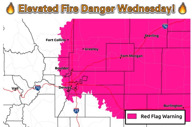
ARed Flag Warning is in effect for today due to the combination of very low RH levels, hot temperatures, gusty winds over 30 mph, and dry fuels. Extreme fire behavior could result today as a result. Westerly downslope flow will be in place today, along with very anomalously hot weather for mid April. Some guidance suggests gusts over 30 mph …

Premium BoulderCAST Daily – Fri 04/11/25 | Warming up for the start of the weekend with fire risk on Saturday

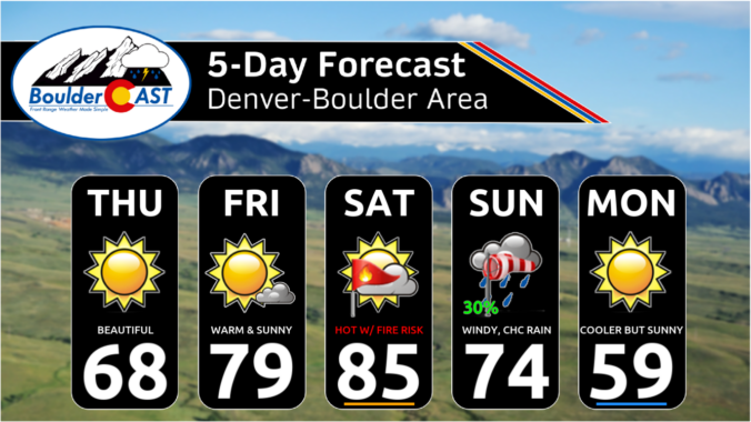
We warm up to end our work week and start the upcoming weekend. The image below shows a dichotomy between the western and eastern US. Over us, hot weather starts to build in today, maximizing tomorrow as high pressure is situated over the southern Plains. Over the eastern US, a large trough is present, with cloud cover, rain and storms, …

Premium This Weekend in Colorado Weather: An early taste of summer, with fire danger, record heat and maybe a few snowflakes sprinkled in!

Gorgeous springtime weather will continue across the Front Range for the next several days as strong ridging will remain parked across Colorado through Saturday. The big ridge will be in full control of our weather through then, but by Sunday a disturbance passing along the Canadian Border will flatten the ridge bringing somewhat cooler temperatures and minor precipitation chances for …

Premium BoulderCAST Daily – Wed 04/09/25 | Elevated fire danger as warm downslope winds gust up to 35 MPH

West-northwest flow aloft remains in-place today alongside continued flattened ridging across Colorado. Moisture levels in this flow have decreased and the result will be much more sunshine today with high temperatures reaching 70 degrees or so. The main change in perceivable weather coming into this Wednesday will be an increase in downslope winds from the WNW through the day. Short-range …

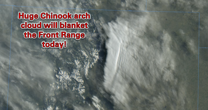
Premium BoulderCAST Daily – Tue 04/08/25 | A relatively warm day stuck beneath a thick Chinook arch cloud

Flattened mid-level ridging is present across the Rockies today with increasingly strong zonal flow developing between the high pressure center off the coast of Baja California and passing shortwaves along the Canadian Border. This setup will put our area in a warm, downslope regime today with temperatures several degrees warmer than Monday, at least in theory. The main challenge today …

Premium BoulderCAST Daily – Sun 04/06/25 | A much warmer end to the weekend

We end the weekend on the milder side. The trough will finally depart into the Southern Plains this afternoon. In its wake, warm ridging will build eastward into the intermountain West. That will spell out a warming trend starting today and maintaining itself for much of the upcoming week. Highs should get to the upper 50s this afternoon. As for …

Premium BoulderCAST Daily – Sat 04/05/25 | Clearing out and slowly warming up

Yesterday's light snow event, focused mainly across western sections of Boulder and Denver and the Foothills will be on its way out fairly quickly by mid-morning today. By later this afternoon and evening, the area of low pressure will be drifting into northern Texas. A trough axis will pass through the Front Range this evening, marking the boundary between dry …

« Older posts Newer posts »