Category: Premium Content (Page 277 of 452)

This content is for Premium Members only.
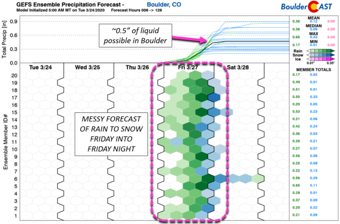
BoulderCAST Daily – Thu 03/26/20 | Partly cloudy and 60’s today, rain/snow tomorrow

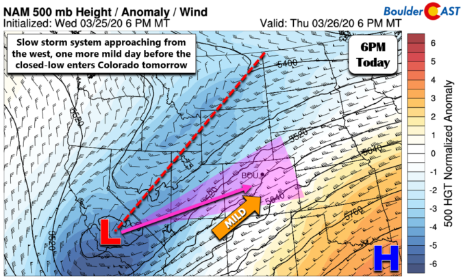
Detailed Forecast Discussion: A storm system sits over California this morning and is set to move into Utah tonight and then across northern Colorado tomorrow.  For today, we're looking at another period of strong southwest flow aloft associated with the subtropical jet stream. Despite some embedded moisture, general downslope flow will allow for partly to mostly sunny skies east of …

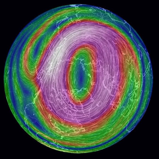
*Premium* Weather Quiz: What does a projected weakening Polar Vortex mean for Colorado?

BACKGROUND: The term Polar Vortex is often used in an inaccurate way by the weather media primarily across the East Coast and Great Lakes. The over-hyped Polar Vortex is a permanent feature of the atmospheric circulation over the North Pole. Far from the equator and blanketed in complete darkness during the winter months, the Polar Vortex contains the Northern Hemisphere’s …

BoulderCAST Daily – Wed 03/25/20 | Gusty, but warm

Detailed Forecast Discussion: The NAM-NEST 500mb height and vorticity animation below shows the evolving atmosphere from this morning into Friday morning. Notice how very little the black height lines change/move across Colorado during the entire animation. We're stuck in the same flow pattern today as we saw yesterday and what we will experience tomorrow. This is a generally dry southwest …

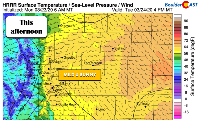
BoulderCAST Daily – Tue 03/24/20 | Spring is in the air

Detailed Forecast Discussion: A hardly noticeable shortwave ridge is passing across the region today which will facilitate quiet conditions when combined with an overall lack of moisture and no other significant weather nearby. Today's NAM model 500mb vorticity forecast map below shows the setup. A mild and borderline warm west-southwest flow into Colorado is clear. We'll see temperatures push the …

BoulderCAST Daily – Sun 03/22/20 | Warming up nicely with sunshine

Detailed Forecast Discussion: A great way to end our weekend today. West-northwest winds have taken hold of the mid-levels of the atmosphere across Colorado today. Yesterday's weak area of low pressure has pushed out into the Midwest. Behind it, much drier air is working in (below). This should prohibit that moist pacific flow from influencing us today. While we are …

BoulderCAST Daily – Sat 03/21/20 | Partial sunshine with highs in the 40’s

Detailed Forecast Discussion: We start the day off with some likely foggy conditions. Clouds cleared out last night into the early morning hours today. And with fresh snow cover, that low-level moisture is prime for fog across the Front Range. We think some sun should work in for at least part of the day today. However, persistent sunshine looks to …

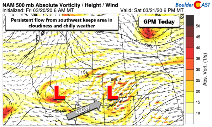
BoulderCAST Daily – Fri 03/20/20 | Continued cold with scattered snow showers

Detailed Forecast Discussion: Following yesterday's snow event, the area picked up a decent amount of precipitation. As of last night, the 24-hour total precipitation with the snow was between 0.75 to 1.5 inches across the Front Range. This certainly keeps us out of any drought conditions. Going to be another cold day as easterly upslope flow remains, along with persistent …

« Older posts Newer posts »